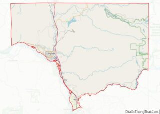
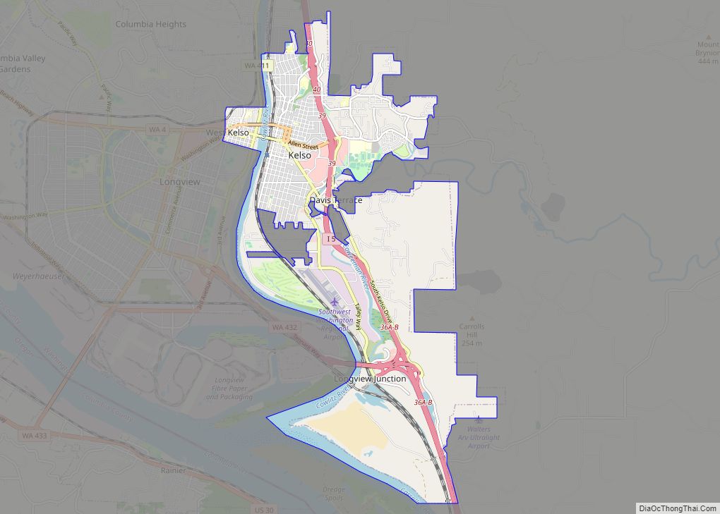
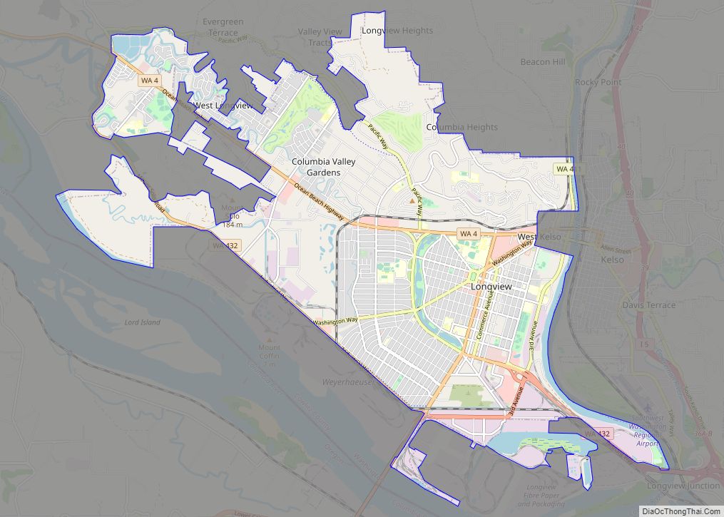
Longview is a city in Cowlitz County, Washington, United States. It is the principal city of the Longview, Washington Metropolitan Statistical Area, which encompasses all of Cowlitz County. Longview’s population was 37,818 at the time of the 2020 census, making it the largest city in Cowlitz County. The city is located in southwestern Washington, at the junction of the Cowlitz and Columbia rivers. Longview shares a border with Kelso to the east, which is the county seat.
The Cowlitz Indian Tribe, a federally recognized tribe of Cowlitz people, is headquartered in Longview.
The Long-Bell Lumber Company, led by Robert A. Long, decided to buy a great expanse of timberland in Cowlitz County in 1918. A total of 14,000 workers were needed to run the two large mills as well as lumber camps that were planned. The number of workers needed was more than a lumber town, or the nearest town, could provide. Long planned and built a complete city in 1921 that could support a population of up to 50,000 and provide labor for the mills as well as attracting other industries. Several buildings in the city were built from Long’s private funds.
| Name: | Longview city |
|---|---|
| LSAD Code: | 25 |
| LSAD Description: | city (suffix) |
| State: | Washington |
| County: | Cowlitz County |
| Incorporated: | February 14, 1924 |
| Elevation: | 20 ft (6 m) |
| Land Area: | 14.79 sq mi (38.30 km²) |
| Water Area: | 0.54 sq mi (1.41 km²) |
| Population Density: | 2,599.58/sq mi (1,003.73/km²) |
| ZIP code: | 98632 |
| Area code: | 360 |
| FIPS code: | 5340245 |
| GNISfeature ID: | 1506304 |
| Website: | mylongview.com |
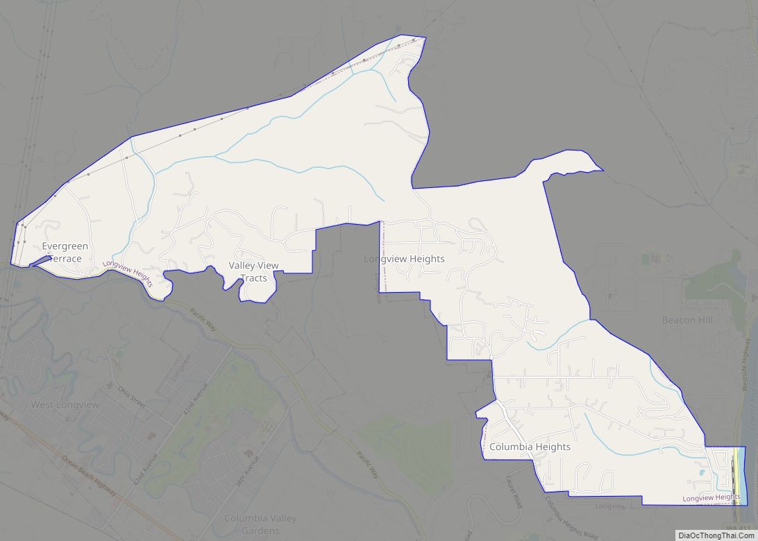
Online Interactive Map
Click on ![]() to view map in "full screen" mode.
to view map in "full screen" mode.
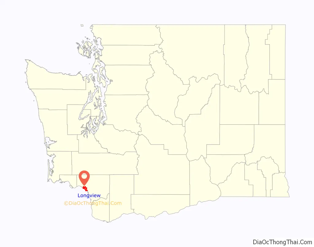
Longview location map. Where is Longview city?

History
Longview was the location of Mount Coffin, an ancestral burial ground for the local indigenous people.
The first Euro-American settlers were led by Harry and Rebecca Jane Huntington, in 1849. The area was named Monticello in honor of Thomas Jefferson’s home in Virginia. In 1852 a group assembled in what would be called the “Monticello Convention” to petition Congress for statehood to be called “Columbia”. Congress agreed to statehood but as Washington, after President Washington, to avoid confusion with the District of Columbia. A monument to the convention is located near the Longview Civic Center. From 1854 to 1865 the town of Monticello was the seat of Cowlitz County, before being destroyed by the flooding of the Cowlitz River in December 1867. In 1865 Nathaniel Stone founded the town of Freeport (a mile upriver from Monticello) which became the seat of Cowlitz County until 1872. The area of the towns of Monticello and Freeport is now part of the city of Longview.
The area remained sparsely populated for nearly 60 years, consisting mostly of farmland and wilderness. In 1918, Missouri timber baron Robert A. Long (1850–1934) decided to move his operation out to the west coast, owing to the Long-Bell Lumber Company’s dwindling supplies in the south. By 1921, Wesley Vandercook had decided to build a mill near the small town of Kelso, Washington. It was apparent that Kelso, with a population of barely 2,000, would not be able to support the approximately 14,000 men that would be required to run the mill.
The Long-Bell company contracted with George Kessler, a city planner based in St. Louis, to build the city that would support the two mills that were now planned.
Kessler designed a masterpiece based on the nation’s capital, with elements of Roman City planning. Its theme is rooted in the City Beautiful movement, which influenced urban design in the early 20th century. Longview was officially incorporated on February 14, 1924. At the time of its conception, Longview was the only planned city of its magnitude to have ever been conceived of and built entirely with private funds. A number of prominent buildings in Longview were purchased with R. A. Long’s personal funds, including R. A. Long High School, the Longview Public Library, the YMCA building and the Monticello Hotel.
The initial growth period, lasting from 1923 to 1934, was very rapid. The city grew from a few thousand people to being the fourth largest city in the state by the 1930s. However, the effects of the Great Depression hampered further development of the planned city until the booming World War II economy, when the Port of Longview became a strategic location for loading cargo going into the Pacific Theater.
Suburban developments created neighborhoods in the western valley in the 1960s. The local economy has been in decline since lumber companies mechanized production in the 1970s and 1980s, reducing the availability of jobs. No major development occurred until a brief boom in the early 2000s, ended by the recession of the late 2000s.
Recently, an initiative from local activists has pushed to implement a new strategic plan to increase development in the city, in an effort to expand affordable housing.
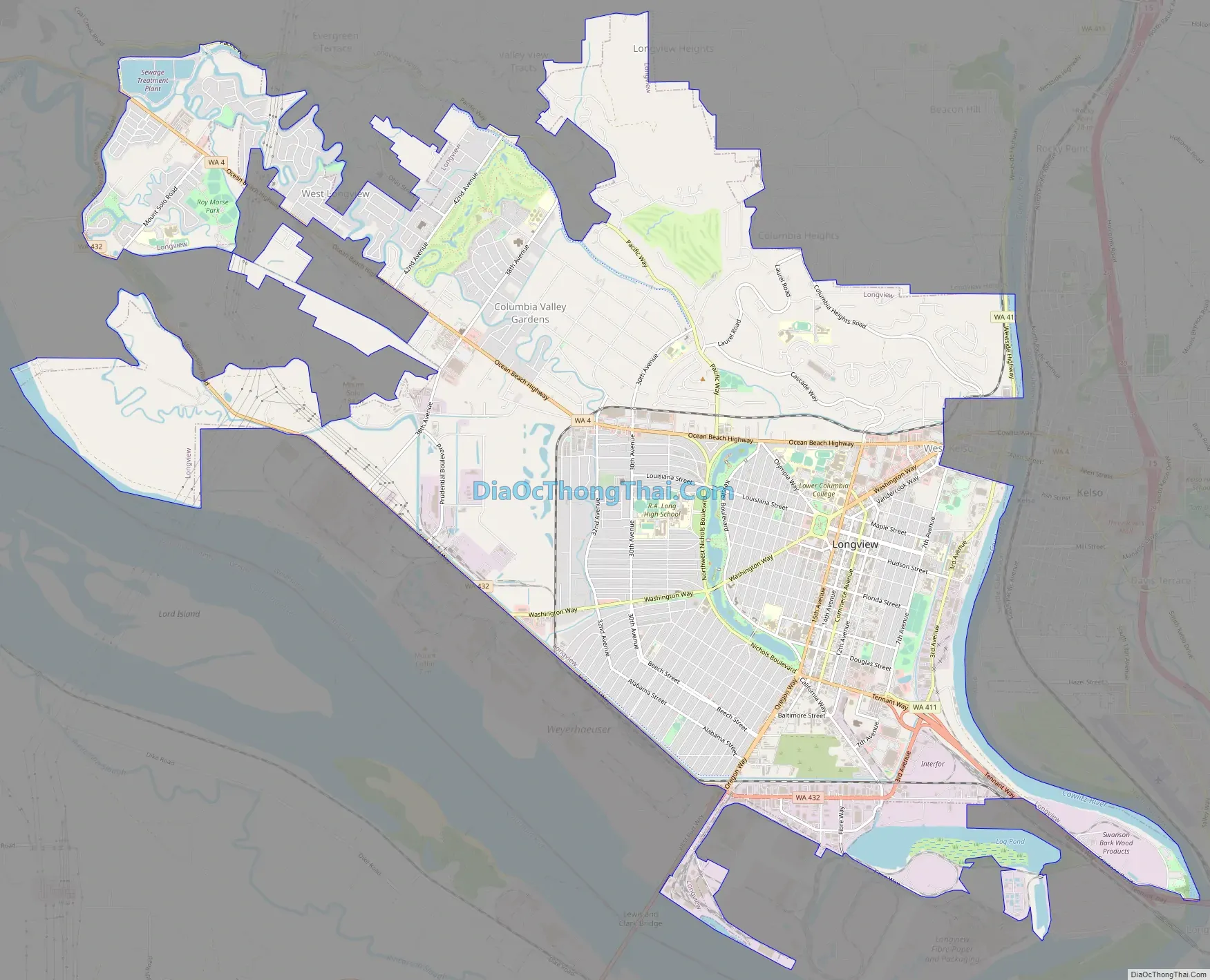
Longview Road Map
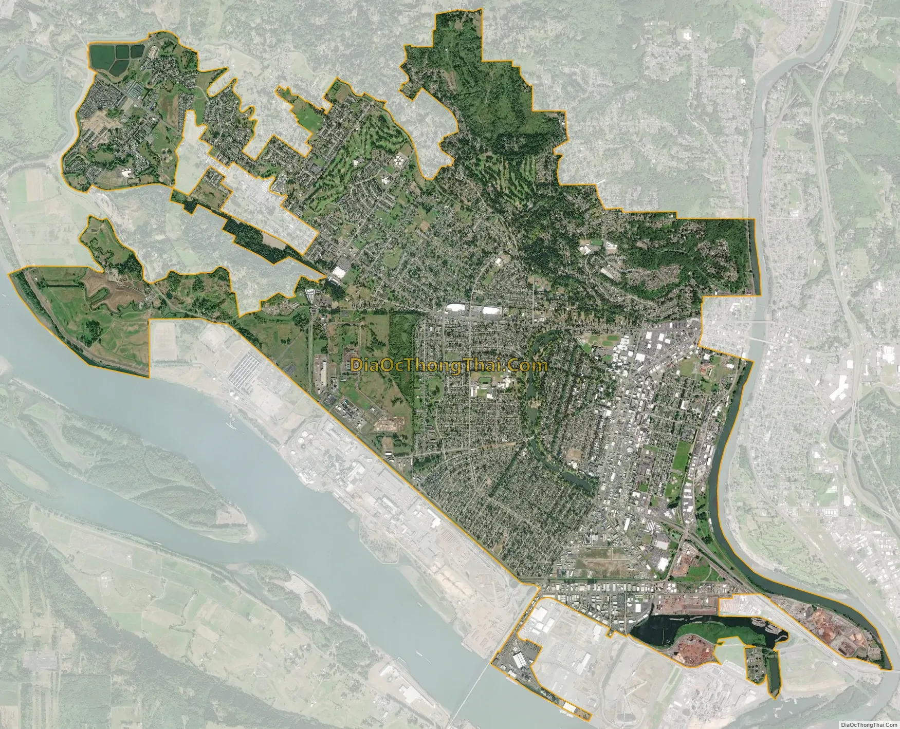
Longview city Satellite Map
Geography
According to the United States Census Bureau, the city has a total area of 14.79 square miles (38.31 km), of which 14.49 square miles (37.53 km) is land and 0.30 square miles (0.78 km) is water.
The Lewis and Clark Bridge spans the Columbia River, linking Longview to Rainier, Oregon. It is the only bridge spanning the river between Portland and Astoria, Oregon.
Climate
Longview is located in a small gorge, so its climate varies from that of its close neighbor, Portland. Longview is generally about 7 °F (4 °C) cooler than Portland. Located about 80 miles (130 km) inland across a stretch of relatively flat ground, the Longview skies can be overcast due to moisture from the Pacific Coast marine layer. The Columbia River gorge permits an exchange of air between eastern and western Washington. The direction and speed of air movement through the gorge is determined primarily by the pressure gradient between the eastern and western slopes of the mountains. Due to the gorge-like effect, marine pushes on summer evenings can frequently reach gusts up to 30 to 40 miles per hour (48 to 64 km/h) There have been gusts of up to 90 to 100 miles per hour (140 to 160 km/h), and over 100 miles per hour (160 km/h) at higher elevations.
Fall is usually cooler but foggy; on some days the fog never clears. By early-to-mid November, rainfall begins in typical Northwest fashion. Winter tends to be chilly and rainy, with occasional violent windstorms or spates of unusually warm—65 to 70 °F (18 to 21 °C)—temperatures. This is due to extremely warm air coming from the Pineapple Express which can drop 3 to 6 inches (76 to 152 mm) of rain in a matter of days. Each year there are one or two snowfalls, typically less than 6 inches (15 cm) but up to 1 metre (3 ft) in the surrounding foothills. Spring is warmer, but still a little wet; this is the most common time for the occasional thunderstorms.
See also
Map of Washington State and its subdivision:- Adams
- Asotin
- Benton
- Chelan
- Clallam
- Clark
- Columbia
- Cowlitz
- Douglas
- Ferry
- Franklin
- Garfield
- Grant
- Grays Harbor
- Island
- Jefferson
- King
- Kitsap
- Kittitas
- Klickitat
- Lewis
- Lincoln
- Mason
- Okanogan
- Pacific
- Pend Oreille
- Pierce
- San Juan
- Skagit
- Skamania
- Snohomish
- Spokane
- Stevens
- Thurston
- Wahkiakum
- Walla Walla
- Whatcom
- Whitman
- Yakima
- Alabama
- Alaska
- Arizona
- Arkansas
- California
- Colorado
- Connecticut
- Delaware
- District of Columbia
- Florida
- Georgia
- Hawaii
- Idaho
- Illinois
- Indiana
- Iowa
- Kansas
- Kentucky
- Louisiana
- Maine
- Maryland
- Massachusetts
- Michigan
- Minnesota
- Mississippi
- Missouri
- Montana
- Nebraska
- Nevada
- New Hampshire
- New Jersey
- New Mexico
- New York
- North Carolina
- North Dakota
- Ohio
- Oklahoma
- Oregon
- Pennsylvania
- Rhode Island
- South Carolina
- South Dakota
- Tennessee
- Texas
- Utah
- Vermont
- Virginia
- Washington
- West Virginia
- Wisconsin
- Wyoming