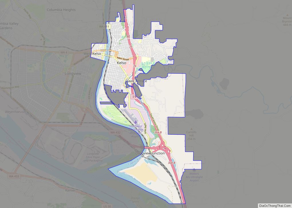
Kelso is a city in the southwestern part of the U.S. state of Washington and is the county seat of Cowlitz County. At the 2020 census, the population was 12,720. Kelso is part of the Longview, Washington Metropolitan statistical area, which has a population of 110,730. Kelso shares its long western border with Longview. It is near Mount St. Helens.
| Name: | Kelso city |
|---|---|
| LSAD Code: | 25 |
| LSAD Description: | city (suffix) |
| State: | Washington |
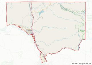
| County: | Cowlitz County |
| Elevation: | 75 ft (23 m) |
| Total Area: | 8.84 sq mi (22.89 km²) |
| Land Area: | 8.13 sq mi (21.07 km²) |
| Water Area: | 0.70 sq mi (1.82 km²) |
| Total Population: | 12,720 |
| Population Density: | 1,526.37/sq mi (589.32/km²) |
| ZIP code: | 98626 |
| Area code: | 360 |
| FIPS code: | 5335065 |
| GNISfeature ID: | 1512343 |
| Website: | kelso.gov |
Online Interactive Map
Click on ![]() to view map in "full screen" mode.
to view map in "full screen" mode.
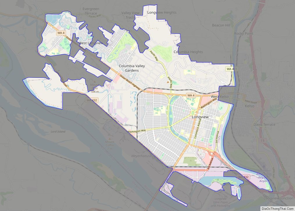
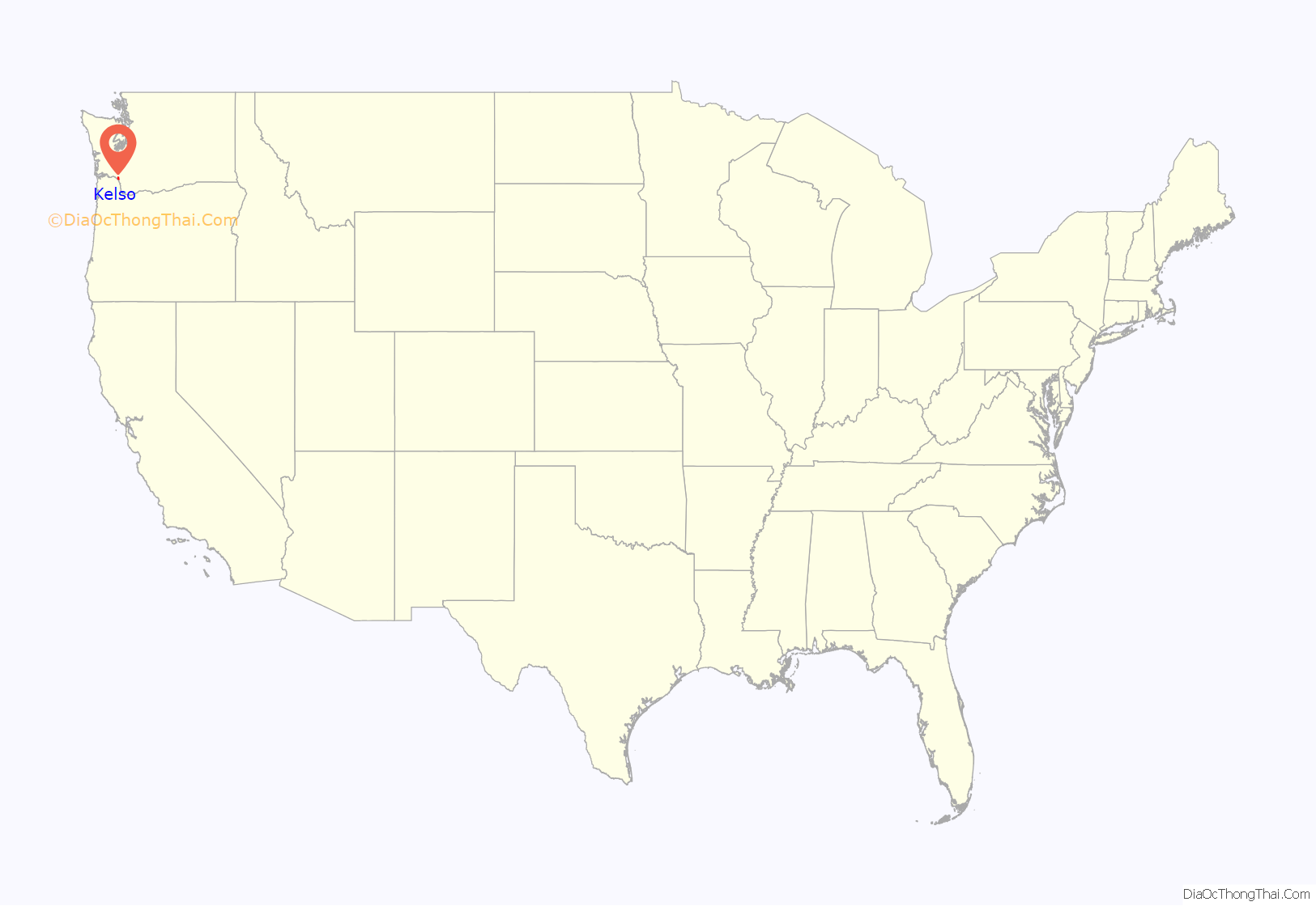
Kelso location map. Where is Kelso city?

History
The earliest known inhabitants of Kelso were Native Americans from the Cowlitz tribe. The Cowlitz people were separated into the Upper (or Taidnapam) and Lower (or Mountain) Cowlitz tribes, who were members of the Sahaptin and Salish language families, respectively. In 1855, European explorers noted that there numbered over 6,000 individuals of the Cowlitz Tribe.
Kelso was founded by Peter W. Crawford, a Scottish surveyor, who, in 1847, took up the first donation land claim on the Lower Cowlitz River. Crawford platted a townsite which he named after his home town of Kelso, Scotland. The original plat was dated and filed in October 1884. It became incorporated in 1889.
In its early days, Kelso obtained the nickname “Little Chicago” as it became famous for its large number of taverns and brothels that catered to local loggers. On weekends, trainloads of loggers would come into town from the surrounding region looking for women, liquor, gambling and fights. The FBI finally forced the mayor to shut them down in the 1950s, with the last tavern/brothel closing in the mid-1960s. The economy continues to be based largely on wood products.
In the late 19th century and into the first part of the 20th century, Kelso was the center for commercial smelt fishing on the Cowlitz River. In 1910, according to the Oregonian Newspaper, 5,000 tons of fish were caught. The Kelso Chamber of Commerce created the slogan in 1956 and became known as the Smelt Capital of the World. The Cowlitz River has historically had heavy runs of smelt and were shipped to markets around the country. Smelt numbers have declined significantly in the past several decades possibly due to overharvesting, global climate change and habitat loss.
Pieces of the mysterious 1947 Maury Island incident took place in Kelso. A military aircraft carrying suspicious slag-like material, supposedly from a UFO, crashed in southeast Kelso.
On May 18, 1980, being only 24 miles (39 km) away, Kelso residents experienced the shock wave caused by the eruption of Mount St. Helens. Called the largest volcanic eruption in historic times in the contiguous United States, Kelso received large amounts of volcanic ash through the air and from the massive mudflow caused by the eruption transported by the Toutle and Cowlitz Rivers. Many areas of the city, including the Three Rivers Golf Course are built on volcanic ash dredged from the Cowlitz River by inmates in state custody and volunteers.
In March 1998, the Aldercrest-Banyon landslide began shifting the foundations of 64 homes and local infrastructure in the east Kelso neighborhood of Aldercrest. Eventually, 129 houses were destroyed by this slow-moving landslide. Investigation showed that these houses had been built on top of an ancient active landslide area, and three straight years of higher-than-average rains set the earth into motion. In October 1998, President Bill Clinton declared this slide a federal disaster. It was the second worst landslide disaster (in cost) in the United States, following the 1956 Portuguese Bend Landslide on Palos Verdes Hills in Southern California. This disaster at Aldercrest led to stricter city zoning ordinances and oversight over geological surveys.
National Register of Historic Places
- Adam Catlin House
- Nat Smith House
- US Post Office – Kelso Main
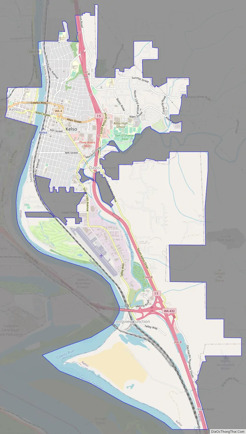
Kelso Road Map
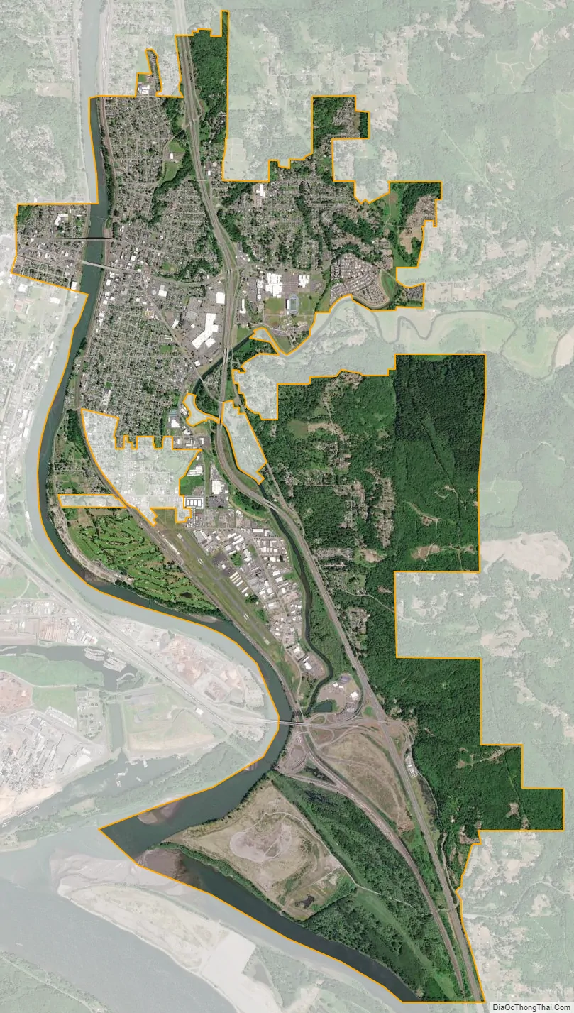
Kelso city Satellite Map
Geography
Kelso is situated on the east side of the Cowlitz River near the Columbia River, opposite from its twin city of Longview on the west bank. It is located on Interstate 5 approximately 48 miles (77 km) north of Portland, Oregon, and 125 miles (201 km) south of Seattle.
According to the United States Census Bureau, the city has a total area of 8.50 square miles (22.01 km), of which 8.14 square miles (21.08 km) is land and 0.36 square miles (0.93 km) is water.
The Columbia, Cowlitz, and Coweeman rivers were used as part of a historical transportation route from Portland, Oregon, to the Puget Sound. Cowlitz steamboats were used as a mode of transportation until 1918.
Climate
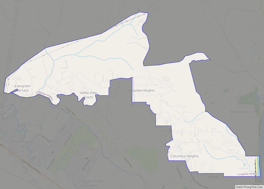
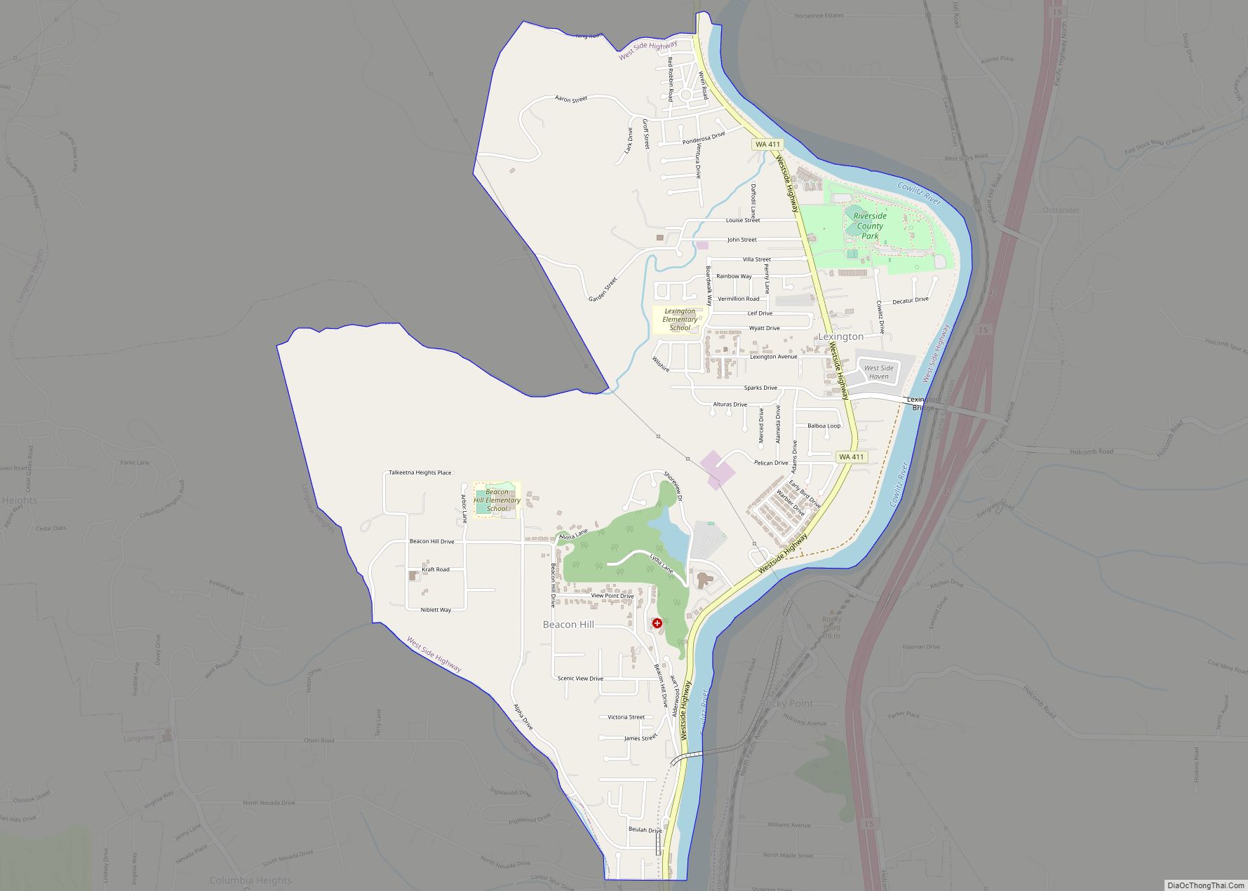
Neighborhoods
- Aldercrest
- Butler Acres
- Davis Terrace
- East Kelso
- Hilltop
- Lexington
- Mt. Brynion
- North Kelso
- Old Kelso Hill
- South Kelso
- West Kelso
- Rose Valley
- Mt Pleasant
See also
Map of Washington State and its subdivision:- Adams
- Asotin
- Benton
- Chelan
- Clallam
- Clark
- Columbia
- Cowlitz
- Douglas
- Ferry
- Franklin
- Garfield
- Grant
- Grays Harbor
- Island
- Jefferson
- King
- Kitsap
- Kittitas
- Klickitat
- Lewis
- Lincoln
- Mason
- Okanogan
- Pacific
- Pend Oreille
- Pierce
- San Juan
- Skagit
- Skamania
- Snohomish
- Spokane
- Stevens
- Thurston
- Wahkiakum
- Walla Walla
- Whatcom
- Whitman
- Yakima
- Alabama
- Alaska
- Arizona
- Arkansas
- California
- Colorado
- Connecticut
- Delaware
- District of Columbia
- Florida
- Georgia
- Hawaii
- Idaho
- Illinois
- Indiana
- Iowa
- Kansas
- Kentucky
- Louisiana
- Maine
- Maryland
- Massachusetts
- Michigan
- Minnesota
- Mississippi
- Missouri
- Montana
- Nebraska
- Nevada
- New Hampshire
- New Jersey
- New Mexico
- New York
- North Carolina
- North Dakota
- Ohio
- Oklahoma
- Oregon
- Pennsylvania
- Rhode Island
- South Carolina
- South Dakota
- Tennessee
- Texas
- Utah
- Vermont
- Virginia
- Washington
- West Virginia
- Wisconsin
- Wyoming