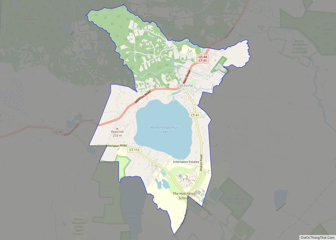
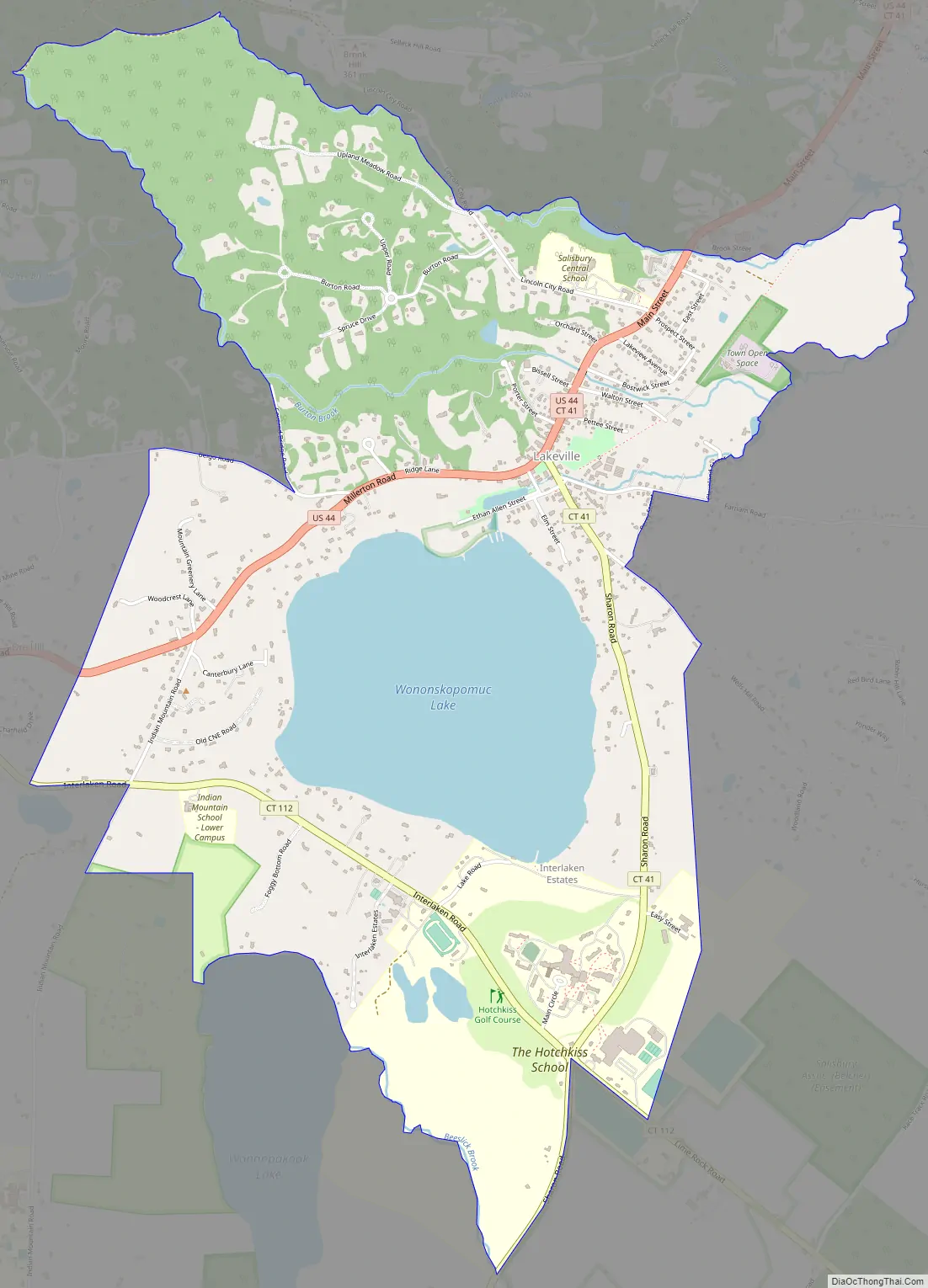
Lakeville is a census-designated place (CDP) in Litchfield County, Connecticut, United States, close to Dutchess County, New York. It is within the town of Salisbury, but has its own ZIP Code (06039). As of the 2010 census, the population of Lakeville was 928, out of 3,741 in the entire town of Salisbury. The Hotchkiss School is located in Lakeville, and the Indian Mountain School is nearby.
| Name: | Lakeville CDP |
|---|---|
| LSAD Code: | 57 |
| LSAD Description: | CDP (suffix) |
| State: | Connecticut |
| County: | Litchfield County |
| Elevation: | 720 ft (220 m) |
| Total Area: | 3.69 sq mi (9.57 km²) |
| Land Area: | 3.15 sq mi (8.16 km²) |
| Water Area: | 0.55 sq mi (1.42 km²) |
| Total Population: | 928 |
| Population Density: | 294/sq mi (113.7/km²) |
| ZIP code: | 06039 |
| FIPS code: | 0941830 |
| GNISfeature ID: | 208366 |
Online Interactive Map
Click on ![]() to view map in "full screen" mode.
to view map in "full screen" mode.
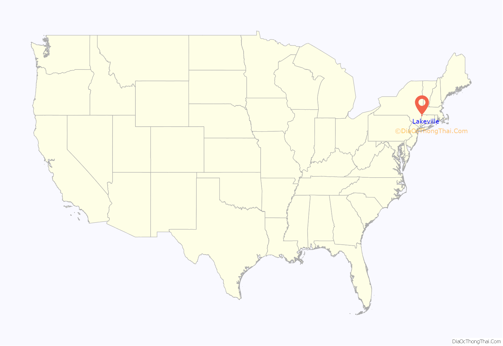
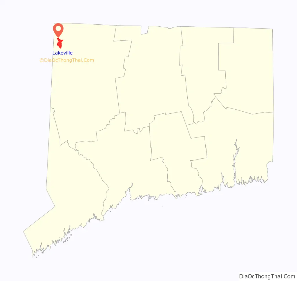
Lakeville location map. Where is Lakeville CDP?
History
Until 1846, Lakeville was called “Furnace Village”, due to the location there of one of the early blast furnaces of the historic Salisbury iron industry (one of which was established in the 1760s by future Revolutionary War hero Ethan Allen. Benjamin B. Hotchkiss, inventor of the Hotchkiss gun was born in nearby Watertown. A boarding school in his name, the Hotchkiss School, was founded by his widow Maria Bissell Hotchkiss in Lakeville in 1891. It later became coeducational. The Indian Mountain School, a boarding school for students Pre-K through 9th, is south of the Lakeville CDP. It was founded in 1922.
Lakeville was the original home to what would eventually relocate and become the Mansfield Training School, an institution for mentally challenged residents of Connecticut from 1860 to 1993.
Other notable events
Lakeville is the site of Connecticut’s oldest cold case. Camp Sloane camper Connie Smith left the camp on Indian Mountain Road on the morning of July 16, 1952. She was ten years old and was from Sundance, Wyoming; she was the granddaughter of former Wyoming Governor Nels H. Smith. Several people observed her walking and hitchhiking toward the center of Lakeville. She was last seen walking along Route 44 near the intersection of Belgo Road. Her disappearance sparked one of the largest searches ever conducted by the Connecticut State Police. Despite a nationwide search, she was never found, and foul play is suspected. Her case remains open and still has a detective assigned to it.
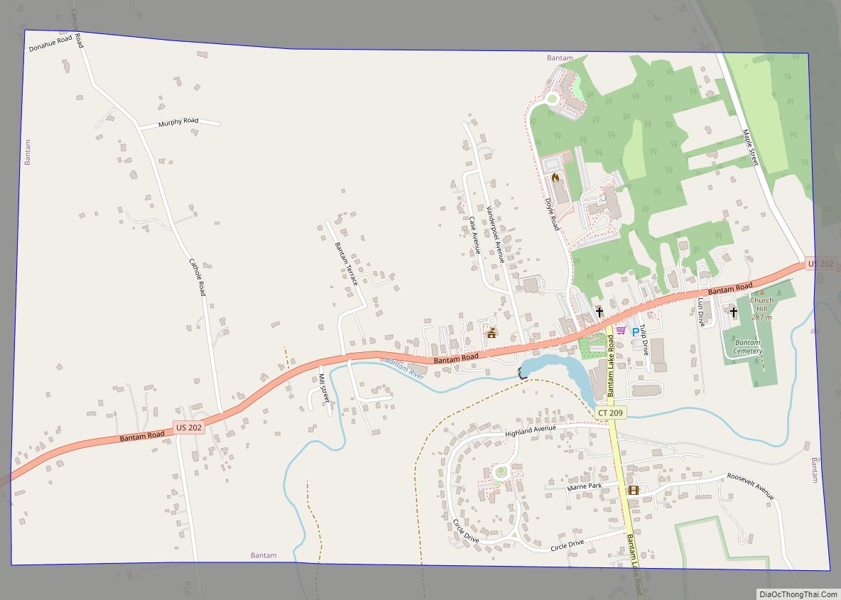
Lakeville Road Map
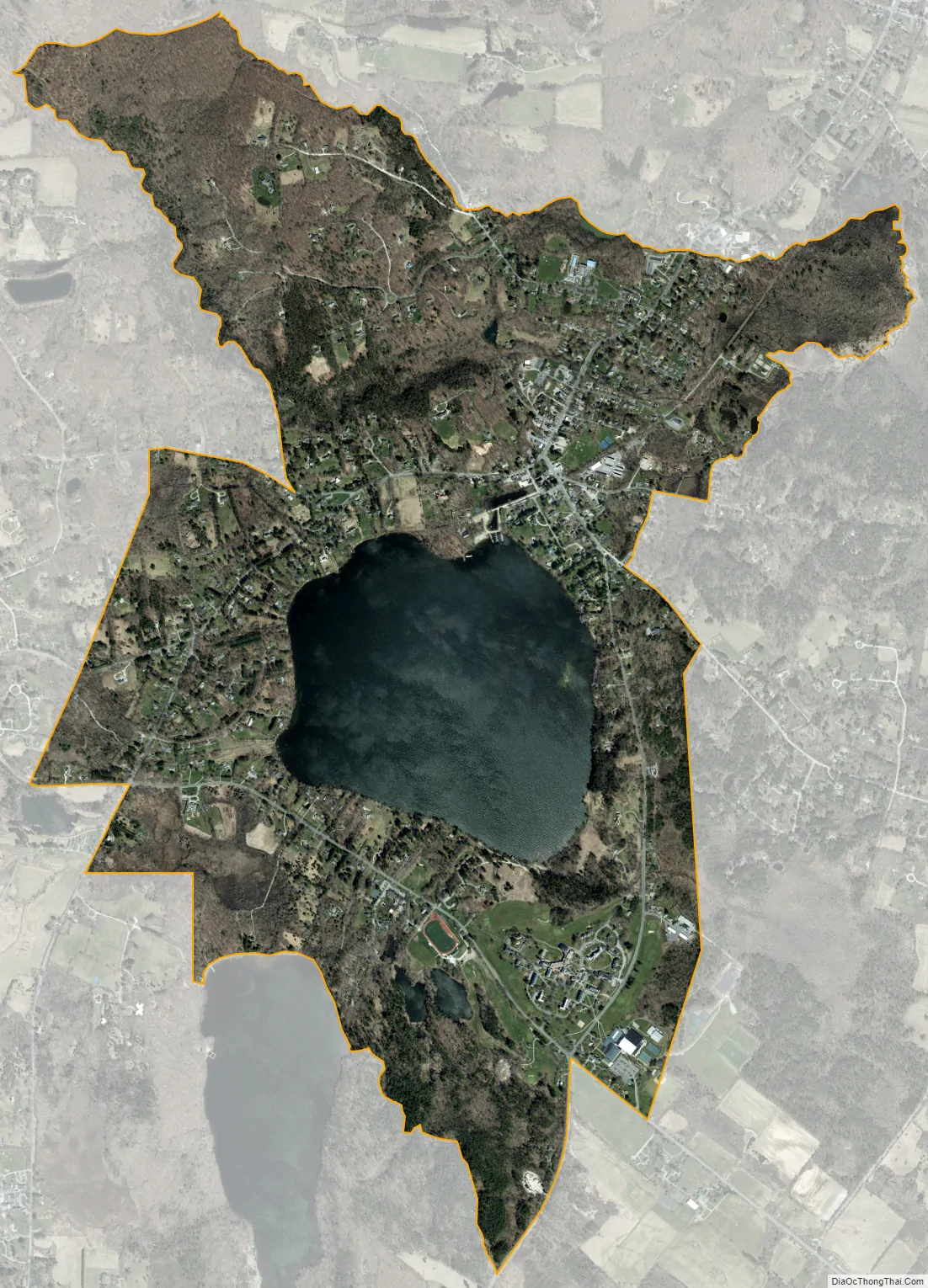
Lakeville city Satellite Map
Geography
Lakeville is in the southwest part of the town of Salisbury, on U.S. Route 44 1.5 miles (2.4 km) southwest of the Salisbury town center. US 44 leads northeast 8 miles (13 km) to Canaan village and west 4 miles (6 km) to Millerton, New York.
According to the U.S. Census Bureau, the Lakeville CDP has a total area of 3.7 square miles (9.6 km), of which 3.2 square miles (8.2 km) are land and 0.54 square miles (1.4 km), or 14.8%, are water. Most of the water area is part of Lake Wononscopomuc, the deepest natural lake in the state.
See also
Map of Connecticut State and its subdivision: Map of other states:- Alabama
- Alaska
- Arizona
- Arkansas
- California
- Colorado
- Connecticut
- Delaware
- District of Columbia
- Florida
- Georgia
- Hawaii
- Idaho
- Illinois
- Indiana
- Iowa
- Kansas
- Kentucky
- Louisiana
- Maine
- Maryland
- Massachusetts
- Michigan
- Minnesota
- Mississippi
- Missouri
- Montana
- Nebraska
- Nevada
- New Hampshire
- New Jersey
- New Mexico
- New York
- North Carolina
- North Dakota
- Ohio
- Oklahoma
- Oregon
- Pennsylvania
- Rhode Island
- South Carolina
- South Dakota
- Tennessee
- Texas
- Utah
- Vermont
- Virginia
- Washington
- West Virginia
- Wisconsin
- Wyoming