Middletown is a city in Middlesex County, Connecticut, United States. Located along the Connecticut River, in the central part of the state, it is 16 miles (26 kilometers) south of Hartford. Middletown is the largest city in the Lower Connecticut River Valley Planning Region. In 1650, it was incorporated by English settlers as a town under its original Native American name, Mattabeseck, after the local indigenous people, also known as the Mattabesett. They were among the many tribes along the Atlantic coast who spoke Algonquian languages. The colonists renamed the settlement in 1653.
When Hartford County was organized on May 10, 1666, Middletown was included within its boundaries. In 1784, the central settlement was incorporated as a city distinct from the town. Both were included within newly formed Middlesex County in May 1785. In 1923, the City of Middletown was consolidated with the Town, making the city limits extensive.
Originally developed as a sailing port and then an industrial center on the Connecticut River, it is now largely residential. Its downtown, based on Main Street, serves as a popular retail, dining, and bar district near Wesleyan University. Middletown was the county seat of Middlesex County from its creation in 1785 until the elimination of county government in 1960. As of the 2020 census, the city had a total population of 47,717. Middletown, Connecticut is considered the southernmost city in the Hartford-Springfield Knowledge Corridor Metropolitan Region, which features a combined metro population of 1.9 million. Middletown is largely a politically progressive city, and is home to one of the largest pride events in all of Connecticut.
| Name: | Middletown city |
|---|---|
| LSAD Code: | 25 |
| LSAD Description: | city (suffix) |
| State: | Connecticut |
| County: | Middlesex County |
| Elevation: | 135 ft (41 m) |
| Total Area: | 42.37 sq mi (109.72 km²) |
| Land Area: | 41.02 sq mi (106.24 km²) |
| Water Area: | 1.35 sq mi (3.49 km²) |
| Total Population: | 47,717 |
| Population Density: | 1,163.26/sq mi (449.14/km²) |
| ZIP code: | 06457 |
| Area code: | 860/959 |
| FIPS code: | 0947290 |
| GNISfeature ID: | 02378281 |
| Website: | www.middletownct.gov |
Online Interactive Map
Click on ![]() to view map in "full screen" mode.
to view map in "full screen" mode.
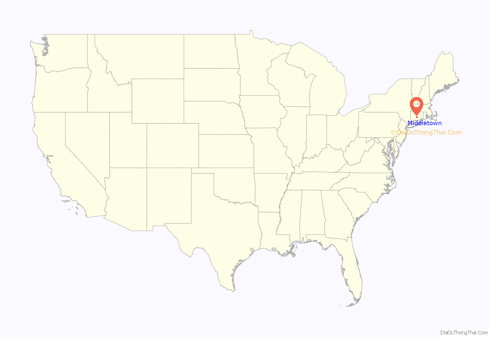
Middletown location map. Where is Middletown city?
History
The land on the western bank of the Connecticut River where Middletown now lies was home to the Mattabesett Native Americans (also spelled Mattabesec, Mattabeseck, and Mattabesek); the area they inhabited—now Middletown and the surrounding area—was named after them. At the time the first European settlers arrived in the region, who were primarily English, the Mattabesett were a part of the group of Algongquian-speaking tribes in the Connecticut Valley, that were under a single chief named Sowheag.
Plans for the colonial settlement were drawn up by the General Court in 1646; the first migrants came from nearby Connecticut colonies in 1650. On September 11, 1651, the General Court of Connecticut established the town of “Mattabesett”. A couple of years later in November 1653, the settlement was renamed as Middletown. This name was chosen because the site was approximately halfway between Windsor and Saybrook on the Great River. Life was not easy for these early colonial Puritans; clearing the land and building houses, and tending farms in the rocky soil of New England was a labor-intensive ordeal. They had a strict society; offenses legally punishable by death in the Connecticut colonies included “witchcraft, blasphemy, cursing or smiting of parents, and incorrigible stubbornness of children.”
The Pequot Mohegan, at that time traditional allies of the English colonists and enemies of the Mattabesett and other local tribes, arrived in the Middletown area in the latter half of the 17th century; conflict between them and local Native American tribes ensued. The Mattabesett and other tribes referred to the Mohegan as “destroyers of men.” Sowheag hoped that the colonists would intervene. They did not. Smallpox epidemics caused high mortality among the Mattabesett, reducing their ability to resist and disrupting their cohesion as a tribe. Records show that, over time, Sowheag was forced to sell off most of the Mattabesett property to the local colonists; by 1676 the Puritans owned all but 300 acres (1.2 km) of the former Mattabesett territory. Native Americans suffered similar fates of illness and dispossession at other colonial sites in 17th-century New England.
During the 18th century, Middletown became the largest and most prosperous settlement in Connecticut. By the time of the American Revolution, Middletown was a thriving port, where one-third of its residents were involved in merchant and maritime activities. Some settlers held enslaved Africans as workers in the early economy of Middletown; they worked as domestic servants, laborers, and in shipping. African slaves were imported by the English in 1661 from Barbados in the Caribbean. By 1756 Middletown had the third-largest African slave population in the state of Connecticut—218 slaves to 5,446 whites.
Middletown merchant traders pushed for the clearance of the Saybrook Bar at the mouth of the Connecticut River, and later sought the creation of Middlesex County in 1785. The name ‘Middlesex’ was chosen because the intention was to make Middletown the head of a long river port, much as London was at the head of its long river port on the Thames in Middlesex County, England. The same persons also established the Middlesex Turnpike (now Route 154) to link all the settlements on the western side of the Connecticut, again with the intent of creating one long port.
After the American Revolution, Connecticut and most northern states abolished slavery. The port’s decline began in the early 19th century during the period of strained American-British relations and resulting trade restrictions, which led to the War of 1812. The port never recovered from the restrictions of the war. The city’s men distinguished themselves in the war effort, as Middletown’s Commodore Thomas Macdonough led American forces to the victory on Lake Champlain in 1814 which ended British hopes for an invasion of New York. After the war, migration of New England families continued west to New York and, later, to the Midwest around the Great Lakes, where more land was available.
In the 19th century, Middletown became a major center for firearms manufacturing. Numerous gun manufacturers in the area supplied the majority of pistols to the United States government during the War of 1812. After that war, however, the center of this business shifted to Springfield, Massachusetts; and Hartford, and New Haven, Connecticut. (See also History of Connecticut industry.)
In 1831 Wesleyan College was established. It became one of the United States’ leading liberal arts universities. The college replaced an earlier educational institution on the same site, Partridge’s American Literary, Scientific and Military Academy. It had moved to Norwich, Vermont and later developed as Norwich University.
The two main buildings of the original campus were built by the people of Middletown in order to attract an academic institution to the city. In 1841, Middletown established the state’s first public high school, which at first enrolled all students from age nine through age sixteen who had previously attended district schools.
During the mid-19th century, manufacturing replaced trade as Middletown’s economic mainstay. But industrial growth was limited after railroad operators bypassed Middletown in their construction of a railway between Hartford and New Haven. There had been an ambitious plan to build a railroad suspension bridge in the White Rock, Middletown to Bodkin Rock, Portland vicinity, which was seen as an unpractical solution.
Middletonians played an active role in the American Civil War. General Joseph K. Mansfield was a Union general at the Battle of Antietam, where he died in action in 1862. Another casualty at Antietam was Brigadier General George Taylor, who had been educated at a private military academy in Middletown. The popular Civil War marching song “Marching Through Georgia” was written by Henry Clay Work, a Middletown resident. Some residents were active in the abolitionism movement, and the city was a hub along the underground railway.
In the latter half of the 19th century, manufacturing was the mainstay of the city’s economy, especially finely made metal parts, such as marine hardware (Wilcox, Crittendon & Co.) and typewriters (Royal Typewriters). There were also several machine tool & die manufacturers in the city. Middletown was the site of a major unit of Goodyear. In addition, there was the pioneer automobile manufacturer Eisenhuth Horseless Vehicle Company. Other manufacturers included in national expositions and now museum collections include the Middletown Plate Company (silver), Middletown Silver Co. and I. E. Palmer (hammocks).
Middletown also briefly was the home of a major-league baseball team, the Middletown Mansfields of the National Association.
In the late 19th and early 20th century, the city underwent a demographic transformation, after having been settled primarily by Protestant people from the British Isles. First the Irish, in response to the Great Famine, and then large numbers of Italian immigrants arrived to work in Middletown’s factories and farms. Many of the Italians were immigrants from Melilli, Sicily. Both groups were primarily Roman Catholic.
Polish and German arrivals followed, and many of these immigrants were also Catholic. By 1910 the population had swelled to nearly 21,000. Meanwhile, the number of African Americans dwindled to 53 persons. Employers chose to hire white immigrants. Later in the century, more African Americans from the South migrated to the area for its industrial jobs and better social conditions. They were part of the Great Migration during the 20th century, up to 1970.
In the early 1980s, two Wesleyan professors arranged to bring a small group of Cambodian refugees to Middletown, who were exiled following the US involvement in Southeast Asia in the Vietnam War. They developed a thriving Cambodian community, as have later migrants from Tibet. Middletown also attracted Hindu immigrants from India and other parts of Southeast Asia, who established the first Hindu temple in Connecticut in Middletown.
Over the decades the new immigrants stimulated the rise of a range of cuisines offered by restaurants. This has become one of the most well-known aspects of the city.
Middletown was hit by floods in 1927 and 1936, and by The Great New England Hurricane in 1938. The Arrigoni Bridge was completed over the Connecticut River in 1938. It replaced an earlier bridge to connect Middletown to Portland and points east.
During the 1950s, as the popularity of the automobile increased, government officials approved the construction of a highway that effectively separated Middletown from the Connecticut River, which had long supported its development. Highway construction demolished historic neighborhoods, including many buildings from the 18th century. New suburban developments were built outside older neighborhoods, attracting the people with money to buy new. In the mid-20th century, Middletown and similar towns lost heavy industry and manufacturing jobs that moved offshore, resulting in a general decline in population. An alternate economy began to develop by the 1990s.
During this period, the city tore down many older buildings in the name of ‘urban renewal’, but sometimes new development was delayed for years. Downtown area had large flat parking lots, or buildings were abandoned and left empty. With high unemployment and limited opportunities, and increasing problems with drugs, crime increased. During the 1960s, Pratt & Whitney opened a large aircraft engine plant in the Maromas section of Middletown. Concurrently, developers bought much of the city’s remaining farms, including most of Oak Grove Dairy, to redevelop as residential suburbs for local workers and commuters to surrounding cities.
During the 1970s, Oddfellows Playhouse was established. The theater attracts hundreds of young people every year from around the state to perform in plays and other performances. The playhouse is one of the few youth theaters in the state of Connecticut. It is located on 128 Washington Street, around the corner from Middletown’s Main Street.
During the 1990s, a partnership between the city, the Middlesex Chamber of Commerce, and Wesleyan University invested substantially in Middletown’s Main Street, improving urban design and supporting new businesses. Their actions helped the revival of downtown Middletown. Crime decreased, and new restaurants and shops opened.
There are numerous houses, buildings and historic districts in Middletown listed on the National Register of Historic Places, and two are further designated as National Historic Landmarks. The Samuel Wadsworth Russell House on High Street, built in 1827, was declared a National Historic Landmark in 2001. The Alsop House, also located on High Street, and built in 1840, was designated a National Historic Landmark in 2009. Both buildings are part of the Wesleyan campus.
The saltbox Samuel Harris House, built in 1686 and not listed on the National Register, may be the oldest surviving house in Middletown.
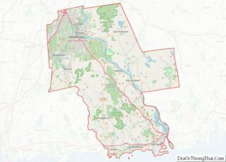
Middletown Road Map
Middletown city Satellite Map
Geography
Middletown sits on the west bank of the Connecticut River, in the south-central portion of the state. Running alongside the river, Route 9 bisects the city. According to the United States Census Bureau, the city has a total area of 42.3 square miles (109.6 km), of which, 40.9 square miles (105.9 km) of it is land and 1.4 square miles (3.7 km) of it is water. The total area is 3.36% water. Middletown shares borders with the neighboring towns of Cromwell, Portland, East Hampton, Haddam, Durham, Middlefield, Berlin, and Meriden. Of all the neighboring towns, Portland and East Hampton are the only ones that do not have any land boundaries, as they are located on the eastern side of the Connecticut River.
The west side of Middletown is flanked by the Metacomet Ridge—a mountainous trap rock ridgeline that stretches from Long Island Sound to nearly the Vermont border. Notable mountains of the Metacomet Ridge in Middletown include Higby Mountain and the north side of Lamentation Mountain. The 50-mile (80 km) Mattabesett Trail traverses the ridge. The Nature Conservancy manages the summit and ledges of Higby Mountain. Major bodies of water include the Connecticut River along the towns eastern boundary, the Mattabesset River along its northern boundary, Crystal Lake in the southern end of town, and Pameacha Pond along South Main Street. The Mount Higby and Adder reservoirs also fall along its western boundary with Middlefield.
Principal communities
- Highland – The westernmost neighborhood of Middletown. It is the only section of the city that Interstate 91 passes through within its total distance through Middletown.
- Westfield – Formerly a village, now a mostly residential neighborhood located in the northwest corner of the city, lying just south of the border with Cromwell.
- Miramichi – A mostly residential neighborhood located in the southwest corner of the city, lying just north of the border with Middlefield.
- Newfield Heights – A commercial-neighborhood with many businesses and restaurants located just to the north of the city center.
- Bretton Heights – A mostly residential neighborhood located a few miles west from the city center.
- Lakeridge Heights – A semi-industrial neighborhood located just below the South Farms area, and just above the Durham town-line.
- South Farms – A mostly residential area lying just to the south of the city center.
- Maromas – A largely industrial and mostly-uninhabited neighborhood, located in the southeastern part of the city. Pratt & Whitney has one of its offices located in this area.
See also
Map of Connecticut State and its subdivision: Map of other states:- Alabama
- Alaska
- Arizona
- Arkansas
- California
- Colorado
- Connecticut
- Delaware
- District of Columbia
- Florida
- Georgia
- Hawaii
- Idaho
- Illinois
- Indiana
- Iowa
- Kansas
- Kentucky
- Louisiana
- Maine
- Maryland
- Massachusetts
- Michigan
- Minnesota
- Mississippi
- Missouri
- Montana
- Nebraska
- Nevada
- New Hampshire
- New Jersey
- New Mexico
- New York
- North Carolina
- North Dakota
- Ohio
- Oklahoma
- Oregon
- Pennsylvania
- Rhode Island
- South Carolina
- South Dakota
- Tennessee
- Texas
- Utah
- Vermont
- Virginia
- Washington
- West Virginia
- Wisconsin
- Wyoming
