Sherwood Manor is a census-designated place (CDP) within the town of Enfield in Hartford County, Connecticut, United States. The population was 5,410 at the 2010 census.
| Name: | Sherwood Manor CDP |
|---|---|
| LSAD Code: | 57 |
| LSAD Description: | CDP (suffix) |
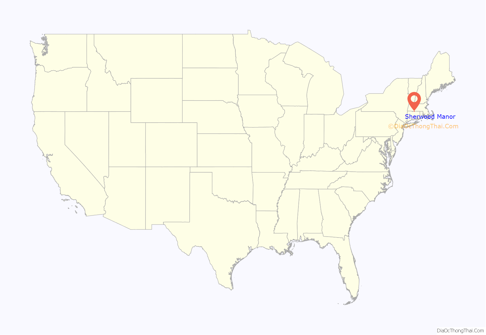
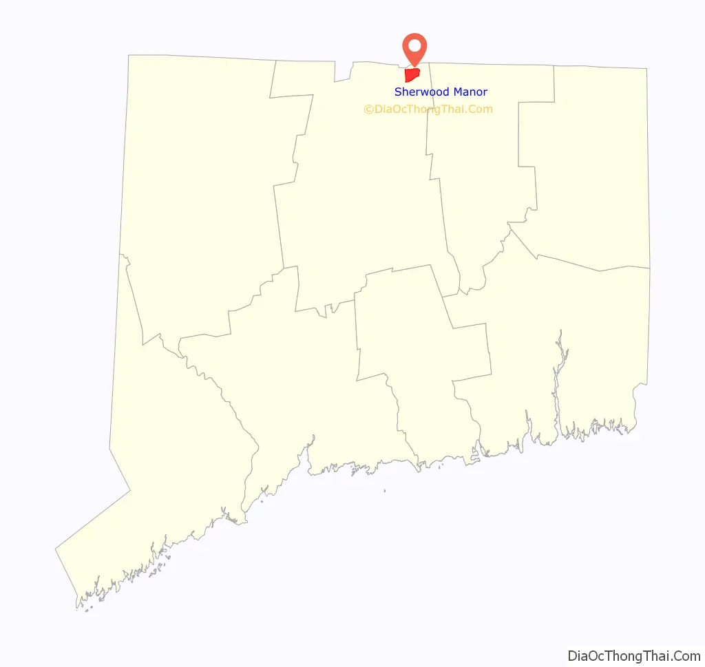
| State: | Connecticut |
| County: | Hartford County |
| Elevation: | 140 ft (40 m) |
| Total Area: | 3.1 sq mi (8.1 km²) |
| Land Area: | 3.1 sq mi (8.1 km²) |
| Water Area: | 0 sq mi (0 km²) |
| Total Population: | 5,410 |
| Population Density: | 1,700/sq mi (670/km²) |
| ZIP code: | 06082 |
| Area code: | 860 |
| FIPS code: | 0968450 |
| GNISfeature ID: | 2377860 |
Online Interactive Map
Click on ![]() to view map in "full screen" mode.
to view map in "full screen" mode.
Sherwood Manor location map. Where is Sherwood Manor CDP?
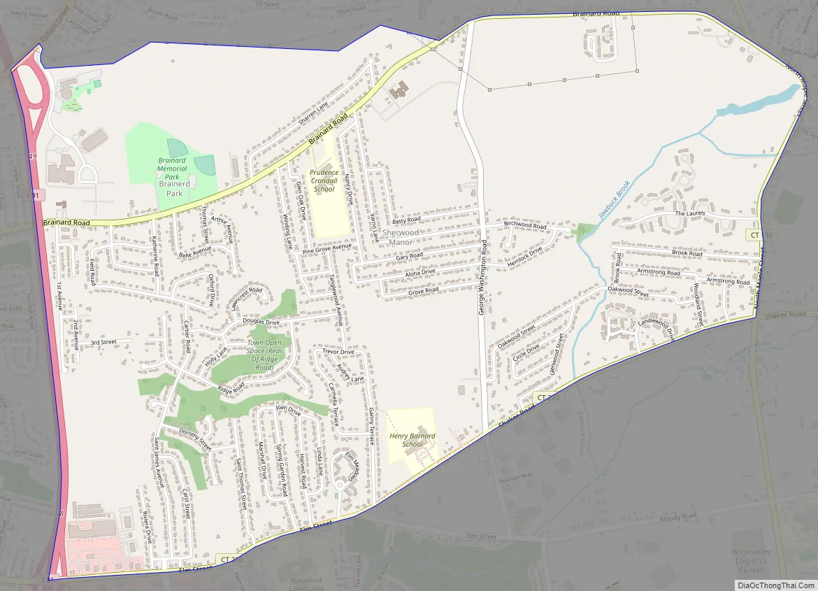
Sherwood Manor Road Map
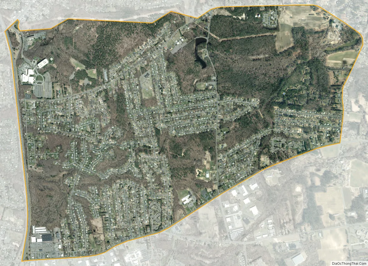
Sherwood Manor city Satellite Map
Geography
The CDP is in the northern part of the town of Enfield, bordered to the west by Interstate 91, to the north partially by Brainard Road, to the east by Connecticut Route 192 (N. Maple Street), and to the south by Connecticut Route 220 (Elm Street/Shaker Road). Thompsonville borders Sherwood Manor to the west, across I-91. Hazardville is 2 miles (3 km) to the southeast, and Longmeadow, Massachusetts, is 3 miles (5 km) to the north.
According to the United States Census Bureau, the CDP has a total area of 3.1 square miles (8.1 km), all of it land.
See also
Map of Connecticut State and its subdivision: Map of other states:- Alabama
- Alaska
- Arizona
- Arkansas
- California
- Colorado
- Connecticut
- Delaware
- District of Columbia
- Florida
- Georgia
- Hawaii
- Idaho
- Illinois
- Indiana
- Iowa
- Kansas
- Kentucky
- Louisiana
- Maine
- Maryland
- Massachusetts
- Michigan
- Minnesota
- Mississippi
- Missouri
- Montana
- Nebraska
- Nevada
- New Hampshire
- New Jersey
- New Mexico
- New York
- North Carolina
- North Dakota
- Ohio
- Oklahoma
- Oregon
- Pennsylvania
- Rhode Island
- South Carolina
- South Dakota
- Tennessee
- Texas
- Utah
- Vermont
- Virginia
- Washington
- West Virginia
- Wisconsin
- Wyoming


