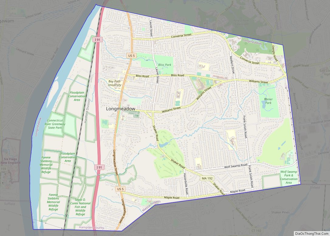
Longmeadow is a town in Hampden County, Massachusetts, in the United States. The population was 15,853 at the 2020 census.
| Name: | Longmeadow CDP |
|---|---|
| LSAD Code: | 57 |
| LSAD Description: | CDP (suffix) |
| State: | Massachusetts |
| County: | Hampden County |
| Incorporated: | 1783 |
| Elevation: | 160 ft (49 m) |
| Total Area: | 9.7 sq mi (25.0 km²) |
| Land Area: | 9.1 sq mi (23.6 km²) |
| Water Area: | 0.5 sq mi (1.3 km²) |
| Total Population: | 15,853 |
| Population Density: | 1,739.8/sq mi (671.74/km²) |
| ZIP code: | 01106, 01116 |
| Area code: | 413 |
| FIPS code: | 2536335 |
| GNISfeature ID: | 0618186 |
| Website: | www.longmeadow.org |
Online Interactive Map
Click on ![]() to view map in "full screen" mode.
to view map in "full screen" mode.
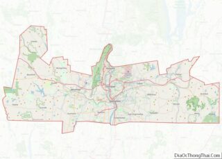
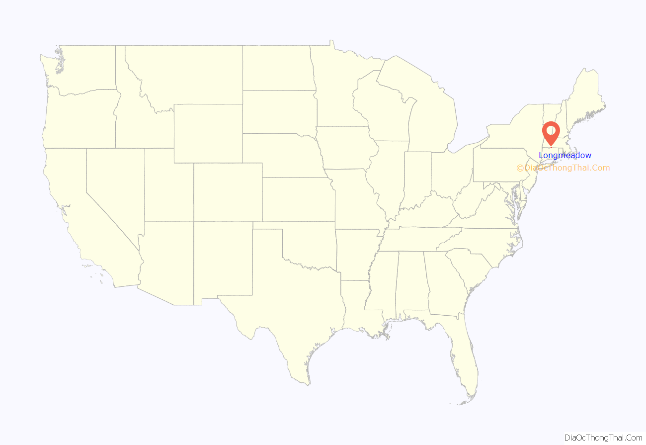
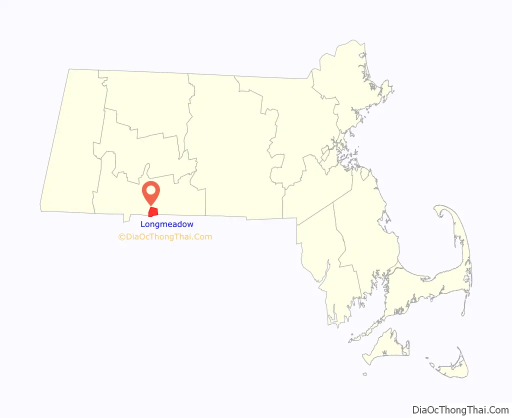
Longmeadow location map. Where is Longmeadow CDP?
History
Longmeadow was first settled in 1644, and officially incorporated October 17, 1783. The town was originally farmland within the limits of Springfield. It remained relatively pastoral until the street railway was built c. 1910, when the population tripled over a fifteen-year period. After Interstate 91 was built in the wetlands on the west side of town, population tripled again between 1960 and 1975.
During the 19th and early 20th centuries, Longmeadow was best known as the site from which Longmeadow brownstone was mined. Several famous American buildings, including Princeton University’s Neo-Gothic library, are made of Longmeadow brownstone. In 1894, the more populous and industrialized “East Village” portion of the town containing the brownstone quarries split off to become East Longmeadow.
Designed by famed golf course architect Donald Ross in 1922, the Longmeadow Country Club was the proving ground for golf equipment designed and manufactured by the Spalding Co. of Chicopee. Bobby Jones, a consultant for Spalding, was a member in standing at LCC and made a number of his instructional films at LCC in the 1930s.
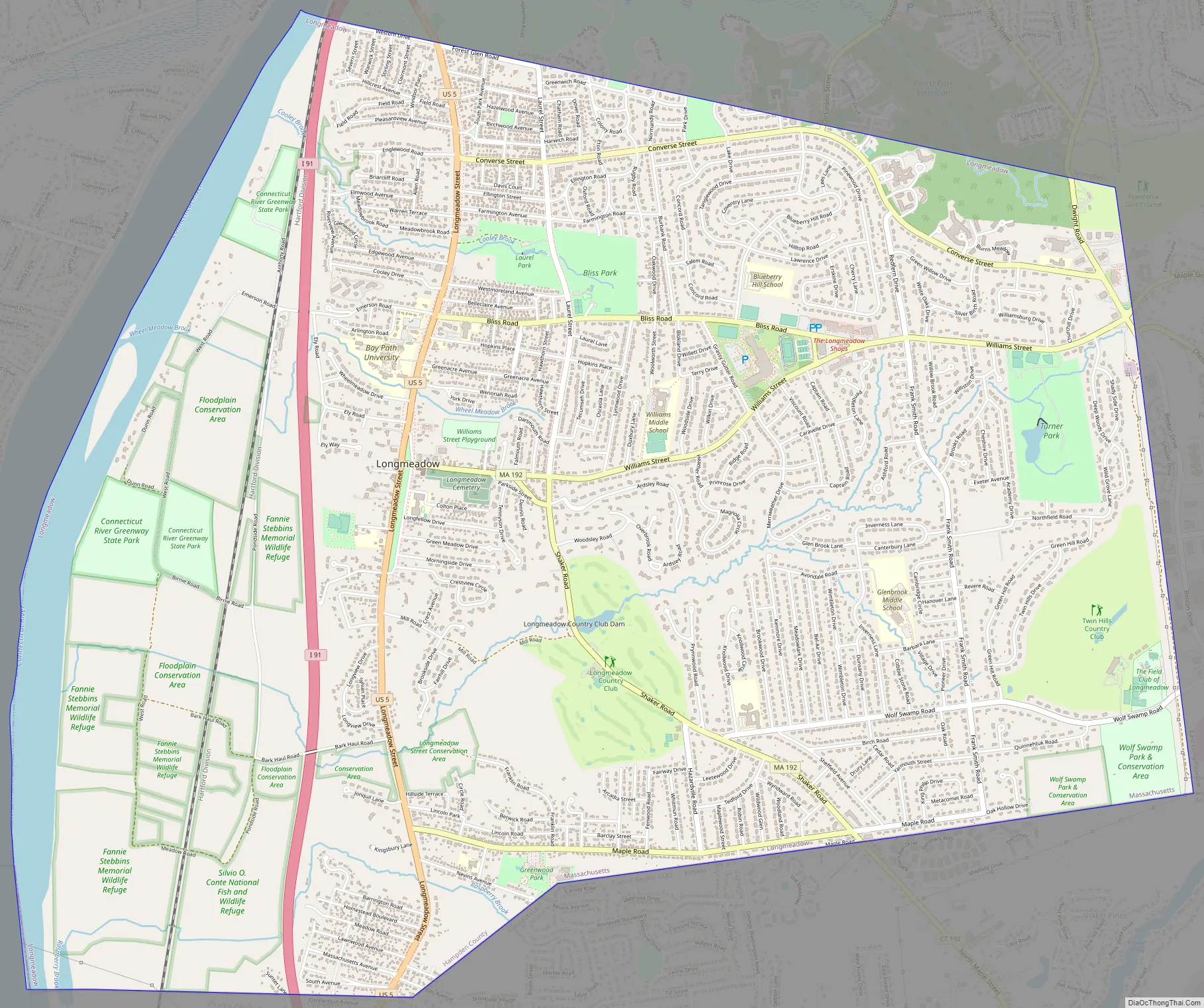
Longmeadow Road Map
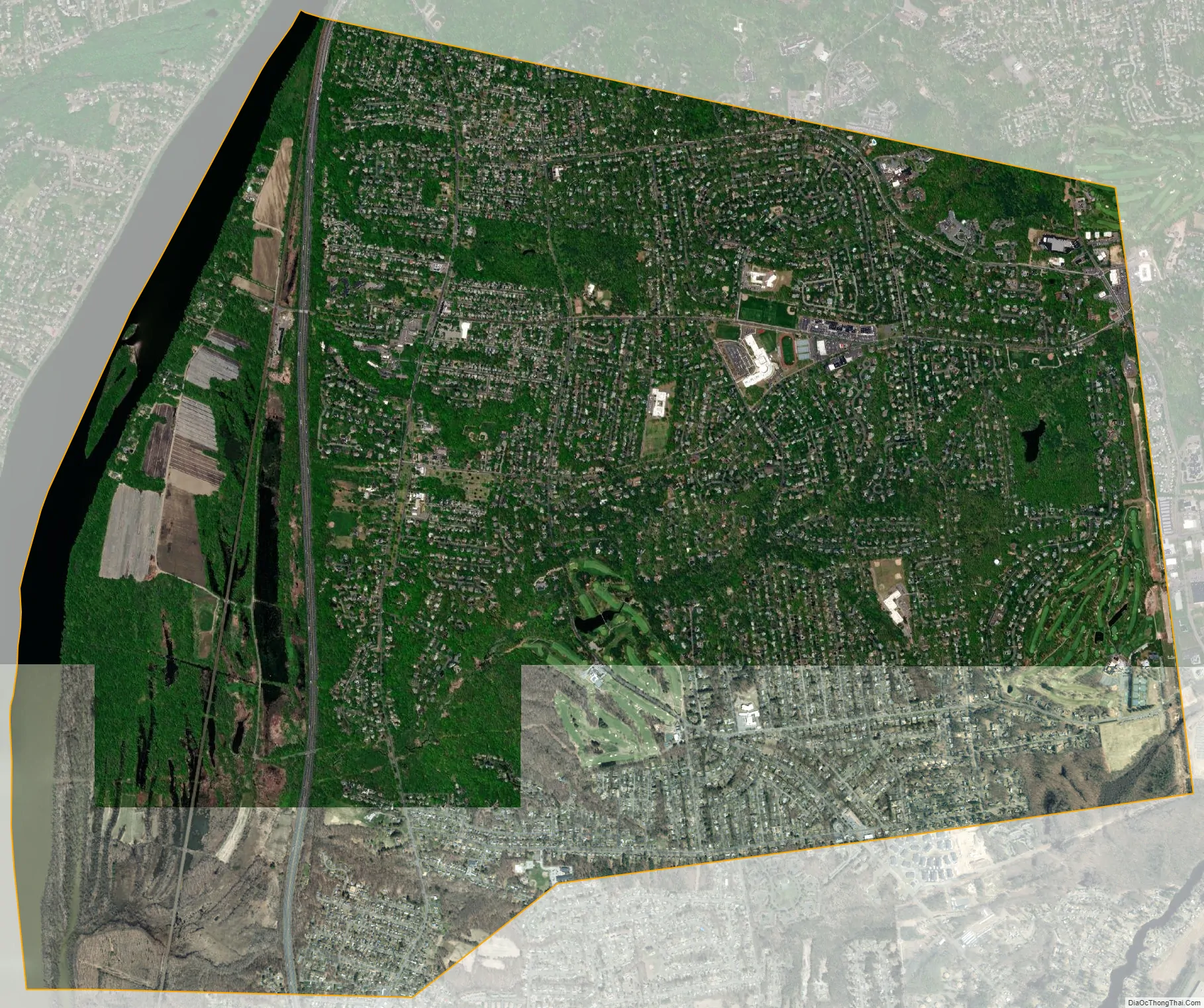
Longmeadow city Satellite Map
Geography
Longmeadow is located in the western part of the state, just south of the city of Springfield, and is bordered on the west by the Connecticut River and Agawam, to the east by East Longmeadow, and to the south by Enfield, Connecticut. It extends approximately 3 miles (5 km) north to south and 4 miles (6.4 km) east to west. It is approximately 20 miles (32 km) north of Hartford.
More than 30% of the town is permanent open space. Conservation areas on the west side of town include more than 750 acres (3.0 km) bordering the Connecticut River. The area supports a wide range of wildlife including deer, beaver, wild turkeys, foxes, and eagles. Springfield’s Forest Park, which at 735 acres (2.97 km) is the largest city park in New England, forms the northern border of the town. The private Twin Hills and public Franconia golf courses, plus town athletic fields and conservation land, cover nearly 2/3 of the eastern border of the town. Two large public parks, the Longmeadow Country Club, and three conservation areas account for the bulk of the remaining formal open space. Almost 20% of the houses in town are in proximity to a “dingle”, a tree-lined steep-sided sandy ravine with a wetland at the bottom that provides a privacy barrier between yards.
Longmeadow has a town common, commonly referred to as “The Green”, located along U.S. Route 5 on the west side of town. It is about 0.5 miles (0.80 km) long. Roughly 100 houses date back before 1900, most of which are in the historic district, are located near the town green. Longmeadow’s Town Green is a historic district on the National Register of Historic Places, and it is surrounded by a number of buildings dating back to the 18th and 19th centuries. Longmeadow is unique as the town green has maintained its residential purpose and has resisted commercial pressure. The current function as listed by the National Register of Historic Places is domestic and landscape. The current sub-function as listed by the National Register of Historic Places is park and single dwelling. Houses along the photogenic main street (Longmeadow Street) are set back farther than in most towns of similar residential density.The town has three recently remodeled elementary schools, two secondary schools, and one high school. The commercial center of town is an area called “The Longmeadow Shops”, including restaurants and clothing stores.
According to the United States Census Bureau, the town has a total area of 9.7 square miles (25.0 km), of which 9.1 square miles (23.6 km) are land and 0.50 square miles (1.3 km), or 5.34%, are water.
See also
Map of Massachusetts State and its subdivision: Map of other states:- Alabama
- Alaska
- Arizona
- Arkansas
- California
- Colorado
- Connecticut
- Delaware
- District of Columbia
- Florida
- Georgia
- Hawaii
- Idaho
- Illinois
- Indiana
- Iowa
- Kansas
- Kentucky
- Louisiana
- Maine
- Maryland
- Massachusetts
- Michigan
- Minnesota
- Mississippi
- Missouri
- Montana
- Nebraska
- Nevada
- New Hampshire
- New Jersey
- New Mexico
- New York
- North Carolina
- North Dakota
- Ohio
- Oklahoma
- Oregon
- Pennsylvania
- Rhode Island
- South Carolina
- South Dakota
- Tennessee
- Texas
- Utah
- Vermont
- Virginia
- Washington
- West Virginia
- Wisconsin
- Wyoming