Watertown is a census-designated place (CDP) in Litchfield County, Connecticut, United States. It comprises the central village of the town of Watertown. As of the 2010 census, the population of the CDP was 3,574, out of 22,514 in the entire town.
| Name: | Watertown CDP |
|---|---|
| LSAD Code: | 57 |
| LSAD Description: | CDP (suffix) |
| State: | Connecticut |
| County: | Litchfield County |
| Elevation: | 583 ft (178 m) |
| Total Area: | 2.12 sq mi (5.50 km²) |
| Land Area: | 2.12 sq mi (5.49 km²) |
| Water Area: | 0.004 sq mi (0.01 km²) |
| Total Population: | 3,574 |
| Population Density: | 1,687/sq mi (651.2/km²) |
| ZIP code: | 06795 |
| FIPS code: | 0980420 |
| GNISfeature ID: | 2631578 |
Online Interactive Map
Click on ![]() to view map in "full screen" mode.
to view map in "full screen" mode.
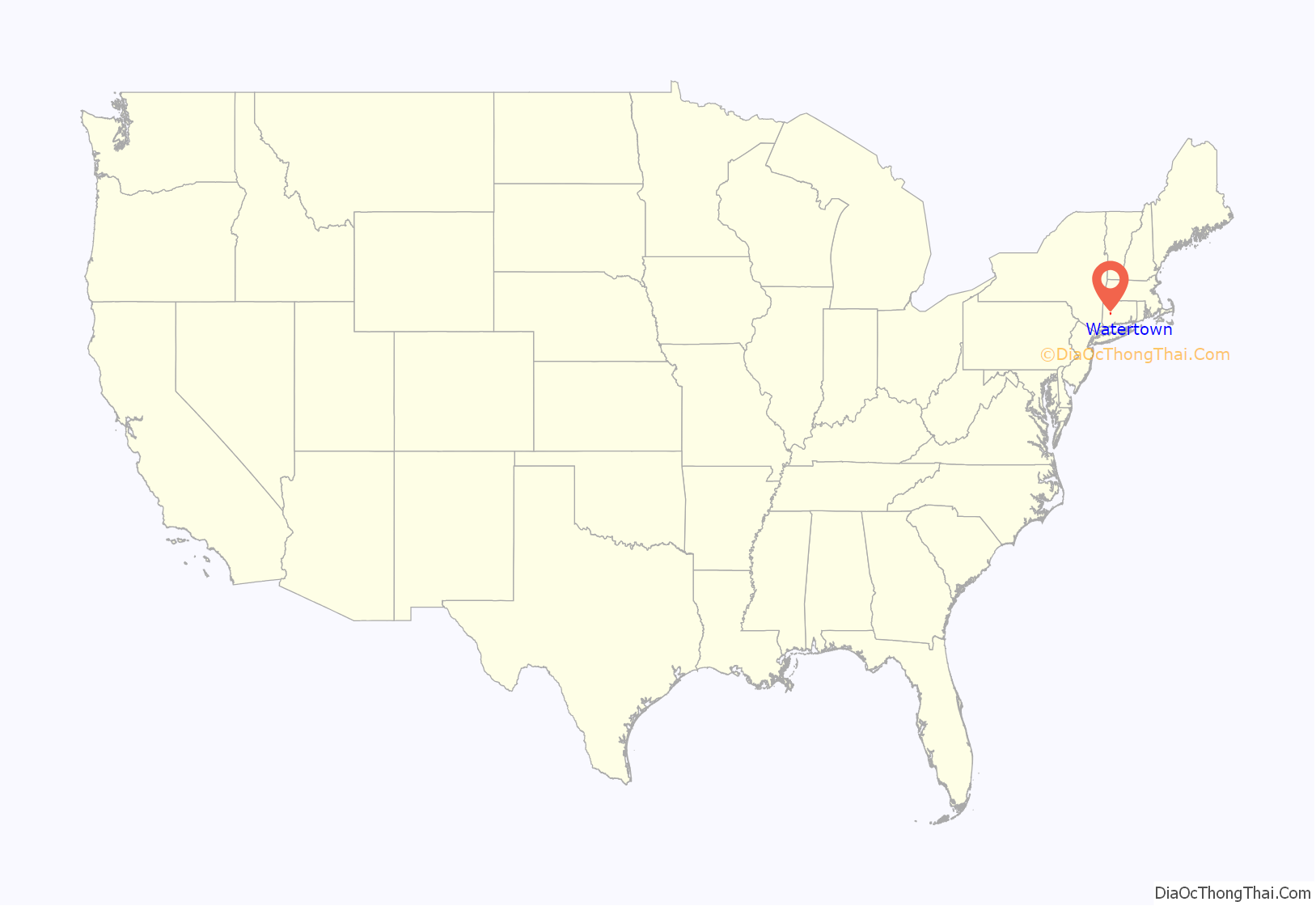
Watertown location map. Where is Watertown CDP?
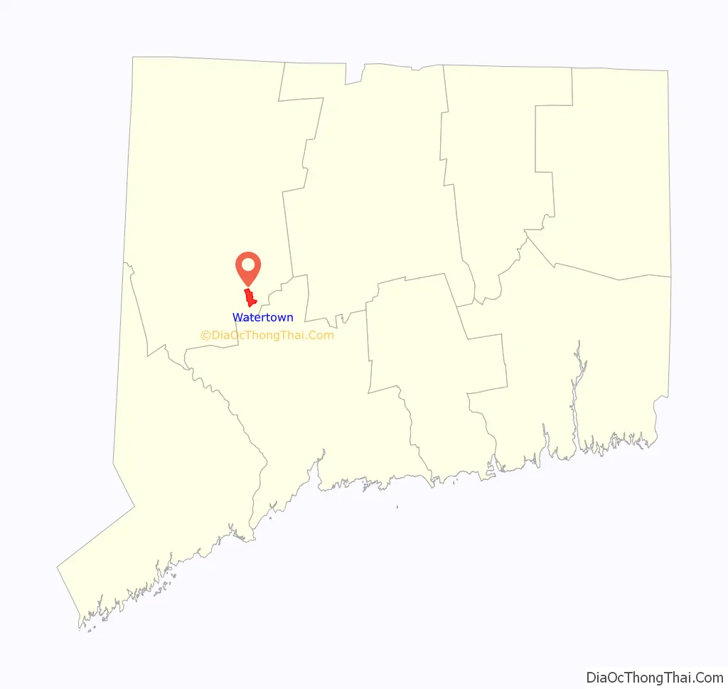
Watertown Road Map
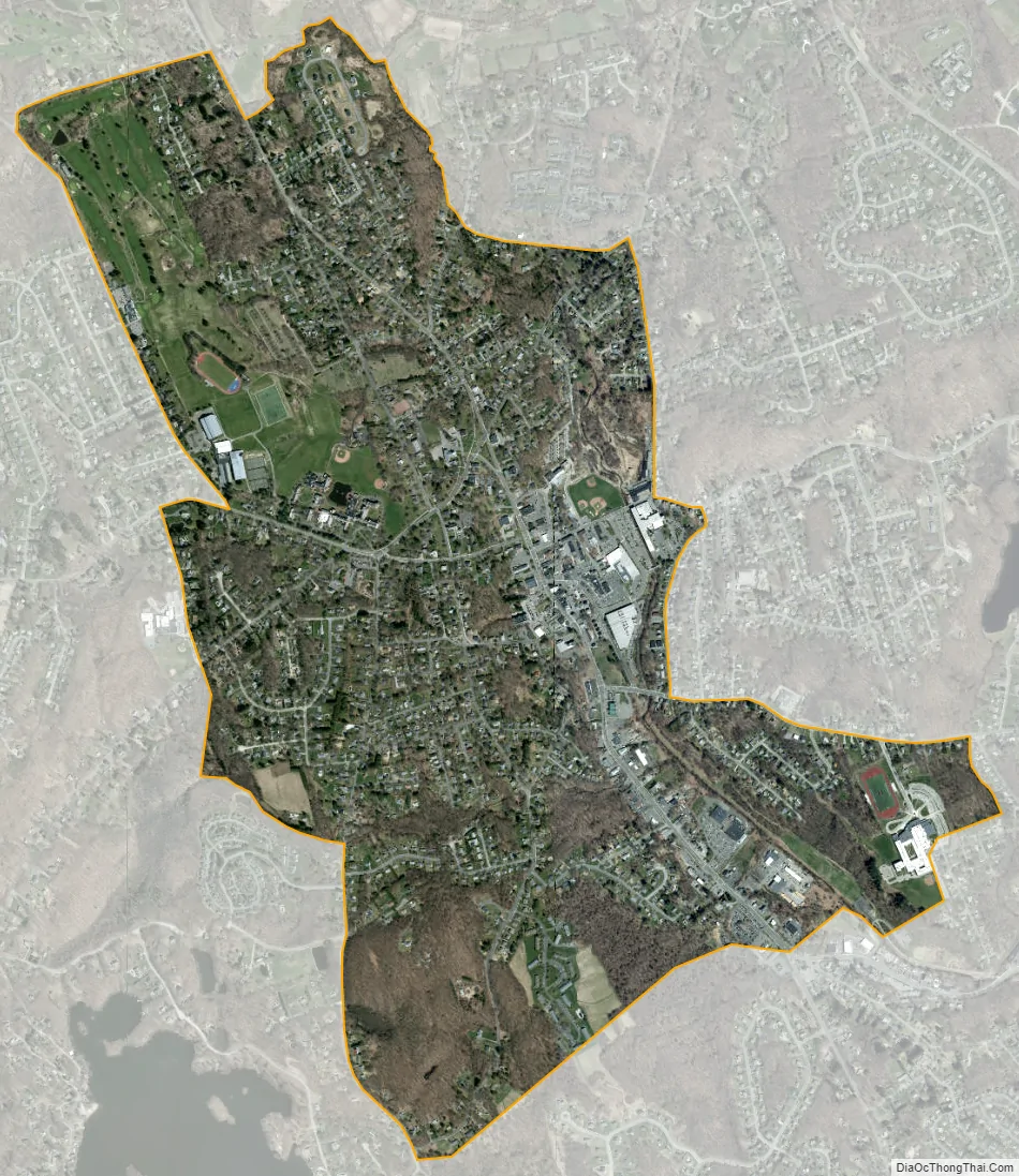
Watertown city Satellite Map
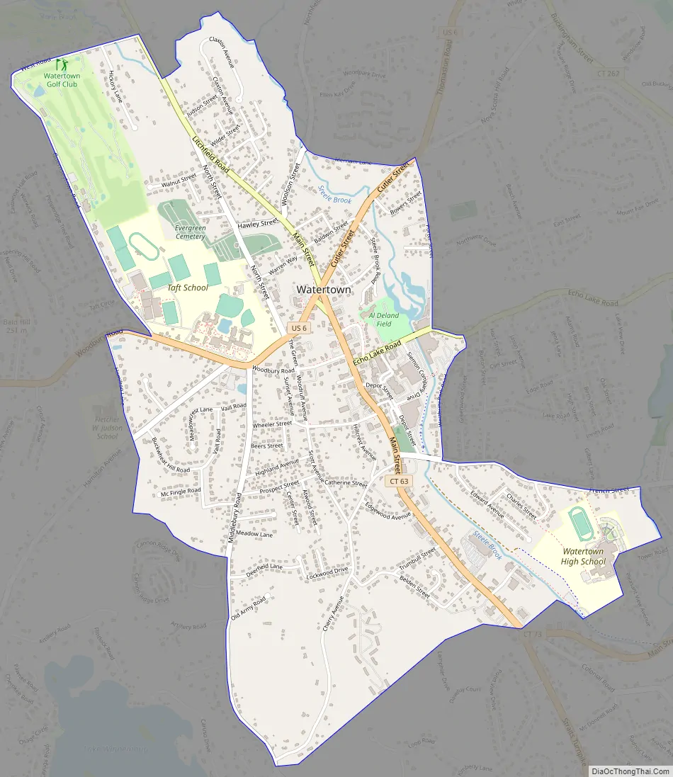
Geography
The Watertown CDP is slightly south of the geographic center of the town of Watertown, on a hill rising to the west of Steele Brook, a southeast-flowing tributary of the Naugatuck River. The CDP is bordered to the southeast by the community of Oakville, the most populous place in Watertown. The Watertown CDP extends to the south as far as the junction of Connecticut Routes 63 and 73; to the west as far as Middlebury Road, Hamilton Lane, and Guernseytown Road; to the north as far as West Road and Merriam Lane; and to the east to Porter Street, Westbury Park Road, and French Street.
U.S. Route 6 follows Cutler Street, Deforest Street, and Woodbury Road through the center of the community; it leads northeast 5 miles (8 km) to Thomaston and southwest 7 miles (11 km) to Woodbury. Connecticut Route 63 is Watertown’s Main Street; it leads north 10 miles (16 km) to Litchfield and south five miles to Interstate 84 at the western border of Waterbury. Downtown Waterbury is five miles to the southeast of Watertown via Routes 63 and 73.
According to the U.S. Census Bureau, the Watertown CDP has a total area of 2.1 square miles (5.5 km), of which 0.00 square miles (0.01 km), or 0.23%, are water.
See also
Map of Connecticut State and its subdivision: Map of other states:- Alabama
- Alaska
- Arizona
- Arkansas
- California
- Colorado
- Connecticut
- Delaware
- District of Columbia
- Florida
- Georgia
- Hawaii
- Idaho
- Illinois
- Indiana
- Iowa
- Kansas
- Kentucky
- Louisiana
- Maine
- Maryland
- Massachusetts
- Michigan
- Minnesota
- Mississippi
- Missouri
- Montana
- Nebraska
- Nevada
- New Hampshire
- New Jersey
- New Mexico
- New York
- North Carolina
- North Dakota
- Ohio
- Oklahoma
- Oregon
- Pennsylvania
- Rhode Island
- South Carolina
- South Dakota
- Tennessee
- Texas
- Utah
- Vermont
- Virginia
- Washington
- West Virginia
- Wisconsin
- Wyoming