West Haven is a city in New Haven County, Connecticut, United States, located on the coast of Long Island Sound. The city is part of the South Central Connecticut Planning Region. At the 2020 census, the population of the city was 55,584.
| Name: | West Haven city |
|---|---|
| LSAD Code: | 25 |
| LSAD Description: | city (suffix) |
| State: | Connecticut |
| County: | New Haven County |
| Elevation: | 33 ft (10 m) |
| Total Area: | 10.92 sq mi (28.27 km²) |
| Land Area: | 10.75 sq mi (27.84 km²) |
| Water Area: | 0.17 sq mi (0.43 km²) |
| Total Population: | 55,584 |
| Population Density: | 5,171/sq mi (1,996.6/km²) |
| ZIP code: | 06516 |
| Area code: | 203/475 |
| FIPS code: | 0982800 |
| GNISfeature ID: | 0211953 |
| Website: | www.cityofwesthaven.com |
Online Interactive Map
Click on ![]() to view map in "full screen" mode.
to view map in "full screen" mode.
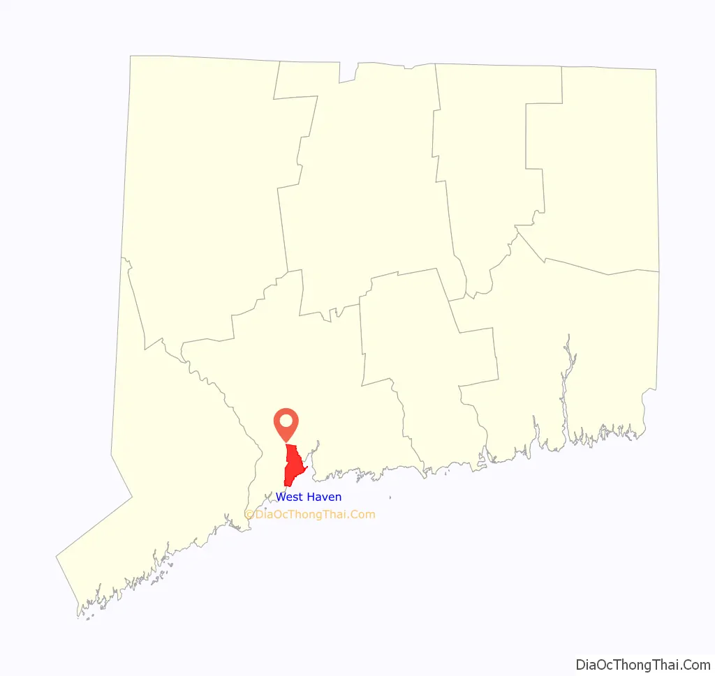
West Haven location map. Where is West Haven city?

History
Settled in 1648, West Haven (then known as West Farms) was a part of the original New Haven Colony. In 1719, it became the separate parish of West Haven, but was still officially a part of New Haven until 1822.
During the American Revolution, West Haven was the frequent launch and arrival point for raiding parties on both sides of the war. On July 5, 1779, the British invaded New Haven Harbor and came ashore in West Haven and East Haven. Thomas Painter, a teenaged militiaman watching for the approaching British ships while standing atop Savin Rock, is depicted on the city seal. The main commercial street, Campbell Avenue, is named for British Adjutant William Campbell, at the time an ensign in the Third Guards, who rescued the Reverend Noah Williston, the local Congregational minister and outspoken revolutionary, from being bayoneted by British and Hessian troopers, after he broke his leg trying to escape his captors. Campbell then ordered the soldiers to help the minister back to the parsonage and had the regimental surgeon set his leg. Campbell is also credited with keeping the troops in reasonably good order during their march through the village and reportedly had two soldiers arrested after a local woman accused them of stealing her jewelry. Campbell was killed hours later atop Allingtown Hill on his way to New Haven by a local farmer-turned defender. Campbell is buried in the Allingtown section of town off Prudden Street. Patriot victims of the invasion are buried in the Christ Church and First Society Cemetery. A historical headstone marks Campbell’s approximate gravesite and is maintained by the West Haven Historical Society.
While West Haven again attempted to incorporate as its own town in 1784, that attempt failed, primarily due to the protests of neighboring Milford, which opposed North Milford becoming part of the new town. West Haven and North Milford tried again in 1786 and 1787 with the same result. The two finally joined to become Orange (incorporated as a town in 1822). In 1921, West Haven split from Orange to become a separate town. It was incorporated as a city in 1961 and is known as “Connecticut’s Youngest City”, although it is also one of the state’s oldest settlements.
The Savin Rock section of West Haven was the site of the Savin Rock Amusement Park, which began in the late 19th century as a regionally renowned seaside resort. It evolved into a general amusement park in the 20th century and eventually closed in the 1960s. The park ran along the west side of the New Haven Harbor beachfront.
What followed was a 40 year struggle to stop Savin Rock’s Redevelopment—approved by voters in 1963 and officially starting in 1966. It involved multiple referendums, petition drives, court cases, and Connecticut Supreme Court decisions affecting the 40 acre area. Opposition began about 1971 soon after old Savin Rock had been torn down and the first project built, but ballooned in 1973 when Save Our Shore (SOS) led a referendum to stop “the Great Wall of China”, an 800 foot 12 story apartment, proposed for a 10 acre parcel, blocking the shore view. A 1974 referendum to stop all development was organized by IMPACT (successor to SOS), but was overturned by the Supreme Court in 1978. This led to a struggle for a Compromise Plan, initiated by Mayor Robert Johnson, and brought to completion by action of the Concerned Citizens for Bradley Point (1979), which petitioned the final holdout to the Plan, to which the Supreme Court had required all developers to agree for any significant change. The Compromise was signed by all in May, 1979, but IMPACT continued to oppose it thru 1980. Thereafter, a committee sought public input and federal money, and in July, 1984, the 20 acre Bradley Point Veterans Memorial Park opened. In 1987 and 1989, the city bought development rights of all the remaining parcels, part of which became the Old Grove Park and part included a former restaurant that became the Savin Rock Conference Center. In 1991, the Land Trust of West Haven, Inc. was founded, but it was not until 2007 that a Conservation Easement was signed, preserving all but the Conference Center, as open space forever—beautiful parks, with walks and bike path, along Connecticut’s longest public shoreline. Several restaurants remain as last reminders of the area including Jimmies, Turk’s of Savin Rock, both for their seafood and split hot dogs and Mike’s Apizza & Restaurant.
West Haven has a mayor-council form of government. Nancy R. Rossi, the city’s twelfth mayor, was elected in 2017. She is West Haven’s first female mayor. There are two independent fire districts served by the First Fire Taxation (Center) and West Shore. The Allingtown Fire District was relatively recently subsumed by the City who’s now responsible for all of its pension-related obligations going forward. Residents expect efforts will be made to consolidate the remaining two fire districts based, in large part, on the recommendation of the State’s Municipal Accountability Review Board (MARB) who is currently providing financial support and guidance to the City. As it currently stands, each of the remaining independent Fire Districts levy its own tax rate.
In 1986, West Haven observed the Bicentennial of the United States Constitution. During the year-long celebrations, the mayor and council passed numerous resolutions to encourage community involvement, including naming the official ship of West Haven—the U.S. Navy destroyer USS Edson (DD-946)—and the city’s official flower, the daylily. Public schools included curriculum on the Constitution from K–12, and school children were released from class to participate in a Constitution Day parade up Campbell Avenue.
In June 2014, the “Where Angels Play” playground opened next to Sea Bluff Beach in West Haven. The playground was built in honor of Charlotte Bacon, a victim of the Sandy Hook Elementary School shooting. The playground is pink for Charlotte’s favorite color and includes some of her drawings.
West Haven Road Map
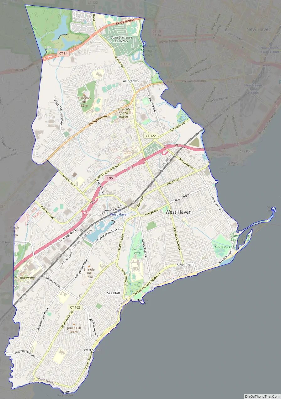
West Haven city Satellite Map

Geography
According to the U.S. Census Bureau, the city has a total area of 11 square miles (28 km), of which 10.75 square miles (27.8 km) is land .2 square miles (0.52 km), or 1.54%, is water. West Haven has 3.5 miles (5.6 km) of publicly accessible beaches, which is one-quarter of the publicly accessible beaches in Connecticut. The hilly Allingtown district of the city is home to the University of New Haven.
West Haven is located in the south-central portion of Connecticut’s 3rd congressional district. The city is bound on the southwest by the Oyster River (the boundary between West Haven and Milford since colonial times), northwest by Orange, north by New Haven and northeast by the West River, which divides West Haven and New Haven. To the east is New Haven Harbor and to the south is Long Island Sound. The Cove River flows through the city.
Principal communities
The three significant neighborhoods in West Haven correspond to the three fire districts. As communities, not all sections of the city fit neatly into these divisions.
- Allingtown
- West Shore
- Center
Additional Neighborhoods:
- Sandy Point – adjacent to Sandy Point Beach and Bird Sanctuary
See also
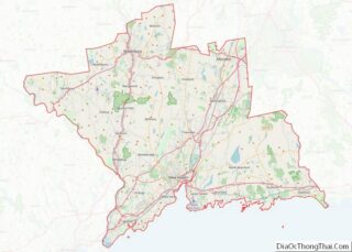
Map of Connecticut State and its subdivision: Map of other states:- Alabama
- Alaska
- Arizona
- Arkansas
- California
- Colorado
- Connecticut
- Delaware
- District of Columbia
- Florida
- Georgia
- Hawaii
- Idaho
- Illinois
- Indiana
- Iowa
- Kansas
- Kentucky
- Louisiana
- Maine
- Maryland
- Massachusetts
- Michigan
- Minnesota
- Mississippi
- Missouri
- Montana
- Nebraska
- Nevada
- New Hampshire
- New Jersey
- New Mexico
- New York
- North Carolina
- North Dakota
- Ohio
- Oklahoma
- Oregon
- Pennsylvania
- Rhode Island
- South Carolina
- South Dakota
- Tennessee
- Texas
- Utah
- Vermont
- Virginia
- Washington
- West Virginia
- Wisconsin
- Wyoming