Buzzards Bay is a census-designated place (CDP) in the town of Bourne in Barnstable County, Massachusetts. The population was 3,859 at the 2010 census. It is the most populous of the five CDPs in Bourne.
| Name: | Buzzards Bay CDP |
|---|---|
| LSAD Code: | 57 |
| LSAD Description: | CDP (suffix) |
| State: | Massachusetts |
| County: | Barnstable County |
| Elevation: | 10 ft (3 m) |
| Total Area: | 2.96 sq mi (7.66 km²) |
| Land Area: | 1.92 sq mi (4.96 km²) |
| Water Area: | 1.04 sq mi (2.70 km²) |
| Total Population: | 4,279 |
| Population Density: | 2,233.30/sq mi (862.43/km²) |
| ZIP code: | 02532, 02542 |
| Area code: | 508 |
| FIPS code: | 2510015 |
| GNISfeature ID: | 0616369 |
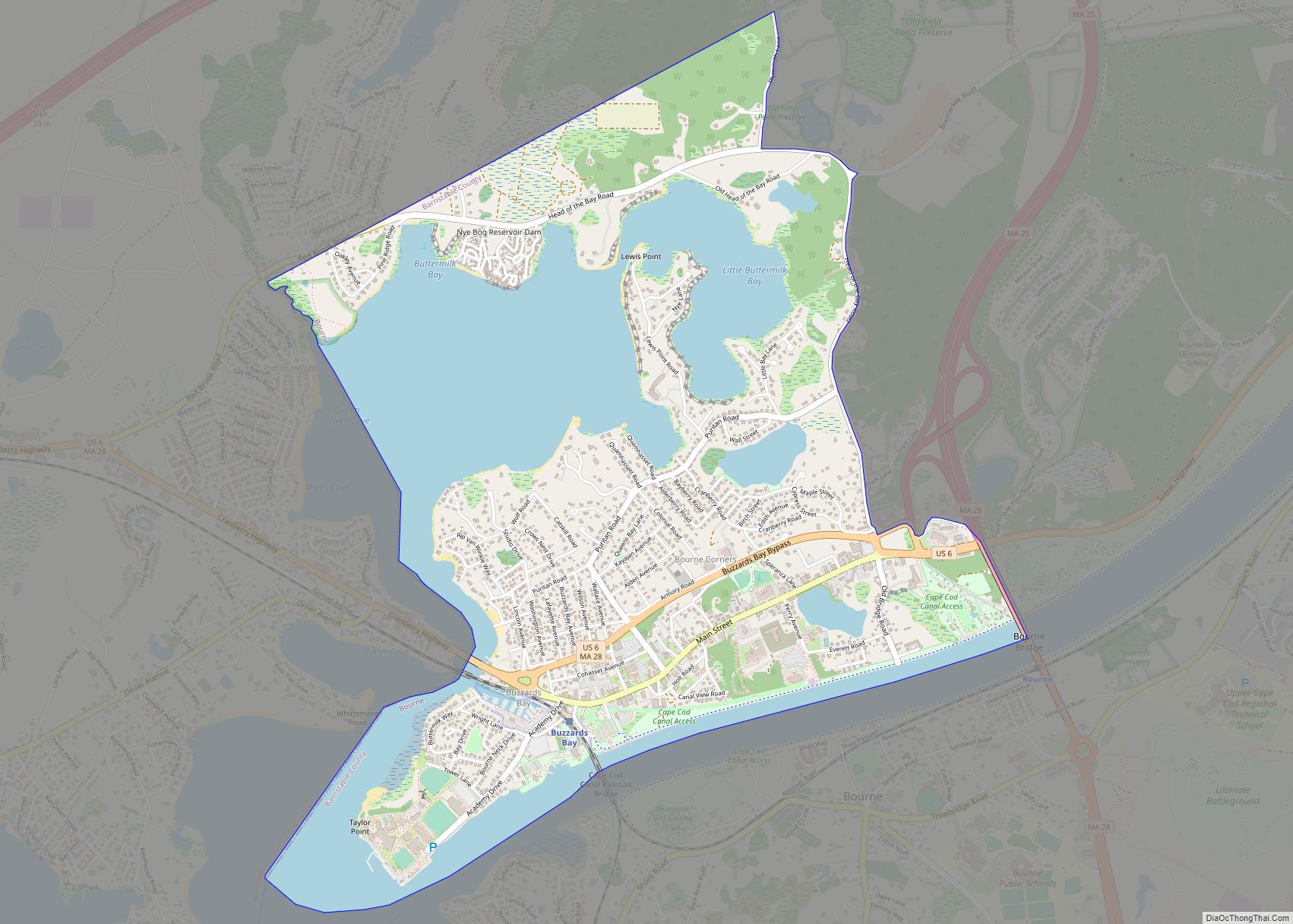
Online Interactive Map
Click on ![]() to view map in "full screen" mode.
to view map in "full screen" mode.
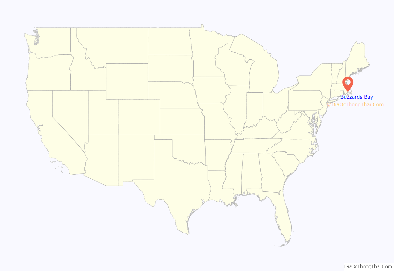
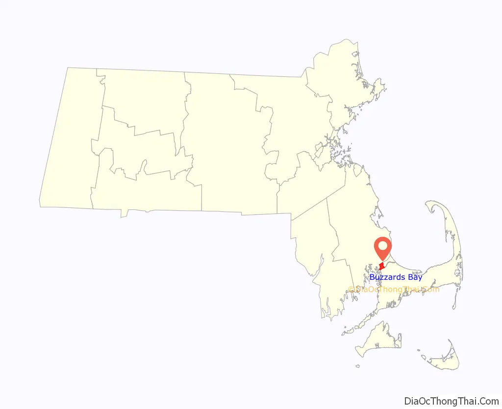
Buzzards Bay location map. Where is Buzzards Bay CDP?
History
Buzzards Bay was originally Wampanoag territory. The “buzzards” for which the town was named were most likely turkey vultures or ospreys. Buzzards Bay was settled by Europeans in 1621.
Among the community’s most prominent residents was President of the United States Grover Cleveland, who maintained a “Summer White House” at his home at Agawam Point in Buzzards Bay. Cleveland’s home, a local landmark, was destroyed by fire on December 10, 1973.
Buzzards Bay Road Map
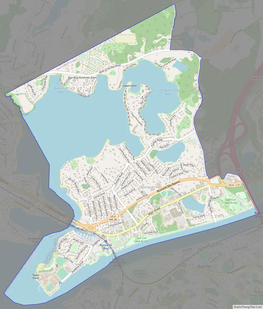
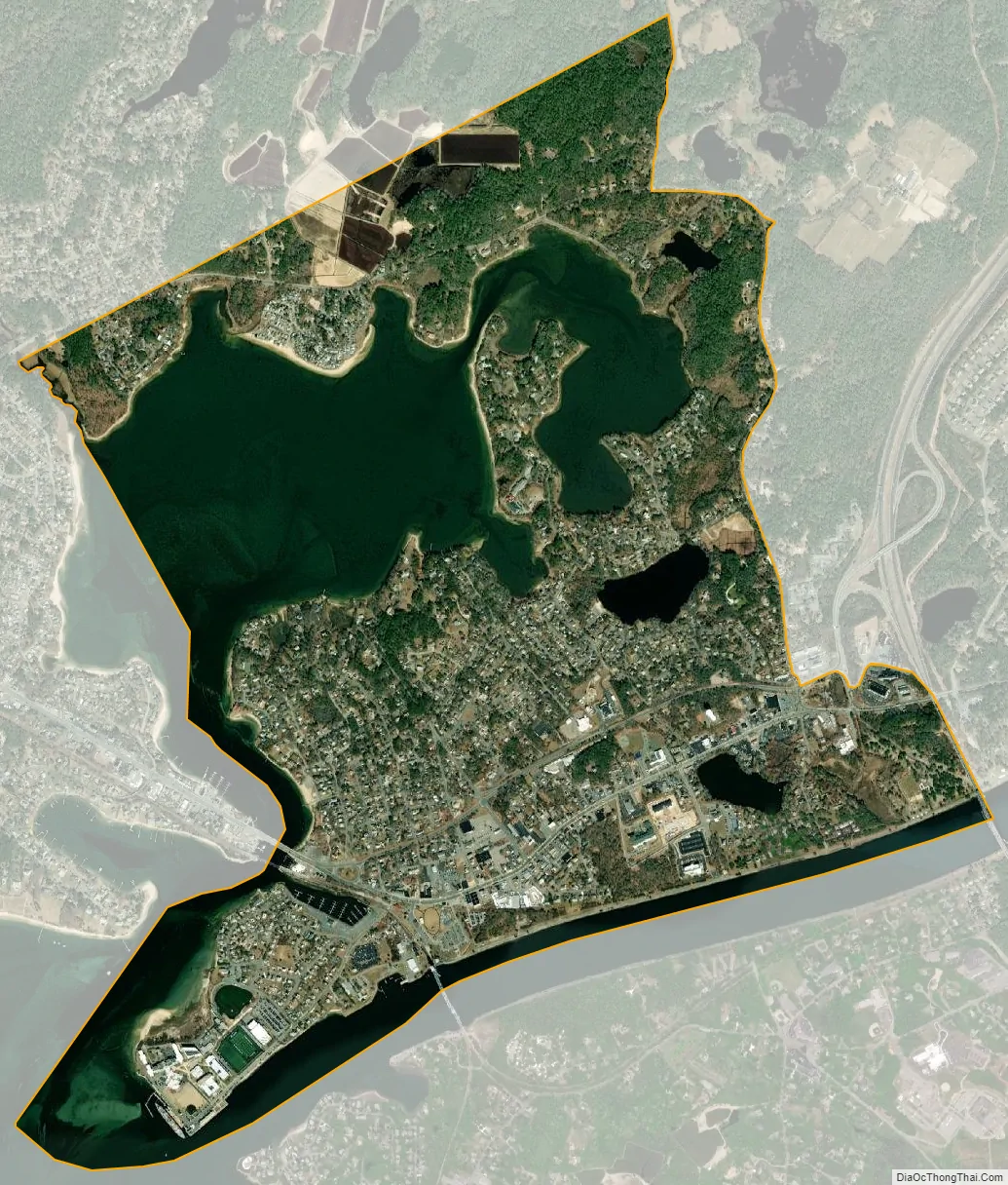
Buzzards Bay city Satellite Map
Geography
Buzzards Bay is located at 41°45′5″N 70°36′49″W / 41.75139°N 70.61361°W / 41.75139; -70.61361 (41.751364, -70.613563). Along with Bournedale and Sagamore Beach, it is one of three communities in Barnstable County located on the mainland side of the Cape Cod Canal. Excessively drained sand underlies most of the community and the majority is mapped as Carver soil series.
According to the United States Census Bureau, the CDP has a total area of 2.9 square miles (7.6 km). 1.9 square miles (5.0 km) of it is land and 1.0 square mile (2.6 km) of it (34.75%) is water, consisting primarily of Buttermilk Bay, an arm of Buzzards Bay that forms the western edge of the CDP.
See also
Map of Massachusetts State and its subdivision: Map of other states:- Alabama
- Alaska
- Arizona
- Arkansas
- California
- Colorado
- Connecticut
- Delaware
- District of Columbia
- Florida
- Georgia
- Hawaii
- Idaho
- Illinois
- Indiana
- Iowa
- Kansas
- Kentucky
- Louisiana
- Maine
- Maryland
- Massachusetts
- Michigan
- Minnesota
- Mississippi
- Missouri
- Montana
- Nebraska
- Nevada
- New Hampshire
- New Jersey
- New Mexico
- New York
- North Carolina
- North Dakota
- Ohio
- Oklahoma
- Oregon
- Pennsylvania
- Rhode Island
- South Carolina
- South Dakota
- Tennessee
- Texas
- Utah
- Vermont
- Virginia
- Washington
- West Virginia
- Wisconsin
- Wyoming