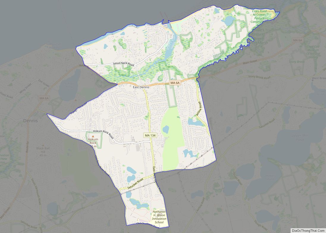
Dennis is a village and census-designated place (CDP) in the town of Dennis in Barnstable County, Massachusetts, United States. The population was 2,407 at the 2010 census. The CDP includes the populated places known as North Dennis and New Boston.
The Dennis post office, one of five post offices in the town of Dennis, is assigned zip code 02638.
| Name: | Dennis CDP |
|---|---|
| LSAD Code: | 57 |
| LSAD Description: | CDP (suffix) |
| State: | Massachusetts |
| County: | Barnstable County |
| Elevation: | 16 ft (5 m) |
| Total Area: | 5.13 sq mi (13.28 km²) |
| Land Area: | 4.91 sq mi (12.72 km²) |
| Water Area: | 0.21 sq mi (0.56 km²) |
| Total Population: | 2,399 |
| Population Density: | 488.50/sq mi (188.61/km²) |
| ZIP code: | 02638 |
| Area code: | 508 |
| FIPS code: | 2516740 |
| GNISfeature ID: | 0615824 |
Online Interactive Map
Click on ![]() to view map in "full screen" mode.
to view map in "full screen" mode.
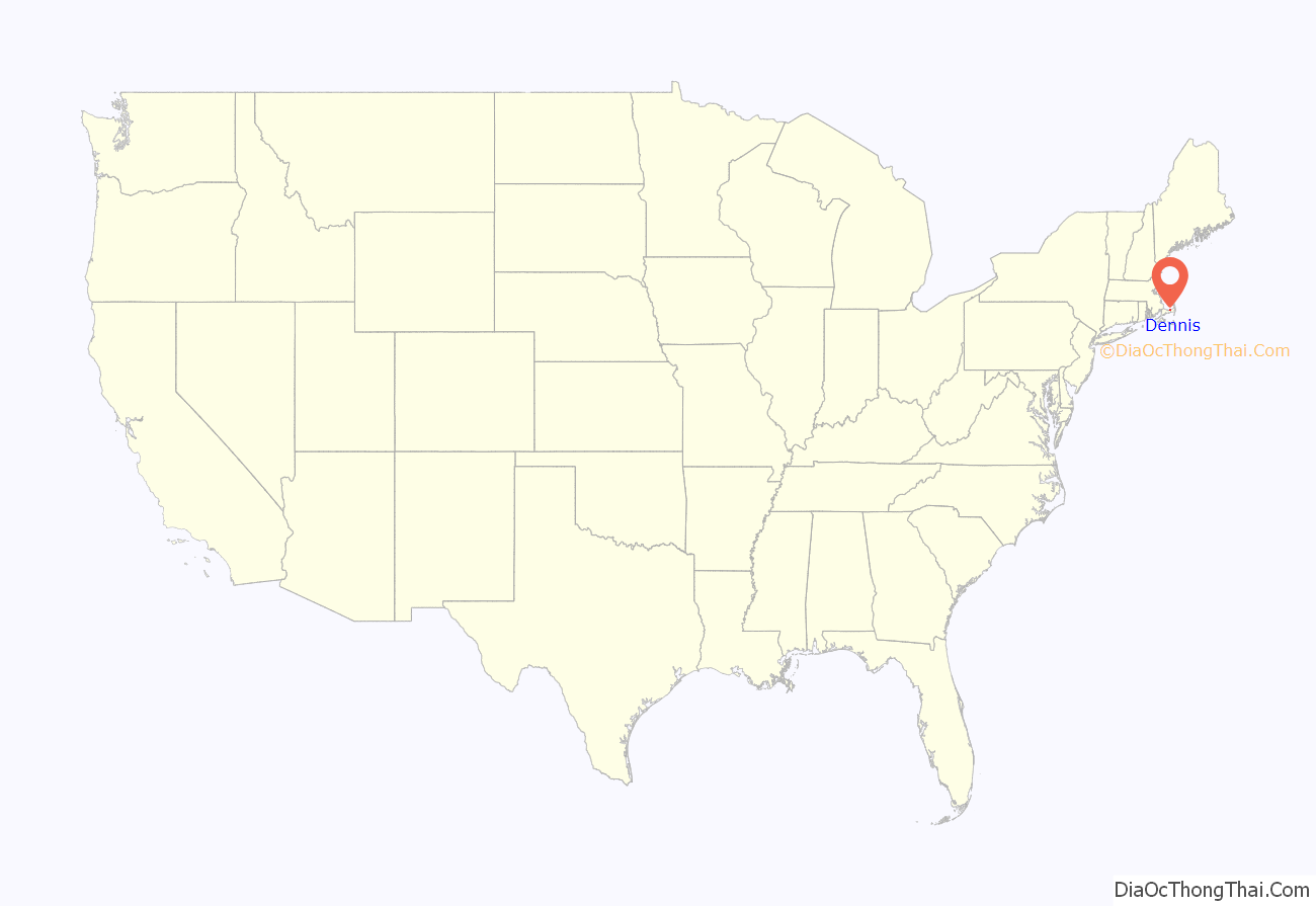
Dennis location map. Where is Dennis CDP?
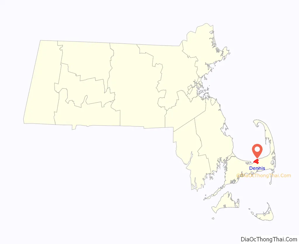
Dennis Road Map
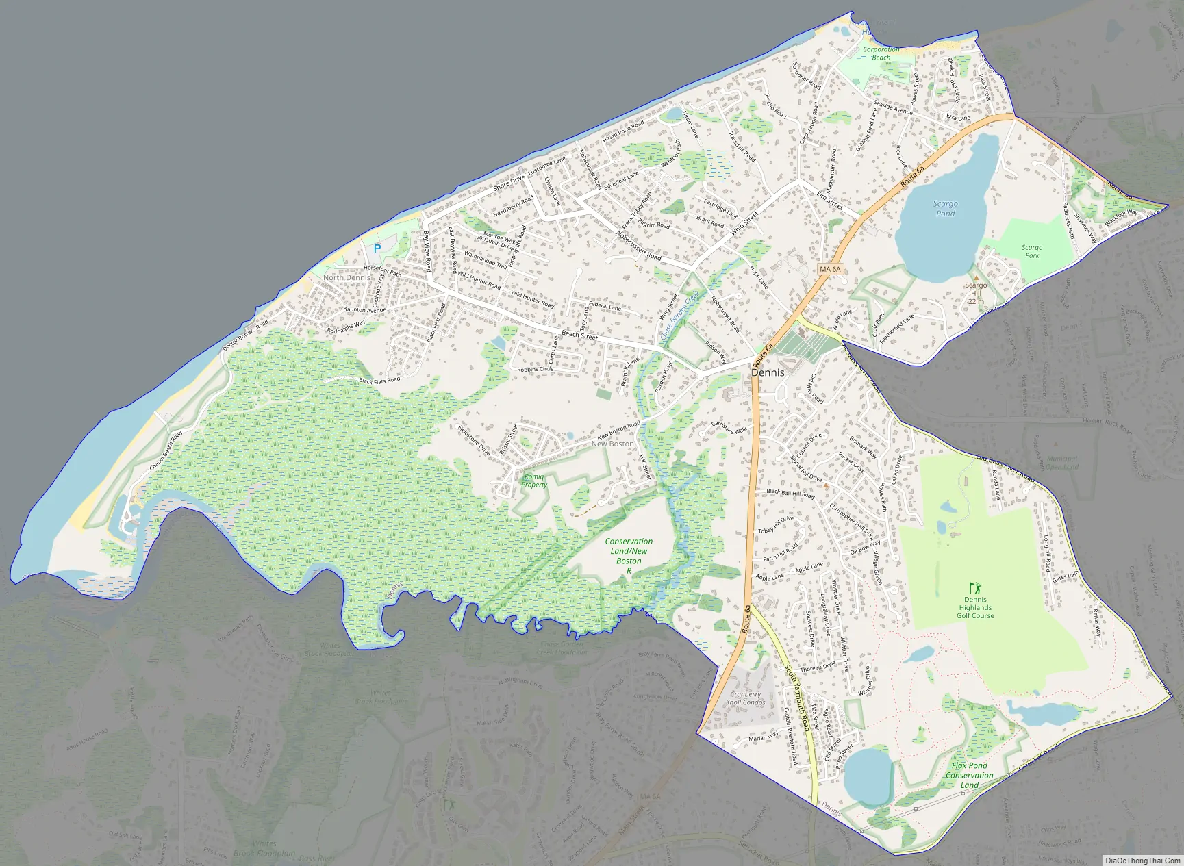
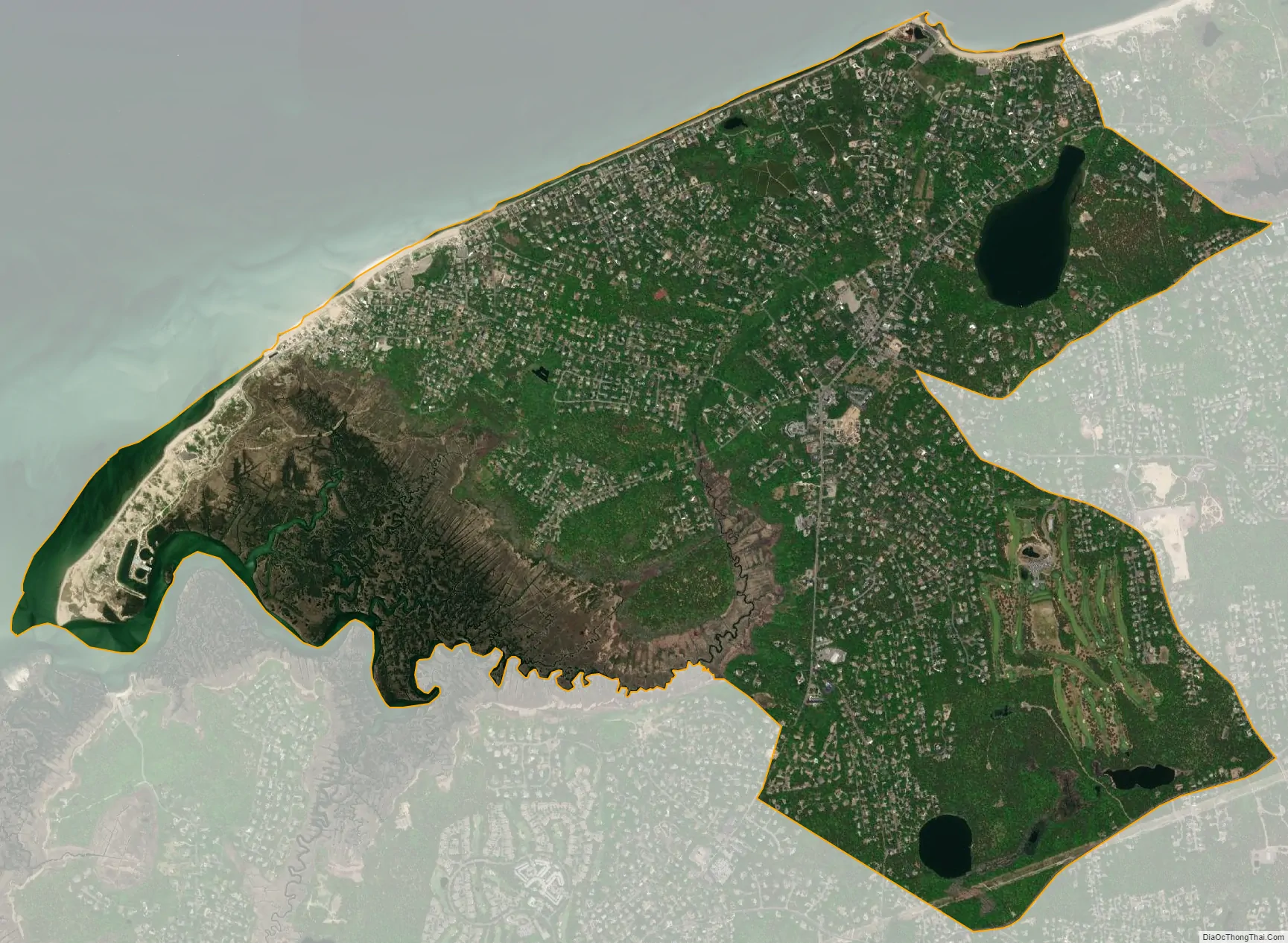
Dennis city Satellite Map
Geography
Dennis is located near Cape Cod Bay in the northern portion of the town of Dennis, at 41°44′6″N 70°11′57″W / 41.73500°N 70.19917°W / 41.73500; -70.19917 (41.73526, -70.199199).
According to the United States Census Bureau, the CDP has a total area of 5.1 square miles (13.2 km), of which 4.9 square miles (12.6 km) is land and 0.19 square miles (0.5 km), or 4.05%, is water.
See also
Map of Massachusetts State and its subdivision: Map of other states:- Alabama
- Alaska
- Arizona
- Arkansas
- California
- Colorado
- Connecticut
- Delaware
- District of Columbia
- Florida
- Georgia
- Hawaii
- Idaho
- Illinois
- Indiana
- Iowa
- Kansas
- Kentucky
- Louisiana
- Maine
- Maryland
- Massachusetts
- Michigan
- Minnesota
- Mississippi
- Missouri
- Montana
- Nebraska
- Nevada
- New Hampshire
- New Jersey
- New Mexico
- New York
- North Carolina
- North Dakota
- Ohio
- Oklahoma
- Oregon
- Pennsylvania
- Rhode Island
- South Carolina
- South Dakota
- Tennessee
- Texas
- Utah
- Vermont
- Virginia
- Washington
- West Virginia
- Wisconsin
- Wyoming