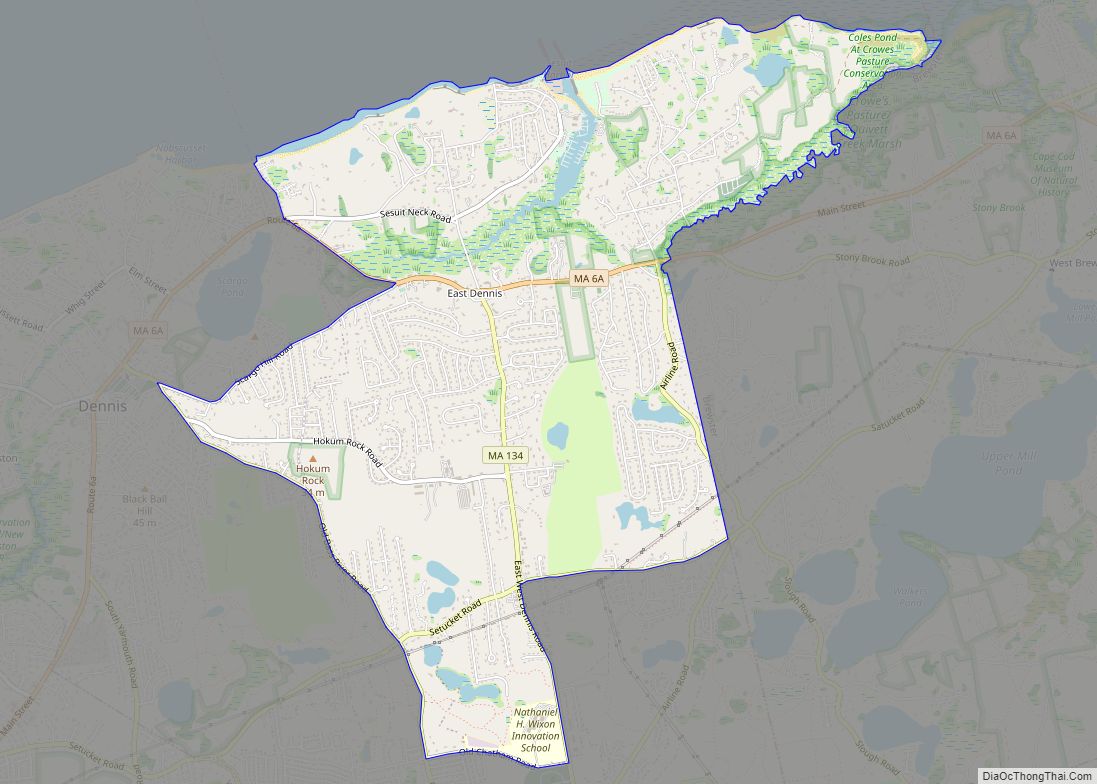
Dennis Port (or Dennisport) is a census-designated place (CDP) in the town of Dennis in Barnstable County, Cape Cod, Massachusetts. At the 2010 census, its population was 3,162.
The Swan Pond River and Upper County Road demarcate Dennis Port’s western border with West Dennis. The village of West Harwich lies directly to Dennis Port’s east, with the border demarcated by the median of Division Street. To the north of Dennis Port is South Dennis. Like other villages along Nantucket Sound, Dennis Port features warm-water beaches, like Haigis Beach, Sea Street Beach, and Glendon Road Beach. Many consider these among Cape Cod’s most desirable beaches for swimming and windsurfing.
By U.S. standards, real estate prices in Dennis Port remain high. Housing stock consists mostly of World War II–era beach cottages built in the Cape Cod architectural style, although many have been expanded or replaced with larger, more contemporary beach houses. Many streets in Dennis Port—particularly those south of Lower County Road, within 0.5 miles (0.80 km) of the beaches—evoke the quaint ambience of an early-20th century seasonal retreat. There are a great deal of hotels, cottage retreats, and businesses geared towards tourists.
Famous residents of Dennis Port include U.S. military hero Benjamin F. Baker.
| Name: | Dennis Port CDP |
|---|---|
| LSAD Code: | 57 |
| LSAD Description: | CDP (suffix) |
| State: | Massachusetts |
| County: | Barnstable County |
| Elevation: | 20 ft (6 m) |
| Total Area: | 3.29 sq mi (8.53 km²) |
| Land Area: | 3.04 sq mi (7.87 km²) |
| Water Area: | 0.25 sq mi (0.66 km²) |
| Total Population: | 3,487 |
| Population Density: | 1,147.79/sq mi (443.12/km²) |
| ZIP code: | 02639 |
| Area code: | 508 |
| FIPS code: | 2516810 |
| GNISfeature ID: | 0615825 |
Online Interactive Map
Click on ![]() to view map in "full screen" mode.
to view map in "full screen" mode.
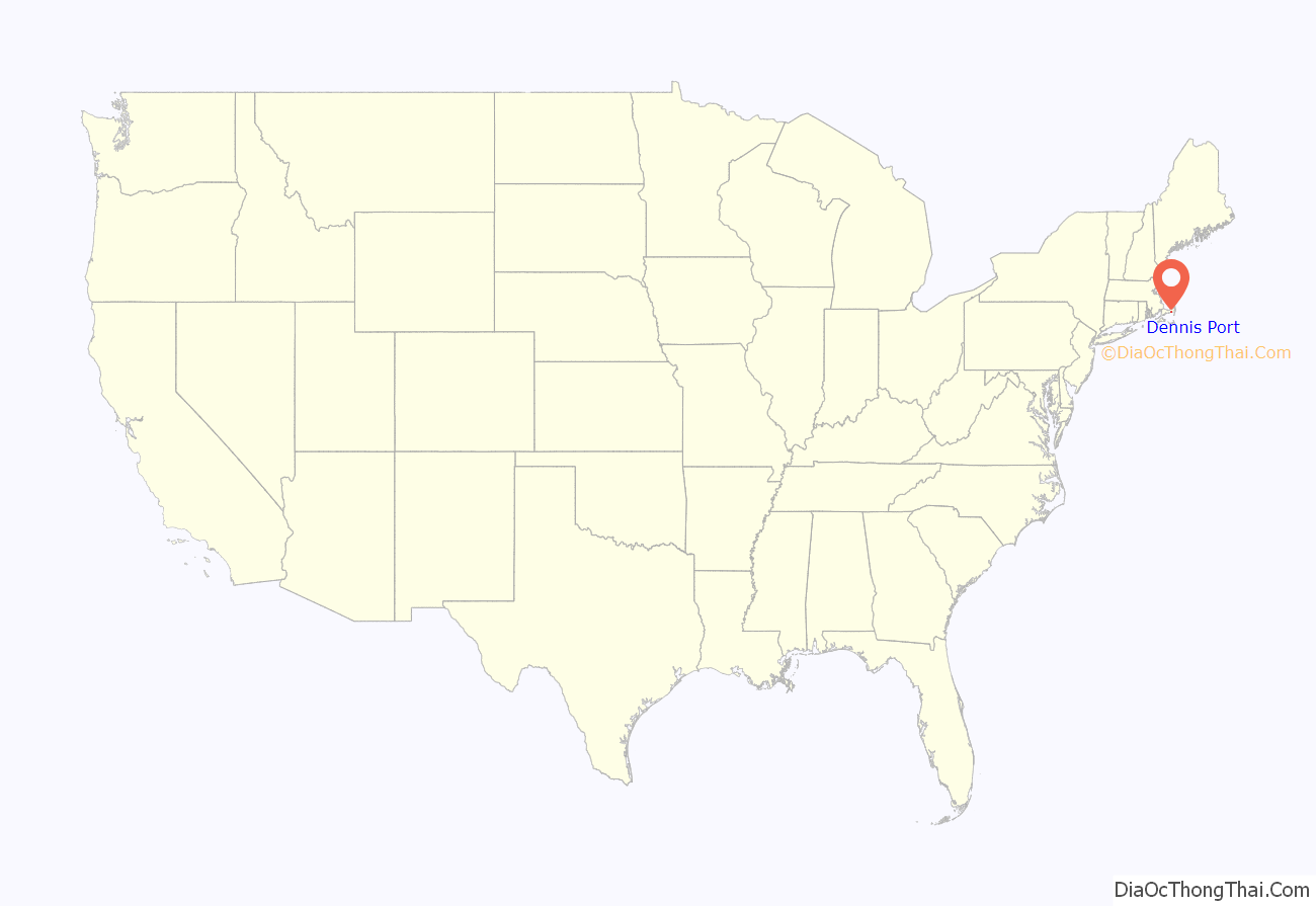
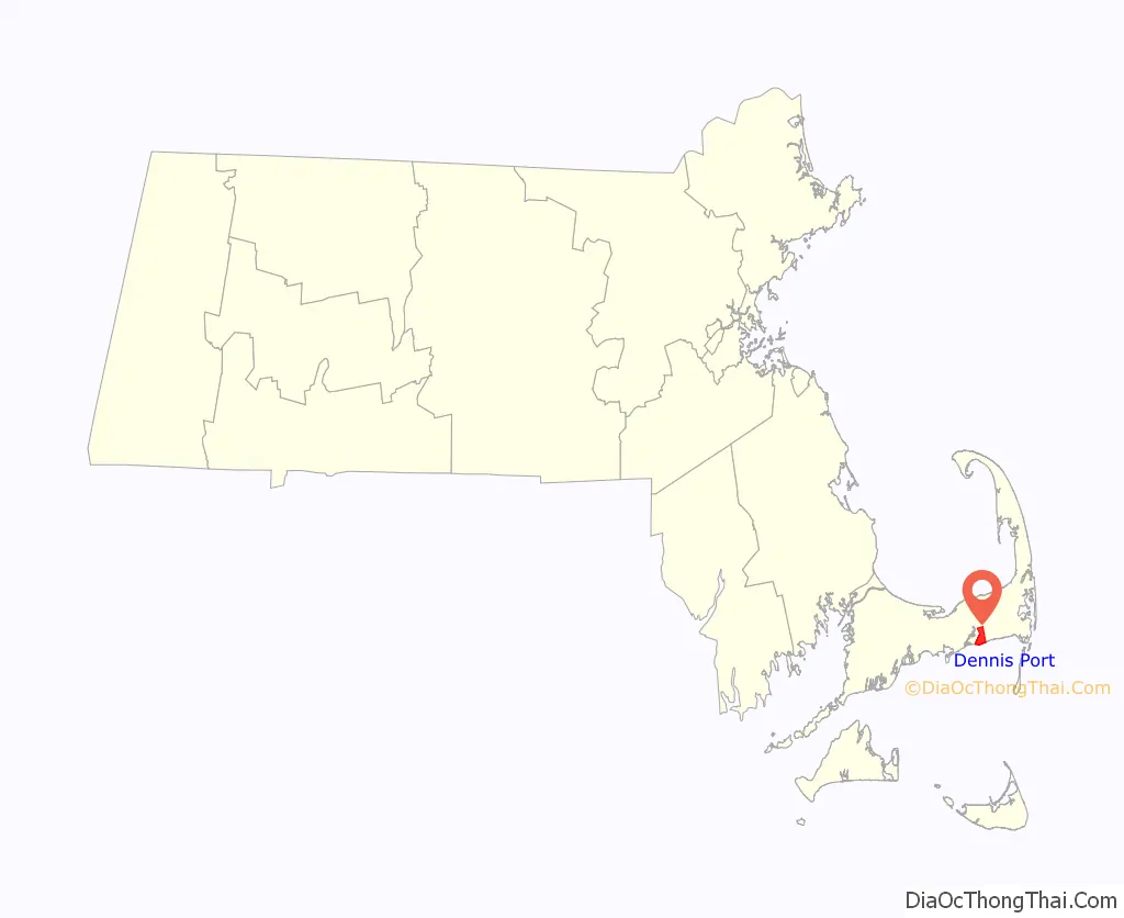
Dennis Port location map. Where is Dennis Port CDP?
Dennis Port Road Map
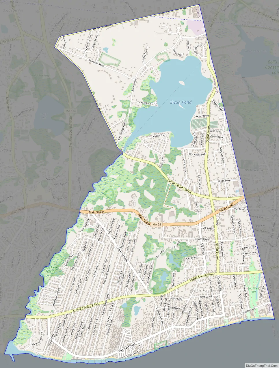
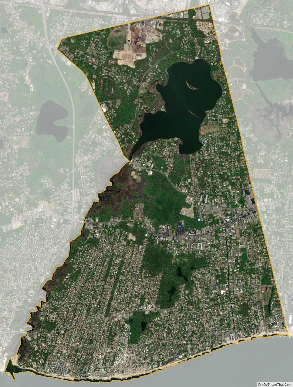
Dennis Port city Satellite Map
Geography
Dennis Port is located at 41°39′50″N 70°8′12″W / 41.66389°N 70.13667°W / 41.66389; -70.13667 (41.663779, -70.136576).
According to the United States Census Bureau, the CDP has a total area of 8.5 square kilometres (3.3 sq mi). 3.0 square miles (7.8 km) of it is land and 0.27 square miles (0.7 km) of it (7.72%) is water.
Dennis Port is said by locals to be a part of the Lower Cape Cod region unlike the rest of Dennis villages.
See also
Map of Massachusetts State and its subdivision: Map of other states:- Alabama
- Alaska
- Arizona
- Arkansas
- California
- Colorado
- Connecticut
- Delaware
- District of Columbia
- Florida
- Georgia
- Hawaii
- Idaho
- Illinois
- Indiana
- Iowa
- Kansas
- Kentucky
- Louisiana
- Maine
- Maryland
- Massachusetts
- Michigan
- Minnesota
- Mississippi
- Missouri
- Montana
- Nebraska
- Nevada
- New Hampshire
- New Jersey
- New Mexico
- New York
- North Carolina
- North Dakota
- Ohio
- Oklahoma
- Oregon
- Pennsylvania
- Rhode Island
- South Carolina
- South Dakota
- Tennessee
- Texas
- Utah
- Vermont
- Virginia
- Washington
- West Virginia
- Wisconsin
- Wyoming