Forestdale is a village and census-designated place (CDP) within the town of Sandwich in Barnstable County, Massachusetts, United States. The population of Forestdale was 4,099 at the 2010 census. It is the most populous of the three CDPs in Sandwich. The ZIP code of Forestdale is 02644.
| Name: | Forestdale CDP |
|---|---|
| LSAD Code: | 57 |
| LSAD Description: | CDP (suffix) |
| State: | Massachusetts |
| County: | Barnstable County |
| Elevation: | 164 ft (50 m) |
| Total Area: | 4.18 sq mi (10.82 km²) |
| Land Area: | 3.81 sq mi (9.88 km²) |
| Water Area: | 0.36 sq mi (0.94 km²) |
| Total Population: | 4,116 |
| Population Density: | 1,079.18/sq mi (416.68/km²) |
| ZIP code: | 02644 |
| Area code: | 508 |
| FIPS code: | 2524190 |
| GNISfeature ID: | 0616600 |
Online Interactive Map
Click on ![]() to view map in "full screen" mode.
to view map in "full screen" mode.
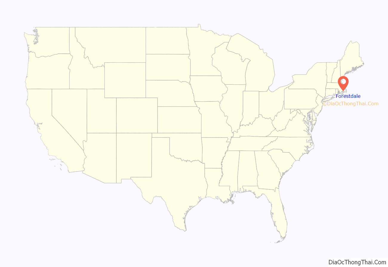
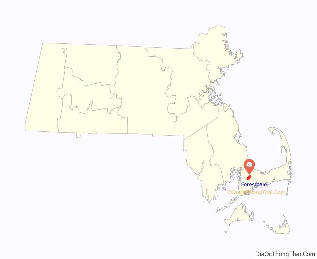
Forestdale location map. Where is Forestdale CDP?
Forestdale Road Map
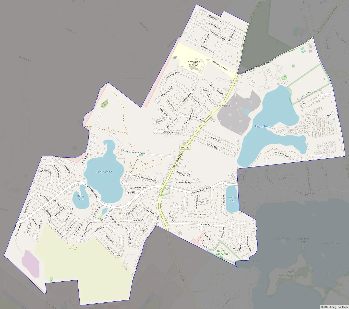
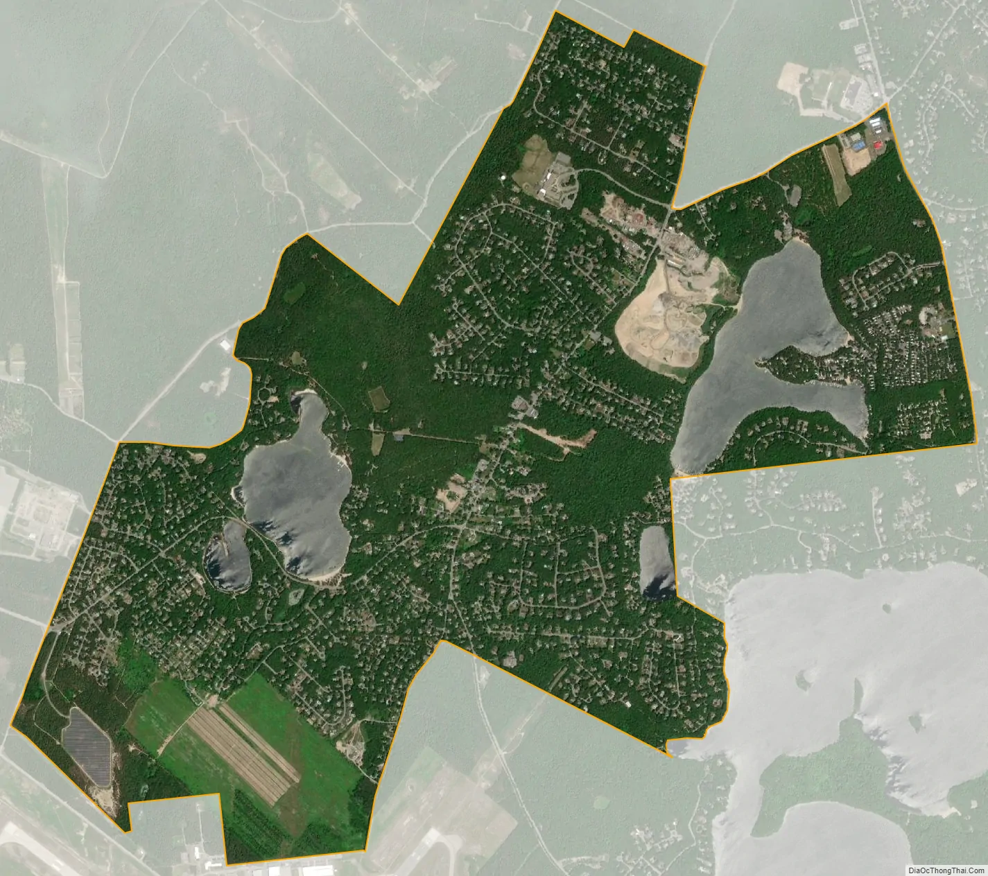
Forestdale city Satellite Map
Geography
Forestdale is located in the southern part of Sandwich at 41°41′0″N 70°30′44″W / 41.68333°N 70.51222°W / 41.68333; -70.51222 (41.683462, -70.512116). It is bordered by the town of Mashpee to the south and by Otis Air National Guard Base to the west. Massachusetts Route 130 (Forestdale Road) is the main route through the community, leading north to Sandwich village and south through Mashpee to Santuit in Barnstable.
According to the United States Census Bureau, the Forestdale CDP has a total area of 4.2 square miles (10.8 km). 3.8 square miles (9.8 km) of it is land, and 0.35 square miles (0.9 km) of it (8.68%) is water.
See also
Map of Massachusetts State and its subdivision: Map of other states:- Alabama
- Alaska
- Arizona
- Arkansas
- California
- Colorado
- Connecticut
- Delaware
- District of Columbia
- Florida
- Georgia
- Hawaii
- Idaho
- Illinois
- Indiana
- Iowa
- Kansas
- Kentucky
- Louisiana
- Maine
- Maryland
- Massachusetts
- Michigan
- Minnesota
- Mississippi
- Missouri
- Montana
- Nebraska
- Nevada
- New Hampshire
- New Jersey
- New Mexico
- New York
- North Carolina
- North Dakota
- Ohio
- Oklahoma
- Oregon
- Pennsylvania
- Rhode Island
- South Carolina
- South Dakota
- Tennessee
- Texas
- Utah
- Vermont
- Virginia
- Washington
- West Virginia
- Wisconsin
- Wyoming