Gardner, officially the City of Gardner, is a city in Worcester County in the Commonwealth of Massachusetts, United States. The population was 21,287 in the 2020 census. Gardner is home of such sites as the Blue Moon Diner, Dunn State Park, Gardner Heritage State Park, and Mount Wachusett Community College.
| Name: | Gardner city |
|---|---|
| LSAD Code: | 25 |
| LSAD Description: | city (suffix) |
| State: | Massachusetts |
| County: | Worcester County |
| Elevation: | 1,100 ft (324 m) |
| Total Area: | 23.02 sq mi (59.61 km²) |
| Land Area: | 22.07 sq mi (57.15 km²) |
| Water Area: | 0.95 sq mi (2.45 km²) |
| Total Population: | 21,287 |
| Population Density: | 964.65/sq mi (372.46/km²) |
| ZIP code: | 01440 |
| Area code: | 978#&351 |
| FIPS code: | 2525485 |
| GNISfeature ID: | 0610059 |
| Website: | gardner-ma.gov |
Online Interactive Map
Click on ![]() to view map in "full screen" mode.
to view map in "full screen" mode.
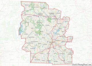
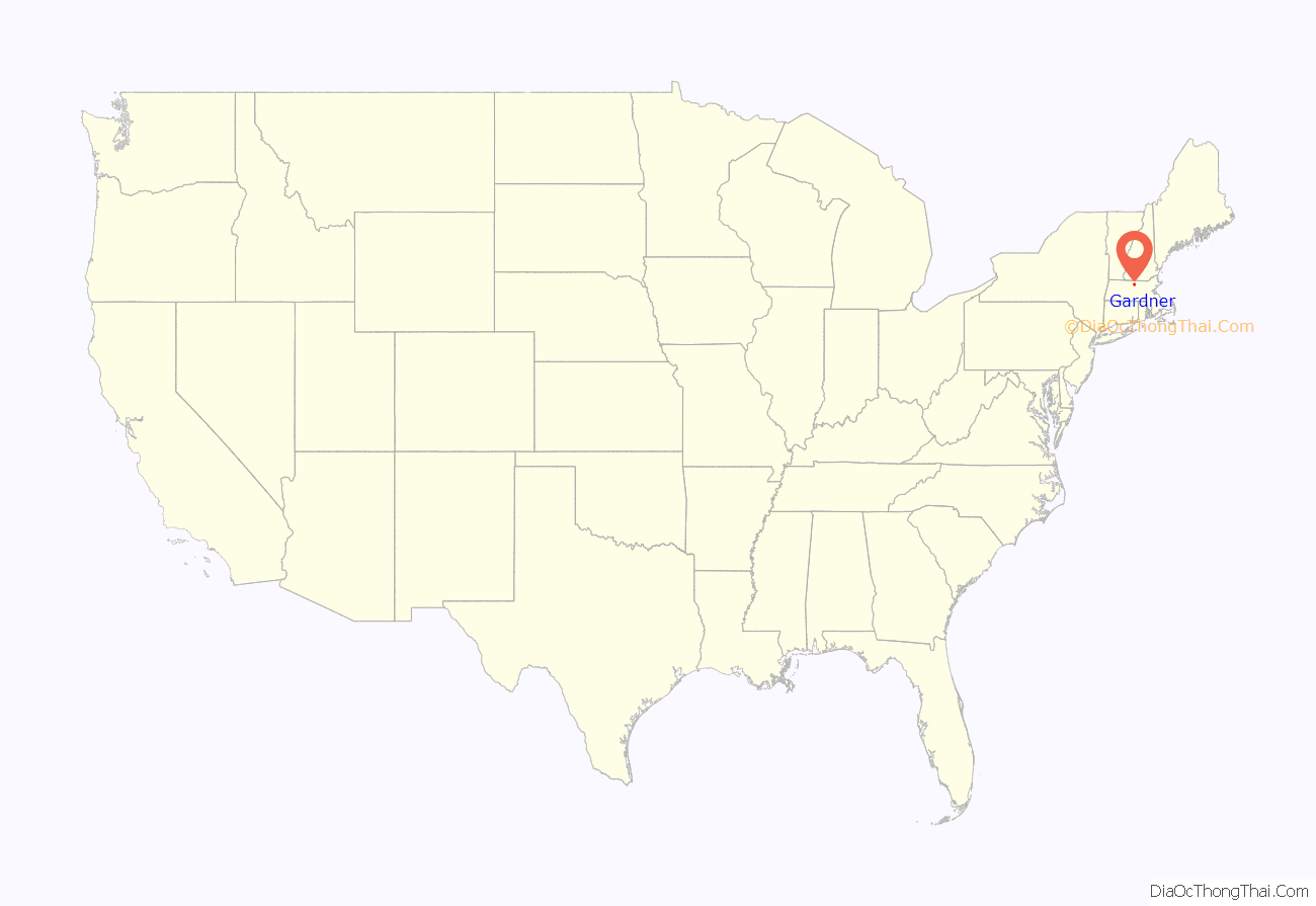
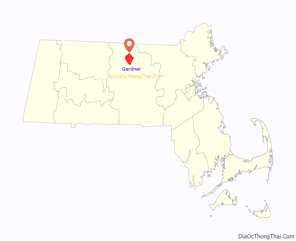
Gardner location map. Where is Gardner city?
History
Named in honor of Thomas Gardner, the land was first settled by Europeans in 1764 and was officially incorporated as a town in 1785, after receiving land grants from the surrounding towns of Ashburnham, Templeton, Westminster, and Winchendon. In circa 1805, Gardner became a center for lumber and furniture industries, and is now known as “The Chair City” and “The Furniture Capital of New England”, due to its long history of production in that industry. By 1910, there were twenty chair factories, which produced four million chairs per year. It was also noted for silversmithing. The Gardner State Hospital pioneered the use of cottage residences.
In 1922, the seal of Gardner was designed by the native-born illustrator Harrison Cady. According to city code, the seal portrays Thomas Gardner standing in front of Crystal Lake with Mount Monadnock in the distance. Within five smaller circles there is a chair, representing the importance of the furniture industry to city economy, as well as the letters W, W, A, and T, representing the surrounding towns of Westminster, Winchendon, Ashburnham, and Templeton, which all contributed land to the city at its founding. Gardner was incorporated as a city in 1923.
Gardner is the birthplace of the Heywood-Wakefield Company, dating from 1826 when the five Heywood brothers, Walter, Levi, Seth, Benjamin, and William, began to fashion wooden chairs and furniture in a barn near their family farm. In the early years, Walter fashioned chairs by hand, also using a foot lathe. He was soon joined by Levi and Benjamin on a part-time basis, while running a nearby country store. In 1831, Levi moved to Boston, where he established an outlet store to sell the chairs, while Benjamin and William remained in Gardner to manufacture them. A fire destroyed their chair shop in 1834. A year later, the partnership of B. F. Heywood and Company was formed, composed of Benjamin, Walter, and William, as well as Moses Wood and James Gates. Gardner was also the home of the Conant Ball Company. Nichols and Stone Chair Company traces their origin to 1762 in Westminster, Massachusetts. The company moved to Gardner at the turn of the twentieth century. As of July 2008, it was announced production would terminate. The name, intellectual property, and the design rights were purchased by L. and J.G. Stickley of Manlius, New York.
Gardner is also home to the first practical time clock. It was invented in 1894 by Edward G. Watkins, while he was an engineer at Heywood-Wakefield when he was asked to make a better time clock to keep track of employees. After recognizing growing nationwide need for a better time clock, Watkins opened Simplex Time Recorder. In 1958, Simplex bought the IBM Time Recorder Division, which also included the fire protection division. This purchase helped propel Simplex to become a leader in fire alarms and business systems. Simplex would be owned and operated under the Watkins family for over a century with family including son, Curt, from 1942 to 1967, and grandson, Chris, from 1967, until it was sold in 2000, to Tyco International.
In 2009, the Annual Chair Luge began and takes place on the last Saturday in September in downtown Gardner and features teams of two racing down the streets in homemade chairs on wheels. The city is also home of the largest American Cancer Society Relay For Life event in New England.
Gardner Road Map
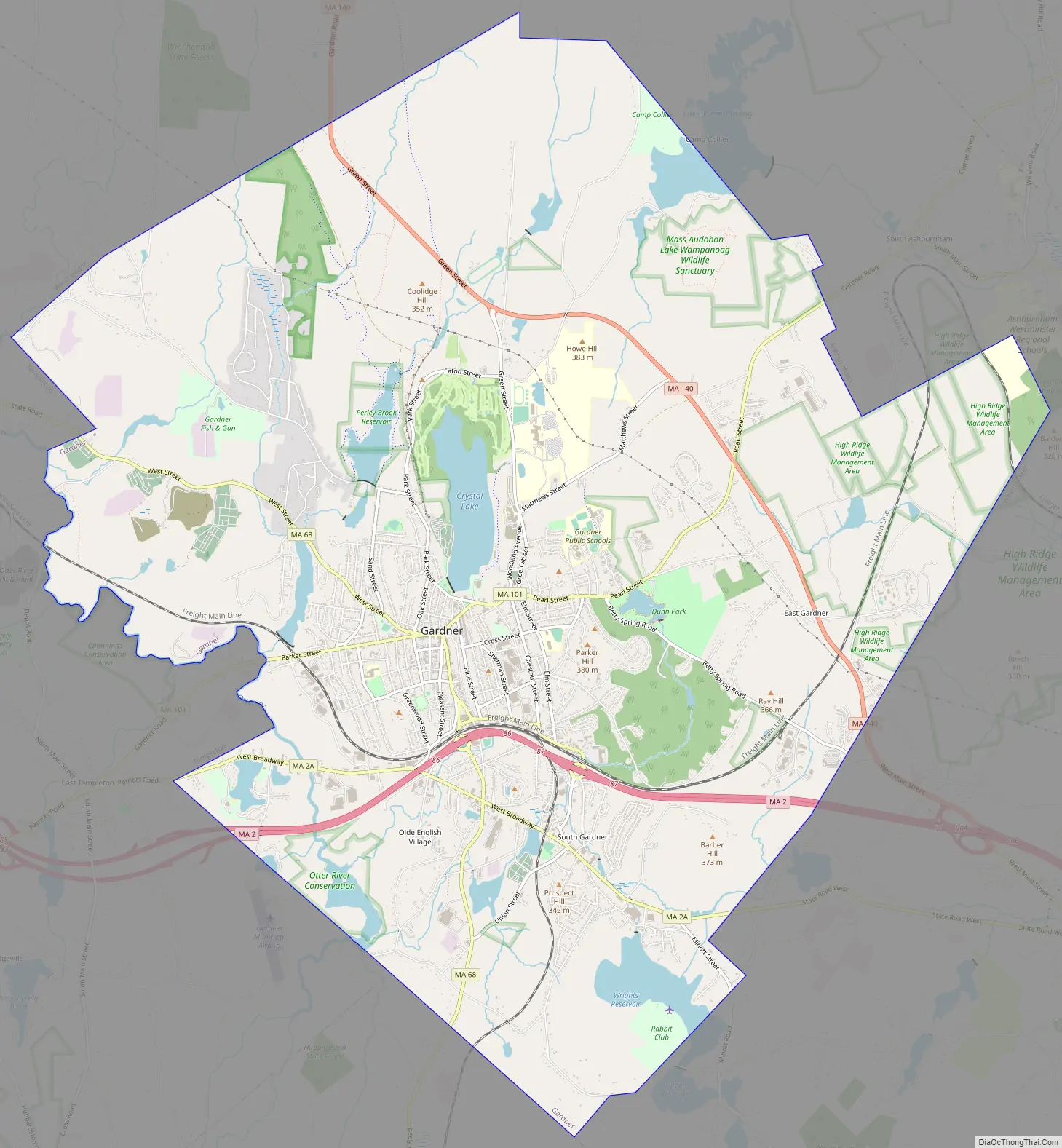
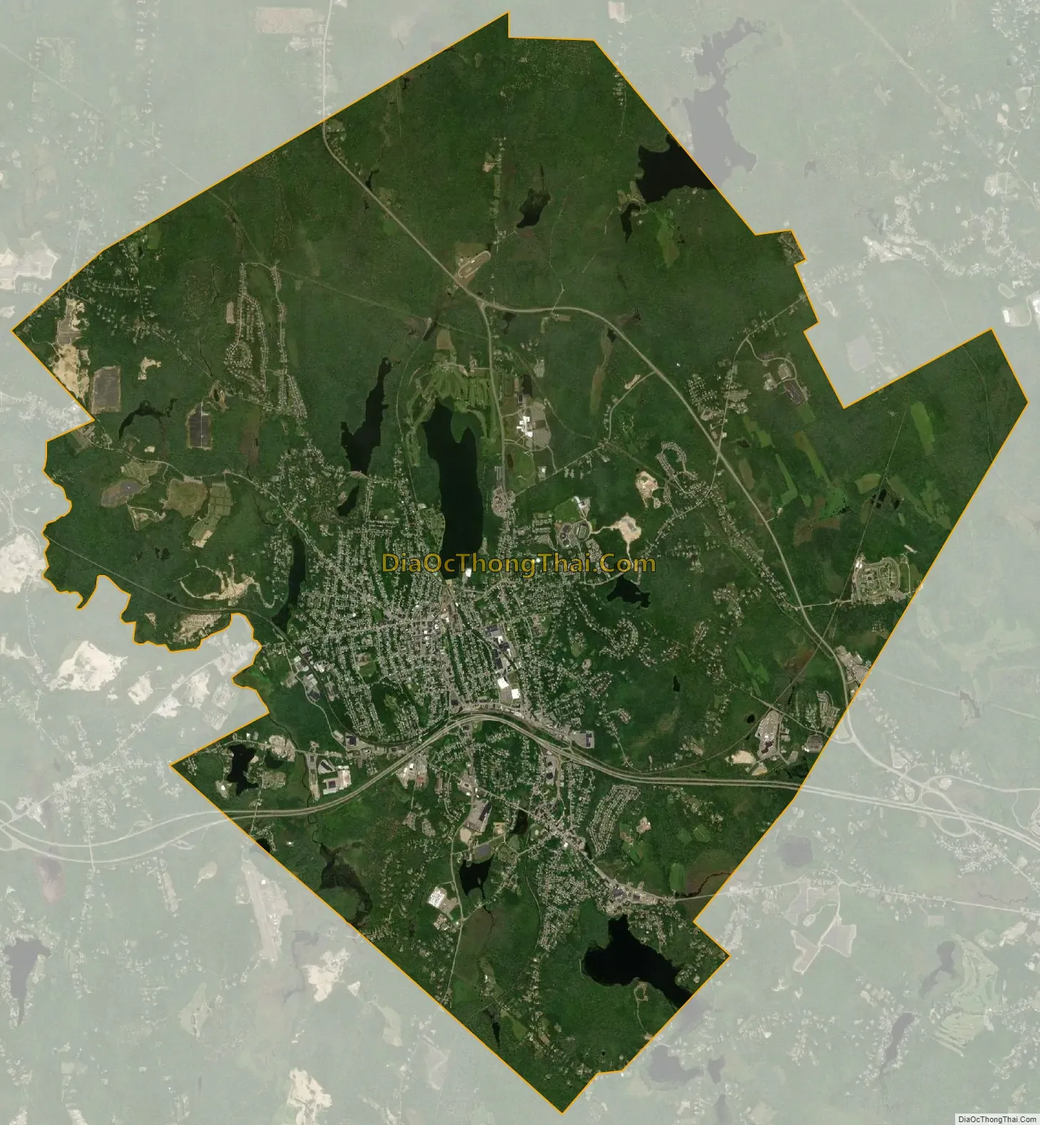
Gardner city Satellite Map
Geography
According to the United States Census Bureau, Gardner has a total area of 23.0 square miles (60 km), of which 22.2 square miles (57 km) is land and 0.8 square miles (2.1 km), or 3.52%, is water. The city is situated on Crystal Lake. Its highest point is the summit of Reservoir Hill, close to the city center, with an elevation of over 1,280 feet (390 m) above sea level.
Gardner is bordered by Winchendon and Ashburnham to the north, Westminster to the east, Hubbardston to the south, and Templeton to the west, all in Massachusetts.
Downtown Gardner, 2005
View of the West Gardner Square Historic District in 2021.
See also
Map of Massachusetts State and its subdivision: Map of other states:- Alabama
- Alaska
- Arizona
- Arkansas
- California
- Colorado
- Connecticut
- Delaware
- District of Columbia
- Florida
- Georgia
- Hawaii
- Idaho
- Illinois
- Indiana
- Iowa
- Kansas
- Kentucky
- Louisiana
- Maine
- Maryland
- Massachusetts
- Michigan
- Minnesota
- Mississippi
- Missouri
- Montana
- Nebraska
- Nevada
- New Hampshire
- New Jersey
- New Mexico
- New York
- North Carolina
- North Dakota
- Ohio
- Oklahoma
- Oregon
- Pennsylvania
- Rhode Island
- South Carolina
- South Dakota
- Tennessee
- Texas
- Utah
- Vermont
- Virginia
- Washington
- West Virginia
- Wisconsin
- Wyoming