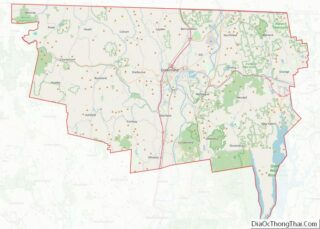
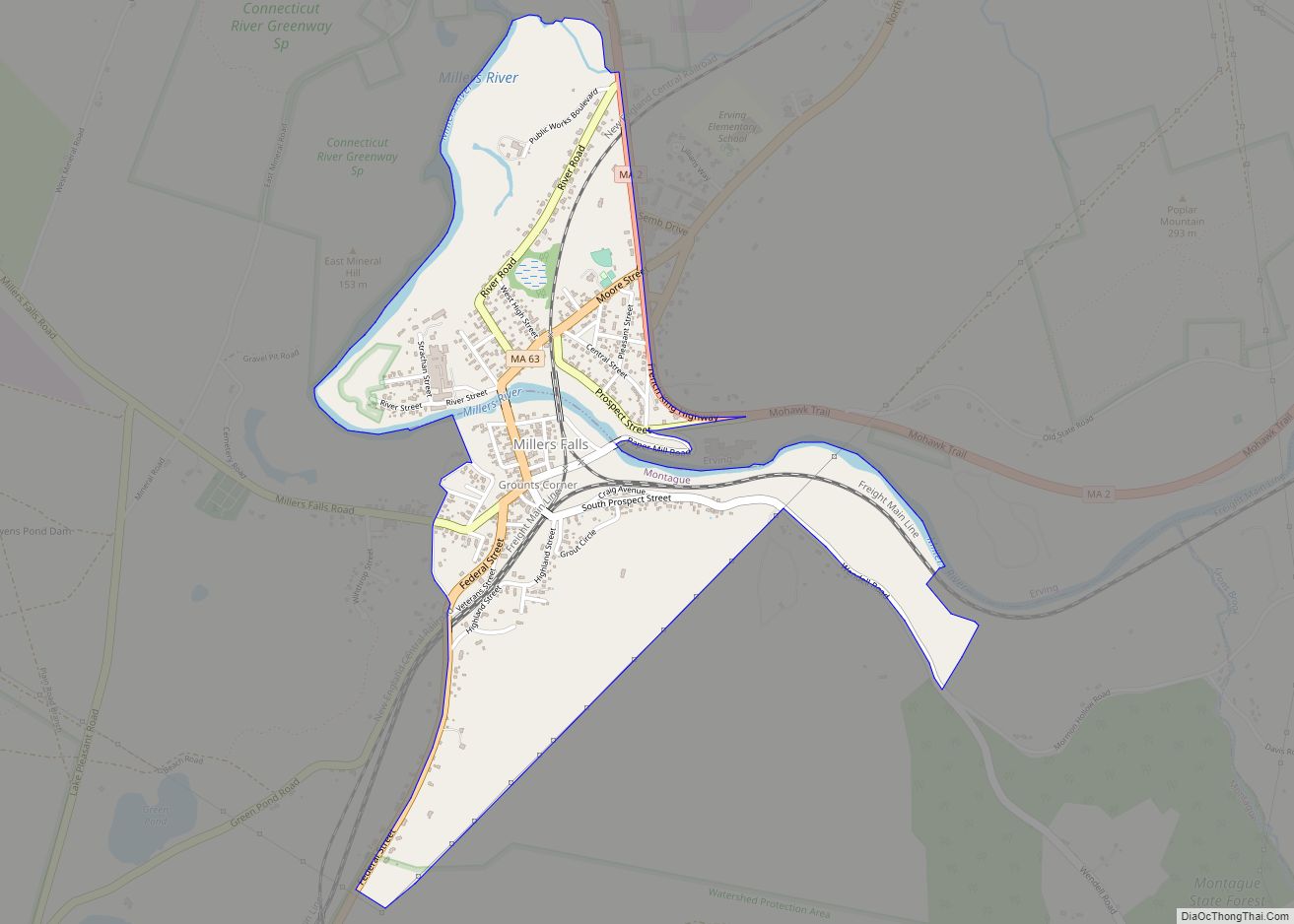
Millers Falls is a census-designated place (CDP) in the towns of Montague and Erving in Franklin County, Massachusetts, United States. The population was 1,139 at the 2010 census. It is part of the Springfield, Massachusetts metropolitan statistical area.
| Name: | Millers Falls CDP |
|---|---|
| LSAD Code: | 57 |
| LSAD Description: | CDP (suffix) |
| State: | Massachusetts |
| County: | Franklin County |
| Elevation: | 295 ft (90 m) |
| Total Area: | 0.96 sq mi (2.48 km²) |
| Land Area: | 0.91 sq mi (2.36 km²) |
| Water Area: | 0.05 sq mi (0.12 km²) |
| Total Population: | 994 |
| Population Density: | 1,088.72/sq mi (420.56/km²) |
| ZIP code: | 01349 |
| Area code: | 413 |
| FIPS code: | 2541410 |
| GNISfeature ID: | 0609184 |
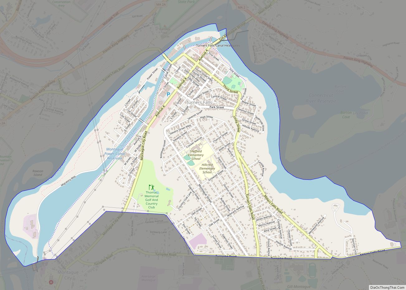
Online Interactive Map
Click on ![]() to view map in "full screen" mode.
to view map in "full screen" mode.
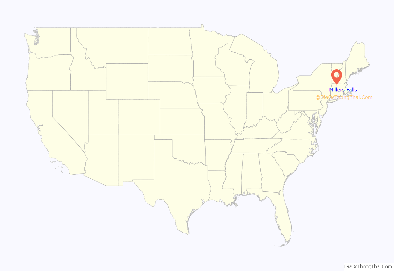
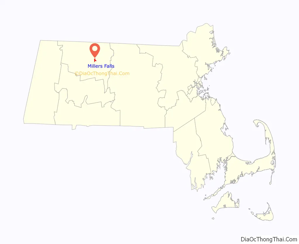
Millers Falls location map. Where is Millers Falls CDP?
History
Located along the Mohawk Trail, Millers Falls was first established in 1824 as an agricultural community, named Grout’s Corner after first settler Martin Grout (1790–1865). In the 1860s, however, the local growth of railroads stimulated development, as the New London Northern Railroad bought the Amherst & Palmer railroad in 1864 and in 1866 extended its line to a connection with the Vermont & Massachusetts at Grout’s Corner. With this new railroad juncture, the abundant water power of the falls at Grout’s Corner provided a perfect place to establish mills. The village’s present name derives from the Millers Falls Manufacturing Company (later the Millers Falls Company), established on the Millers River in 1868, and famed for its fine hand tools.
The central portion of the village was listed on the National Register of Historic Places in 2021.
Main Street in 1910
Millers River in 1912
Paper mill in 1912
Millers Falls Road Map
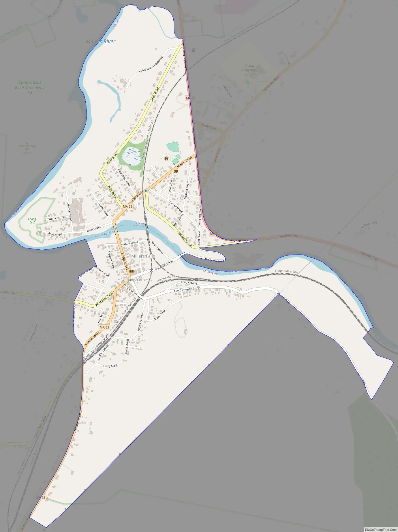
Millers Falls city Satellite Map
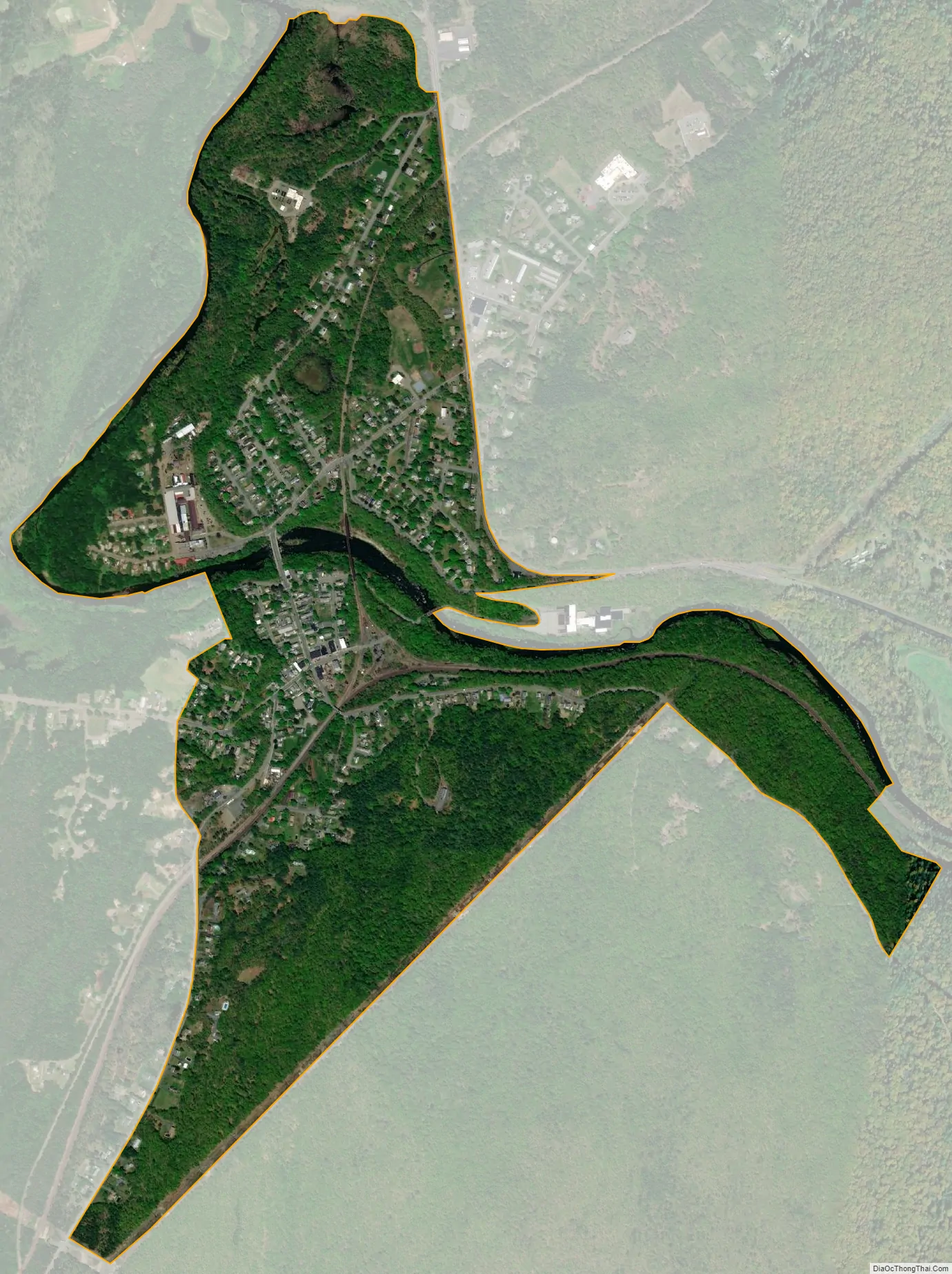
Geography
Millers Falls is located at 42°34′45″N 72°29′36″W / 42.57917°N 72.49333°W / 42.57917; -72.49333 (42.579154, -72.493414), near the border with Erving, Massachusetts.
According to the United States Census Bureau, the CDP has a total area of 2.4 km (0.9 mi²), of which 2.3 km (0.9 mi²) is land and 0.1 km (0.04 mi²) (3.26%) is water. The village is drained by the Millers River, a tributary of the Connecticut River.
Millers Falls is crossed by Massachusetts Routes 2 and 63.
See also
Map of Massachusetts State and its subdivision: Map of other states:- Alabama
- Alaska
- Arizona
- Arkansas
- California
- Colorado
- Connecticut
- Delaware
- District of Columbia
- Florida
- Georgia
- Hawaii
- Idaho
- Illinois
- Indiana
- Iowa
- Kansas
- Kentucky
- Louisiana
- Maine
- Maryland
- Massachusetts
- Michigan
- Minnesota
- Mississippi
- Missouri
- Montana
- Nebraska
- Nevada
- New Hampshire
- New Jersey
- New Mexico
- New York
- North Carolina
- North Dakota
- Ohio
- Oklahoma
- Oregon
- Pennsylvania
- Rhode Island
- South Carolina
- South Dakota
- Tennessee
- Texas
- Utah
- Vermont
- Virginia
- Washington
- West Virginia
- Wisconsin
- Wyoming