Orleans is a census-designated place (CDP) in the town of Orleans in Barnstable County, Massachusetts, United States. The population was 1,621 at the 2010 census.
| Name: | Orleans CDP |
|---|---|
| LSAD Code: | 57 |
| LSAD Description: | CDP (suffix) |
| State: | Massachusetts |
| County: | Barnstable County |
| Elevation: | 59 ft (18 m) |
| Total Area: | 2.47 sq mi (6.41 km²) |
| Land Area: | 2.32 sq mi (6.01 km²) |
| Water Area: | 0.15 sq mi (0.40 km²) |
| Total Population: | 1,767 |
| Population Density: | 761.64/sq mi (294.13/km²) |
| ZIP code: | 02653 |
| Area code: | 508 |
| FIPS code: | 2551405 |
| GNISfeature ID: | 0616894 |
Online Interactive Map
Click on ![]() to view map in "full screen" mode.
to view map in "full screen" mode.
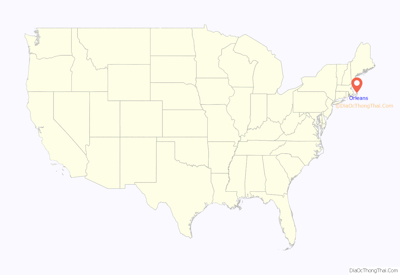
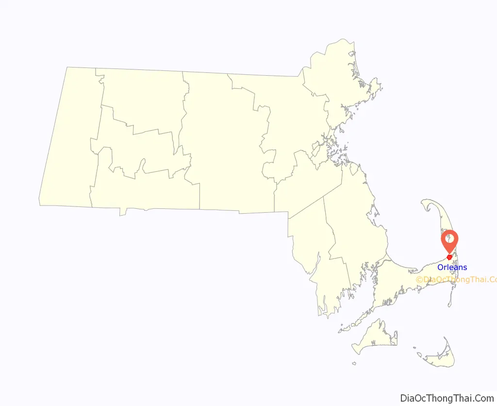
Orleans location map. Where is Orleans CDP?
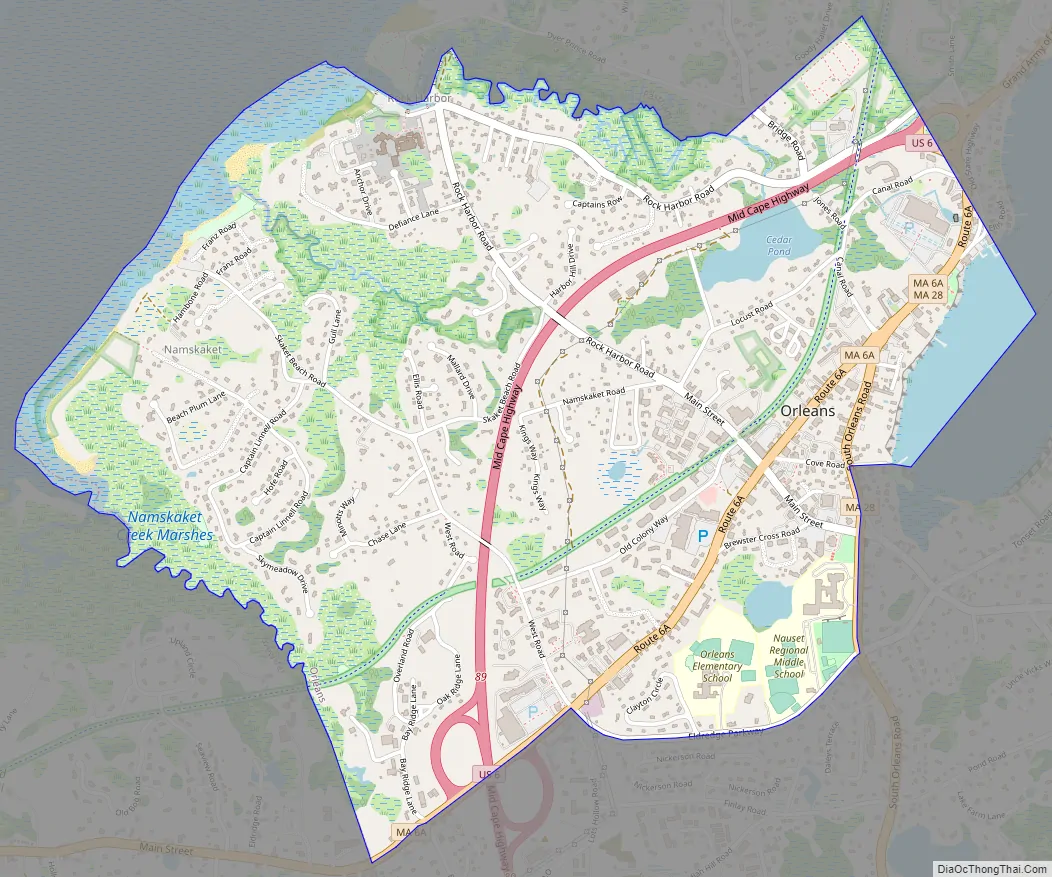
Orleans Road Map
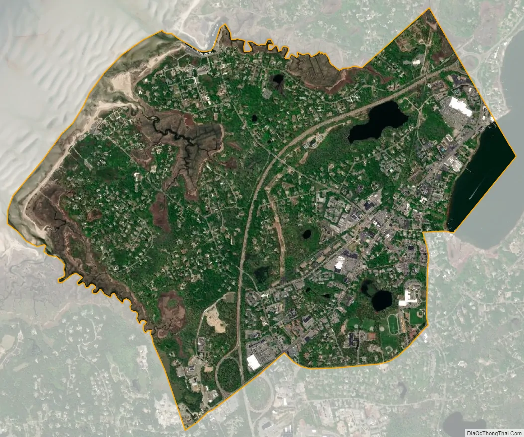
Orleans city Satellite Map
Geography
The Orleans CDP consists of the main settlement in the town of Orleans, located in the northern part of the town. It is bordered to the north by the town of Eastham, to the northwest by Cape Cod Bay, to the southwest by the town of Brewster, to the south by Massachusetts Route 6A and Eldredge Parkway, and to the east by Massachusetts Route 28 and Town Cove. Routes 28 and 6A converge at the center of the village. U.S. Route 6 passes through the CDP and meets the two other highways at the Orleans Rotary at the eastern edge of the CDP.
According to the United States Census Bureau, the CDP has a total area of 2.4 square miles (6.2 km). 2.3 square miles (5.9 km) of it is land, and 0.12 square miles (0.3 km) of it (4.51%) is water.
See also
Map of Massachusetts State and its subdivision: Map of other states:- Alabama
- Alaska
- Arizona
- Arkansas
- California
- Colorado
- Connecticut
- Delaware
- District of Columbia
- Florida
- Georgia
- Hawaii
- Idaho
- Illinois
- Indiana
- Iowa
- Kansas
- Kentucky
- Louisiana
- Maine
- Maryland
- Massachusetts
- Michigan
- Minnesota
- Mississippi
- Missouri
- Montana
- Nebraska
- Nevada
- New Hampshire
- New Jersey
- New Mexico
- New York
- North Carolina
- North Dakota
- Ohio
- Oklahoma
- Oregon
- Pennsylvania
- Rhode Island
- South Carolina
- South Dakota
- Tennessee
- Texas
- Utah
- Vermont
- Virginia
- Washington
- West Virginia
- Wisconsin
- Wyoming