Sagamore is a census-designated place (CDP) in the town of Bourne in Barnstable County, Massachusetts, United States. The population was 3,623 at the 2010 census. “Sagamore” was one of the words used by northeastern Native Americans to designate an elected chief or leader.
| Name: | Sagamore CDP |
|---|---|
| LSAD Code: | 57 |
| LSAD Description: | CDP (suffix) |
| State: | Massachusetts |
| County: | Barnstable County |
| Elevation: | 56 ft (17 m) |
| Total Area: | 3.51 sq mi (9.09 km²) |
| Land Area: | 3.33 sq mi (8.62 km²) |
| Water Area: | 0.18 sq mi (0.46 km²) |
| Total Population: | 3,851 |
| Population Density: | 1,156.46/sq mi (446.51/km²) |
| ZIP code: | 02561 |
| Area code: | 508 |
| FIPS code: | 2558965 |
| GNISfeature ID: | 2378214 |
Online Interactive Map
Click on ![]() to view map in "full screen" mode.
to view map in "full screen" mode.
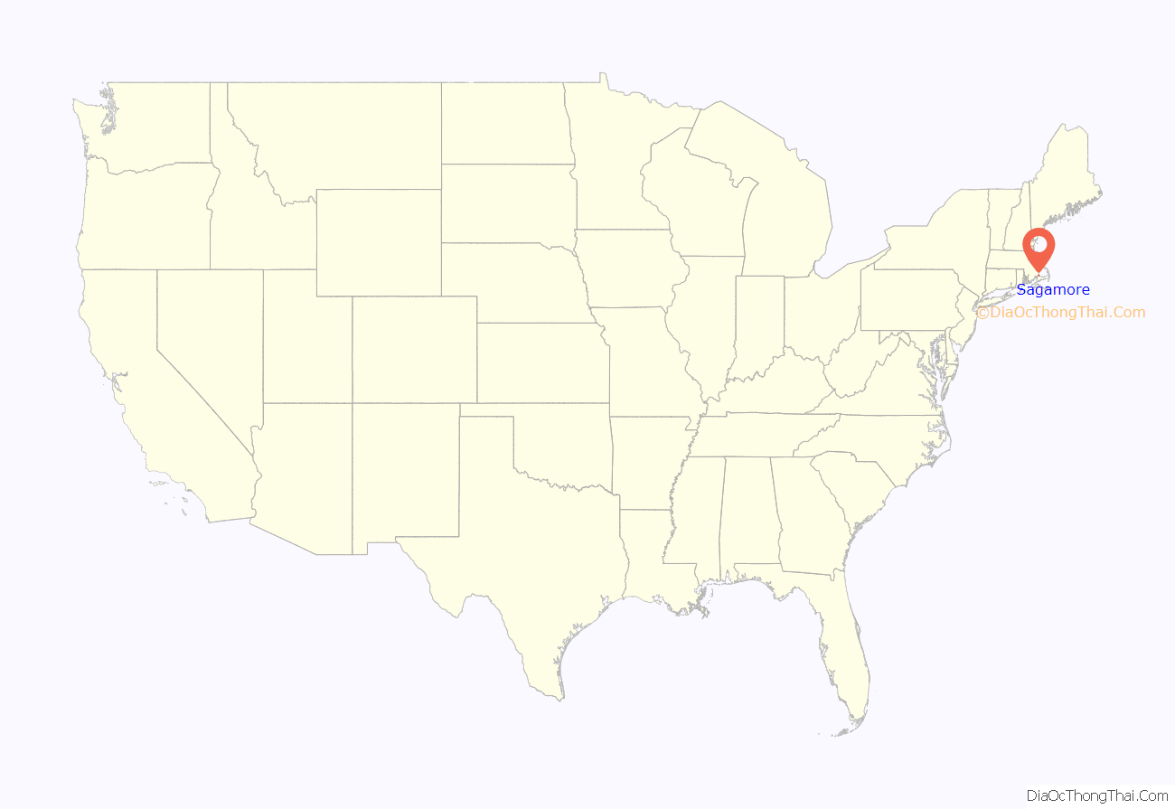
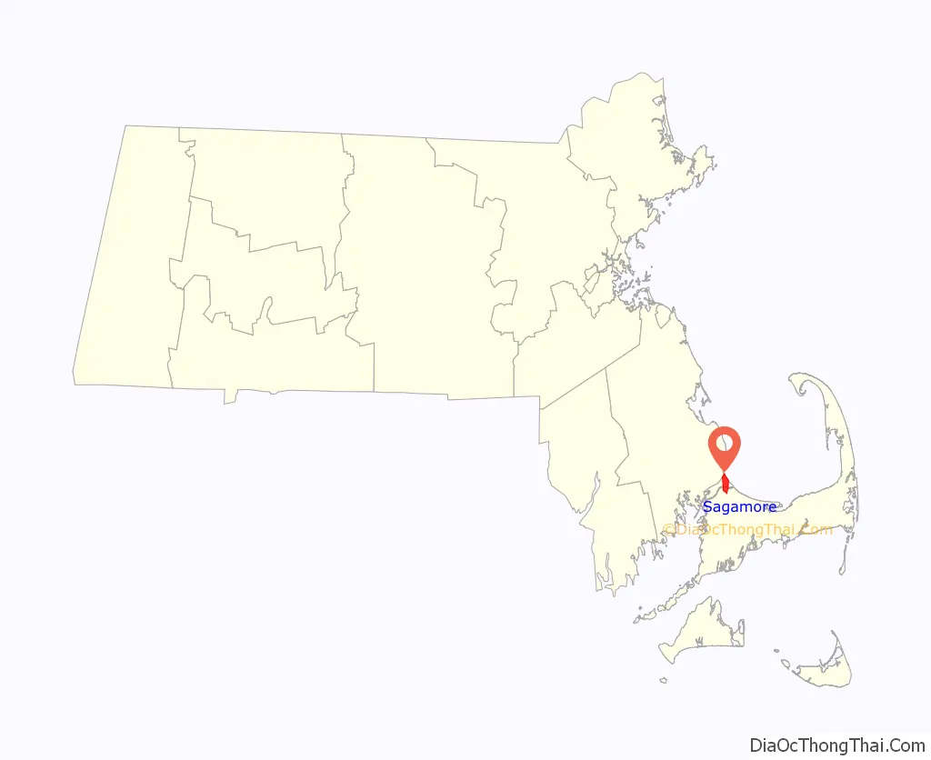
Sagamore location map. Where is Sagamore CDP?
Sagamore Road Map
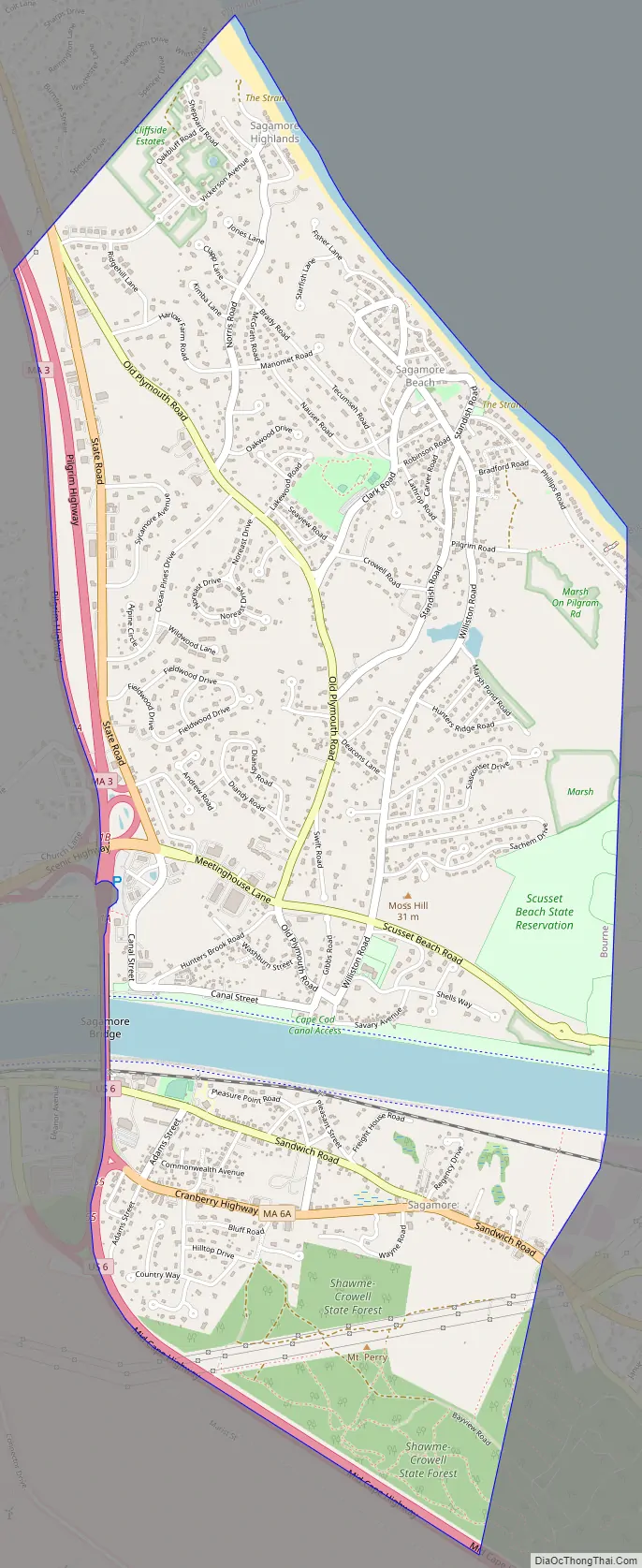
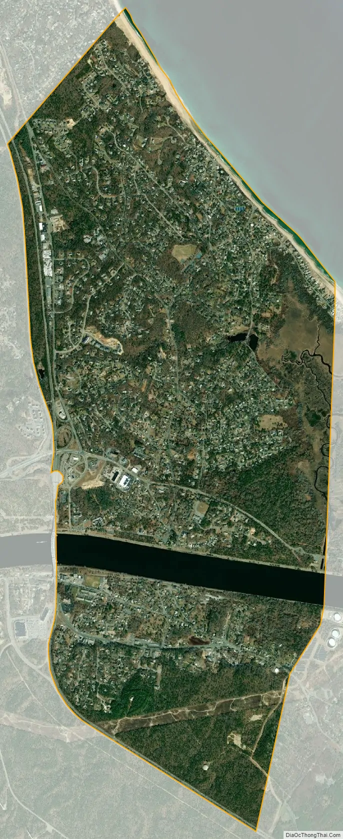
Sagamore city Satellite Map
Geography
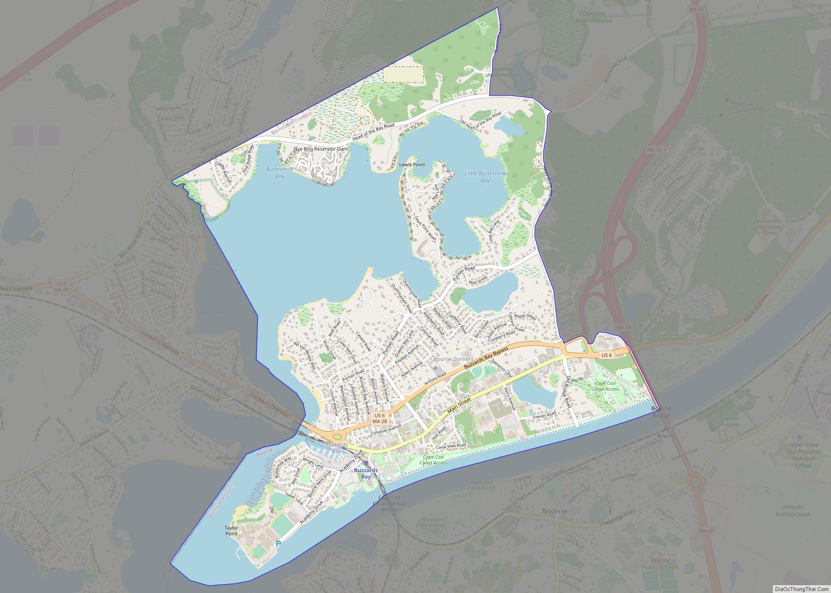
Sagamore is located in the northeastern corner of the town of Bourne. It is bordered to the northeast by Cape Cod Bay, to the northwest by the town of Plymouth, to the west by the Massachusetts Route 3 expressway, to the southwest and south by U.S. Route 6 (the Mid-Cape Highway), and to the east by the town of Sandwich. The northern half of Sagamore is along the shore of Cape Cod Bay, known as Sagamore Beach. The Cape Cod Canal passes east to west through the southern part of the village. The Sagamore Bridge carrys Route 6 across the canal and into Sagamore.
According to the United States Census Bureau, Sagamore has a total area of 3.5 square miles (9.1 km): 3.3 square miles (8.6 km) of land and 0.19 square miles (0.5 km) (5.10%) of water.
See also
Map of Massachusetts State and its subdivision: Map of other states:- Alabama
- Alaska
- Arizona
- Arkansas
- California
- Colorado
- Connecticut
- Delaware
- District of Columbia
- Florida
- Georgia
- Hawaii
- Idaho
- Illinois
- Indiana
- Iowa
- Kansas
- Kentucky
- Louisiana
- Maine
- Maryland
- Massachusetts
- Michigan
- Minnesota
- Mississippi
- Missouri
- Montana
- Nebraska
- Nevada
- New Hampshire
- New Jersey
- New Mexico
- New York
- North Carolina
- North Dakota
- Ohio
- Oklahoma
- Oregon
- Pennsylvania
- Rhode Island
- South Carolina
- South Dakota
- Tennessee
- Texas
- Utah
- Vermont
- Virginia
- Washington
- West Virginia
- Wisconsin
- Wyoming