West Falmouth is a census-designated place (CDP) in the town of Falmouth in Barnstable County, Massachusetts, United States. The population was 1,738 at the 2010 census.
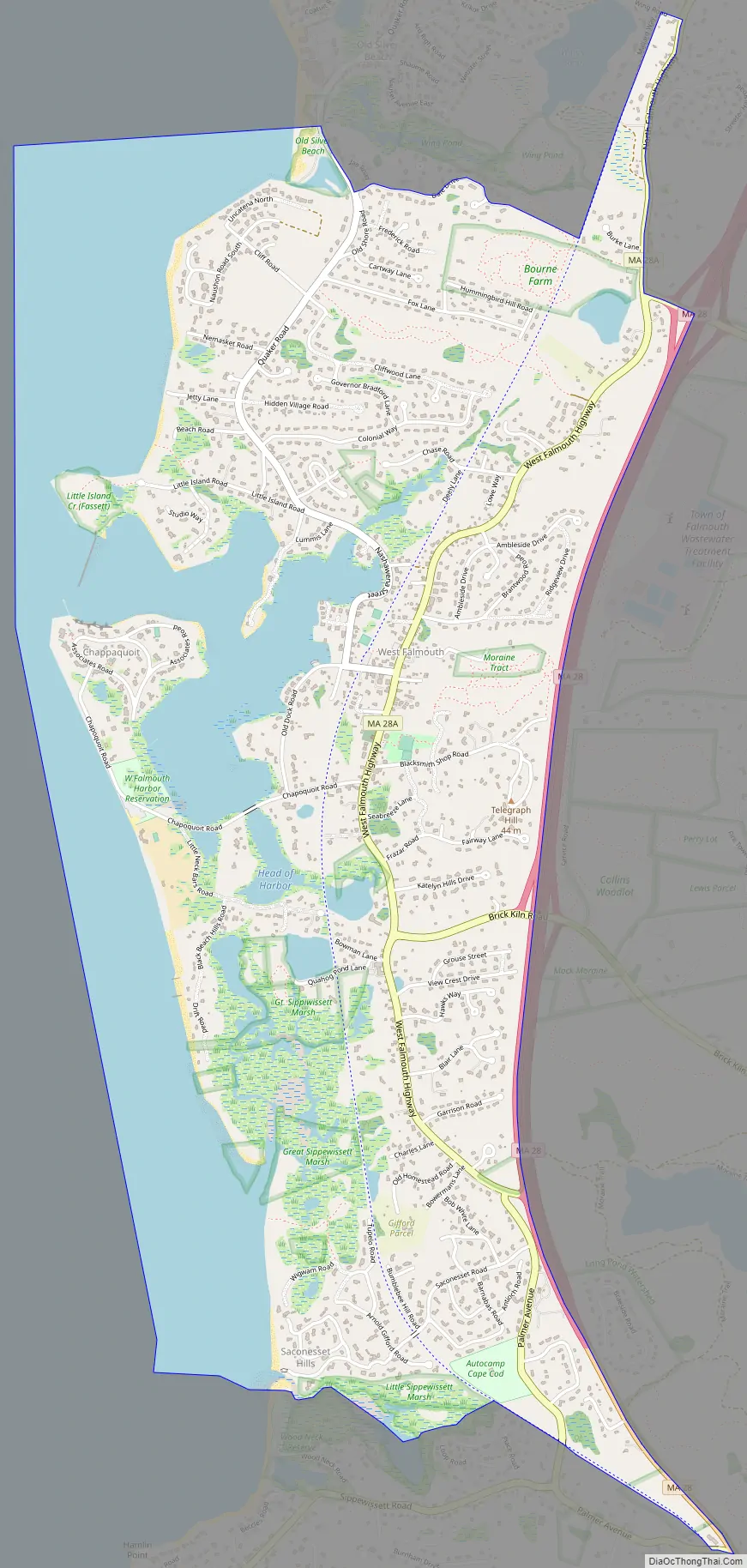
West Falmouth Village Historic District is at the heart of West Falmouth Village. Historic buildings include the West Falmouth Library, Quaker Meeting House and Quaker Carriage Sheds, Emerson House, the West Falmouth Fire Station, and numerous historic houses. Other nearby attractions include the Shining Sea Bikeway, the public beach at Chapoquoit Beach, West Falmouth Harbor, Bourne Farm, Great Sippewissett Marsh, Swift Playground on Blacksmith Shop Road, and the Mock Moraine conservation area. There are several restaurants, markets, inns, real estate agents, and shops in West Falmouth, as well as a post office.
| Name: | West Falmouth CDP |
|---|---|
| LSAD Code: | 57 |
| LSAD Description: | CDP (suffix) |
| State: | Massachusetts |
| County: | Barnstable County |
| Elevation: | 7 ft (2 m) |
| Total Area: | 4.36 sq mi (11.28 km²) |
| Land Area: | 3.08 sq mi (7.98 km²) |
| Water Area: | 1.28 sq mi (3.31 km²) |
| Total Population: | 1,812 |
| Population Density: | 588.12/sq mi (227.08/km²) |
| ZIP code: | 02574 |
| Area code: | 508 |
| FIPS code: | 2575960 |
| GNISfeature ID: | 0616149 |
Online Interactive Map
Click on ![]() to view map in "full screen" mode.
to view map in "full screen" mode.
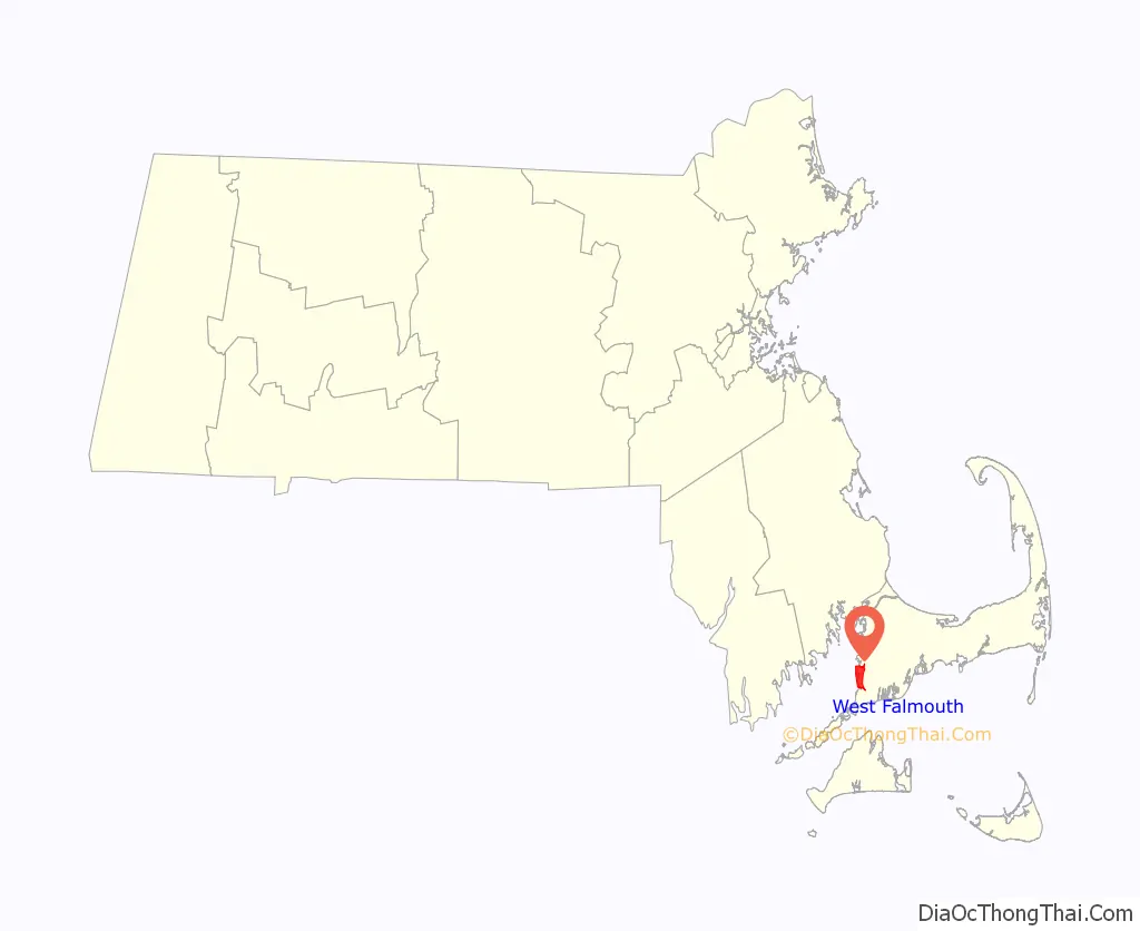
West Falmouth location map. Where is West Falmouth CDP?

West Falmouth Road Map
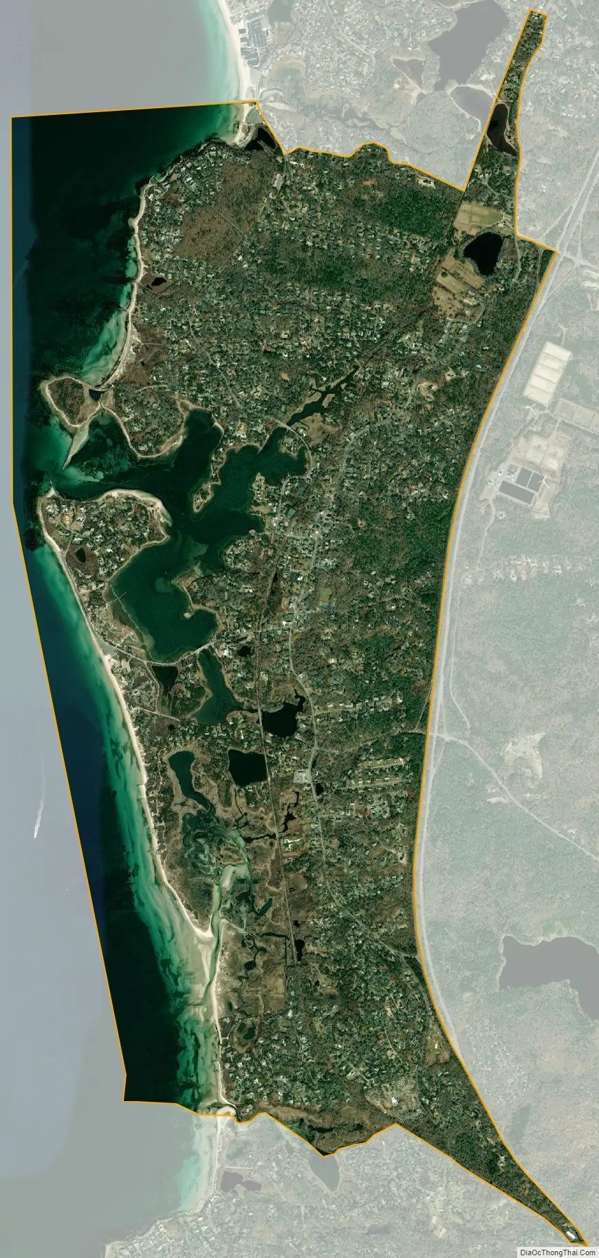
West Falmouth city Satellite Map
Geography
West Falmouth is located in the west-central part of the town of Falmouth at 41°35′59″N 70°38′16″W / 41.59972°N 70.63778°W / 41.59972; -70.63778 (41.599628, -70.637812). It is bordered to the north by North Falmouth, to the east by Massachusetts Route 28, to the south by Little Sippewisset Marsh, and to the west by Buzzards Bay.
According to the United States Census Bureau, the West Falmouth CDP has a total area of 4.4 square miles (11.3 km). 3.1 square miles (8.0 km) of it is land, and 1.3 square miles (3.3 km) of it (29.32%) is water.
See also
Map of Massachusetts State and its subdivision: Map of other states:- Alabama
- Alaska
- Arizona
- Arkansas
- California
- Colorado
- Connecticut
- Delaware
- District of Columbia
- Florida
- Georgia
- Hawaii
- Idaho
- Illinois
- Indiana
- Iowa
- Kansas
- Kentucky
- Louisiana
- Maine
- Maryland
- Massachusetts
- Michigan
- Minnesota
- Mississippi
- Missouri
- Montana
- Nebraska
- Nevada
- New Hampshire
- New Jersey
- New Mexico
- New York
- North Carolina
- North Dakota
- Ohio
- Oklahoma
- Oregon
- Pennsylvania
- Rhode Island
- South Carolina
- South Dakota
- Tennessee
- Texas
- Utah
- Vermont
- Virginia
- Washington
- West Virginia
- Wisconsin
- Wyoming