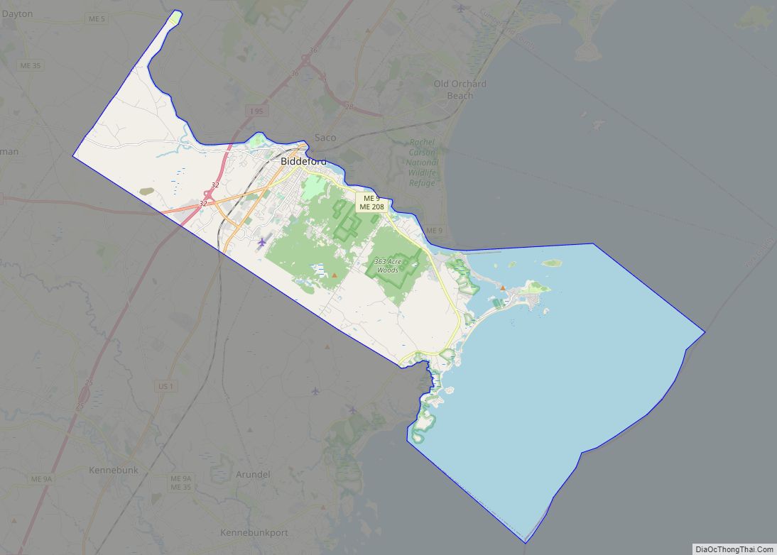
Biddeford is a city in York County, Maine, United States. It is the principal commercial center of York County. Its population was 22,552 at the 2020 census. The twin cities of Saco and Biddeford include the resort communities of Biddeford Pool and Fortunes Rocks. The town is the site of the University of New England and the annual La Kermesse Franco-Americaine Festival. First visited by Europeans in 1616, it is the site of one of the earliest European settlements in the United States. It is home to Saint Joseph’s Church, the tallest building in Maine.
Biddeford is a principal population center of the Portland-South Portland-Biddeford metropolitan statistical area.
| Name: | Biddeford city |
|---|---|
| LSAD Code: | 25 |
| LSAD Description: | city (suffix) |
| State: | Maine |
| County: | York County |
| Elevation: | 69 ft (21 m) |
| Total Area: | 59.08 sq mi (153.02 km²) |
| Land Area: | 30.09 sq mi (77.92 km²) |
| Water Area: | 29.00 sq mi (75.10 km²) |
| Total Population: | 22,552 |
| Population Density: | 749.61/sq mi (289.42/km²) |
| Area code: | 207 |
| FIPS code: | 2304860 |
| GNISfeature ID: | 0562119 |
| Website: | http://www.Biddefordmaine.org |
Online Interactive Map
Click on ![]() to view map in "full screen" mode.
to view map in "full screen" mode.
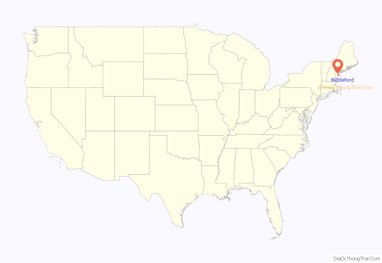
Biddeford location map. Where is Biddeford city?
History
The first European to settle at Biddeford was physician Richard Vines in the winter of 1616–1617 at Winter Harbor, as he called Biddeford Pool. This 1616 landing by a European antedates the Mayflower landing in Plymouth, Massachusetts, (located 100 miles to the south) by about four years, a fact overlooked in much of New England lore. In 1630, the Plymouth Company granted the land south of the River Swanckadocke to Dr. Vines and John Oldham. In 1653, the town included both sides of the river, and was incorporated by the Massachusetts General Court as Saco.
Biddeford was first incorporated as the Town of Saco in 1653. Roger Spencer was granted the right in 1653 to build the first sawmill. Lumber and fish became the community’s chief exports. In 1659, Major William Phillips of Boston became a proprietor, and constructed a garrison and mill at the falls. During King Philip’s War in 1675, the town was attacked by Indians. Settlers withdrew to Winter Harbor for safety, and their homes and mills upriver at the falls were burned. In 1693, a stone fort was built a short distance below the falls, but it was captured by the Indians in 1703, when 11 colonists were killed and 24 taken captive to Canada. In 1688, Fort Mary was built near the entrance to Biddeford Pool. The town was reorganized in 1718 as Biddeford, after Bideford, a town in Devon, England, from which some settlers had emigrated. After the Fall of Quebec in 1759, hostilities with the natives ceased.
In 1762, the land northeast of the river was set off as Pepperellborough, which in 1805 was renamed Saco. The first bridge to Saco was built in 1767. The river divides into two falls that drop 40 feet (12 m), providing water power for mills. Factories were established to make boots and shoes. The developing mill town also had granite quarries and brickyards, in addition to lumber and grain mills. Major textile manufacturing facilities were constructed along the riverbanks, including the Laconia Company in 1845, and the Pepperell Company in 1850. Biddeford was incorporated as a city in 1855.
The mills attracted waves of immigrants, including the Irish, Albanians, and French-Canadians from Quebec. At one time, the textile mills employed as many as 12,000 people, but as happened elsewhere, the industry entered a long period of decline. As of 2009, the last remaining textile company in the city, WestPoint Home, closed. The property occupying the mill has been sold and is being redeveloped into housing and new businesses. The last log drive down the Saco River was in 1943, with the last log sawed in 1948. Biddeford’s name is engraved near the top level of The Pilgrim Monument, in Provincetown, Massachusetts, along with the names of some of the oldest cities and towns in New England.
During World War II, the Biddeford Pool Military Reservation was established from 1942 to 1945, on what is now the Abenakee Golf Club. It had four circular concrete platforms called “Panama mounts” for 155-mm guns, three of which remain today.
Biddeford Road Map
Biddeford city Satellite Map
Geography
According to the United States Census Bureau, the city has a total area of 59.08 square miles (153.02 km), of which 28.99 square miles (75.08 km) are covered by water. Situated beside Saco Bay on the Gulf of Maine, Biddeford is drained by the Little River and the Saco River. The city proper has very diverse geography, from inland rolling hillside, to urban settlement, to coastal sprawl.
The city is crossed by Interstate 95, U. S. Route 1, and state routes 5, 9, 111, and 208. It is bordered by the city of Saco to the north, the Atlantic Ocean to the east, the towns of Dayton and Lyman to the west, and the towns of Kennebunkport and Arundel to the south. The Little River forms a portion of the border between Biddeford and the Goose Rocks neighborhood of Kennebunkport, in Biddeford’s most southerly region (Granite Point). East Point, located on the peninsula of Biddeford Pool, is the easternmost point in York County.
Timber Island, the most southerly point in the City of Biddeford, lies in Goosefare Bay at the mouth of the Little River, and is accessible at low tide from Goose Rocks Beach in Kennebunkport. The island and most of adjacent Timber Point became part of the Rachel Carson National Wildlife Refuge in December 2011.
The city has almost 15 miles (24 km) of frontage along the Saco River, and an Atlantic coastline on which the seaside neighborhoods of Hills Beach, Biddeford Pool, Fortunes Rocks and Granite Point are located. Biddeford includes Wood Island Light, a lighthouse located about a mile offshore from Biddeford Pool.
Climate
This climatic region is typified by large seasonal temperature differences, with warm to hot (and often humid) summers and cold (sometimes severely cold) winters. According to the Köppen climate classification, Biddeford has a humid continental climate, Dfb on climate maps.
See also
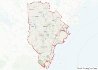
Map of Maine State and its subdivision: Map of other states:- Alabama
- Alaska
- Arizona
- Arkansas
- California
- Colorado
- Connecticut
- Delaware
- District of Columbia
- Florida
- Georgia
- Hawaii
- Idaho
- Illinois
- Indiana
- Iowa
- Kansas
- Kentucky
- Louisiana
- Maine
- Maryland
- Massachusetts
- Michigan
- Minnesota
- Mississippi
- Missouri
- Montana
- Nebraska
- Nevada
- New Hampshire
- New Jersey
- New Mexico
- New York
- North Carolina
- North Dakota
- Ohio
- Oklahoma
- Oregon
- Pennsylvania
- Rhode Island
- South Carolina
- South Dakota
- Tennessee
- Texas
- Utah
- Vermont
- Virginia
- Washington
- West Virginia
- Wisconsin
- Wyoming
