Saco /ˈsɑːkoʊ/ is a city in York County, Maine, United States. The population was 20,381 at the 2020 census. It is home to Ferry Beach State Park, Funtown Splashtown USA, Thornton Academy, as well as General Dynamics Armament Systems (also known by its former name, Saco Defense), a subsidiary of the defense contractor General Dynamics. Saco sees much tourism during summer months due to its amusement parks, Camp Ellis Beach and Pier, Ferry Beach State Park, and proximity to Old Orchard Beach.
Saco is part of the Portland–South Portland–Biddeford, Maine metropolitan statistical area. Saco’s twin-city is Biddeford.
| Name: | Saco city |
|---|---|
| LSAD Code: | 25 |
| LSAD Description: | city (suffix) |
| State: | Maine |
| County: | York County |
| Elevation: | 66 ft (20 m) |
| Total Area: | 52.83 sq mi (136.83 km²) |
| Land Area: | 38.59 sq mi (99.93 km²) |
| Water Area: | 14.24 sq mi (36.89 km²) |
| Total Population: | 20,381 |
| Population Density: | 528.21/sq mi (203.94/km²) |
| ZIP code: | 04072 |
| Area code: | 207 |
| FIPS code: | 2364675 |
| GNISfeature ID: | 0574646 |
| Website: | www.sacomaine.org |
Online Interactive Map
Click on ![]() to view map in "full screen" mode.
to view map in "full screen" mode.
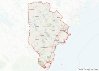
Saco location map. Where is Saco city?


History
This was territory of the Abenaki tribe whose fortified village was located up the Sokokis Trail at Pequawket (now Fryeburg). There was a settlement at the mouth of the Saco river, with homes and permanent cultivation, at the time of contact with Europeans in the early 1600s.
In July 1607, 500 warriors led by sakmow (Grand Chief) of the Mi’kmaq First Nations Henri Membertou attacked the village at present-day Saco, killing 20 of their braves, including two of their leaders, Onmechin and Marchin, leading to conflict that lasted until 1615.
In 1630 the Plymouth Company granted Thomas Lewis and Richard Bonython a charter to establish a town at Saco, with a deed that extended 4 miles (6.4 km) along the sea, by 8 miles (13 km) inland. Settled in 1631 as part of Winter Harbor (as Biddeford Pool was first known). The government of Maine, under Ferdinando Gorges, was based in the town from 1636 to 1653. It would be reorganized in 1653 by the Massachusetts General Court as Saco, which would be renamed Biddeford in 1718.
The settlement was attacked by Indians in 1675 during King Philip’s War. Settlers moved to the mouth of the river, and the houses and mills they left behind were burned. Saco lay in contested territory between New England and New France, which recruited the Indians as allies. In 1689 during King William’s War, it was again attacked, with some residents taken captive. Hostilities intensified from 1702 until 1709, then ceased in 1713 with the Treaty of Portsmouth. The community was rebuilt and in 1718 incorporated as Biddeford. Peace would not last, however, and the town was again attacked in 1723 during Dummer’s War, when it contained 14 garrisons. In August and September 1723, there were Indian raids on Saco, Maine and Dover, New Hampshire. But in 1724, a Massachusetts militia destroyed Norridgewock, an Abenaki stronghold on the Kennebec River organizing raids on English settlements. The region became less dangerous, especially after the French defeat in 1745 at the Battle of Louisburg. The French and Indian Wars finally ended with the 1763 Treaty of Paris.
In 1762, the northeastern bank of Biddeford separated as the District of Pepperrellborough, named for Sir William Pepperrell, hero of the Battle of Louisburg and late proprietor of the town. Amos Chase was one of the pioneers of Pepperrellborough. He was chosen as a selectman at the first town meeting, and served as the first deacon of the Congregational Church. Dea. Chase was one of the area’s largest taxpayers, and was prominent in civic affairs during the American Revolution, serving on the town’s Committee of Correspondence and Committee of Inspection.
The district was incorporated as the Town of Pepperellborough in 1775. Inhabitants found the name to be cumbersome, so in 1805 it was renamed Saco. It would be incorporated as a city in 1867. Saco became a center for lumbering, with log drives down the river from Little Falls Plantation (now Dayton, Lyman, Hollis and part of Limington). At Saco Falls, the timber was cut by 17 sawmills. In 1827, the community produced 21,000,000 feet (6,400,000 m) of sawn lumber, some of which was used for shipbuilding.
On Factory Island, the Saco Iron Works began operation in 1811. The Saco Manufacturing Company established a cotton mill in 1826, and a canal was dug through rock to provide water power. The mill burned in 1830, but was replaced in 1831 by the York Manufacturing Company. With the arrival of the Portland, Saco and Portsmouth Railroad in 1842, Factory Island developed into a major textile manufacturing center, with extensive brick mills dominating the Saco and Biddeford waterfronts. Other businesses included foundries, belting and harnessmaking, and machine shops. But the New England textile industry faded in the 20th century, and the York Manufacturing Company would close in 1958. The prosperous mill town era, however, left behind much fine architecture in the Georgian, Federal, Greek Revival and Victorian styles. Many buildings are now listed on the National Register of Historic Places.
In 1844, Laurel Hill Cemetery was established on 25-acre (10 ha) of land. Still in operation, it is one of the earliest examples of the Rural cemetery movement.
Saco has taken steps to make the city more environmentally friendly. In early 2007 a small wind turbine was erected near the water treatment plant at the foot of Front street. Another larger wind turbine was erected on the top of York Hill in December 2007, and was expected to generate power for the new train station for Amtrak’s Downeaster, although this was torn down in 2018 as the wind turbine never came close to generating the amount of energy promised. Saco also has two growing business parks.
Amos Chase house on Ferry Road; built c. 1743
York Manufacturing Co. in 1916
Civil War memorial in Eastman Park
Saco City Hall
Masonic Hall
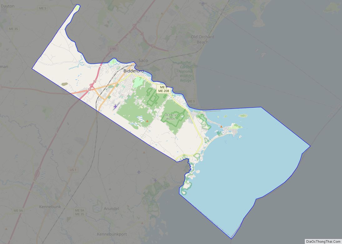
Saco Road Map

Saco city Satellite Map

Geography
According to the United States Census Bureau, the city has a total area of 52.76 square miles (136.65 km), of which, 38.46 square miles (99.61 km) of it is land and 14.30 square miles (37.04 km) is water. Situated beside Saco Bay on the Gulf of Maine, Saco is drained by the Saco River.
Saco borders the city of Biddeford, as well as the towns of Scarborough, Buxton, Dayton and Old Orchard Beach.
Terrain
Saco contains a wide variety of landforms, including beaches, fields, forests, bogs, and urban areas.
This is an archive of documents related to erosion issues in the Camp Ellis section of Saco and Saco River maintenance.
See also
Map of Maine State and its subdivision: Map of other states:- Alabama
- Alaska
- Arizona
- Arkansas
- California
- Colorado
- Connecticut
- Delaware
- District of Columbia
- Florida
- Georgia
- Hawaii
- Idaho
- Illinois
- Indiana
- Iowa
- Kansas
- Kentucky
- Louisiana
- Maine
- Maryland
- Massachusetts
- Michigan
- Minnesota
- Mississippi
- Missouri
- Montana
- Nebraska
- Nevada
- New Hampshire
- New Jersey
- New Mexico
- New York
- North Carolina
- North Dakota
- Ohio
- Oklahoma
- Oregon
- Pennsylvania
- Rhode Island
- South Carolina
- South Dakota
- Tennessee
- Texas
- Utah
- Vermont
- Virginia
- Washington
- West Virginia
- Wisconsin
- Wyoming