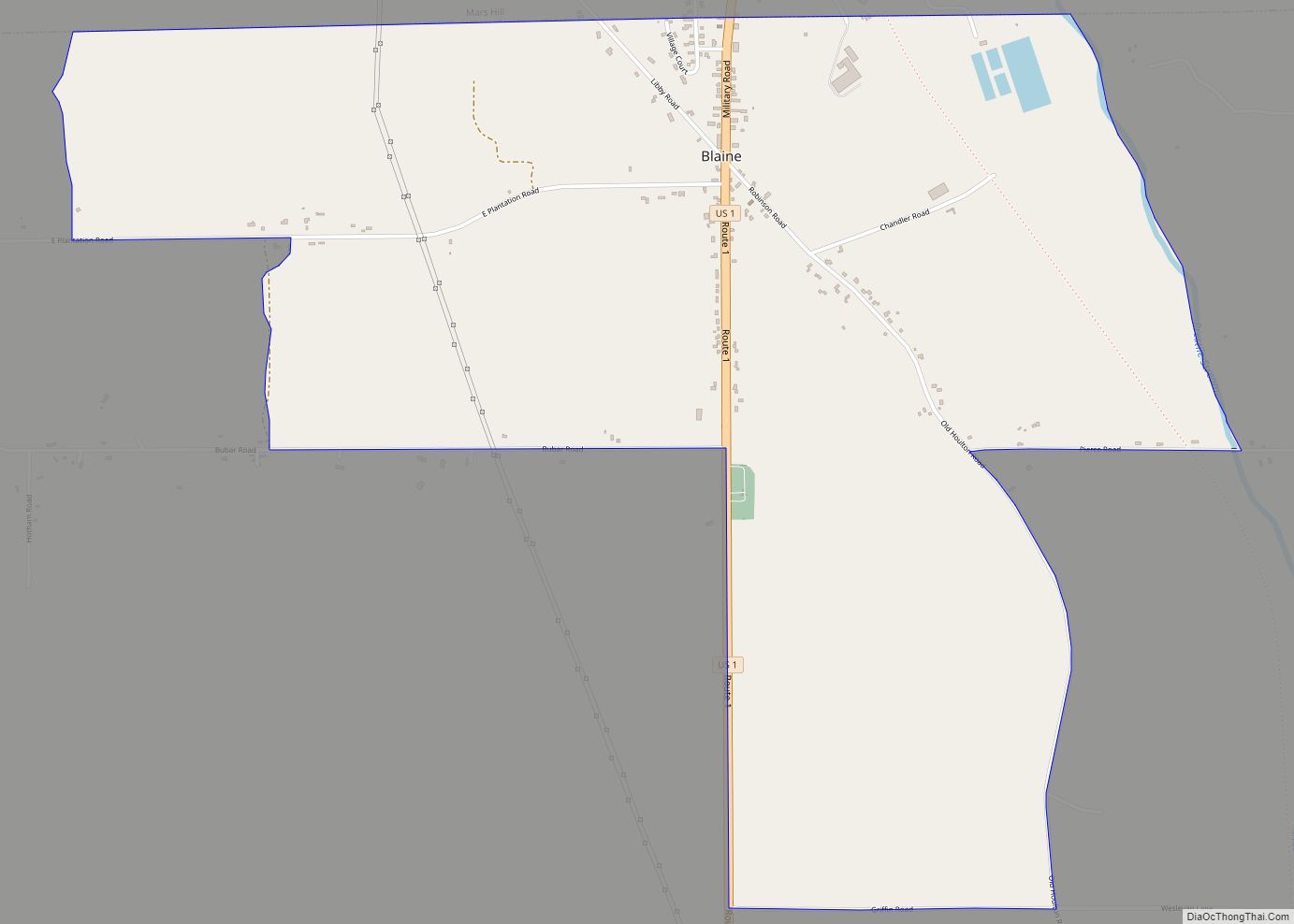
Blaine is a census-designated place (CDP) comprising the main village within the town of Blaine in Aroostook County, Maine, United States. The population of the CDP was 301 at the 2010 census, out of a population of 726 for the entire town. Prior to 2010, the village was part of the Mars Hill-Blaine CDP.
| Name: | Blaine CDP |
|---|---|
| LSAD Code: | 57 |
| LSAD Description: | CDP (suffix) |
| State: | Maine |
| County: | Aroostook County |
| Elevation: | 505 ft (154 m) |
| Total Area: | 2.73 sq mi (7.07 km²) |
| Land Area: | 2.73 sq mi (7.07 km²) |
| Water Area: | 0.00 sq mi (0.00 km²) |
| Total Population: | 250 |
| Population Density: | 91.58/sq mi (35.36/km²) |
| ZIP code: | 04734 |
| Area code: | 207 |
| FIPS code: | 2305350 |
| GNISfeature ID: | 2652330 |
Online Interactive Map
Click on ![]() to view map in "full screen" mode.
to view map in "full screen" mode.
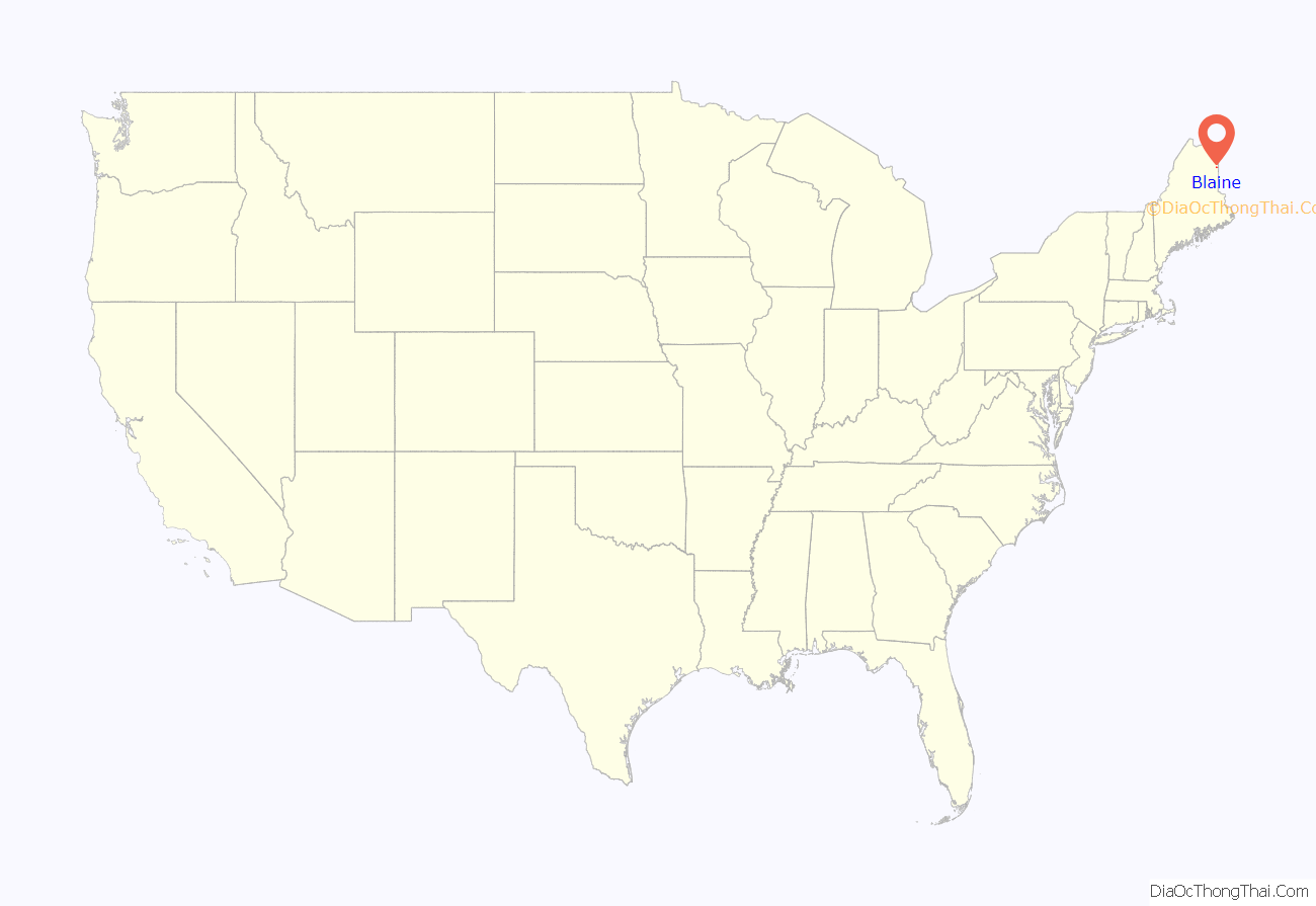
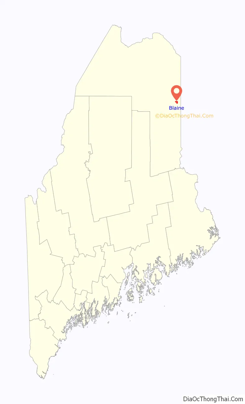
Blaine location map. Where is Blaine CDP?
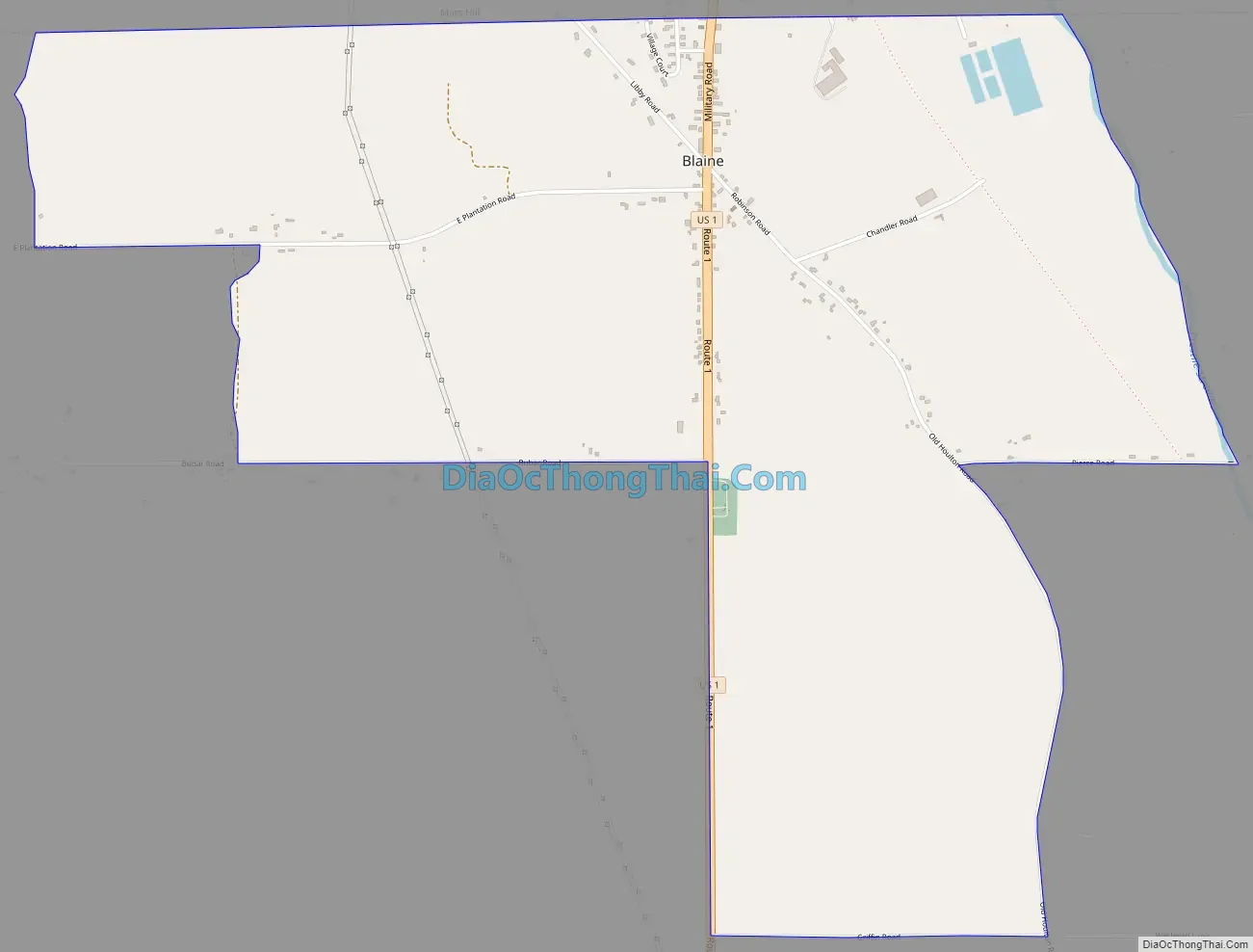
Blaine Road Map
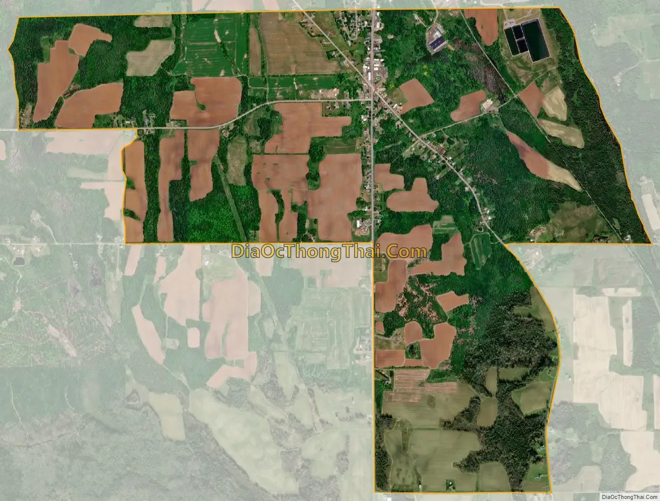
Blaine city Satellite Map
Geography
The Blaine CDP is located along the northern edge of the town of Blaine, bordered by the town of Mars Hill to the north. U.S. Route 1 runs through the center of the CDP, leading north 15 miles (24 km) to Presque Isle and south 26 miles (42 km) to Houlton.
According to the United States Census Bureau, the CDP has a total area of 2.7 square miles (7.1 km), all land.
See also
Map of Maine State and its subdivision: Map of other states:- Alabama
- Alaska
- Arizona
- Arkansas
- California
- Colorado
- Connecticut
- Delaware
- District of Columbia
- Florida
- Georgia
- Hawaii
- Idaho
- Illinois
- Indiana
- Iowa
- Kansas
- Kentucky
- Louisiana
- Maine
- Maryland
- Massachusetts
- Michigan
- Minnesota
- Mississippi
- Missouri
- Montana
- Nebraska
- Nevada
- New Hampshire
- New Jersey
- New Mexico
- New York
- North Carolina
- North Dakota
- Ohio
- Oklahoma
- Oregon
- Pennsylvania
- Rhode Island
- South Carolina
- South Dakota
- Tennessee
- Texas
- Utah
- Vermont
- Virginia
- Washington
- West Virginia
- Wisconsin
- Wyoming