Caribou is the second largest city in Aroostook County, Maine, United States. Its population was 7,396 at the 2020 census, and between the 2010 and 2020 census it was the fastest-shrinking city in Maine. The city is a service center for the agricultural and tourism industries, and the location of a National Weather Service Forecast Office.
| Name: | Caribou city |
|---|---|
| LSAD Code: | 25 |
| LSAD Description: | city (suffix) |
| State: | Maine |
| County: | Aroostook County |
| Elevation: | 449 ft (137 m) |
| Total Area: | 80.09 sq mi (207.44 km²) |
| Land Area: | 79.29 sq mi (205.36 km²) |
| Water Area: | 0.80 sq mi (2.08 km²) |
| Total Population: | 7,396 |
| Population Density: | 93.28/sq mi (36.01/km²) |
| ZIP code: | 04736 |
| Area code: | 207 |
| FIPS code: | 2310565 |
| GNISfeature ID: | 0563512 |
| Website: | www.cariboumaine.org |
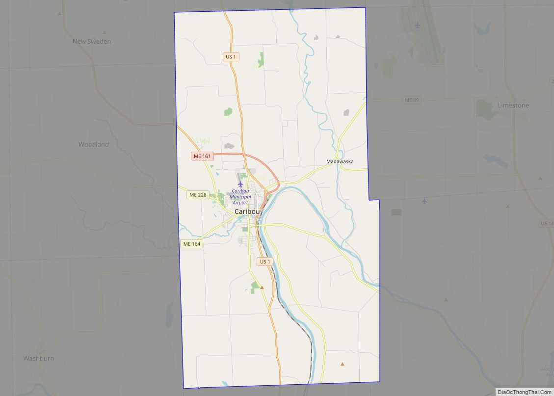
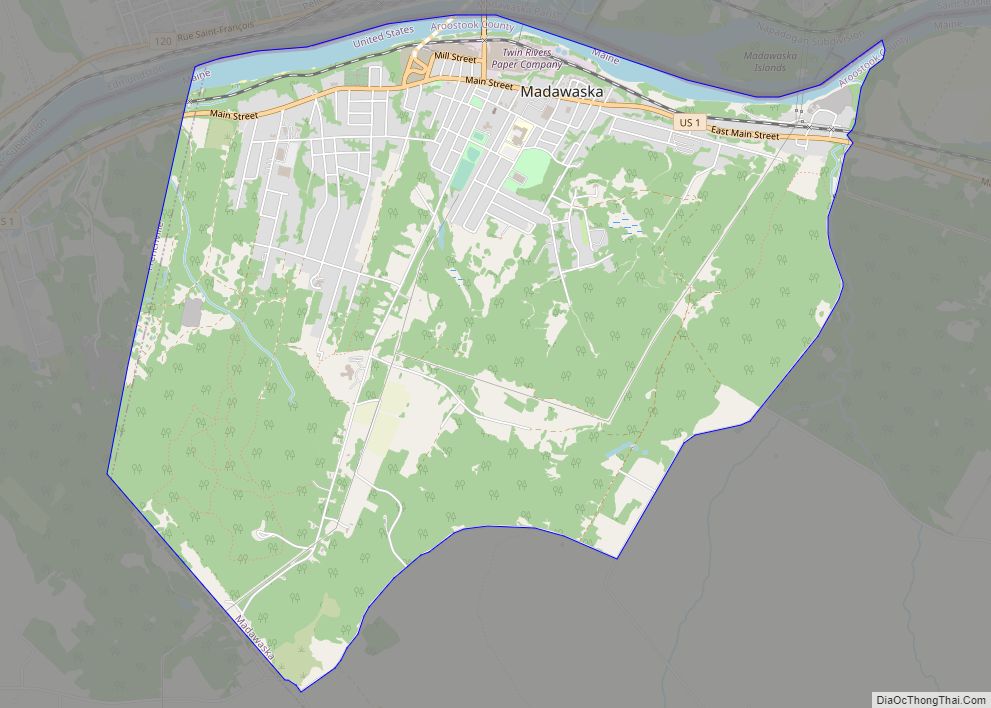
Online Interactive Map
Click on ![]() to view map in "full screen" mode.
to view map in "full screen" mode.
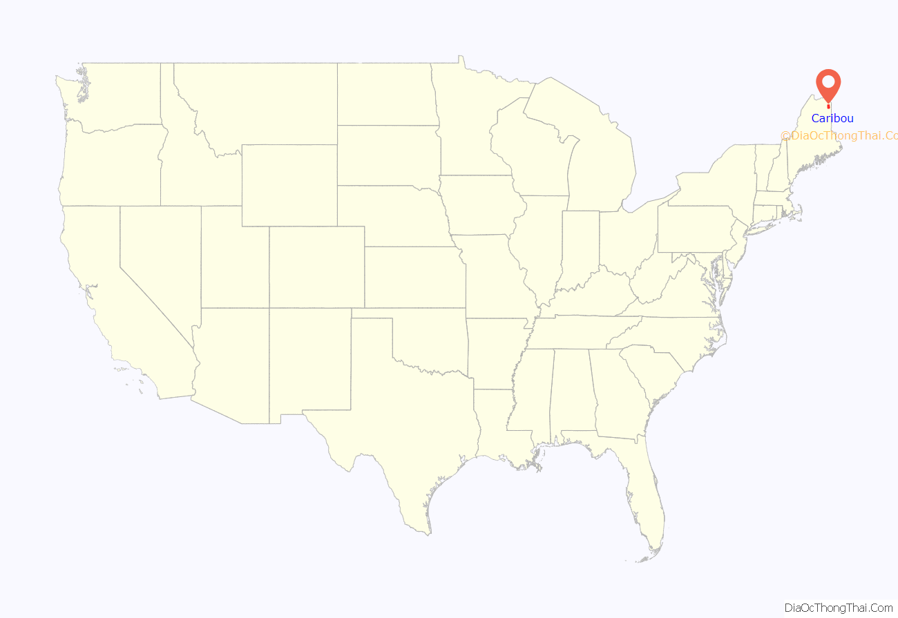
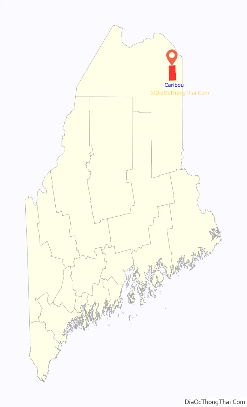
Caribou location map. Where is Caribou city?
History
Lumbermen and trappers first set up camps in the area in the 1810s. The first settlers came to what is now Caribou in the 1820s. Between 1838 and 1840, the undeclared Aroostook War flared between the United States and Canada, and the Battle of Caribou occurred in December 1838. The dispute over the international boundary delayed settlement of the area until after the signing of the Webster-Ashburton Treaty in 1842. With peace restored, European settlers arrived in gradually-increasing numbers beginning in 1843. From Eaton Plantation and part of half-township H, Caribou was incorporated in 1859 as the town of Lyndon on April 5. In 1869, it annexed Eaton, Sheridan and Forestville plantations. On February 26 of that year its name was changed to Caribou, only to revert to Lyndon on March 9. On February 8, 1877, Caribou was finally confirmed as the town’s permanent name. Two enduring mysteries are the reason for the original name of Lyndon, and the reasons for the town’s name being subsequently changed back and forth between Lyndon and Caribou. Caribou was the “jumping off” point for a large influx of settlers who immigrated directly from Sweden in 1870–1871, and settled the nearby “Swedish colony.” The small town grew throughout the late 19th century, and with the coming of the Bangor and Aroostook Railroad in the 1890s, agricultural exports exploded. This began a boom period which lasted well into the 1960s. Caribou became the largest potato shipping hub in the world, and had many related industries.
Nearby to the northeast, Loring Air Force Base opened in the early 1950s near Limestone, with bomber and tanker aircraft of the Strategic Air Command. It provided a major economic boost to the area, with construction starting in 1947 on “Limestone Army Air Field.” Caribou was incorporated as a city in 1967 on February 23, but the area’s boom period leveled off in the 1970s as a result of difficulties in its traditional potato industry. That, along with closure of the base in 1994, contributed to a decline in population in the 1980s and 1990s.
In September 1984, Caribou was the lift-off location of the first successful solo balloon crossing of the Atlantic Ocean by Colonel Joseph Kittinger. This flight is memorialized at the Rosie O’Grady Balloon of Peace Park one mile (1.6 km) south of the city on Main Street. This site includes a large replica of Kittinger’s balloon.
The Caribou Public Library is a Carnegie library. Designed in the Romanesque Revival style by local architect Schuyler C. Page, it was built in 1911–1912 with a $10,000 grant.
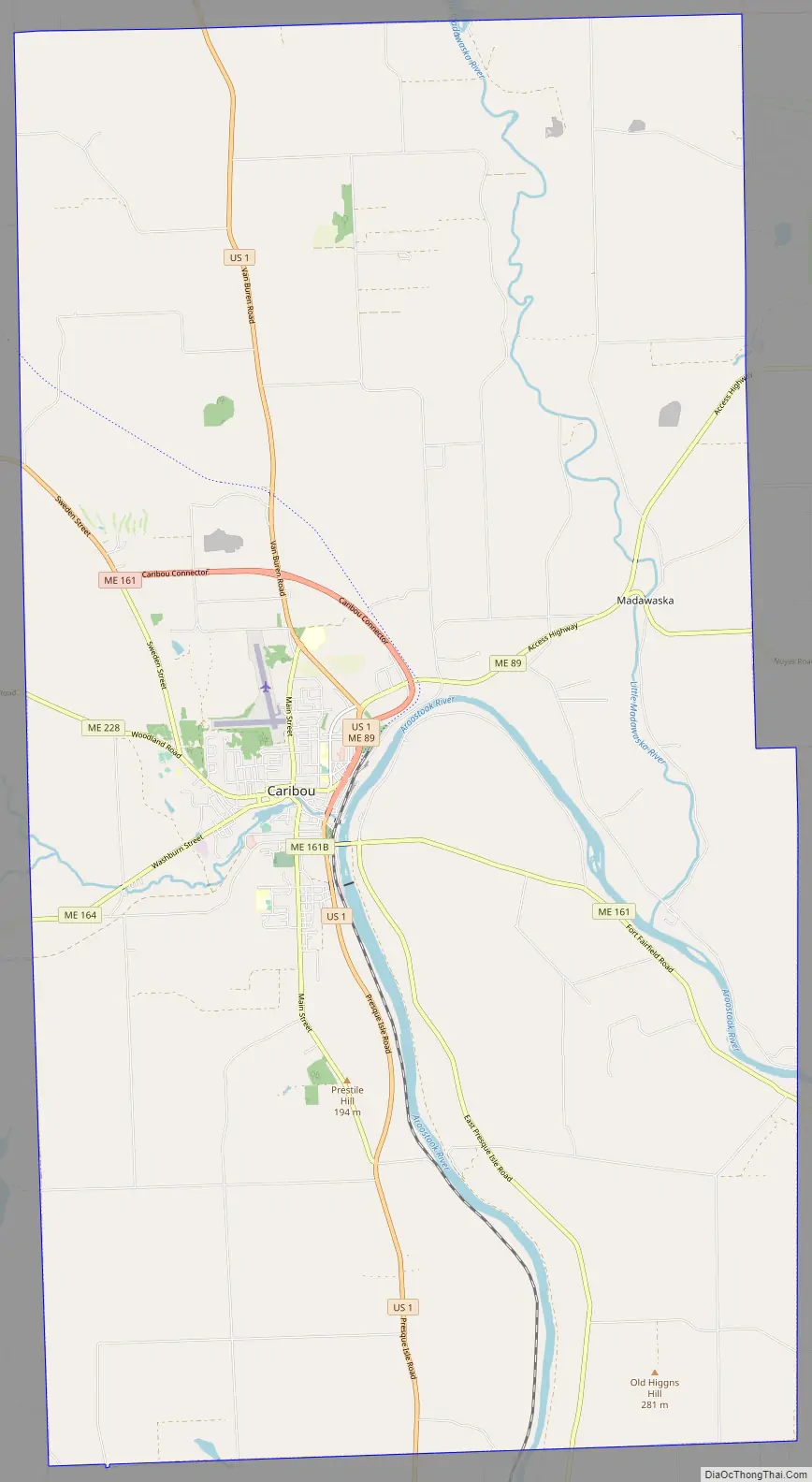
Caribou Road Map
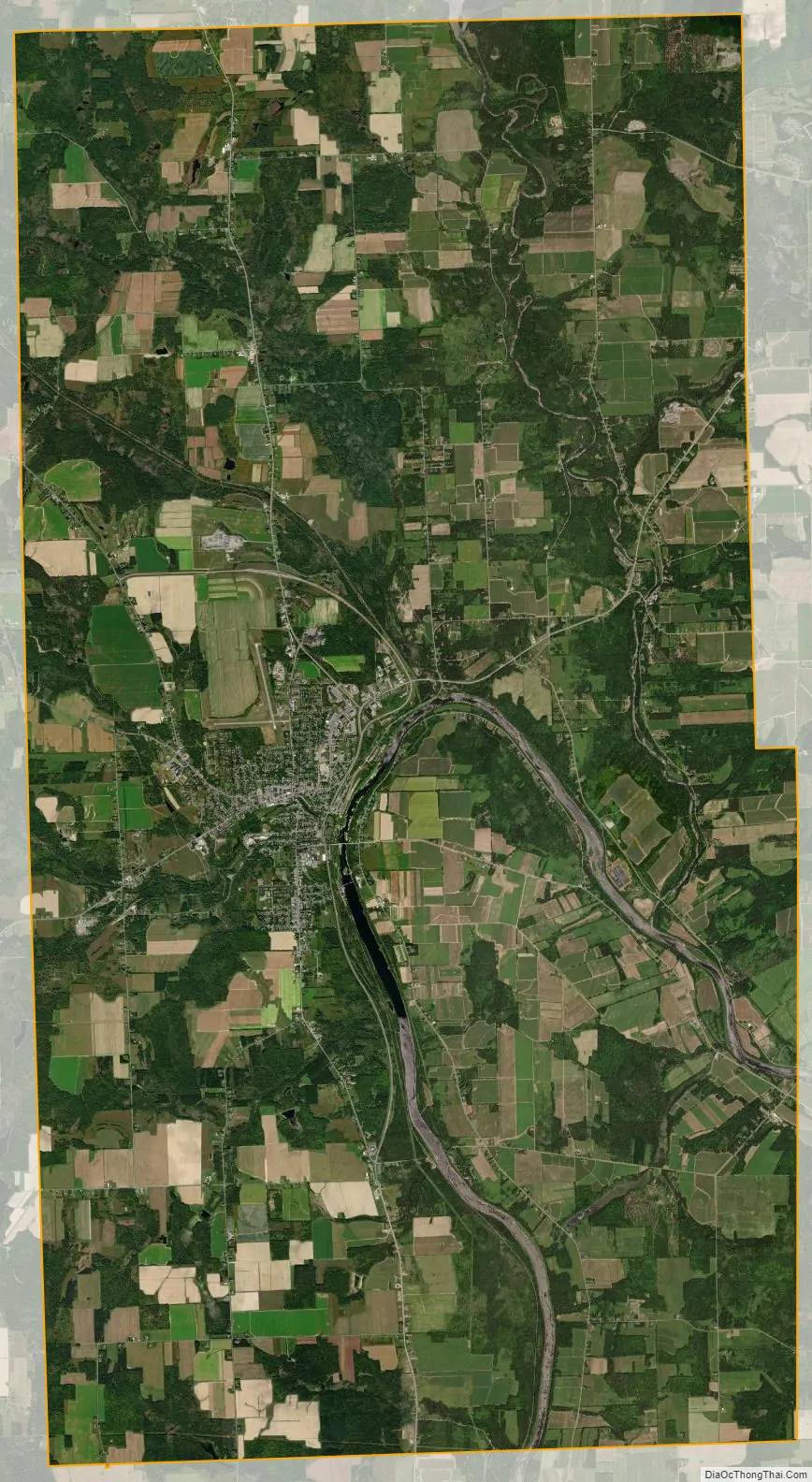
Caribou city Satellite Map
Geography
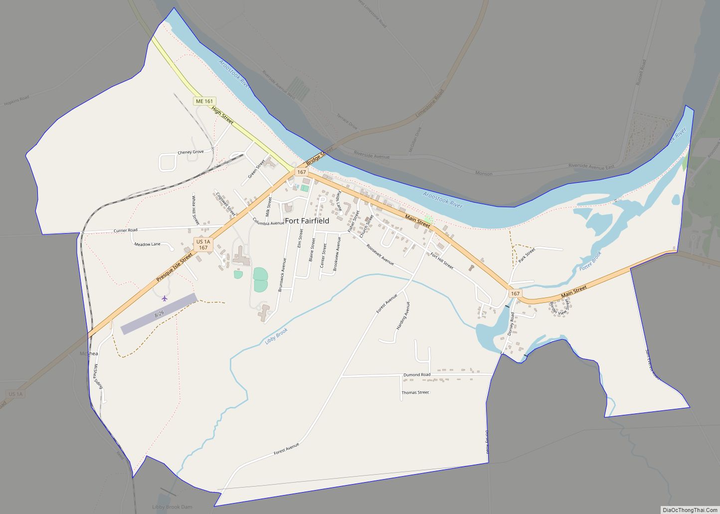
According to the United States Census Bureau, the city has a total area of 80.10 square miles (207.5 km), of which 79.26 square miles (205.3 km) is land and 0.84 square miles (2.2 km) is water. Caribou is located on the northern bend of the Aroostook River before it heads southeast to join the Saint John River just east of Fort Fairfield, Maine.
Caribou is located in the geographical center of Aroostook County, at an elevation of 449 feet (137 m) above sea level. The county is readily accessible by two major highways; Interstate 95 from the south and the Trans-Canada Highway (New Brunswick Route 2) from the north and east. In sparsely populated Aroostook County, Caribou is at the hub of spokes serving the area via U.S. 1 and Maine State routes 89, 161, 164, 205 and 228. In 2013, a bypass was completed just outside the urban limits.
Caribou has a municipal airport, with full east–west and north–south runways. It is primarily used for corporate, hobby, and Civil Air Patrol usage. Presque Isle International Airport in Presque Isle serves as the primary hub for air service. Daily flights are scheduled to and from northern Maine on United Airlines with connections to Newark Liberty International Airport.
Seaports are also close by in coastal Maine, New Brunswick, and Quebec. The closest deep-water port is Rivière-du-Loup, Quebec, 120 miles (190 km) north of Caribou, on the St. Lawrence River.
The Eastern Maine Railroad serves Caribou and Aroostook County, also connecting Maine, Vermont and the Canadian provinces of Quebec and New Brunswick and providing a direct rail link between northern Maine; Saint John, New Brunswick; and Montreal, Quebec. Given the city’s economic and cultural ties with the Canadian provinces of Quebec and New Brunswick, cross-border partnerships and relationships are often a common facet in many businesses.
Climate
Caribou has a humid continental climate (Köppen Dfb), with very cold, snowy winters, and mild to warm summers, and is located in USDA hardiness zone 4b/4a. The monthly daily average temperature ranges from 11.7 °F (−11.3 °C) in January to 66.7 °F (19.3 °C) in July. On average, there are 38 nights annually that drop to 0 °F (−18 °C) or below, and 91 days where the temperature stays below freezing, including 69 days from December through February. Although 1991–2020 averaged 2 days annually with highs at or above 90 °F (32 °C), more than 35 percent of all years on record have not seen such temperatures. Extreme temperatures range from −41 °F (−41 °C) on February 1, 1955, up to 96 °F (36 °C) as recently as June 19, 2020. Precipitation is substantial year-round, with a slight summer maximum, and with fall being wetter than spring. On average, the driest month is February, and the wettest month is July.
The average first freeze of the season occurs on September 23, and the last May 15, resulting in a freeze-free season of 130 days; the corresponding dates for measurable snowfall, i.e. at least 0.1 in (0.25 cm), are October 23 and April 25. The average annual snowfall for Caribou is approximately 118.2 inches (3.0 m), while snowfall has ranged from 68.5 inches (1.74 m) in 1961–1962 to 196.5 inches (4.99 m) in 2007−2008; the record snowiest month was December 1972 with 59.9 inches (1.52 m), while the most snow in one calendar day was 28.6 inches (73 cm) on March 14, 1984. Measurable snowfalls typically occur from early November to early April. A snow depth of at least 10 in (25 cm) is on average seen 78 days per winter, including 63 days from January to March, when the snow pack is typically most reliable.
See also
Map of Maine State and its subdivision: Map of other states:- Alabama
- Alaska
- Arizona
- Arkansas
- California
- Colorado
- Connecticut
- Delaware
- District of Columbia
- Florida
- Georgia
- Hawaii
- Idaho
- Illinois
- Indiana
- Iowa
- Kansas
- Kentucky
- Louisiana
- Maine
- Maryland
- Massachusetts
- Michigan
- Minnesota
- Mississippi
- Missouri
- Montana
- Nebraska
- Nevada
- New Hampshire
- New Jersey
- New Mexico
- New York
- North Carolina
- North Dakota
- Ohio
- Oklahoma
- Oregon
- Pennsylvania
- Rhode Island
- South Carolina
- South Dakota
- Tennessee
- Texas
- Utah
- Vermont
- Virginia
- Washington
- West Virginia
- Wisconsin
- Wyoming