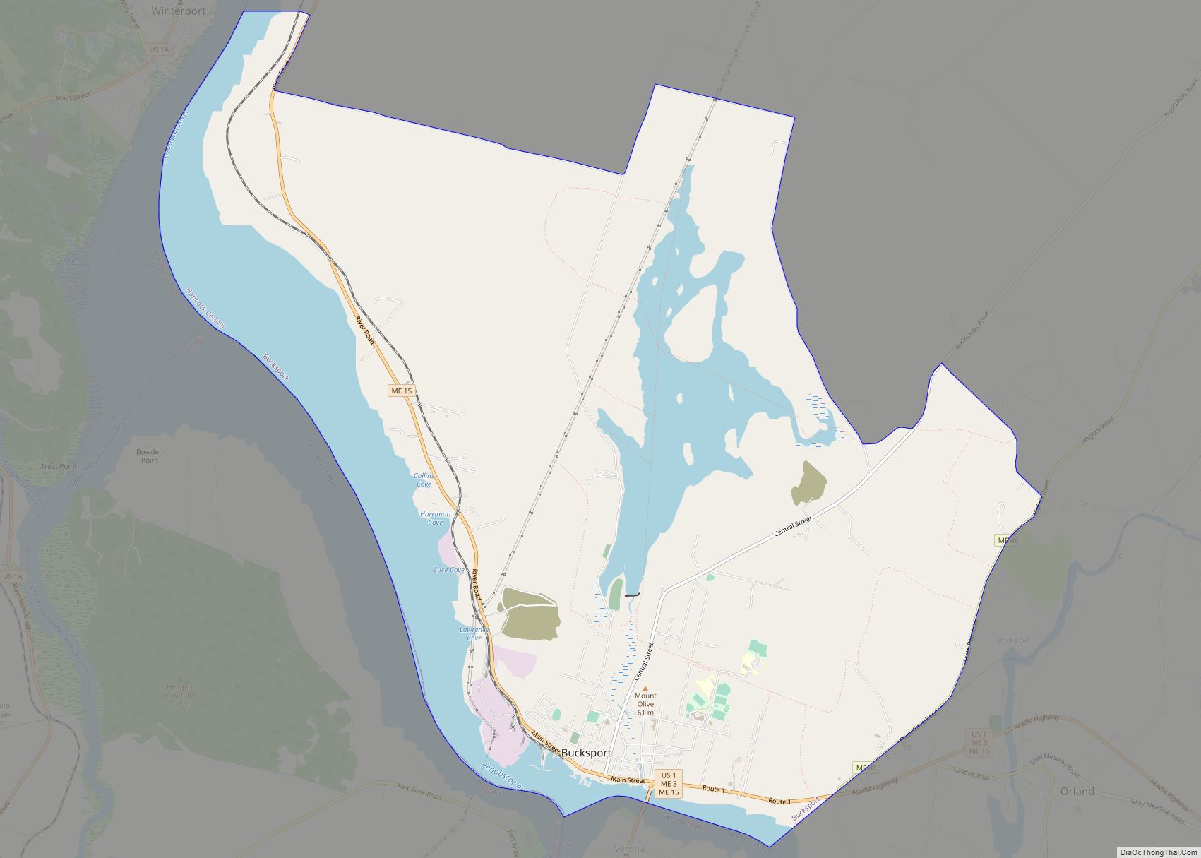
Bucksport is a census-designated place (CDP) in the town of Bucksport in Hancock County, Maine, United States. The population was 2,885 at the 2010 census, down from 2,970 at the 2000 census.
| Name: | Bucksport CDP |
|---|---|
| LSAD Code: | 57 |
| LSAD Description: | CDP (suffix) |
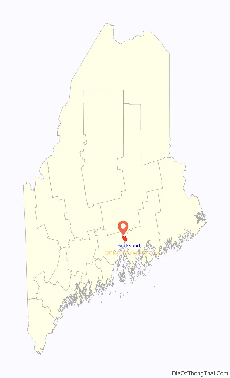
| State: | Maine |
| County: | Hancock County |
| Elevation: | 56 ft (17 m) |
| Total Area: | 14.54 sq mi (37.67 km²) |
| Land Area: | 11.41 sq mi (29.56 km²) |
| Water Area: | 3.13 sq mi (8.11 km²) |
| Total Population: | 2,832 |
| Population Density: | 248.16/sq mi (95.81/km²) |
| ZIP code: | 04416 |
| Area code: | 207 |
| FIPS code: | 2308780 |
| GNISfeature ID: | 0563131 |
Online Interactive Map
Click on ![]() to view map in "full screen" mode.
to view map in "full screen" mode.
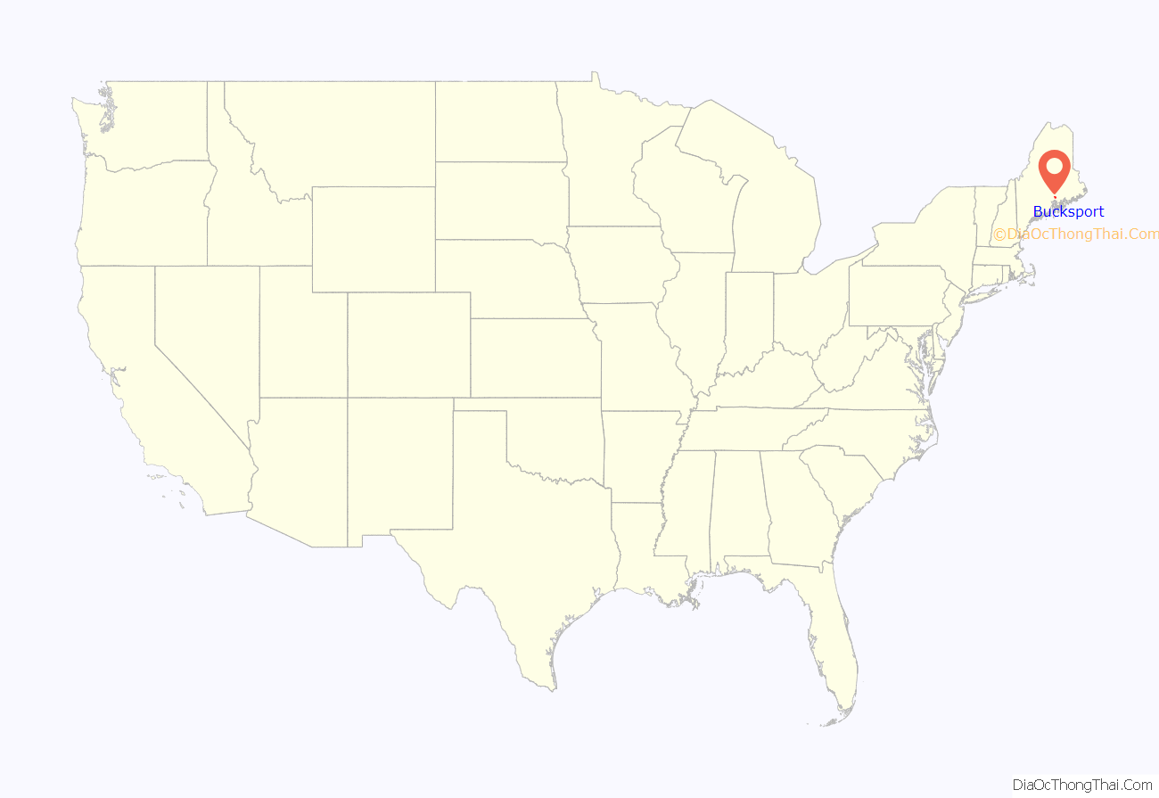
Bucksport location map. Where is Bucksport CDP?
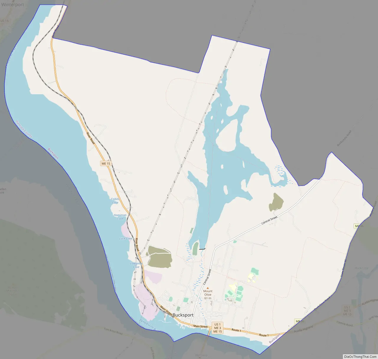
Bucksport Road Map
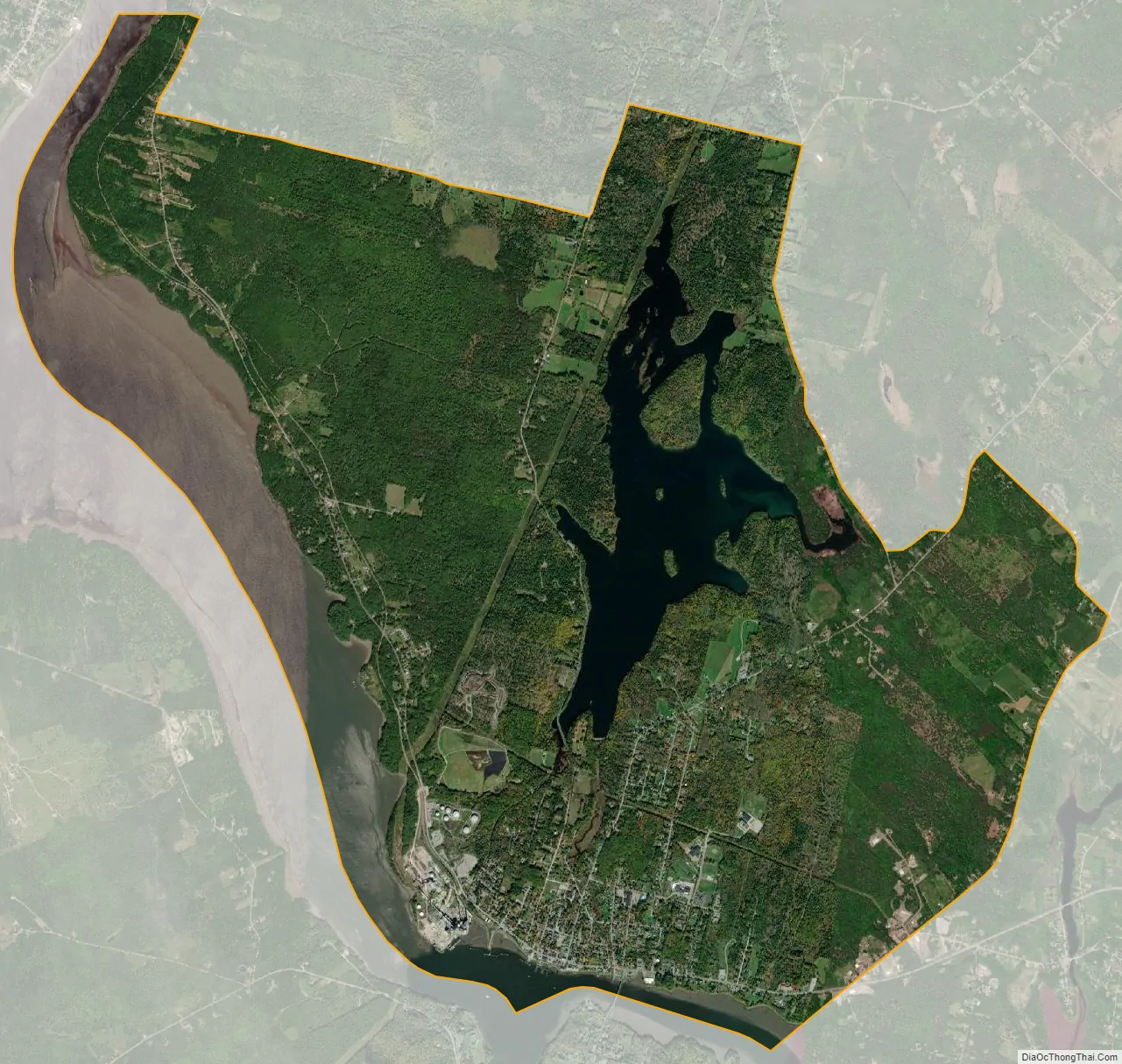
Bucksport city Satellite Map
Geography
The Bucksport CDP is the primary settlement in the town of Bucksport and is located in the southwestern part of the town limits at 44°34′41″N 68°47′39″W / 44.577934°N 68.794173°W / 44.577934; -68.794173 (44.577934, −68.794173). The western border of the CDP follows the Bucksport town line (and Hancock–Waldo County line) down the middle of the Penobscot River. The southern border follows the center of the Eastern Channel of the Penobscot, which separates Bucksport from the town of Verona Island. The southeastern border of the CDP follows the Bucksport–Orland town line, then follows Maine State Route 46 northeast to Russell Hill Road. The CDP border continues north and west, following Russell Hill Road, Bucksmills Road, Millvale Road, Cross Road, Silver Lake Road, and Town Farm Road to Maine State Route 15 at Bucksport Center. The border follows ME 15 north to an unnamed brook, then runs downstream (west) to the Penobscot.
U.S. Route 1 passes through the southeast corner of Bucksport, entering the CDP from the south on a bridge from Verona Island and leaving east into Orland. US-1 leads east 19 miles (31 km) to Ellsworth and southwest 18 miles (29 km) to Belfast. Maine Route 15 follows Main Street through the center of Bucksport and leads north up the Penobscot 19 miles to Bangor.
According to the United States Census Bureau, the Bucksport CDP has a total area of 14.6 square miles (37.7 km), of which 11.4 square miles (29.6 km) are land and 3.1 square miles (8.1 km), or 21.54%, are water.
See also
Map of Maine State and its subdivision: Map of other states:- Alabama
- Alaska
- Arizona
- Arkansas
- California
- Colorado
- Connecticut
- Delaware
- District of Columbia
- Florida
- Georgia
- Hawaii
- Idaho
- Illinois
- Indiana
- Iowa
- Kansas
- Kentucky
- Louisiana
- Maine
- Maryland
- Massachusetts
- Michigan
- Minnesota
- Mississippi
- Missouri
- Montana
- Nebraska
- Nevada
- New Hampshire
- New Jersey
- New Mexico
- New York
- North Carolina
- North Dakota
- Ohio
- Oklahoma
- Oregon
- Pennsylvania
- Rhode Island
- South Carolina
- South Dakota
- Tennessee
- Texas
- Utah
- Vermont
- Virginia
- Washington
- West Virginia
- Wisconsin
- Wyoming