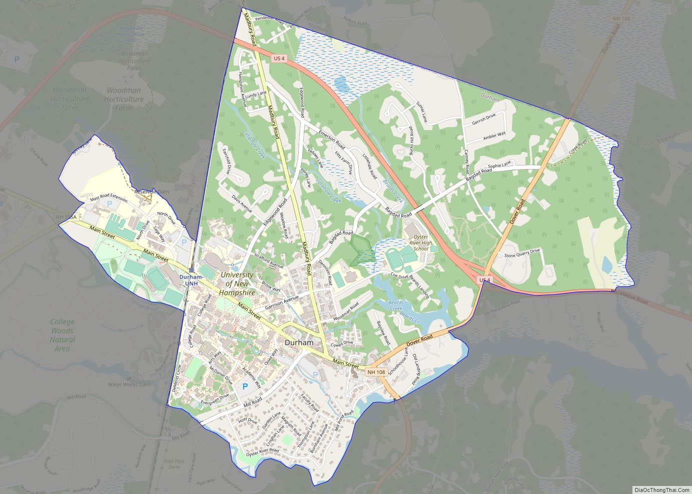
Durham is a census-designated place (CDP) and the main village in the town of Durham in Strafford County, New Hampshire, United States. The population of the CDP was 11,147 at the 2020 census, out of 15,490 in the entire town. The CDP is home to the University of New Hampshire.
| Name: | Durham CDP |
|---|---|
| LSAD Code: | 57 |
| LSAD Description: | CDP (suffix) |
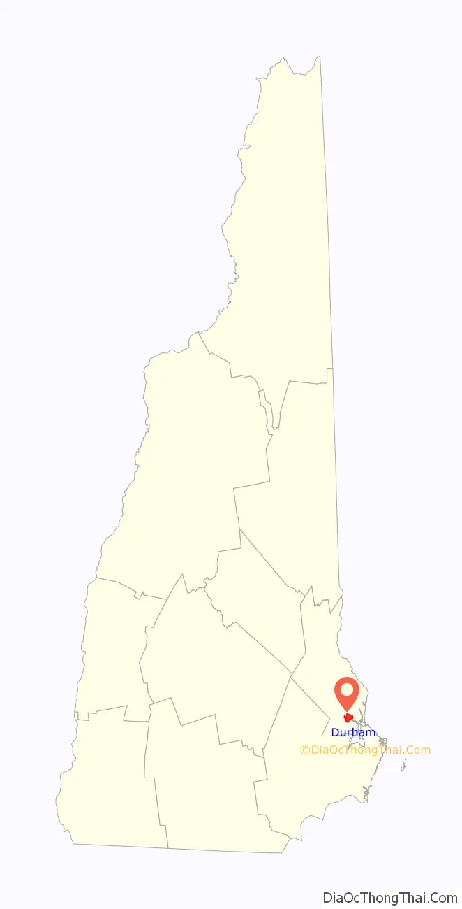
| State: | New Hampshire |
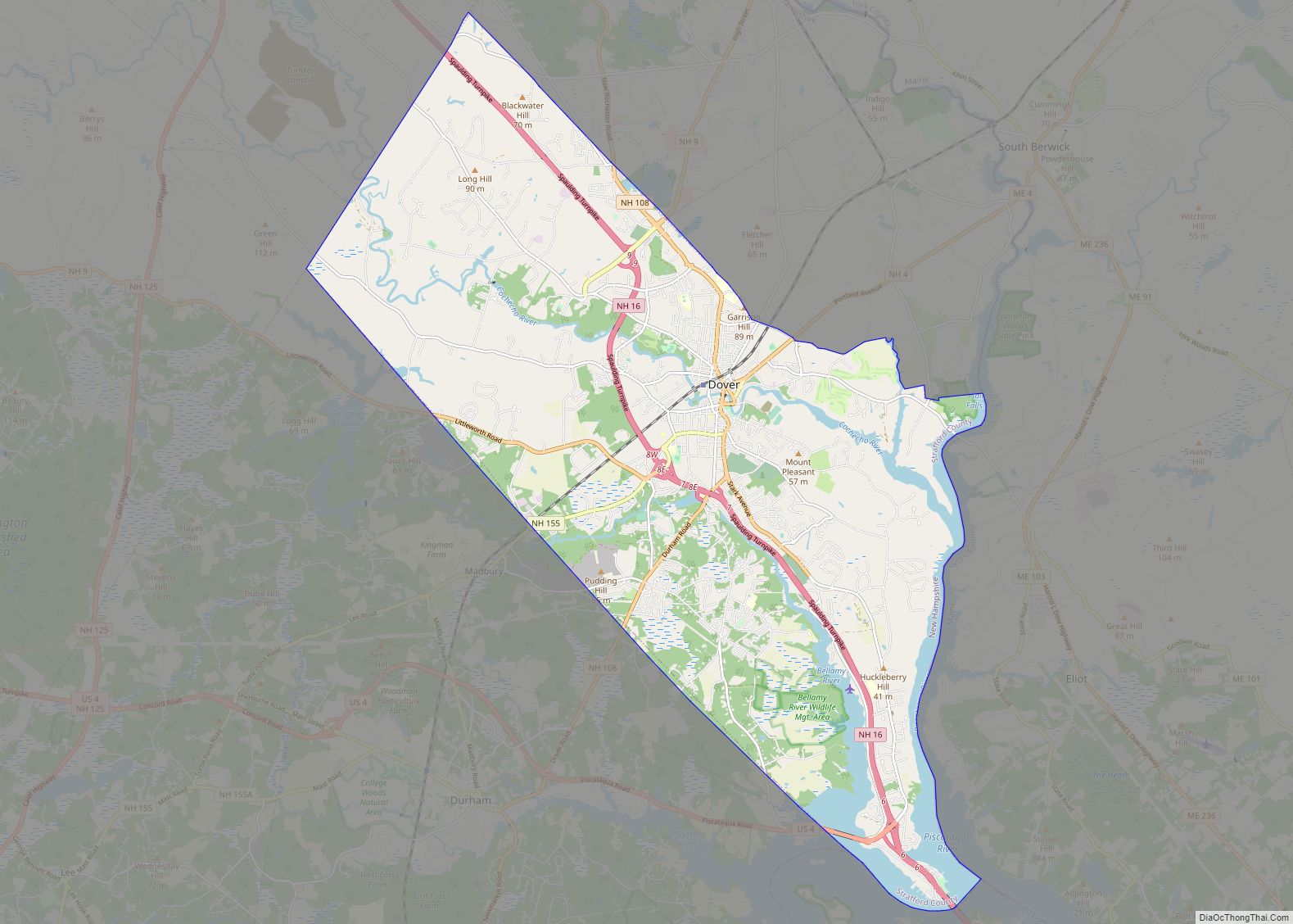
| County: | Strafford County |
| Elevation: | 60 ft (20 m) |
| Total Area: | 3.08 sq mi (7.98 km²) |
| Land Area: | 3.02 sq mi (7.84 km²) |
| Water Area: | 0.06 sq mi (0.15 km²) |
| Total Population: | 11,147 |
| Population Density: | 3,684.96/sq mi (1,422.65/km²) |
| ZIP code: | 03824 |
| Area code: | 603 |
| FIPS code: | 3319620 |
| GNISfeature ID: | 2378059 |
Online Interactive Map
Click on ![]() to view map in "full screen" mode.
to view map in "full screen" mode.
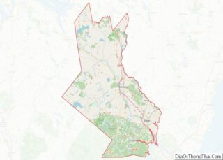
Durham location map. Where is Durham CDP?

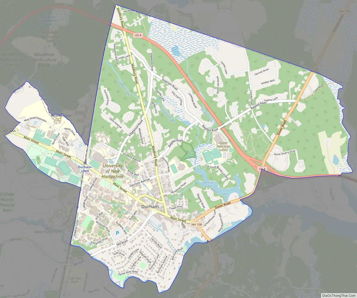
Durham Road Map
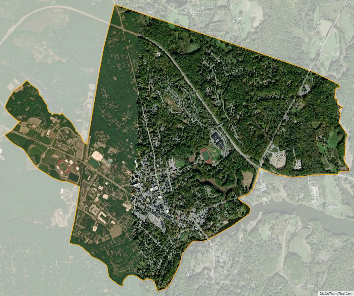
Durham city Satellite Map
Geography
The CDP is in the northern part of the town of Durham, on the north side of the Oyster River. It is bordered to the north by the town of Madbury. The western edge of the CDP follows the Pan Am Railways line, Reservoir Brook, Spinney Lane, Mast Road, and a portion of College Brook, then turns west and south through College Woods. The southern border of the CDP follows the Oyster River as far as Beards Creek, which it follows north to New Hampshire Route 108. The border then follows U.S. Route 4 east to Johnson Creek, the eastern edge of the CDP.
U.S. Route 4 passes through the northern part of the CDP, bypassing the town center. Route 4 leads southeast 9 miles (14 km) to Interstate 95 in Portsmouth and west 34 miles (55 km) to Concord, the state capital. Route 108 passes through the center of the CDP, leading north 5 miles (8 km) to the center of Dover and south 12 miles (19 km) to Exeter. The campus of the University of New Hampshire occupies the southwestern part of the CDP.
According to the U.S. Census Bureau, the Durham CDP has a total area of 3.1 square miles (8.0 km), of which 3.0 square miles (7.8 km) are land and 0.06 square miles (0.15 km), or 1.83%, are water.
See also
Map of New Hampshire State and its subdivision: Map of other states:- Alabama
- Alaska
- Arizona
- Arkansas
- California
- Colorado
- Connecticut
- Delaware
- District of Columbia
- Florida
- Georgia
- Hawaii
- Idaho
- Illinois
- Indiana
- Iowa
- Kansas
- Kentucky
- Louisiana
- Maine
- Maryland
- Massachusetts
- Michigan
- Minnesota
- Mississippi
- Missouri
- Montana
- Nebraska
- Nevada
- New Hampshire
- New Jersey
- New Mexico
- New York
- North Carolina
- North Dakota
- Ohio
- Oklahoma
- Oregon
- Pennsylvania
- Rhode Island
- South Carolina
- South Dakota
- Tennessee
- Texas
- Utah
- Vermont
- Virginia
- Washington
- West Virginia
- Wisconsin
- Wyoming