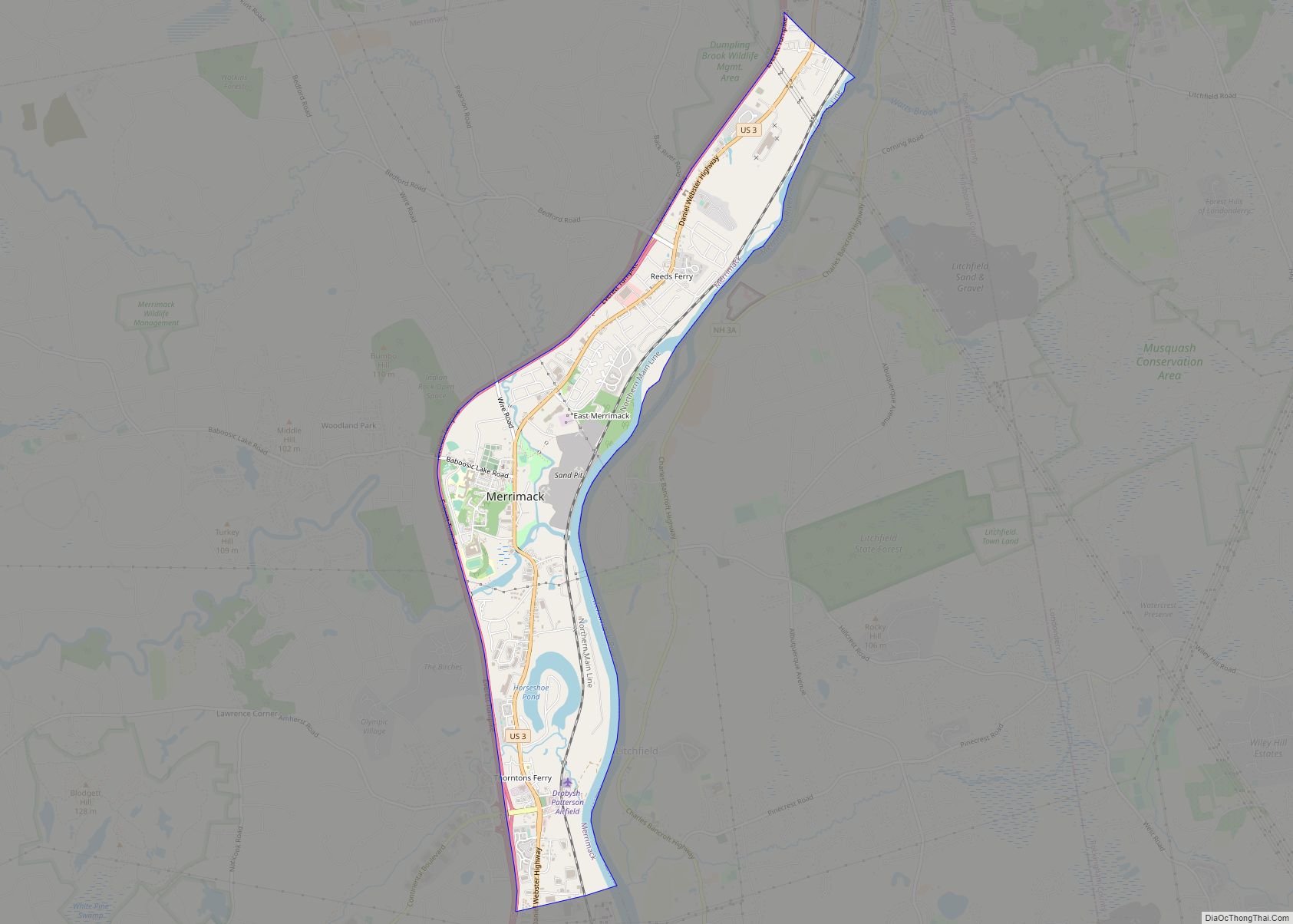
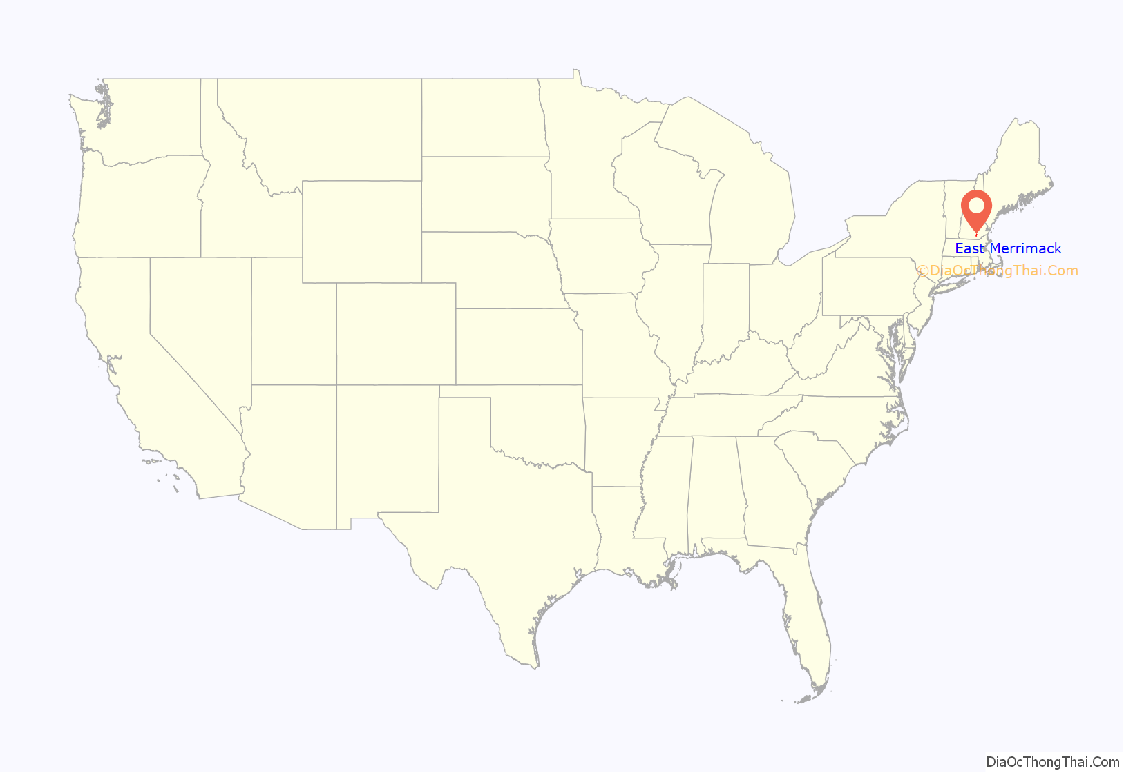
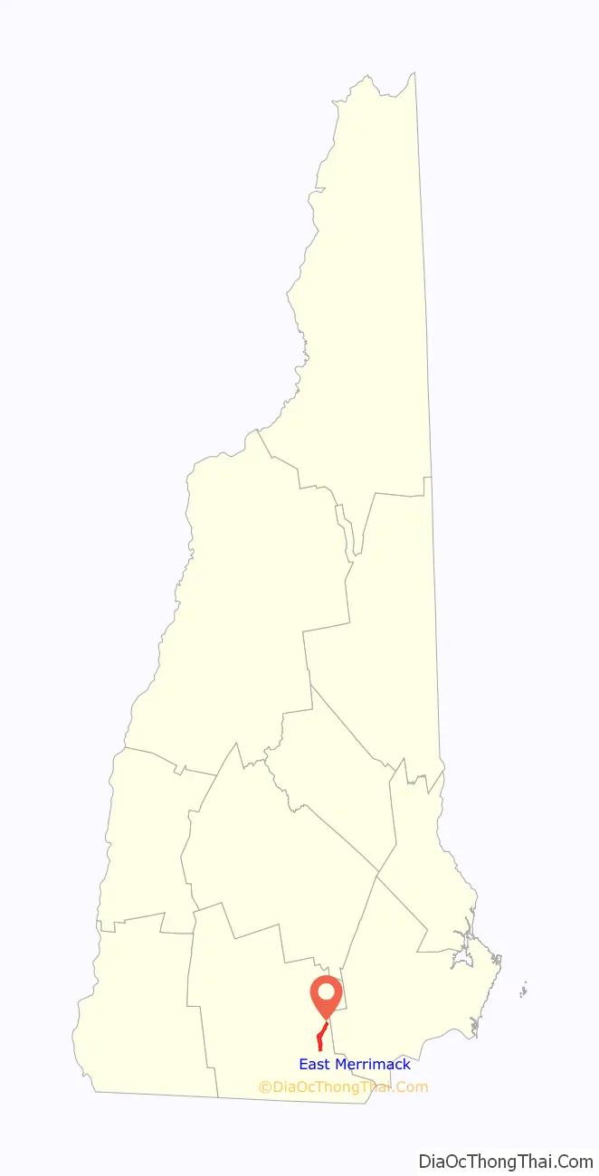
East Merrimack is a census-designated place (CDP) in the town of Merrimack, Hillsborough County, New Hampshire, United States. There is no village center named “East Merrimack”; rather, the CDP refers to the region of the town of Merrimack lying east of the F. E. Everett Turnpike, overlapping portions of the villages of Reeds Ferry, Thornton’s Ferry, and the center of Merrimack. The population was 5,176 at the 2020 census, up from 4,197 at the 2010 census.
| Name: | East Merrimack CDP |
|---|---|
| LSAD Code: | 57 |
| LSAD Description: | CDP (suffix) |
| State: | New Hampshire |
| County: | Hillsborough County |
| Elevation: | 98 ft (30 m) |
| Total Area: | 3.72 sq mi (9.63 km²) |
| Land Area: | 3.38 sq mi (8.74 km²) |
| Water Area: | 0.34 sq mi (0.89 km²) |
| Total Population: | 5,176 |
| Population Density: | 1,533.18/sq mi (592.03/km²) |
| Area code: | 603 |
| FIPS code: | 3321780 |
| GNISfeature ID: | 1867352 |
Online Interactive Map
Click on ![]() to view map in "full screen" mode.
to view map in "full screen" mode.
East Merrimack location map. Where is East Merrimack CDP?
East Merrimack Road Map
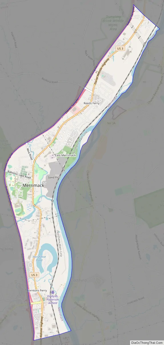
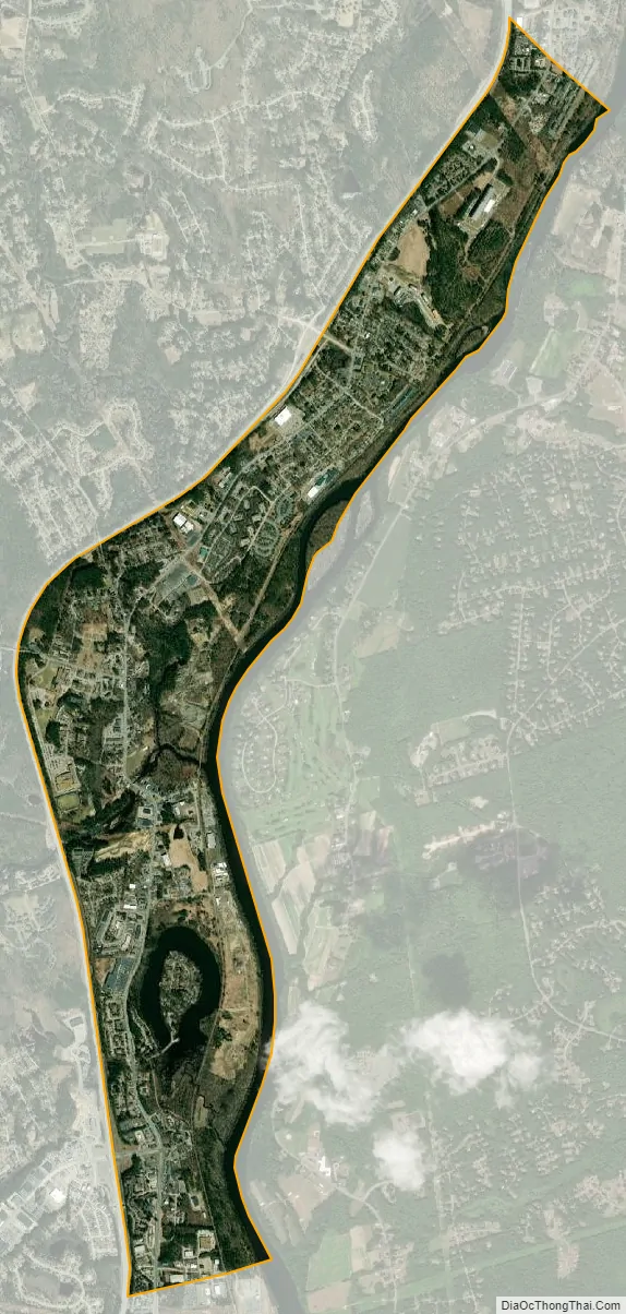
East Merrimack city Satellite Map
Geography
East Merrimack is located in the eastern part of the town of Merrimack, bordered to the west by the Everett Turnpike and to the east by the Merrimack River, which forms the town boundary with Litchfield. To the north, the CDP extends to the Bedford town line, and to the south it extends past Star Drive. U.S. Route 3 is the main road through the CDP, leading north 10 miles (16 km) to Manchester and south 7 miles (11 km) to Nashua. The Everett Turnpike is accessible from Exit 11 (Continental Boulevard) near the southern end of the CDP and from partial Exit 12 (Bedford Road) near the north end.
According to the United States Census Bureau, the CDP has a total area of 3.7 square miles (9.6 km), of which 3.4 square miles (8.7 km) are land and 0.3 square miles (0.9 km), or 9.27%, are water. Most of the water area is within the Merrimack River.
See also
Map of New Hampshire State and its subdivision: Map of other states:- Alabama
- Alaska
- Arizona
- Arkansas
- California
- Colorado
- Connecticut
- Delaware
- District of Columbia
- Florida
- Georgia
- Hawaii
- Idaho
- Illinois
- Indiana
- Iowa
- Kansas
- Kentucky
- Louisiana
- Maine
- Maryland
- Massachusetts
- Michigan
- Minnesota
- Mississippi
- Missouri
- Montana
- Nebraska
- Nevada
- New Hampshire
- New Jersey
- New Mexico
- New York
- North Carolina
- North Dakota
- Ohio
- Oklahoma
- Oregon
- Pennsylvania
- Rhode Island
- South Carolina
- South Dakota
- Tennessee
- Texas
- Utah
- Vermont
- Virginia
- Washington
- West Virginia
- Wisconsin
- Wyoming