Epping is a census-designated place (CDP) and the main village in the town of Epping, Rockingham County, New Hampshire, United States. The population of the CDP was 2,693 at the 2020 census, out of 7,125 in the entire town.
| Name: | Epping CDP |
|---|---|
| LSAD Code: | 57 |
| LSAD Description: | CDP (suffix) |
| State: | New Hampshire |
| County: | Rockingham County |
| Elevation: | 129 ft (39 m) |
| Total Area: | 4.34 sq mi (11.23 km²) |
| Land Area: | 4.30 sq mi (11.14 km²) |
| Water Area: | 0.04 sq mi (0.09 km²) |
| Total Population: | 2,693 |
| Population Density: | 626.13/sq mi (241.77/km²) |
| ZIP code: | 03042 |
| Area code: | 603 |
| FIPS code: | 3324580 |
| GNISfeature ID: | 2378062 |
Online Interactive Map
Click on ![]() to view map in "full screen" mode.
to view map in "full screen" mode.
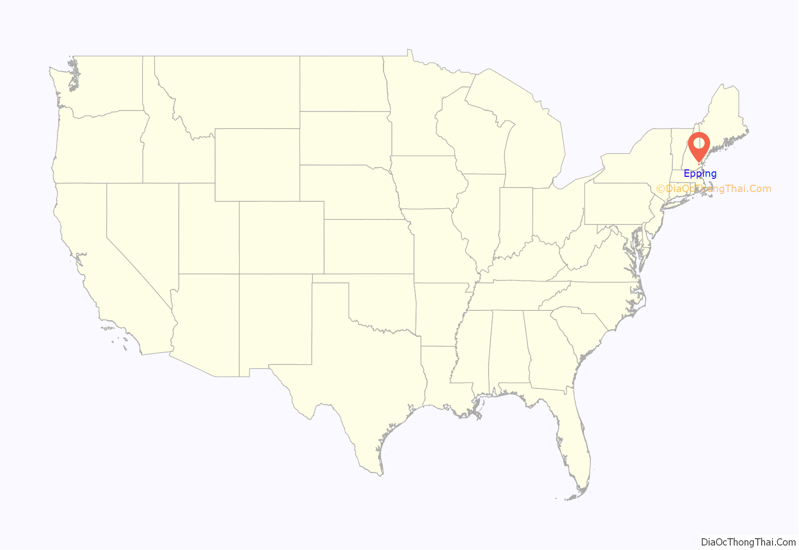
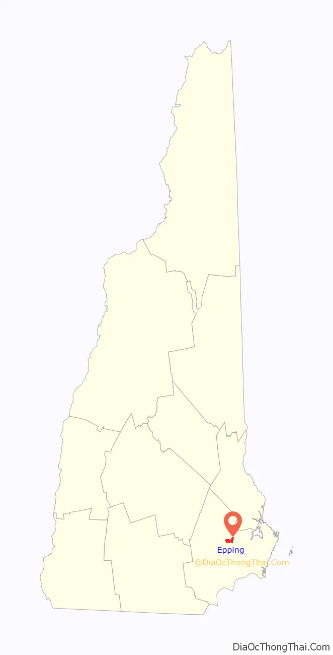
Epping location map. Where is Epping CDP?
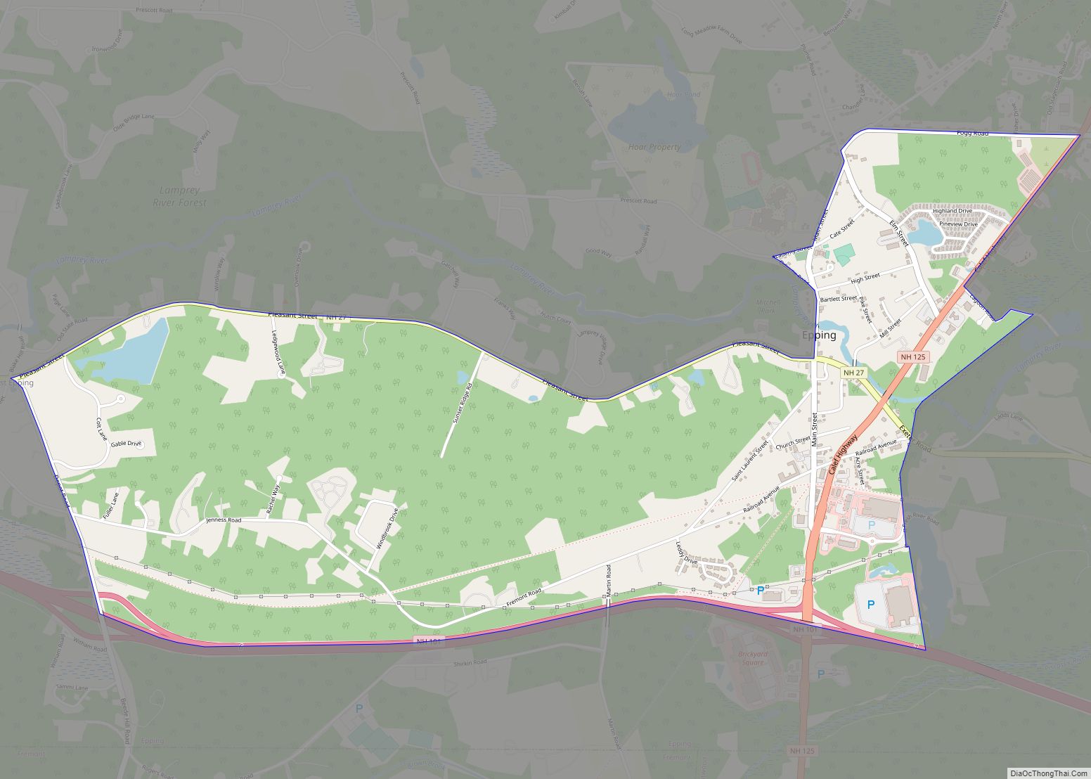
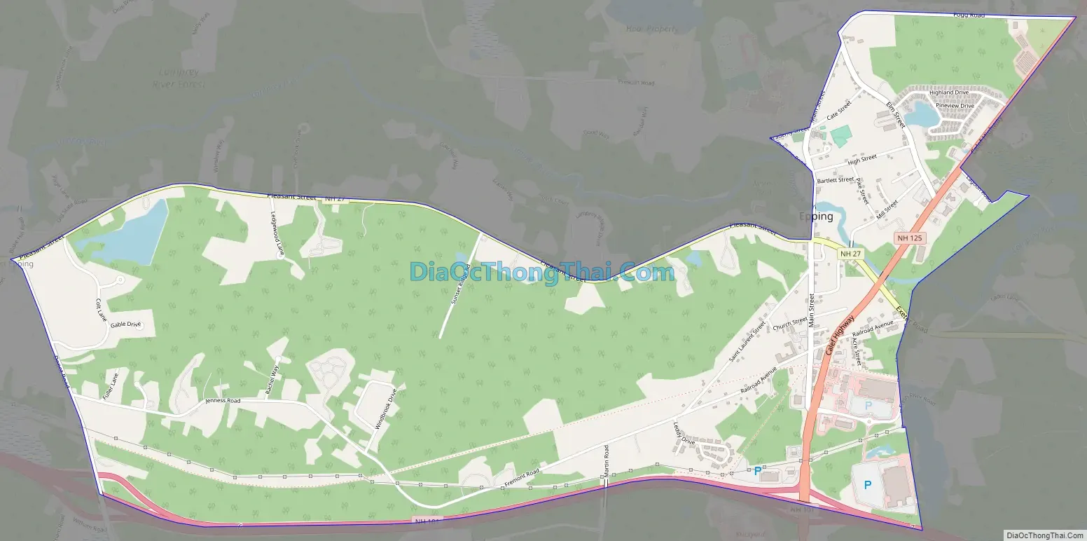
Epping Road Map
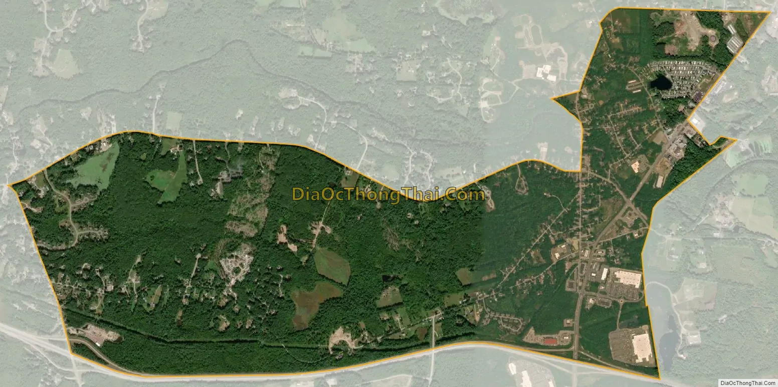
Epping city Satellite Map
Geography
The CDP is in the south-central part of the town of Epping, comprising most of the main village of Epping, part of the village of West Epping, and less densely developed land in between. The CDP is bordered to the south by the New Hampshire Route 101 expressway and to the west by the Lamprey River from NH 101 to NH 27 (Pleasant Street). The northern border of the CDP follows NH 27 and the Lamprey River, until the village of Epping in the eastern part of the CDP, where it follows Prescott Road and Old Hedding Road to Delaney Road, east of NH 125. The eastern border stays east of NH 125 from Old Hedding Road to NH 101.
NH Route 101, with one exit in Epping, leads east 12 miles (19 km) to Interstate 95 in Hampton and west 19 miles (31 km) to Interstate 93 in Manchester. Route 125, which intersects Route 101 at Exit 7 in Epping, leads north 21 miles (34 km) to Rochester and south 20 miles (32 km) to Haverhill, Massachusetts. Route 27, the pre-expressway routing of Route 101, leads east 7 miles (11 km) to Exeter and west 6 miles (10 km) to Raymond.
According to the U.S. Census Bureau, the Epping CDP has a total area of 4.3 square miles (11.2 km), of which 0.04 square miles (0.1 km), or 0.82%, are water. The Lamprey River passes through Epping village, flowing east toward Great Bay.
See also
Map of New Hampshire State and its subdivision: Map of other states:- Alabama
- Alaska
- Arizona
- Arkansas
- California
- Colorado
- Connecticut
- Delaware
- District of Columbia
- Florida
- Georgia
- Hawaii
- Idaho
- Illinois
- Indiana
- Iowa
- Kansas
- Kentucky
- Louisiana
- Maine
- Maryland
- Massachusetts
- Michigan
- Minnesota
- Mississippi
- Missouri
- Montana
- Nebraska
- Nevada
- New Hampshire
- New Jersey
- New Mexico
- New York
- North Carolina
- North Dakota
- Ohio
- Oklahoma
- Oregon
- Pennsylvania
- Rhode Island
- South Carolina
- South Dakota
- Tennessee
- Texas
- Utah
- Vermont
- Virginia
- Washington
- West Virginia
- Wisconsin
- Wyoming