Hampton is a census-designated place (CDP) comprising the town center and surrounding developed areas of the town of Hampton, Rockingham County, New Hampshire, United States. The population of the CDP was 9,597 at the 2020 census, out of 16,214 in the entire town.
| Name: | Hampton CDP |
|---|---|
| LSAD Code: | 57 |
| LSAD Description: | CDP (suffix) |
| State: | New Hampshire |
| County: | Rockingham County |
| Elevation: | 40 ft (10 m) |
| Total Area: | 5.54 sq mi (14.35 km²) |
| Land Area: | 5.45 sq mi (14.10 km²) |
| Water Area: | 0.10 sq mi (0.25 km²) |
| Total Population: | 9,597 |
| Population Density: | 1,762.53/sq mi (680.52/km²) |
| ZIP code: | 03842, 03843 |
| Area code: | 603 |
| FIPS code: | 3332980 |
| GNISfeature ID: | 2378068 |
Online Interactive Map
Click on ![]() to view map in "full screen" mode.
to view map in "full screen" mode.
Hampton location map. Where is Hampton CDP?


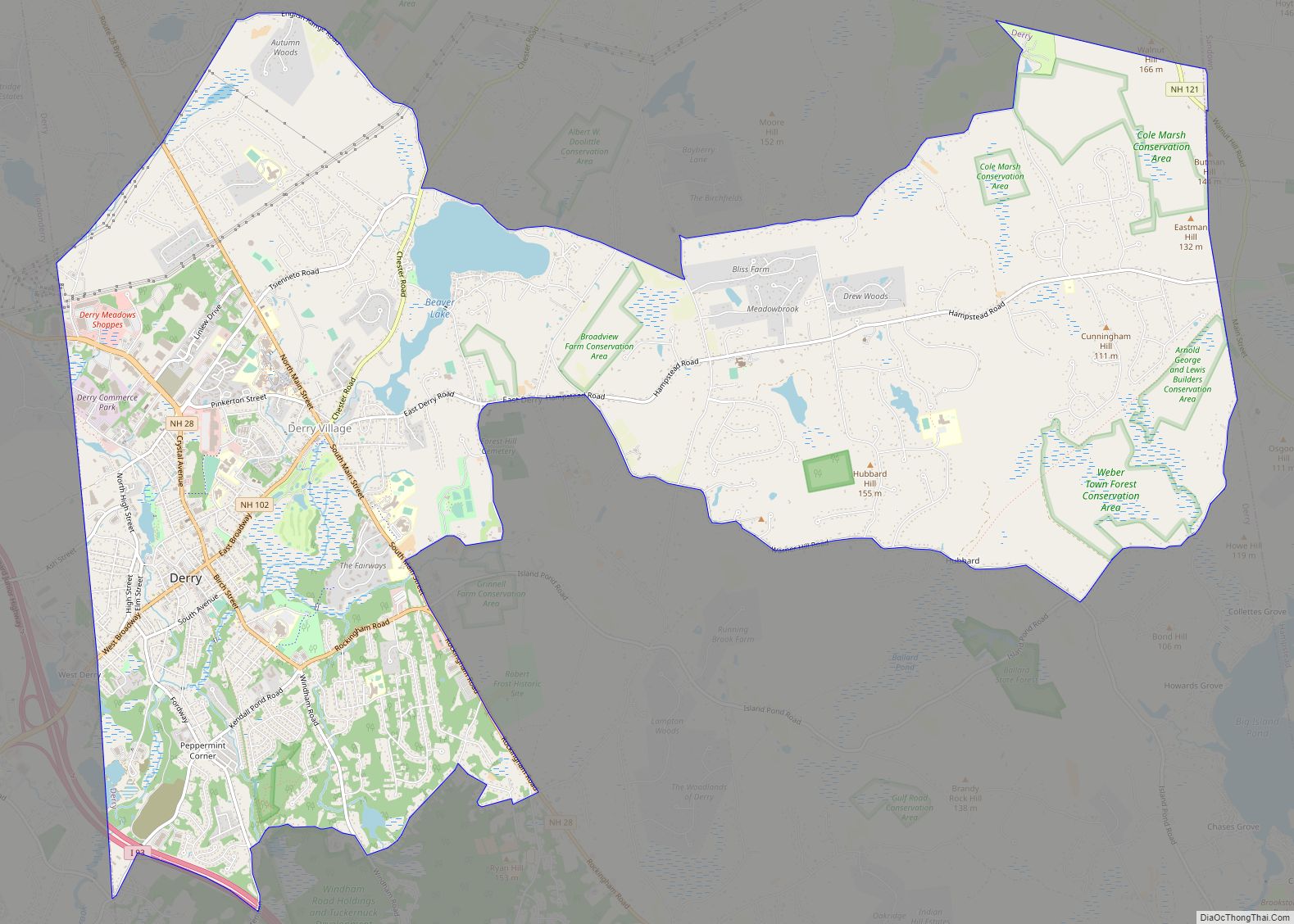
Hampton Road Map
Hampton city Satellite Map

Geography
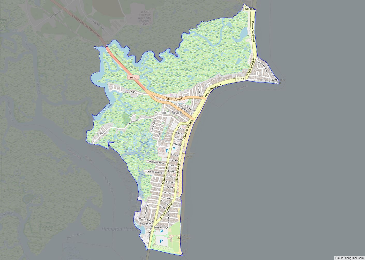
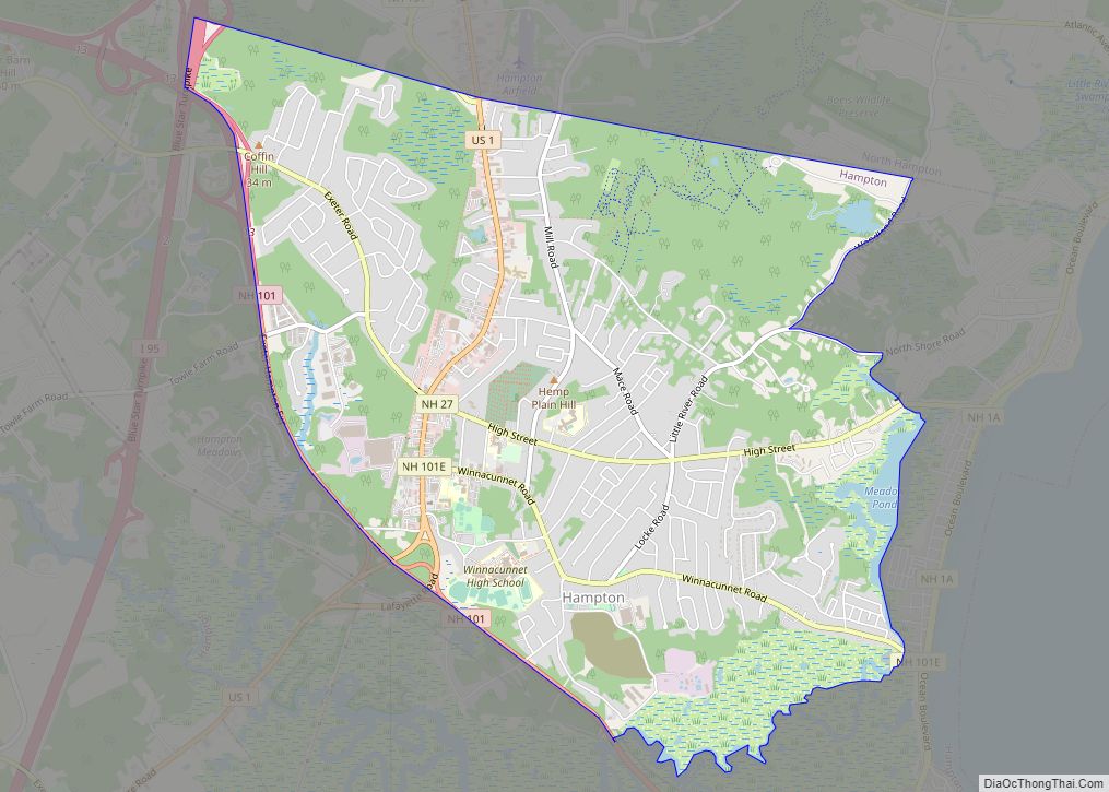
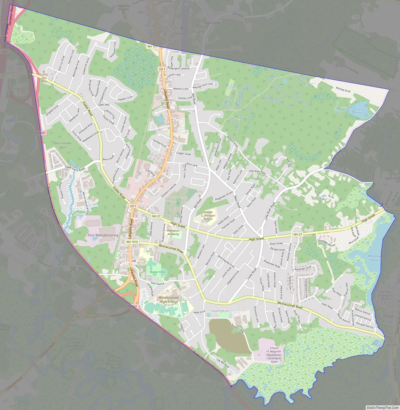
The CDP occupies the central part of the town of Hampton, centered on the intersection of U.S. Route 1 (Lafayette Road) with New Hampshire Route 27 (Exeter Road/High Street). The CDP is bordered to the north by the town of North Hampton and to the southeast by the Hampton Beach CDP within the town of Hampton. The eastern border of the Hampton CDP begins at Woodland Road, then proceeds down Nilus Brook and through Meadow Pond. The southern border follows Tide Mill Creek through the Hampton Saltmarsh from Meadow Pond to New Hampshire Route 101, which forms the southwestern border of the CDP to Interstate 95, the western extent of the CDP.
U.S. Route 1 leads north from Hampton 10 miles (16 km) to Portsmouth and south the same distance to Newburyport, Massachusetts. Route 27 leads east 2 miles (3 km) to the Atlantic Ocean and west 7 miles (11 km) to Exeter. Route 101 (the Exeter–Hampton Expressway) is accessible from Exit 13 (NH 27) on the west edge of the CDP and from US 1 on the southern edge. Route 101 leads southeast 2 miles (3 km) to the Atlantic Ocean in Hampton Beach and west 35 miles (56 km) to Manchester. Interstate 95 is accessible from Route 101 at the western edge of the CDP and leads north 60 miles (97 km) to Portland, Maine, and south 46 miles (74 km) to Boston, Massachusetts.
According to the U.S. Census Bureau, the Hampton CDP has a total area of 5.5 square miles (14.3 km), of which 5.4 square miles (14.1 km) are land and 0.1 square miles (0.2 km), or 1.72%, are water.
See also
Map of New Hampshire State and its subdivision: Map of other states:- Alabama
- Alaska
- Arizona
- Arkansas
- California
- Colorado
- Connecticut
- Delaware
- District of Columbia
- Florida
- Georgia
- Hawaii
- Idaho
- Illinois
- Indiana
- Iowa
- Kansas
- Kentucky
- Louisiana
- Maine
- Maryland
- Massachusetts
- Michigan
- Minnesota
- Mississippi
- Missouri
- Montana
- Nebraska
- Nevada
- New Hampshire
- New Jersey
- New Mexico
- New York
- North Carolina
- North Dakota
- Ohio
- Oklahoma
- Oregon
- Pennsylvania
- Rhode Island
- South Carolina
- South Dakota
- Tennessee
- Texas
- Utah
- Vermont
- Virginia
- Washington
- West Virginia
- Wisconsin
- Wyoming