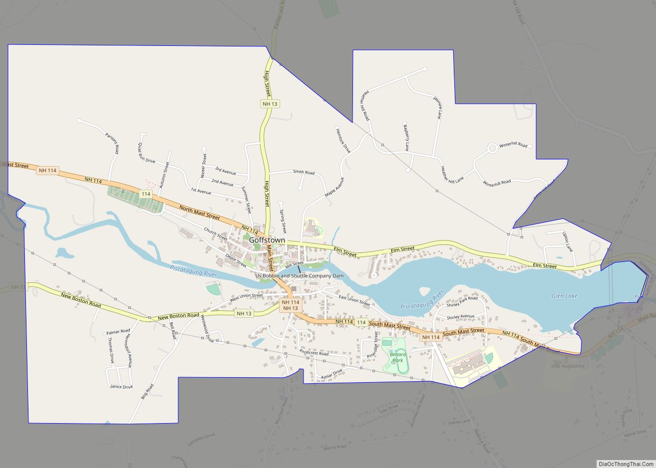
Goffstown is a census-designated place (CDP) and the main village in the town of Goffstown in Hillsborough County, New Hampshire, United States. The population of the CDP was 3,366 at the 2020 census, out of 18,577 in the entire town.
| Name: | Goffstown CDP |
|---|---|
| LSAD Code: | 57 |
| LSAD Description: | CDP (suffix) |
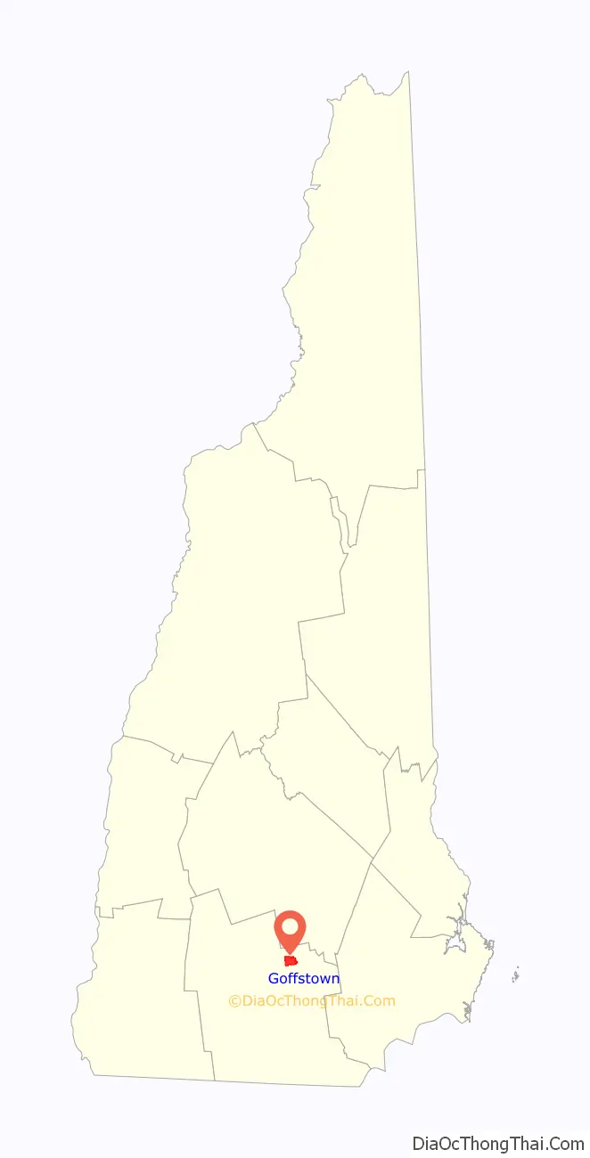
| State: | New Hampshire |
| County: | Hillsborough County |
| Elevation: | 315 ft (96 m) |
| Total Area: | 3.40 sq mi (8.81 km²) |
| Land Area: | 3.17 sq mi (8.20 km²) |
| Water Area: | 0.24 sq mi (0.61 km²) |
| Total Population: | 3,366 |
| Population Density: | 1,062.84/sq mi (410.37/km²) |
| ZIP code: | 03045 |
| Area code: | 603 |
| FIPS code: | 3329780 |
| GNISfeature ID: | 2629722 |
Online Interactive Map
Click on ![]() to view map in "full screen" mode.
to view map in "full screen" mode.
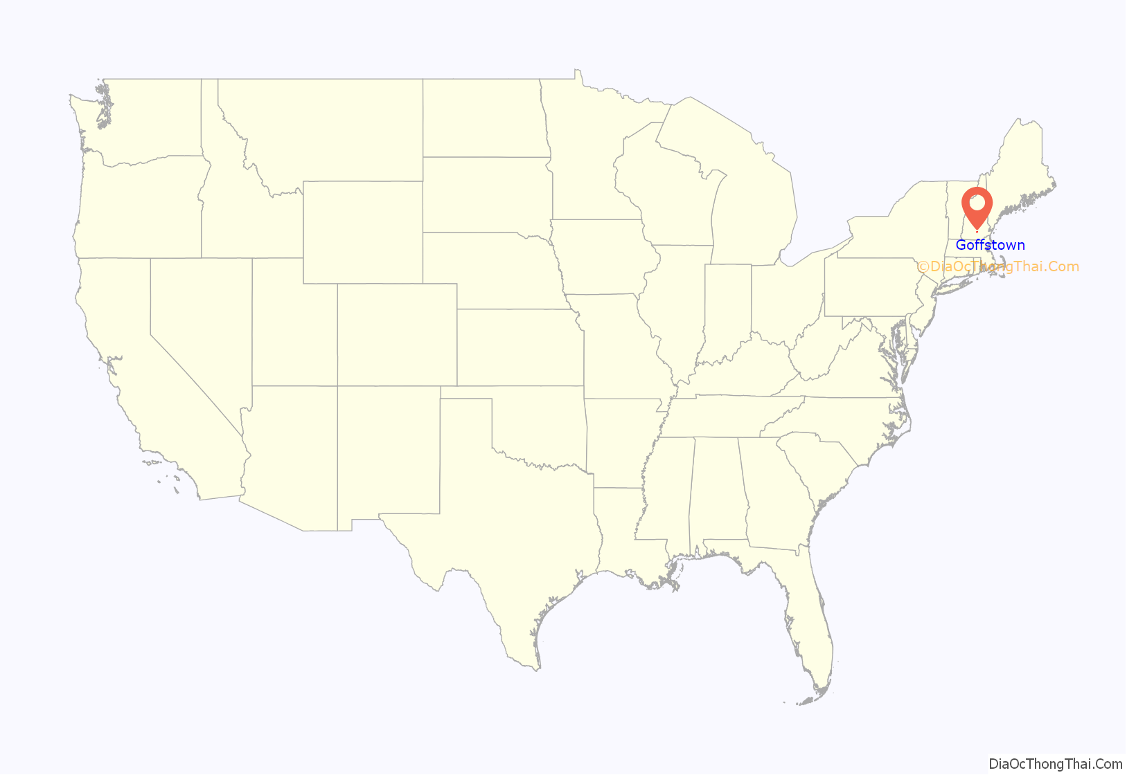
Goffstown location map. Where is Goffstown CDP?
Goffstown Road Map
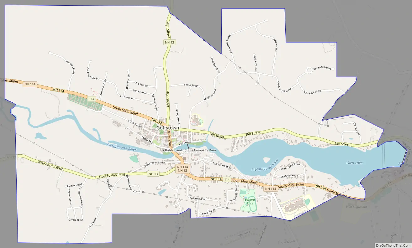
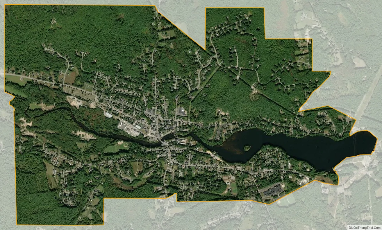
Goffstown city Satellite Map
Geography
The CDP is in the center of the western part of the town of Goffstown, on both sides of the Piscataquog River. The CDP extends north beyond Parsons Road, 3rd Avenue, Whipple Lane, Smith Road, Hemlock Drive, Heather Hill Road, and Winter Hill Road, and extends east past Paige Hill Road to include all of Upton Lane and all of Glen Lake on the Piscataquog. To the south, the CDP extends beyond Park Lane, Goffstown High School, Ashlar Drive, Westwood Drive, and Janice Drive, and to the west the CDP extends beyond Cushing Road and Parsons Road.
New Hampshire Route 114 passes through the center of the community, leading southeast 7 miles (11 km) to Route 101 in Bedford and northwest 18 miles (29 km) to Henniker. New Hampshire Route 13 also passes through the center, joining Route 114 to cross the Piscataquog, but leading north and east 16 miles (26 km) to Concord and southwest 7 miles (11 km) to New Boston. Downtown Manchester is 8 miles (13 km) to the east via Elm Street and Goffstown Back Road.
According to the U.S. Census Bureau, the Goffstown CDP has a total area of 3.4 square miles (8.8 km), of which 3.2 square miles (8.2 km) are land and 0.2 square miles (0.6 km), or 6.95%, are water.
See also
Map of New Hampshire State and its subdivision: Map of other states:- Alabama
- Alaska
- Arizona
- Arkansas
- California
- Colorado
- Connecticut
- Delaware
- District of Columbia
- Florida
- Georgia
- Hawaii
- Idaho
- Illinois
- Indiana
- Iowa
- Kansas
- Kentucky
- Louisiana
- Maine
- Maryland
- Massachusetts
- Michigan
- Minnesota
- Mississippi
- Missouri
- Montana
- Nebraska
- Nevada
- New Hampshire
- New Jersey
- New Mexico
- New York
- North Carolina
- North Dakota
- Ohio
- Oklahoma
- Oregon
- Pennsylvania
- Rhode Island
- South Carolina
- South Dakota
- Tennessee
- Texas
- Utah
- Vermont
- Virginia
- Washington
- West Virginia
- Wisconsin
- Wyoming