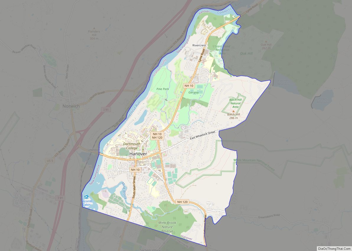
Hanover is a census-designated place (CDP) and the main village in the town of Hanover in Grafton County, New Hampshire, United States. The population of the CDP was 9,078 at the 2020 census, out of 11,870 in the entire town. The CDP includes the campus of Dartmouth College.
| Name: | Hanover CDP |
|---|---|
| LSAD Code: | 57 |
| LSAD Description: | CDP (suffix) |
| State: | New Hampshire |
| County: | Grafton County |
| Elevation: | 531 ft (162 m) |
| Total Area: | 4.91 sq mi (12.71 km²) |
| Land Area: | 4.52 sq mi (11.71 km²) |
| Water Area: | 0.38 sq mi (0.99 km²) |
| Total Population: | 9,078 |
| Population Density: | 2,007.52/sq mi (775.11/km²) |
| ZIP code: | 03755 |
| Area code: | 603 |
| FIPS code: | 3333780 |
| GNISfeature ID: | 2378069 |
Online Interactive Map
Click on ![]() to view map in "full screen" mode.
to view map in "full screen" mode.
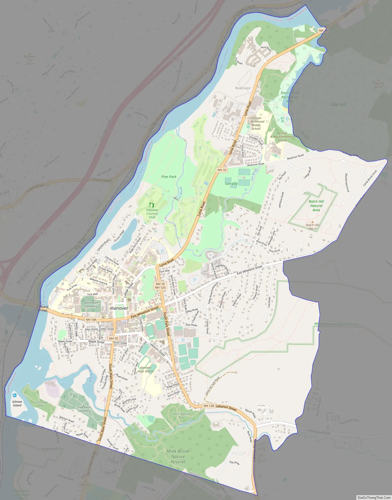
Hanover location map. Where is Hanover CDP?


Hanover Road Map
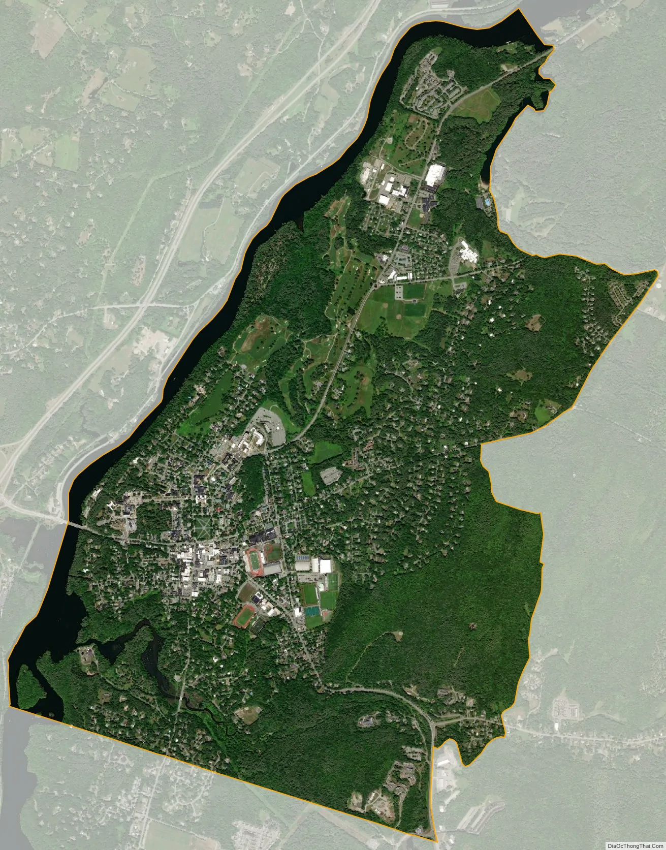
Hanover city Satellite Map
Geography
The CDP is in the southwestern corner of the town of Hanover, bordered to the south by the city of Lebanon and to the west by the Connecticut River, which forms the New Hampshire–Vermont boundary. To the north the CDP extends upriver as far as the outlet of Storrs Pond. The eastern border of the CDP follows the outlet brook upstream to Storrs Pond, then continues up Camp Brook and Reservoir Road to Grasse Road at the outlet of the Lower Hanover Reservoir. The eastern border continues south on Grasse Road, then west on Wheelock Street to a line east of Low Road. The CDP border runs over Velvet Rocks and down an unnamed brook to Mink Brook, then west to New Hampshire Route 120, which it follows south to the Lebanon city line.
New Hampshire Route 10 passes through the center of Hanover, leading north 10 miles (16 km) to Lyme and south 4 miles (6 km) to West Lebanon. Route 10A (West Wheelock Street) leaves Route 10 at the town center and leads west across Ledyard Bridge 1 mile (1.6 km) to Interstate 91 in Norwich, Vermont. New Hampshire Route 120 leads southeast from Hanover 5 miles (8 km) to Interstate 89 and 6 miles (10 km) to the center of Lebanon.
According to the U.S. Census Bureau, the Hanover CDP has a total area of 4.9 square miles (12.7 km), of which 4.5 square miles (11.7 km) are land and 0.4 square miles (1.0 km), or 7.83%, are water.
See also
Map of New Hampshire State and its subdivision: Map of other states:- Alabama
- Alaska
- Arizona
- Arkansas
- California
- Colorado
- Connecticut
- Delaware
- District of Columbia
- Florida
- Georgia
- Hawaii
- Idaho
- Illinois
- Indiana
- Iowa
- Kansas
- Kentucky
- Louisiana
- Maine
- Maryland
- Massachusetts
- Michigan
- Minnesota
- Mississippi
- Missouri
- Montana
- Nebraska
- Nevada
- New Hampshire
- New Jersey
- New Mexico
- New York
- North Carolina
- North Dakota
- Ohio
- Oklahoma
- Oregon
- Pennsylvania
- Rhode Island
- South Carolina
- South Dakota
- Tennessee
- Texas
- Utah
- Vermont
- Virginia
- Washington
- West Virginia
- Wisconsin
- Wyoming