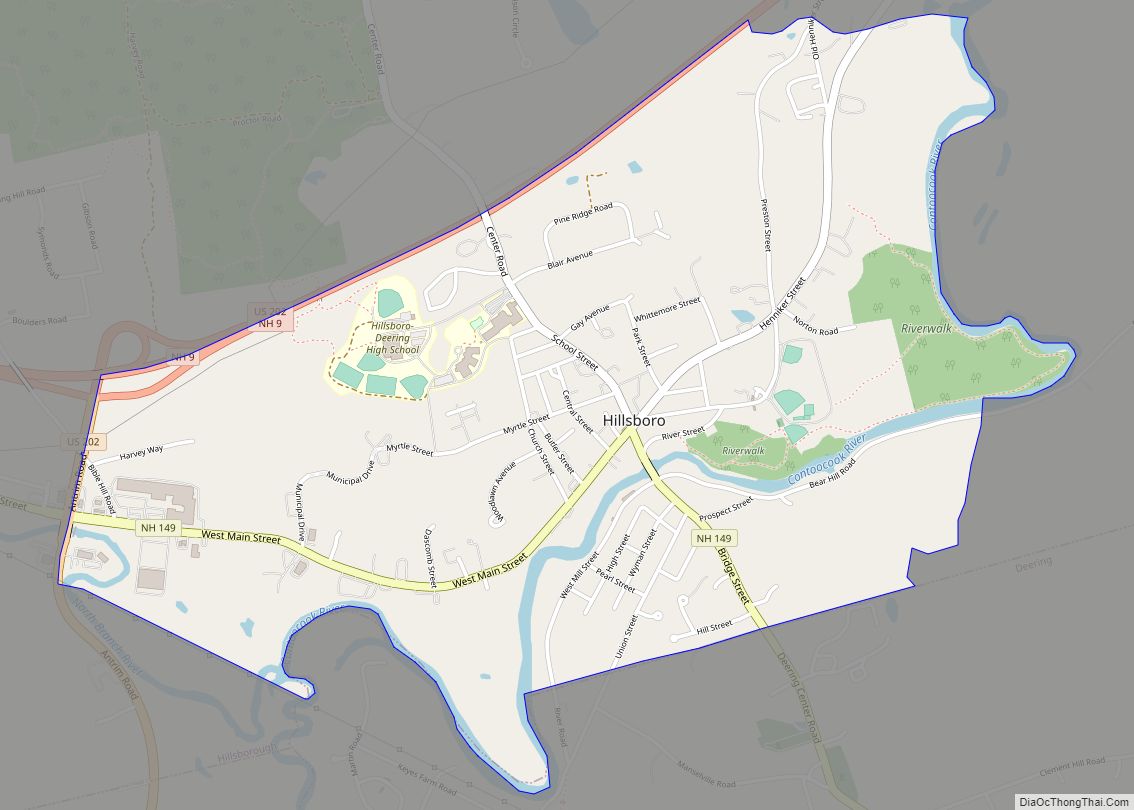
Hillsborough (frequently spelled Hillsboro) is a census-designated place (CDP) and the main village in the town of Hillsborough in Hillsborough County, New Hampshire, United States. The population of the CDP was 2,156 at the 2020 census, out of 5,939 in the entire town.
| Name: | Hillsborough CDP |
|---|---|
| LSAD Code: | 57 |
| LSAD Description: | CDP (suffix) |
| State: | New Hampshire |
| County: | Hillsborough County |
| Elevation: | 640 ft (200 m) |
| Total Area: | 1.95 sq mi (5.04 km²) |
| Land Area: | 1.95 sq mi (5.04 km²) |
| Water Area: | 0.00 sq mi (0.00 km²) |
| Total Population: | 2,156 |
| Population Density: | 1,107.91/sq mi (427.75/km²) |
| ZIP code: | 03244 |
| Area code: | 603 |
| FIPS code: | 3336020 |
| GNISfeature ID: | 2378071 |
Online Interactive Map
Click on ![]() to view map in "full screen" mode.
to view map in "full screen" mode.
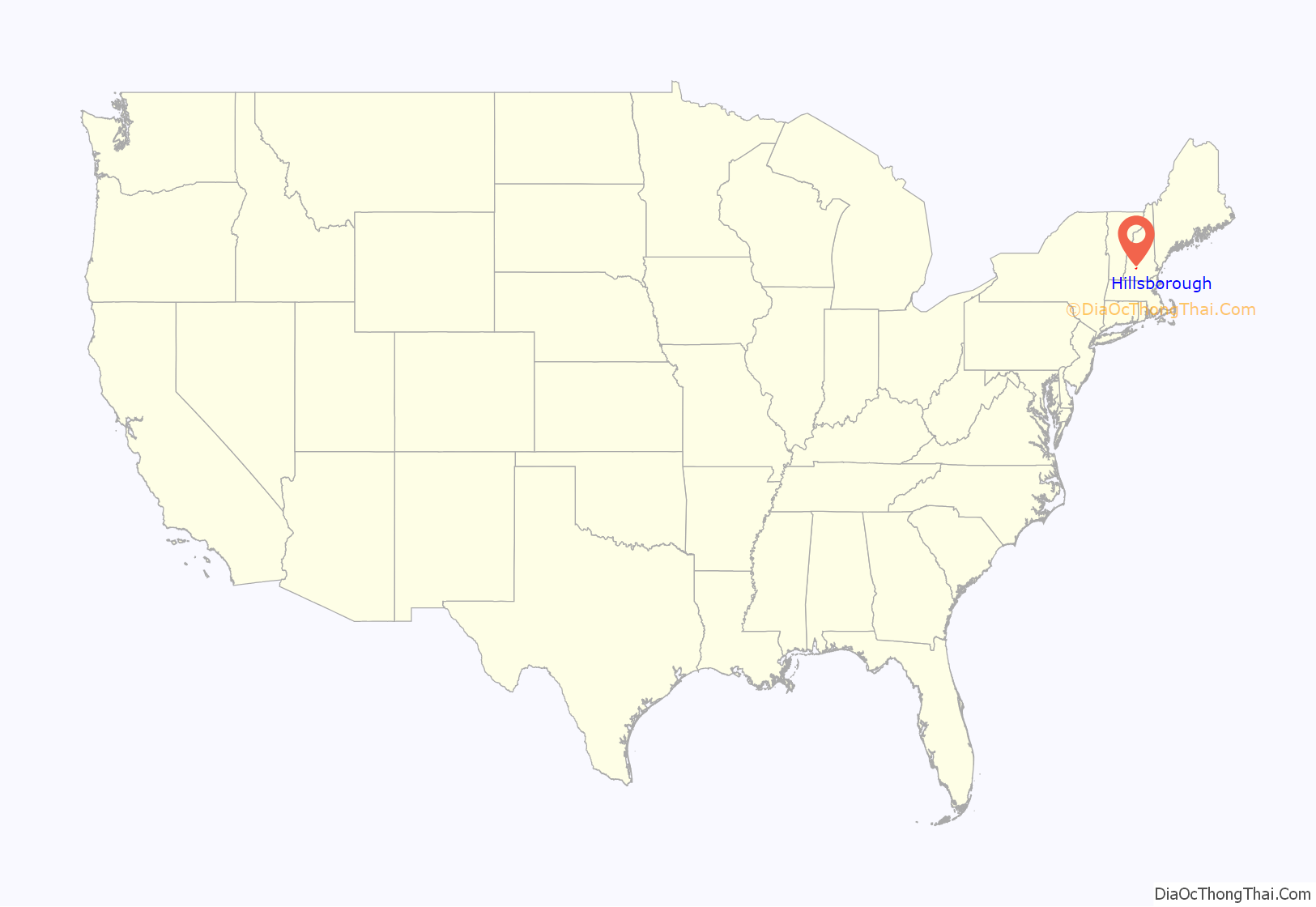
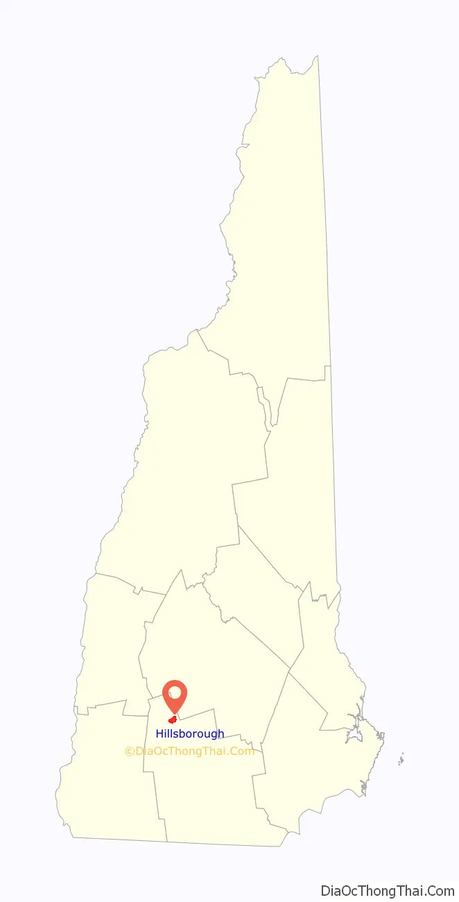
Hillsborough location map. Where is Hillsborough CDP?
Hillsborough Road Map
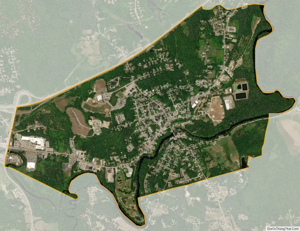
Hillsborough city Satellite Map
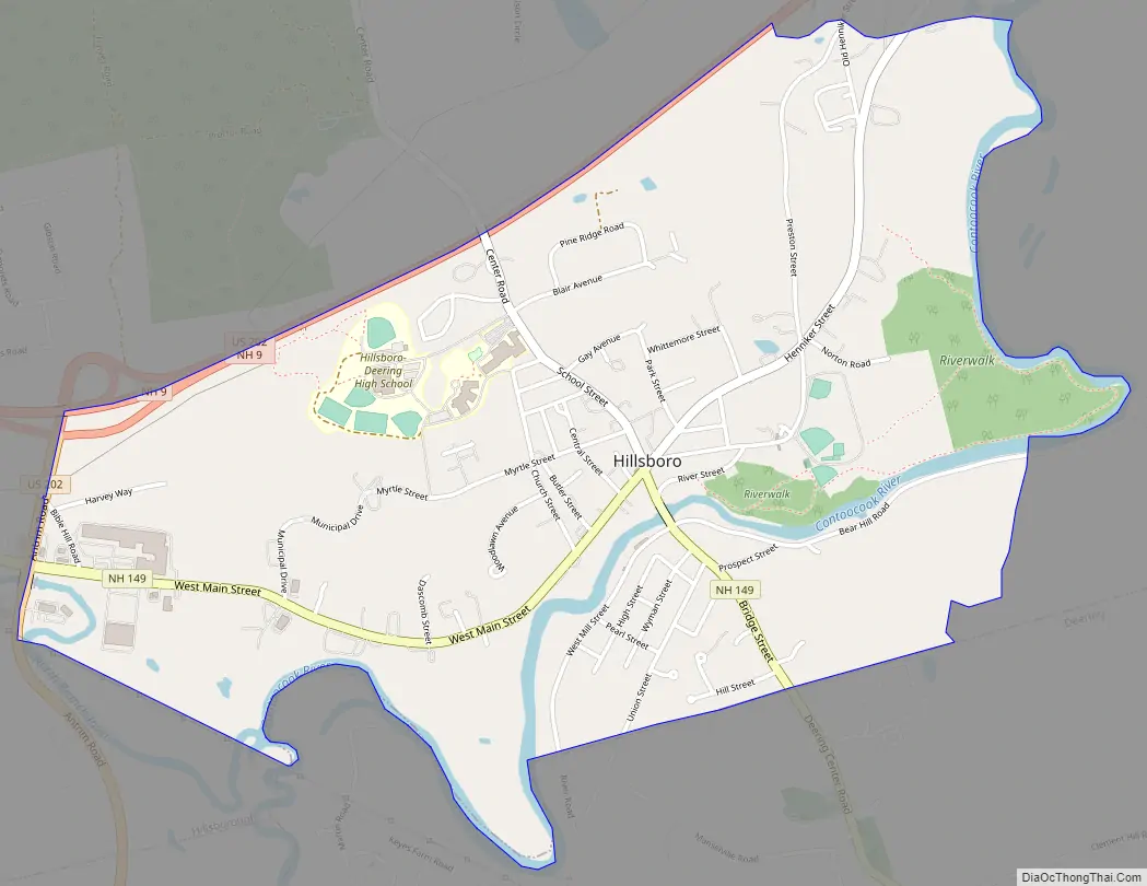
Geography
The CDP is in the southeastern part of the town of Hillsborough, along the Contoocook River. The southern border of the CDP follows the town line with Deering. Parts of the eastern and southern borders follow the Contoocook River. The northern border is the Route 202/9 bypass, and the western border follows Route 202 and a power line in the valley of the North Branch of the Contoocook.
Routes 202 and 9 lead east from Hillsborough 22 miles (35 km) to Concord, the state capital. US 202 leads south 20 miles (32 km) to Peterborough, while NH 9 leads southwest 28 miles (45 km) to Keene. New Hampshire Route 149 passes through the center of the CDP, leading southeast 12 miles (19 km) to Weare.
According to the U.S. Census Bureau, the Hillsborough CDP has a total area of 1.9 square miles (5.0 km), all of it recorded as land.
See also
Map of New Hampshire State and its subdivision: Map of other states:- Alabama
- Alaska
- Arizona
- Arkansas
- California
- Colorado
- Connecticut
- Delaware
- District of Columbia
- Florida
- Georgia
- Hawaii
- Idaho
- Illinois
- Indiana
- Iowa
- Kansas
- Kentucky
- Louisiana
- Maine
- Maryland
- Massachusetts
- Michigan
- Minnesota
- Mississippi
- Missouri
- Montana
- Nebraska
- Nevada
- New Hampshire
- New Jersey
- New Mexico
- New York
- North Carolina
- North Dakota
- Ohio
- Oklahoma
- Oregon
- Pennsylvania
- Rhode Island
- South Carolina
- South Dakota
- Tennessee
- Texas
- Utah
- Vermont
- Virginia
- Washington
- West Virginia
- Wisconsin
- Wyoming