Hudson is a census-designated place (CDP) and the urban center of the town of Hudson in Hillsborough County, New Hampshire, United States. The population of the CDP was 7,534 at the 2020 census, out of 25,394 in the entire town.
| Name: | Hudson CDP |
|---|---|
| LSAD Code: | 57 |
| LSAD Description: | CDP (suffix) |
| State: | New Hampshire |
| County: | Hillsborough County |
| Elevation: | 150 ft (50 m) |
| Total Area: | 3.26 sq mi (8.43 km²) |
| Land Area: | 3.08 sq mi (7.96 km²) |
| Water Area: | 0.18 sq mi (0.47 km²) |
| Total Population: | 7,534 |
| Population Density: | 2,450.08/sq mi (945.99/km²) |
| ZIP code: | 03051 |
| Area code: | 603 |
| FIPS code: | 3337860 |
| GNISfeature ID: | 2378074 |
Online Interactive Map
Click on ![]() to view map in "full screen" mode.
to view map in "full screen" mode.
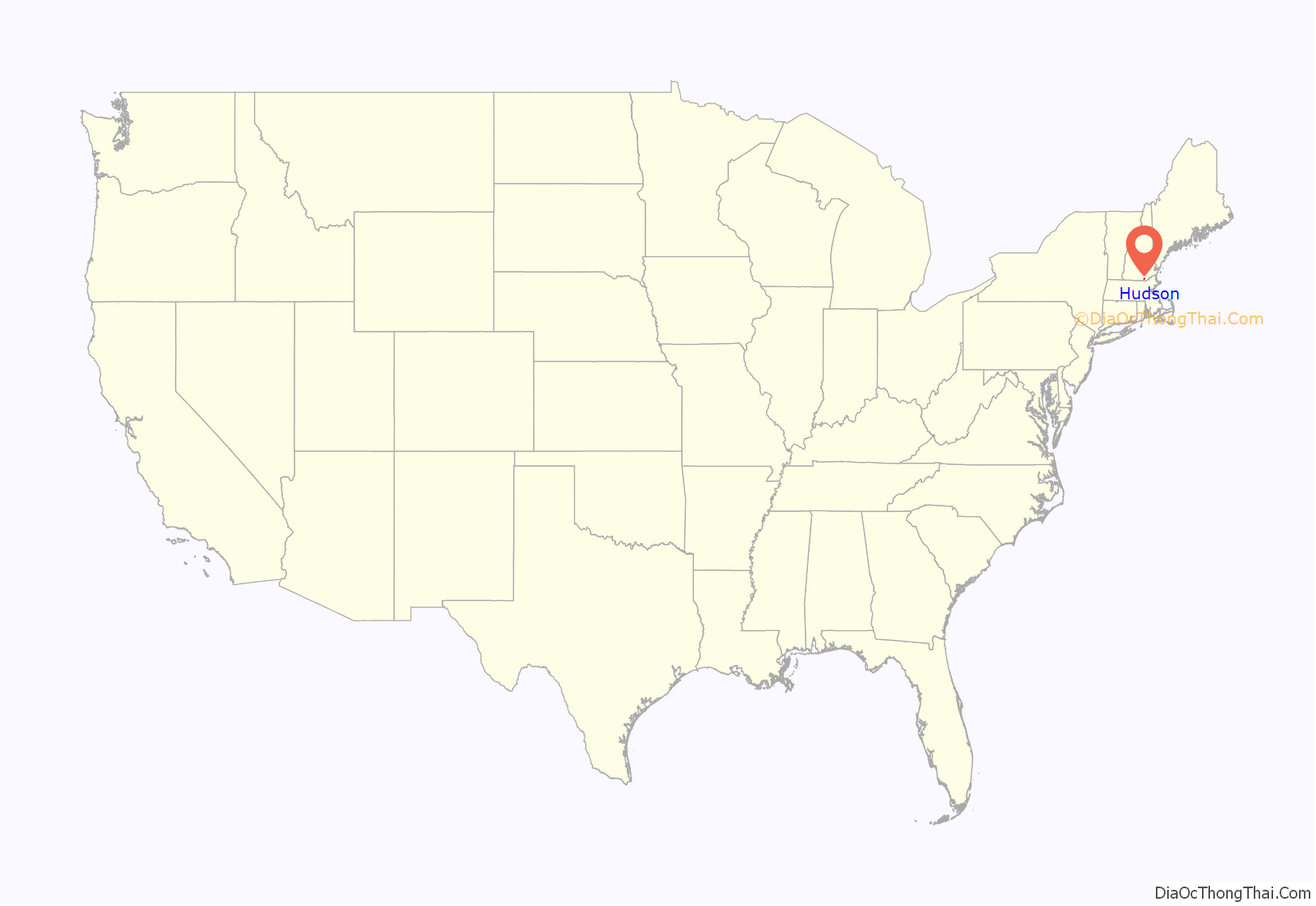
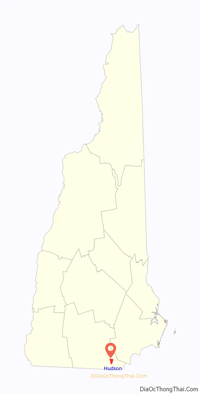
Hudson location map. Where is Hudson CDP?
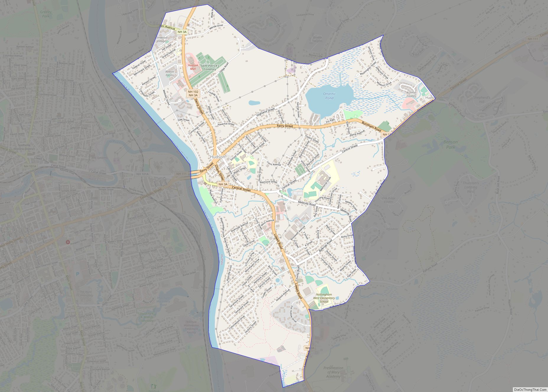
Hudson Road Map
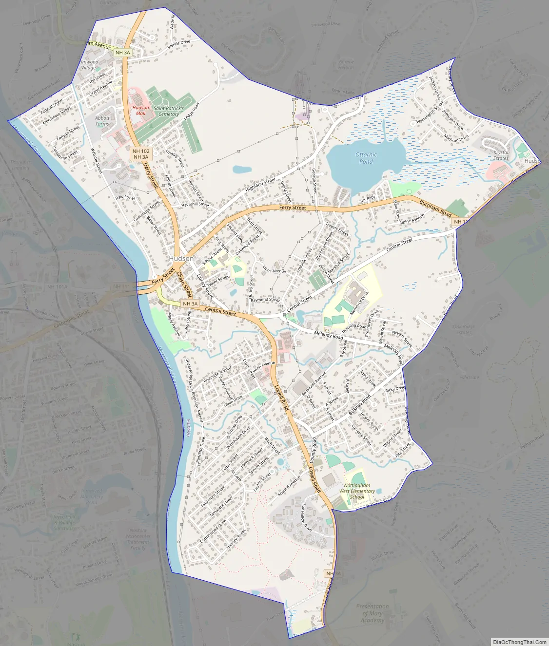
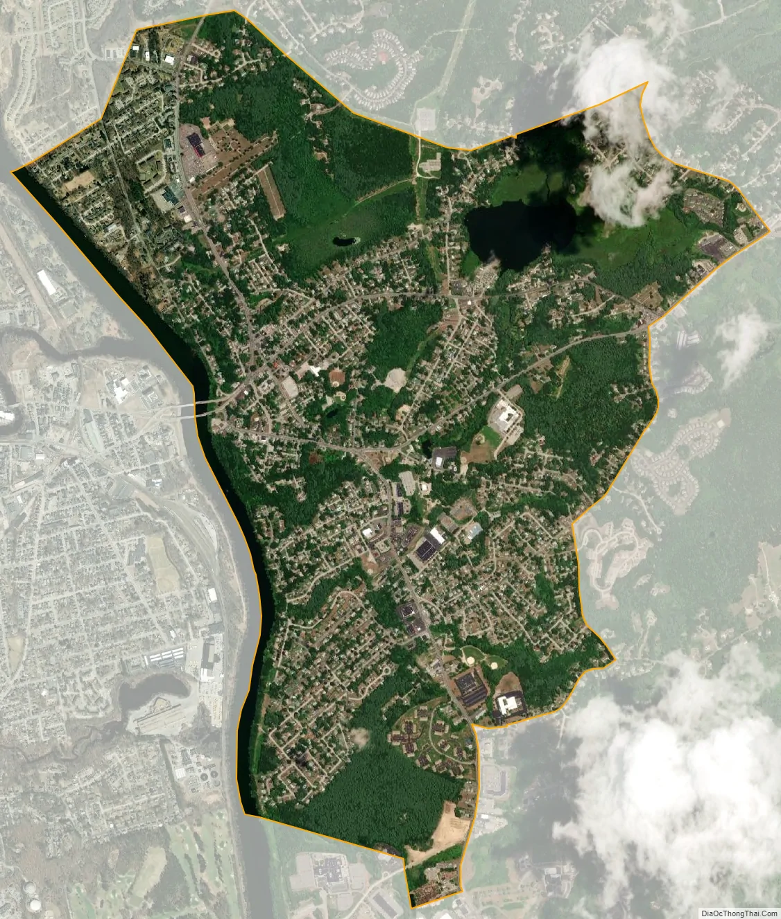
Hudson city Satellite Map
Geography
The CDP occupies the center part of the west side of the town of Hudson, along the east side of the Merrimack River, which also forms the Nashua city line. The CDP includes all of Hudson village, as well as a small portion of Hudson Center. The CDP extends north to a line running between Federal Street and Garrison Farm Road, then runs east so that it passes north of Elmwood Drive and Megan Drive. The northern border then runs south of Wagner Way, Joel Path, and Bonnie Lane, and north of Monroe Drive and Jackson Drive, until it reaches Greeley Street, the eastern extent of the CDP. The border runs south on Greeley Street, then west on New Hampshire Route 111, then south on Belknap Road and Melendy Road. The border turns west to follow Pelham Road, then turns south on New Hampshire Route 3A (Lowell Road) to Third Brook, which it follows west to the Merrimack.
Route 111 is the main east-west road through the CDP, leading west across the Merrimack River into Nashua and east 9 miles (14 km) to Interstate 93 in Windham. Route 3A runs north from Hudson 17 miles (27 km) to Manchester and southeast 14 miles (23 km) to Lowell, Massachusetts. New Hampshire Route 102 begins in Hudson and leads northeast 10 miles (16 km) to Derry.
According to the U.S. Census Bureau, the Hudson CDP has a total area of 3.2 square miles (8.4 km), of which 3.1 square miles (8.0 km) are land and 0.2 square miles (0.5 km), or 5.57%, are water. Besides the Merrimack River, the CDP contains Ottarnic Pond in the east.
See also
Map of New Hampshire State and its subdivision: Map of other states:- Alabama
- Alaska
- Arizona
- Arkansas
- California
- Colorado
- Connecticut
- Delaware
- District of Columbia
- Florida
- Georgia
- Hawaii
- Idaho
- Illinois
- Indiana
- Iowa
- Kansas
- Kentucky
- Louisiana
- Maine
- Maryland
- Massachusetts
- Michigan
- Minnesota
- Mississippi
- Missouri
- Montana
- Nebraska
- Nevada
- New Hampshire
- New Jersey
- New Mexico
- New York
- North Carolina
- North Dakota
- Ohio
- Oklahoma
- Oregon
- Pennsylvania
- Rhode Island
- South Carolina
- South Dakota
- Tennessee
- Texas
- Utah
- Vermont
- Virginia
- Washington
- West Virginia
- Wisconsin
- Wyoming