Londonderry is a census-designated place (CDP) within the town of Londonderry in Rockingham County, New Hampshire, United States. The population of the CDP was 11,645 at the 2020 census, out of 25,826 in the entire town.
| Name: | Londonderry CDP |
|---|---|
| LSAD Code: | 57 |
| LSAD Description: | CDP (suffix) |
| State: | New Hampshire |
| County: | Rockingham County |
| Elevation: | 250 ft (80 m) |
| Total Area: | 12.24 sq mi (31.71 km²) |
| Land Area: | 12.22 sq mi (31.65 km²) |
| Water Area: | 0.02 sq mi (0.06 km²) |
| Total Population: | 11,645 |
| Population Density: | 953.02/sq mi (367.96/km²) |
| ZIP code: | 03038, 03053 |
| Area code: | 603 |
| FIPS code: | 3343140 |
| GNISfeature ID: | 2378079 |
Online Interactive Map
Click on ![]() to view map in "full screen" mode.
to view map in "full screen" mode.
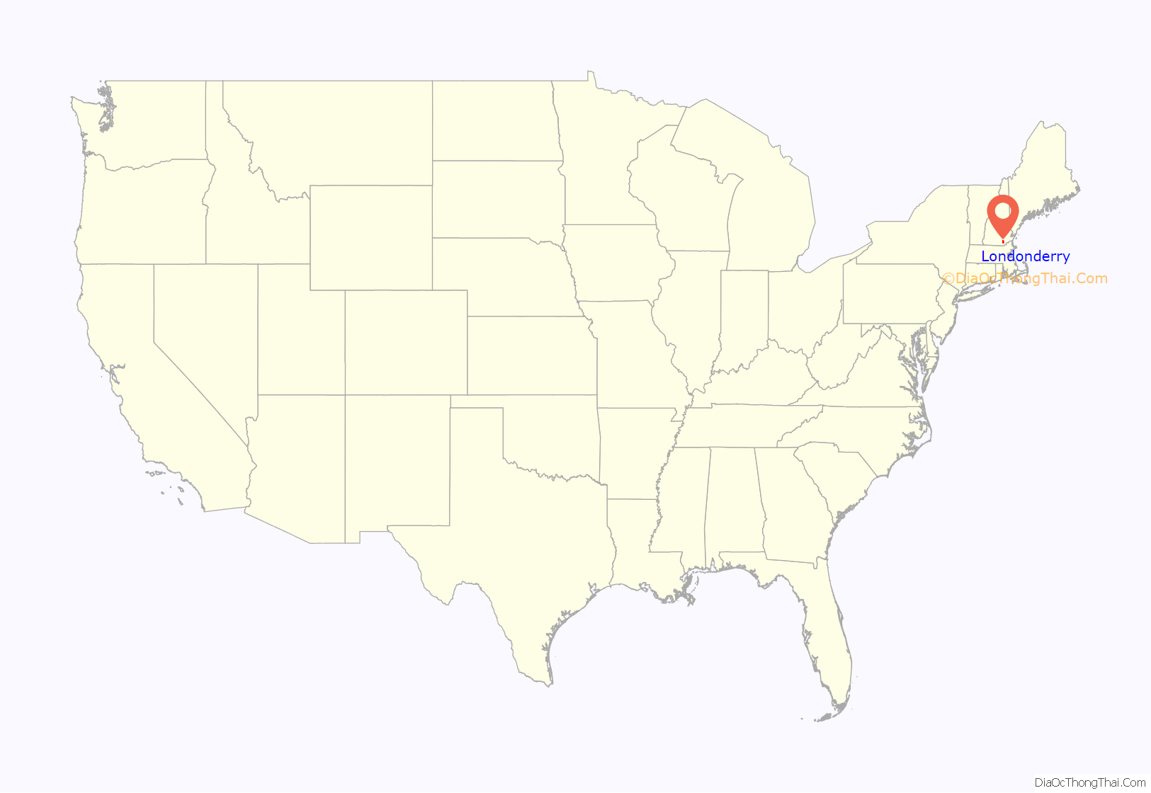
Londonderry location map. Where is Londonderry CDP?
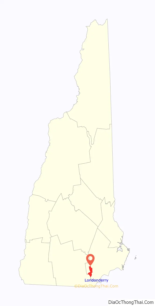
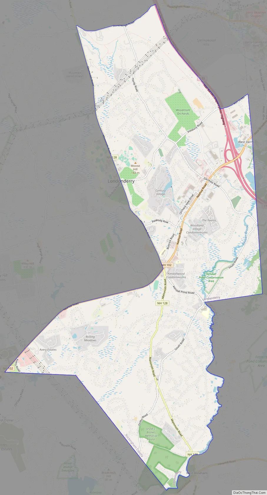
Londonderry Road Map
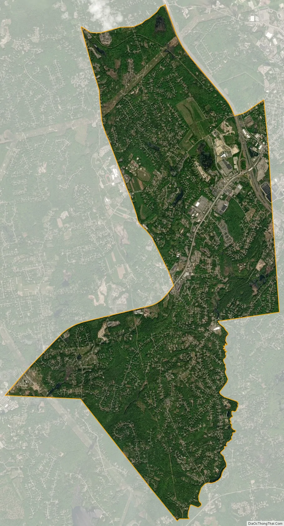
Londonderry city Satellite Map
Geography
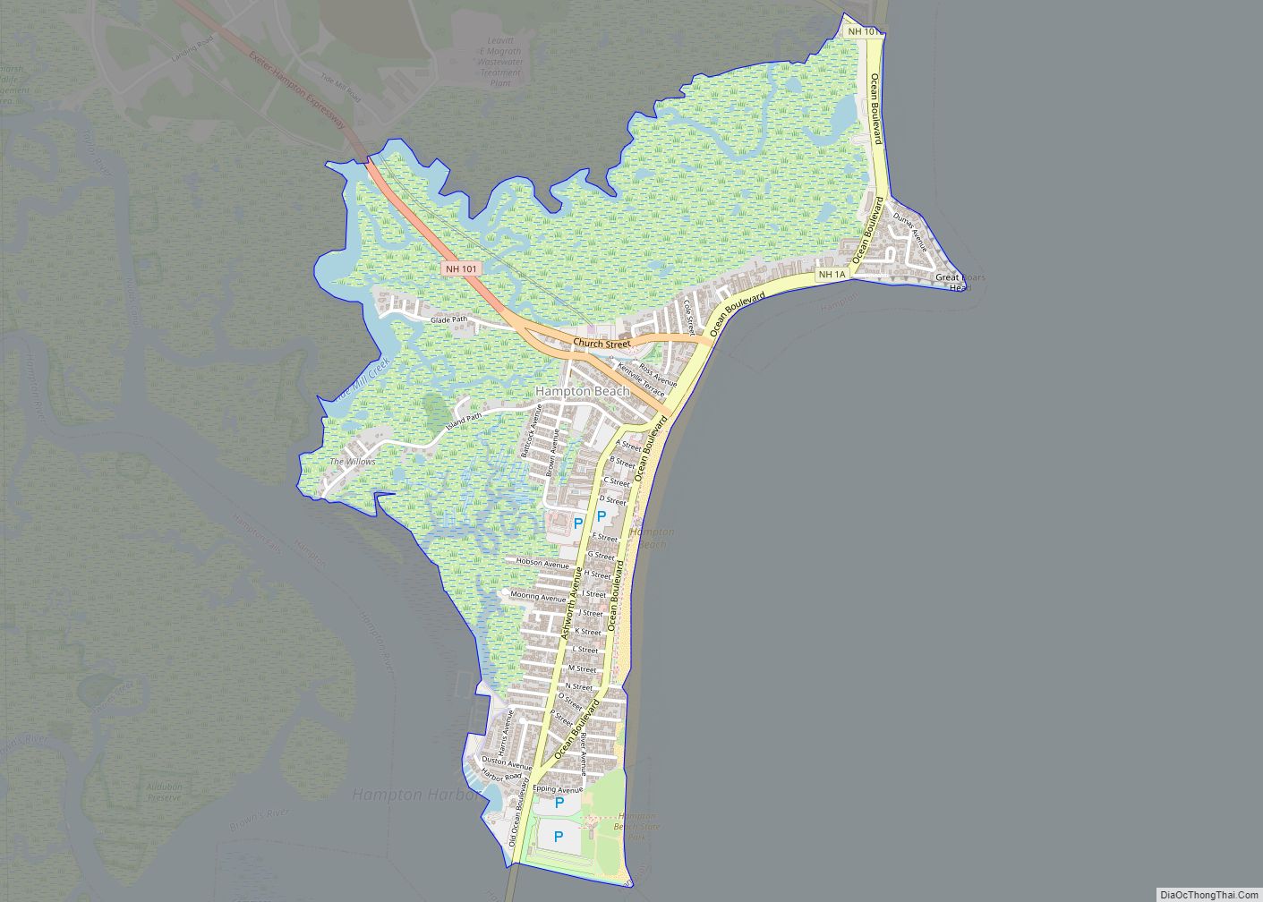
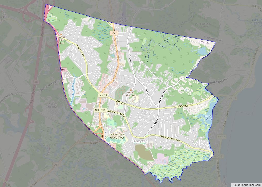
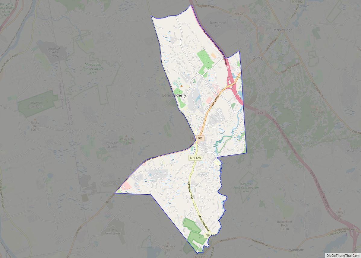
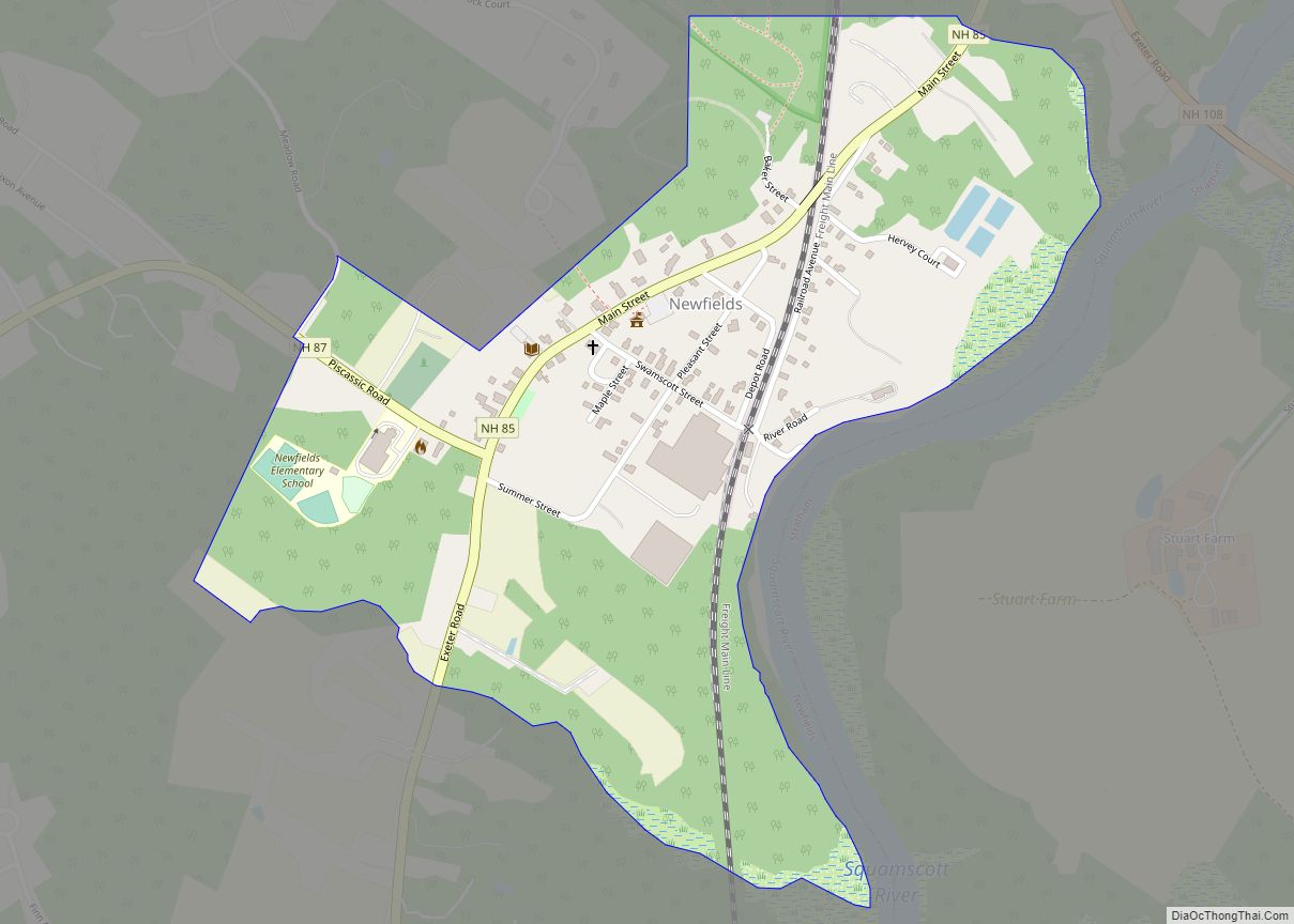
The CDP occupies the more intensively developed eastern and southern parts of the town of Londonderry, including the east half of the historic town center near the top of Moose Hill. The CDP includes the Londonderry town offices (east side of Mammoth Road) but not the Londonderry High School and Middle School complexes (west side of Mammoth Road). The CDP is bordered to the east by the town of Derry, to the southeast by the town of Windham, and to the southwest by the town of Hudson. From the Hudson town line, the CDP boundary follows New Hampshire Route 102 (Nashua Road), New Hampshire Route 128 (Mammoth Road), Stonehenge Road, Interstate 93, and Ash Street to the Derry town line.
New Hampshire Route 102 crosses the CDP, leading northeast 3 miles (5 km) to the center of Derry and southwest 7 miles (11 km) to Hudson. Route 128 leads north 5 miles (8 km) to New Hampshire Route 28 in North Londonderry and south 16 miles (26 km) to Lowell, Massachusetts. Manchester is 12 miles (19 km) to the north via Routes 128 and 28.
According to the U.S. Census Bureau, the Londonderry CDP has a total area of 12.2 square miles (31.7 km), of which 0.023 square miles (0.06 km), or 0.19%, are water. Most of the CDP drains southeast to Beaver Brook, which forms the border with the town of Windham and flows south to the Merrimack River in Lowell, Massachusetts. The southwest corner of the CDP drains west via Chase Brook to the Merrimack in Litchfield.
See also
Map of New Hampshire State and its subdivision: Map of other states:- Alabama
- Alaska
- Arizona
- Arkansas
- California
- Colorado
- Connecticut
- Delaware
- District of Columbia
- Florida
- Georgia
- Hawaii
- Idaho
- Illinois
- Indiana
- Iowa
- Kansas
- Kentucky
- Louisiana
- Maine
- Maryland
- Massachusetts
- Michigan
- Minnesota
- Mississippi
- Missouri
- Montana
- Nebraska
- Nevada
- New Hampshire
- New Jersey
- New Mexico
- New York
- North Carolina
- North Dakota
- Ohio
- Oklahoma
- Oregon
- Pennsylvania
- Rhode Island
- South Carolina
- South Dakota
- Tennessee
- Texas
- Utah
- Vermont
- Virginia
- Washington
- West Virginia
- Wisconsin
- Wyoming