Milford is a census-designated place (CDP) and the main village in the town of Milford, Hillsborough County, New Hampshire, United States. The population of the CDP was 9,212 at the 2020 census, out of 16,131 in the entire town.
| Name: | Milford CDP |
|---|---|
| LSAD Code: | 57 |
| LSAD Description: | CDP (suffix) |
| State: | New Hampshire |
| County: | Hillsborough County |
| Elevation: | 263 ft (80 m) |
| Total Area: | 5.71 sq mi (14.79 km²) |
| Land Area: | 5.68 sq mi (14.72 km²) |
| Water Area: | 0.03 sq mi (0.07 km²) |
| Total Population: | 9,212 |
| Population Density: | 1,621.26/sq mi (625.99/km²) |
| ZIP code: | 03055 |
| Area code: | 603 |
| FIPS code: | 3347940 |
| GNISfeature ID: | 2378082 |
Online Interactive Map
Click on ![]() to view map in "full screen" mode.
to view map in "full screen" mode.
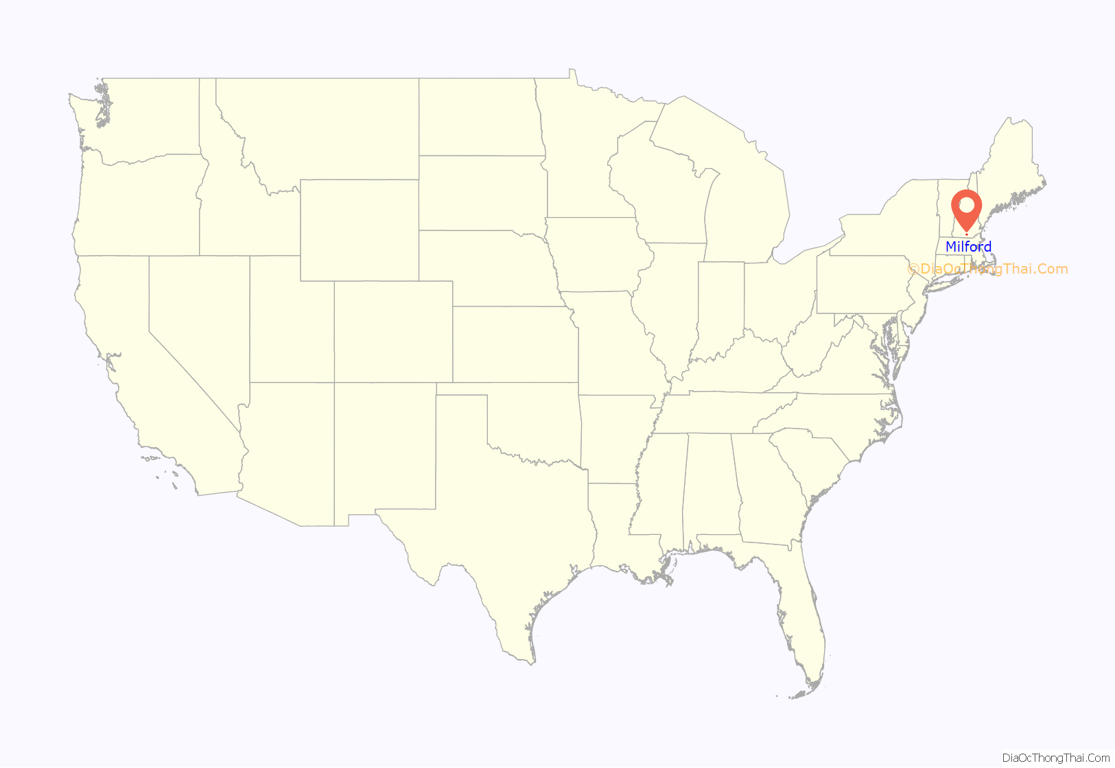
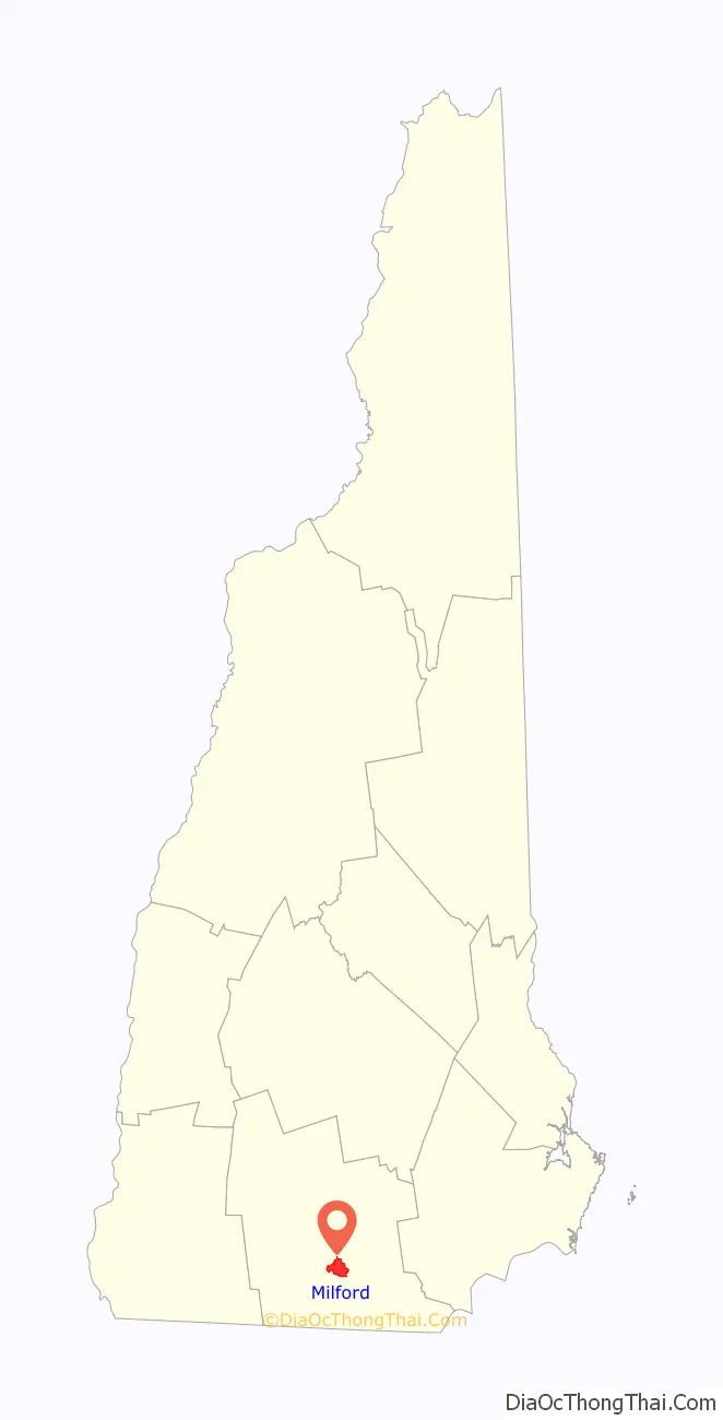
Milford location map. Where is Milford CDP?
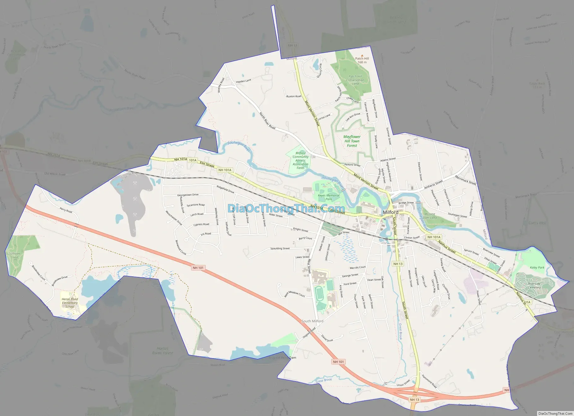
Milford Road Map
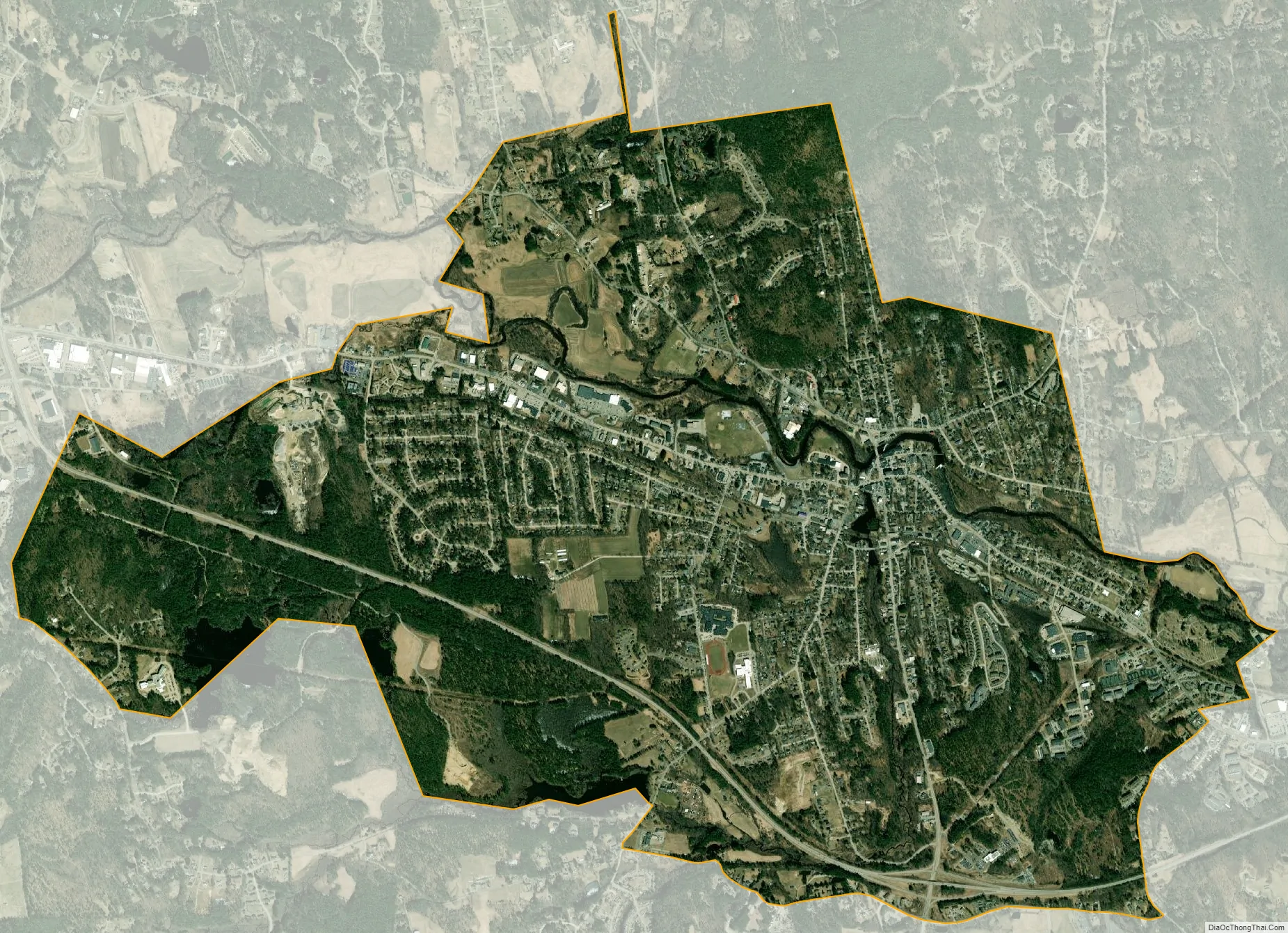
Milford city Satellite Map
Geography
The CDP occupies the center to northeastern part of the town of Milford, along both sides of the Souhegan River. It is bordered to the northeast by the town of Amherst, to the southeast by Ponemah Hill Road, and to the south by Emerson Road, Armory Road, and Osgood Pond. To the west the CDP extends to Whitten Road so as to include Brookview Drive and Brookview Court, and then follows Tucker Brook downstream to the Souhegan River. North of the river, the CDP border passes north of Riverlea Road and Jennison Road to return to the Amherst town line.
New Hampshire Route 101, a limited-access bypass, runs through the south side of the CDP, leading northeast 19 miles (31 km) to Manchester and west 17 miles (27 km) to Peterborough. New Hampshire Route 13 passes through the center of the CDP (around the Milford Oval), leading north 17 miles (27 km) to Goffstown and south 24 miles (39 km) to Leominster, Massachusetts. New Hampshire Route 101A leads southeast from Milford 11 miles (18 km) to Nashua.
According to the U.S. Census Bureau, the Milford CDP has a total area of 5.7 square miles (14.8 km), of which 0.03 square miles (0.07 km), or 0.47%, are water.
See also
Map of New Hampshire State and its subdivision: Map of other states:- Alabama
- Alaska
- Arizona
- Arkansas
- California
- Colorado
- Connecticut
- Delaware
- District of Columbia
- Florida
- Georgia
- Hawaii
- Idaho
- Illinois
- Indiana
- Iowa
- Kansas
- Kentucky
- Louisiana
- Maine
- Maryland
- Massachusetts
- Michigan
- Minnesota
- Mississippi
- Missouri
- Montana
- Nebraska
- Nevada
- New Hampshire
- New Jersey
- New Mexico
- New York
- North Carolina
- North Dakota
- Ohio
- Oklahoma
- Oregon
- Pennsylvania
- Rhode Island
- South Carolina
- South Dakota
- Tennessee
- Texas
- Utah
- Vermont
- Virginia
- Washington
- West Virginia
- Wisconsin
- Wyoming