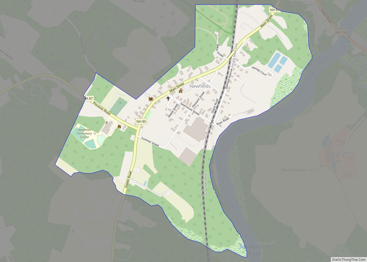
Newfields is a census-designated place (CDP) and the main village within the town of Newfields, Rockingham County, New Hampshire, United States. The population of the CDP was 378 at the 2020 census, out of 1,769 in the entire town.
| Name: | Newfields CDP |
|---|---|
| LSAD Code: | 57 |
| LSAD Description: | CDP (suffix) |
| State: | New Hampshire |
| County: | Rockingham County |
| Elevation: | 55 ft (17 m) |
| Total Area: | 0.38 sq mi (0.98 km²) |
| Land Area: | 0.38 sq mi (0.98 km²) |
| Water Area: | 0.00 sq mi (0.00 km²) |
| Total Population: | 378 |
| Population Density: | 994.74/sq mi (384.02/km²) |
| ZIP code: | 03856 |
| Area code: | 603 |
| FIPS code: | 3351300 |
| GNISfeature ID: | 2629731 |
Online Interactive Map
Click on ![]() to view map in "full screen" mode.
to view map in "full screen" mode.
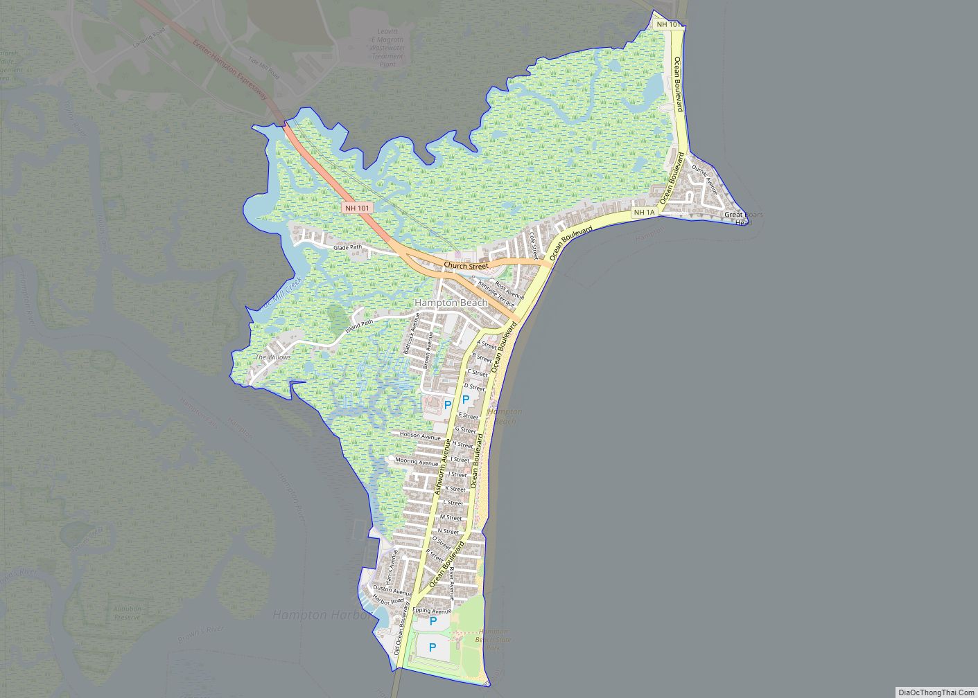
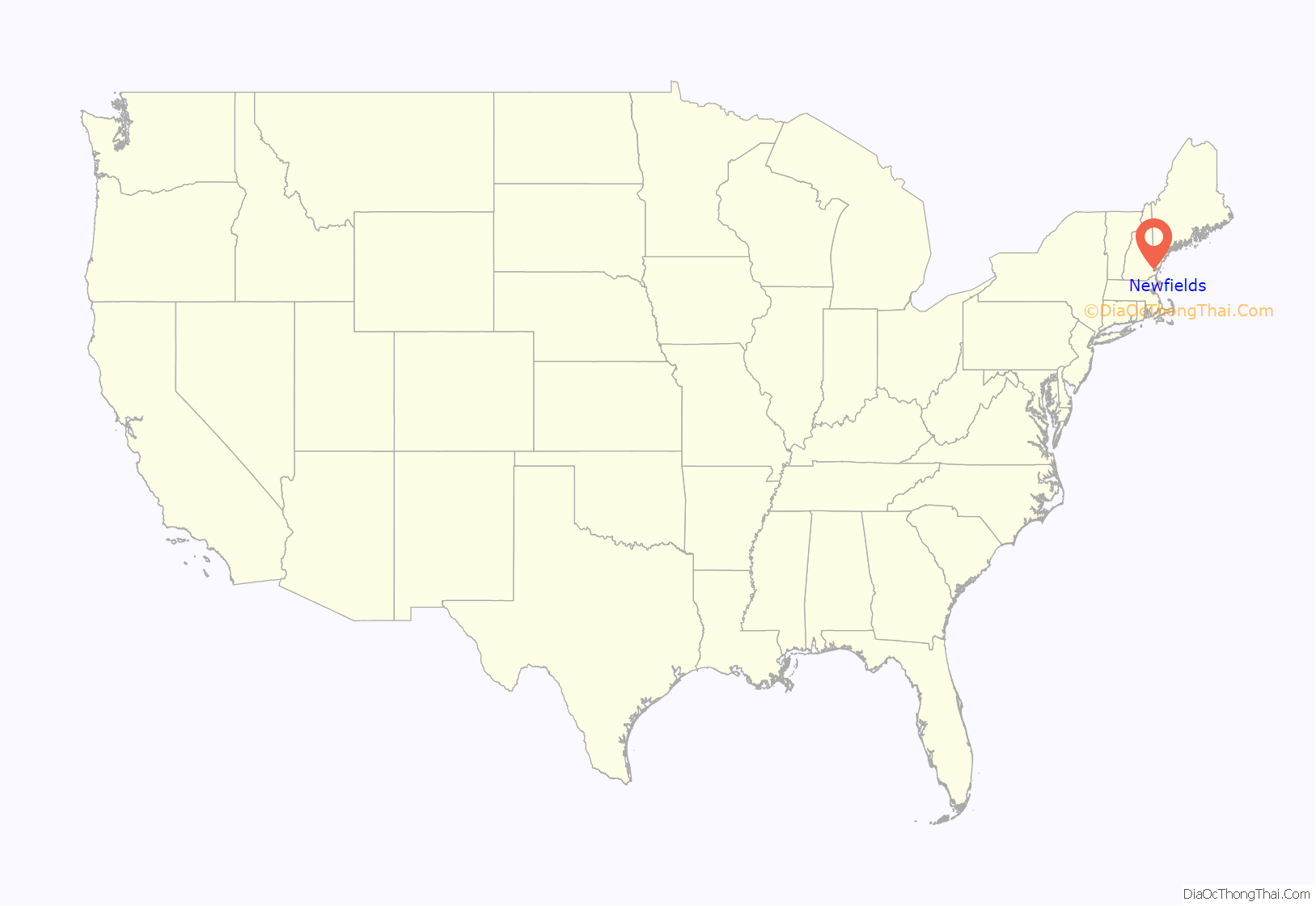
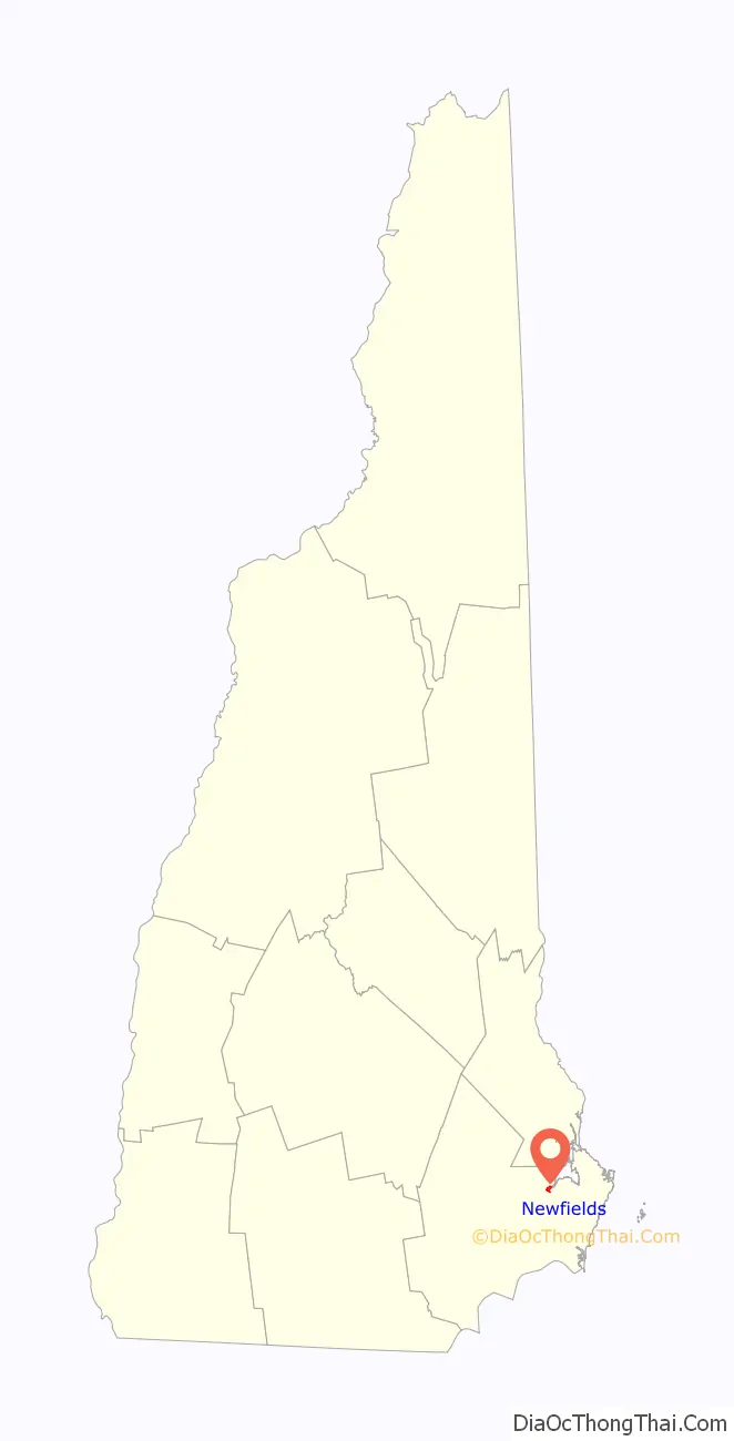
Newfields location map. Where is Newfields CDP?
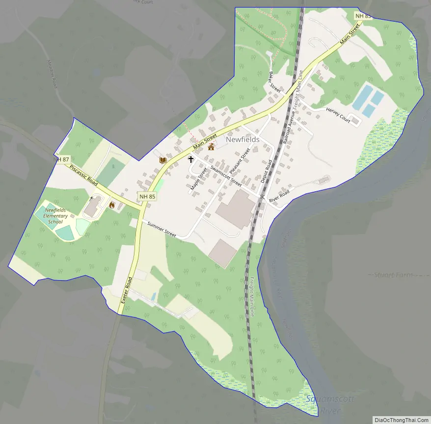
Newfields Road Map
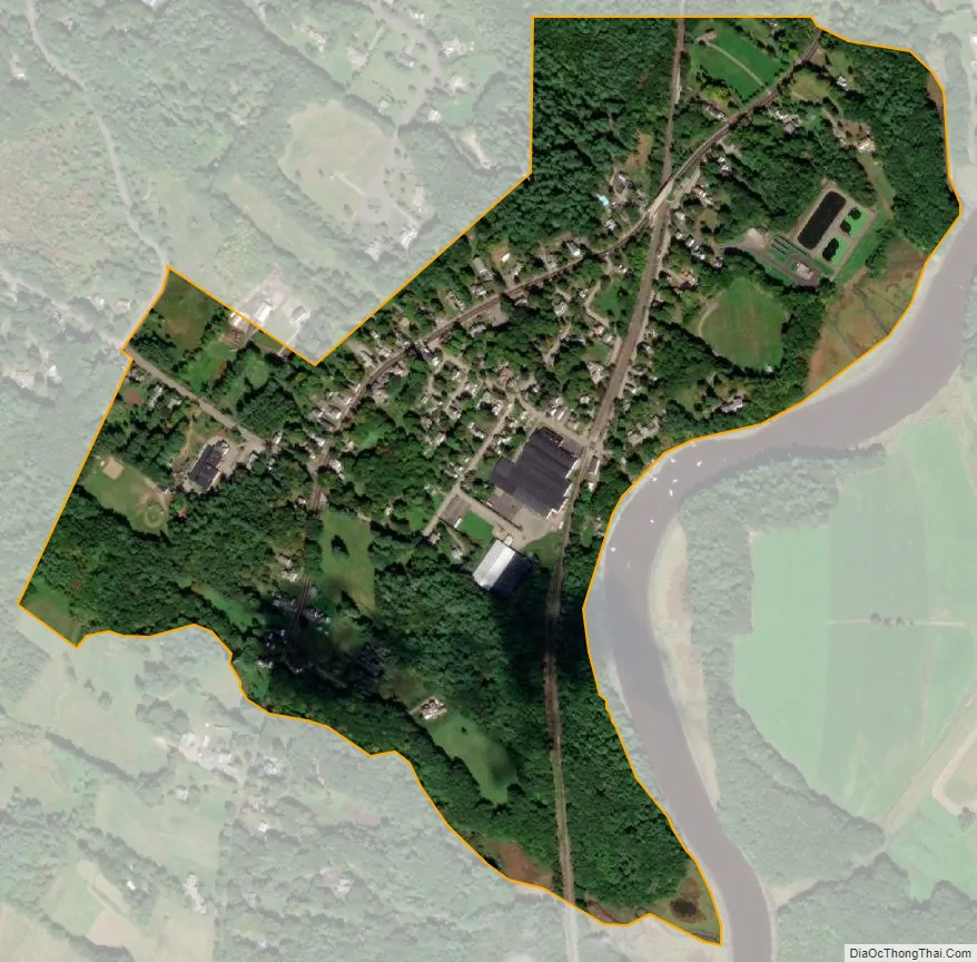
Newfields city Satellite Map
Geography
The CDP is on the eastern edge of the town of Newfields, along the west side of the Squamscott River, which forms the town line with Stratham. The CDP extends south along the river to Parting Brook and north along it to an unnamed brook west of New Hampshire Route 108. To the west the CDP reaches to the east end of Meadow Road at New Hampshire Route 87.
New Hampshire Route 85 passes through the center of the community as Main Street; it leads northeast 0.8 miles (1.3 km) to Route 108 and south 4 miles (6 km) to the center of Exeter. Durham is 8 miles (13 km) to the north via Routes 85 and 108. Route 87 (Piscassic Road) leads west from Newfields 6 miles (10 km) to Route 125 in Epping.
According to the U.S. Census Bureau, the Newfields CDP has a total area of 0.39 square miles (1.0 km), all of it recorded as land.
See also
Map of New Hampshire State and its subdivision: Map of other states:- Alabama
- Alaska
- Arizona
- Arkansas
- California
- Colorado
- Connecticut
- Delaware
- District of Columbia
- Florida
- Georgia
- Hawaii
- Idaho
- Illinois
- Indiana
- Iowa
- Kansas
- Kentucky
- Louisiana
- Maine
- Maryland
- Massachusetts
- Michigan
- Minnesota
- Mississippi
- Missouri
- Montana
- Nebraska
- Nevada
- New Hampshire
- New Jersey
- New Mexico
- New York
- North Carolina
- North Dakota
- Ohio
- Oklahoma
- Oregon
- Pennsylvania
- Rhode Island
- South Carolina
- South Dakota
- Tennessee
- Texas
- Utah
- Vermont
- Virginia
- Washington
- West Virginia
- Wisconsin
- Wyoming