Bernardsville (/ˈbɜːrnərdzvɪl/) is the northernmost borough in Somerset County, in the U.S. state of New Jersey. The borough is nestled in the heart of the Raritan Valley region. As of the 2020 United States census, the borough’s population was 7,893, an increase of 186 (+2.4%) from the 2010 census count of 7,707, which in turn reflected an increase of 362 (+4.9%) from the 7,345 counted in the 2000 census. Bernardsville is often mispronounced as “Ber-NARDS-ville” as opposed to the correct pronunciation “BER-nards-ville”.
Bernardsville was incorporated as a borough by an act of the New Jersey Legislature on March 6, 1924, from portions of Bernards Township, based on the results of a referendum held on April 29, 1924. The borough was named for Sir Francis Bernard, 1st Baronet, who served as governor of the Province of New Jersey before the Revolutionary War. In 2009, part of the borough was listed on the National Register of Historic Places as the Olcott Avenue Historic District.
In 2000, Bernardsville had the 10th-highest per capita income in the state. Based on data from the 2006–2010 American Community Survey, the borough had a per-capita income of $70,141, ranked 27th in the state. In 2019, the borough was ranked by Bloomberg News as 64th on its 2019 list of Bloomberg Richest Places, one of 18 in the state included on the list.
| Name: | Bernardsville borough |
|---|---|
| LSAD Code: | 21 |
| LSAD Description: | borough (suffix) |
| State: | New Jersey |
| County: | Somerset County |
| Incorporated: | April 29, 1924 |
| Elevation: | 682 ft (208 m) |
| Total Area: | 12.91 sq mi (33.44 km²) |
| Land Area: | 12.84 sq mi (33.24 km²) |
| Water Area: | 0.07 sq mi (0.19 km²) 0.58% |
| Total Population: | 7,893 |
| Population Density: | 614.9/sq mi (237.4/km²) |
| ZIP code: | 07924 |
| Area code: | 908 |
| FIPS code: | 3405590 |
| GNISfeature ID: | 0885159 |
| Website: | www.bernardsvilleboro.org |
Online Interactive Map
Click on ![]() to view map in "full screen" mode.
to view map in "full screen" mode.
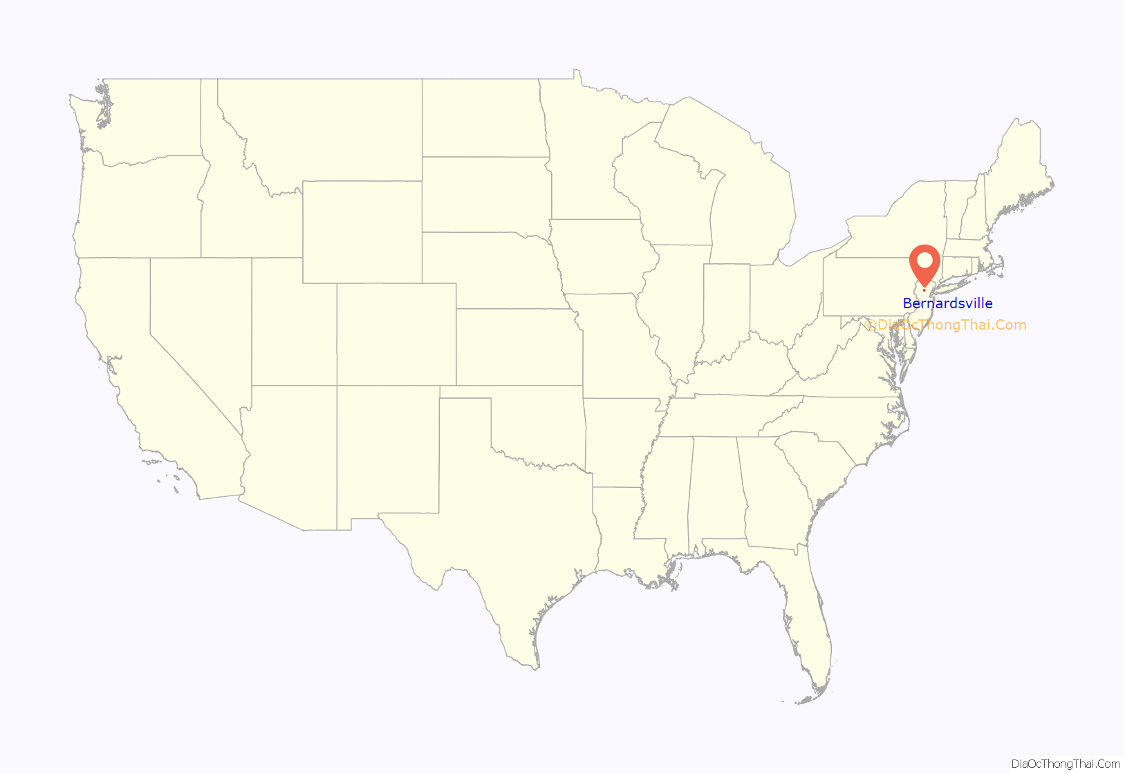
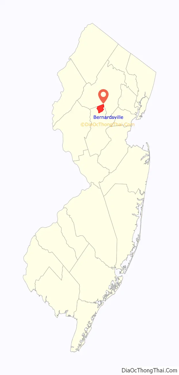
Bernardsville location map. Where is Bernardsville borough?
History
Bernardsville was originally a section of Bernards Township known as Vealtown. In 1840, Vealtown became Bernardsville, named after Sir Francis Bernard, Colonial governor of New Jersey from 1758 to 1760. Located in the northernmost part of Somerset County, just 12 miles (19 km) south of Morristown, the borough includes some of the last vestiges of the Great Eastern Forest.
During the Revolutionary War, General Charles Lee rested his troops in Vealtown around the night of December 12 to 13, 1776. General Lee and some of his guard spent the night about 3 miles (5 km) southeast at White’s Inn on the southeast side of Basking Ridge, near the manor house of Continental Army general William Alexander, Lord Stirling. On the morning of December 13, General Lee was captured by the British and removed to New York. The Vealtown Tavern, now known as the John Parker Tavern, was a regular stop during the 1779–1780 winter encampment at Morristown.
After the Civil War, many wealthy and prominent New Yorkers moved into the area, first as summer visitors, then later as permanent residents of the Bernardsville Mountain. For most, the men worked in New York City while the women and children spent summers in Bernardsville. The Gladstone Branch of the existing railroad line was built through Bernardsville in 1872 and played an important role in the borough’s development. The Gladstone line, whose five o’clock train was appropriately nicknamed “the millionaire’s special,” as it was direct route to Penn Station, allowed the men who built grand estates in Bernardsville to commute to the city on a daily basis rather than only visit their families on weekends. Bernardsville did not become an independent municipality until 1924, when it split from Bernards Township.
On November 4, 2020, The Bernardsville Library announced that it would join the MAIN Library System, which has member libraries in all of Morris County, all of Hunterdon County and parts of Somerset and Warren counties. The Bernardsville Library is the second library from Somerset County to join the MAIN System, after the Bernards Township Library in neighboring Bernards Township. The library joined the MAIN System on January 11, 2021
On January 15, 2021, Kings Food Markets announced that it would close their Bernardsville location on Morristown Road, officially closing on January 23, 2021.
Historic district
The New Jersey State Review Board for Historic Sites recommended the creation of the Olcott Avenue historic district on February 10, 2009. While the Olcott Avenue School is but one historic structure within Bernardsville’s first historic district area, the area’s appeal and historic significance is part of the story of the rise of the middle class in Bernardsville and how this particular location impacted the entire region, from the downtown, Little Italy, and the Mountain Colony areas.
The Olcott Avenue Historic District is a 28-acre (11 ha) historic district located along portions of Olcott, Childsworth, and Highview Avenues, and Church Street that recognizes a neighborhood developed in the early 20th century. It was added to the National Register of Historic Places on November 20, 2009, for its significance in architecture, community planning and development, and education.
According to the National Park Service:
Olcott Avenue is named after Frederic P. Olcott, a New York banker, politician, and philanthropist, who lived here. The street was originally named after Stewart Wolfe. In 1905, Olcott financed the construction of a high school, the first in the township, and donated it to the Bernards Township Board of Education. The stone building features Tudor Revival style and was designed by architect Henry Janeway Hardenbergh, who also lived here. Hardenbergh also designed the Bernardsville United Methodist Church and the parish house at St. Bernard’s Church. The district includes several houses designed with Colonial Revival style.
Colonial Revival style house
Bernardsville United Methodist Church
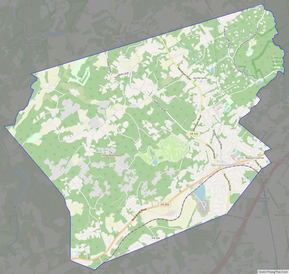
Bernardsville Road Map
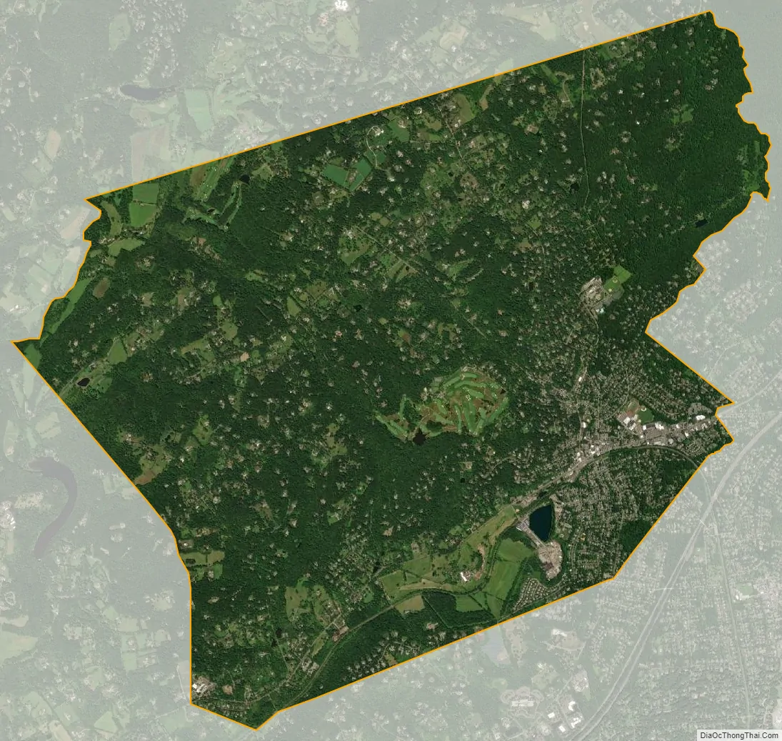
Bernardsville city Satellite Map
Geography
According to the United States Census Bureau, the borough had a total area of 12.91 square miles (33.44 km), including 12.84 square miles (33.24 km) of land and 0.08 square miles (0.19 km) of water (0.58%).
Unincorporated communities, localities and place names located partially or completely within the borough include Blazuers Corner, Mine Brook and Somerseten.
The borough borders Bernards Township to the east, Far Hills to the southwest, and Peapack-Gladstone to the west in Somerset County, Harding Township to the northeast and both Mendham Borough and Mendham Township to the northwest in Morris County.
Climate
Bernardsville has a climate that borders between Humid continental and Humid subtropical with cool sometimes cold winters and warm to hot, humid summers on average. High elevations of the town have a warm summer humid continental climate with more snow during the winter and more orographic precipitation. Summer is the wettest season with frequent afternoon thunderstorms while Winter is the driest season.
See also
Map of New Jersey State and its subdivision: Map of other states:- Alabama
- Alaska
- Arizona
- Arkansas
- California
- Colorado
- Connecticut
- Delaware
- District of Columbia
- Florida
- Georgia
- Hawaii
- Idaho
- Illinois
- Indiana
- Iowa
- Kansas
- Kentucky
- Louisiana
- Maine
- Maryland
- Massachusetts
- Michigan
- Minnesota
- Mississippi
- Missouri
- Montana
- Nebraska
- Nevada
- New Hampshire
- New Jersey
- New Mexico
- New York
- North Carolina
- North Dakota
- Ohio
- Oklahoma
- Oregon
- Pennsylvania
- Rhode Island
- South Carolina
- South Dakota
- Tennessee
- Texas
- Utah
- Vermont
- Virginia
- Washington
- West Virginia
- Wisconsin
- Wyoming


