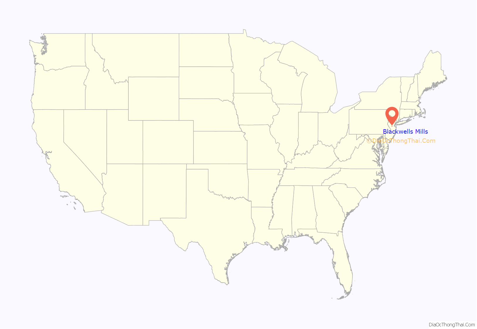
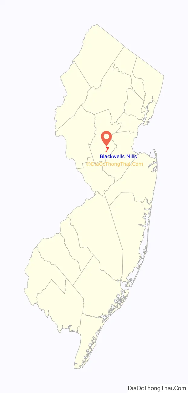
Blackwells Mills is an unincorporated community and census-designated place (CDP) located in Franklin Township in Somerset County, in the U.S. state of New Jersey. As of the 2010 U.S. census, the CDP’s population was 803.
| Name: | Blackwells Mills CDP |
|---|---|
| LSAD Code: | 57 |
| LSAD Description: | CDP (suffix) |
| State: | New Jersey |
| County: | Somerset County |
| Elevation: | 89 ft (27 m) |
| Total Area: | 7.80 sq mi (20.21 km²) |
| Land Area: | 7.68 sq mi (19.89 km²) |
| Water Area: | 0.12 sq mi (0.32 km²) 5.70% |
| Total Population: | 9,473 |
| Population Density: | 1,233.46/sq mi (476.24/km²) |
| FIPS code: | 3406025 |
| GNISfeature ID: | 02583968 |
Online Interactive Map
Click on ![]() to view map in "full screen" mode.
to view map in "full screen" mode.
Blackwells Mills location map. Where is Blackwells Mills CDP?
History
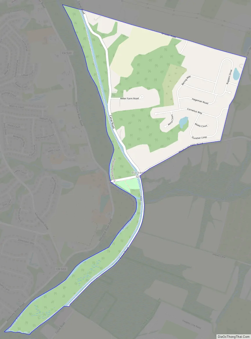
Blackwells Mills is on the east side of the Millstone River in Franklin Township, Somerset County, New Jersey. A mill was built in 1746 by Peter Schenk. His daughter married a Mercer and the mill passed to her family. The mill was purchased by William Blackwell in 1804 with his uncle Capt. Jacob Blackwell. These men were from nearby Hopewell Township. William Blackwell built a fine Federal period house on the land across the road on the Hillsborough side. Following Hurricane Floyd, the house was moved westward to higher ground. It is still standing. Following the death of William Blackwell in the 1850s, his son John came into possession of the mill. John Blackwell died early in life, and his widow sold the mill to Augustus VanZant in 1872. On May 31, 1771 the west bank of the Millstone River became Hillsborough Township.
The mill burned down in 1885 and was rebuilt. A major restoration was done in 1943.
Blackwells Mills Road Map
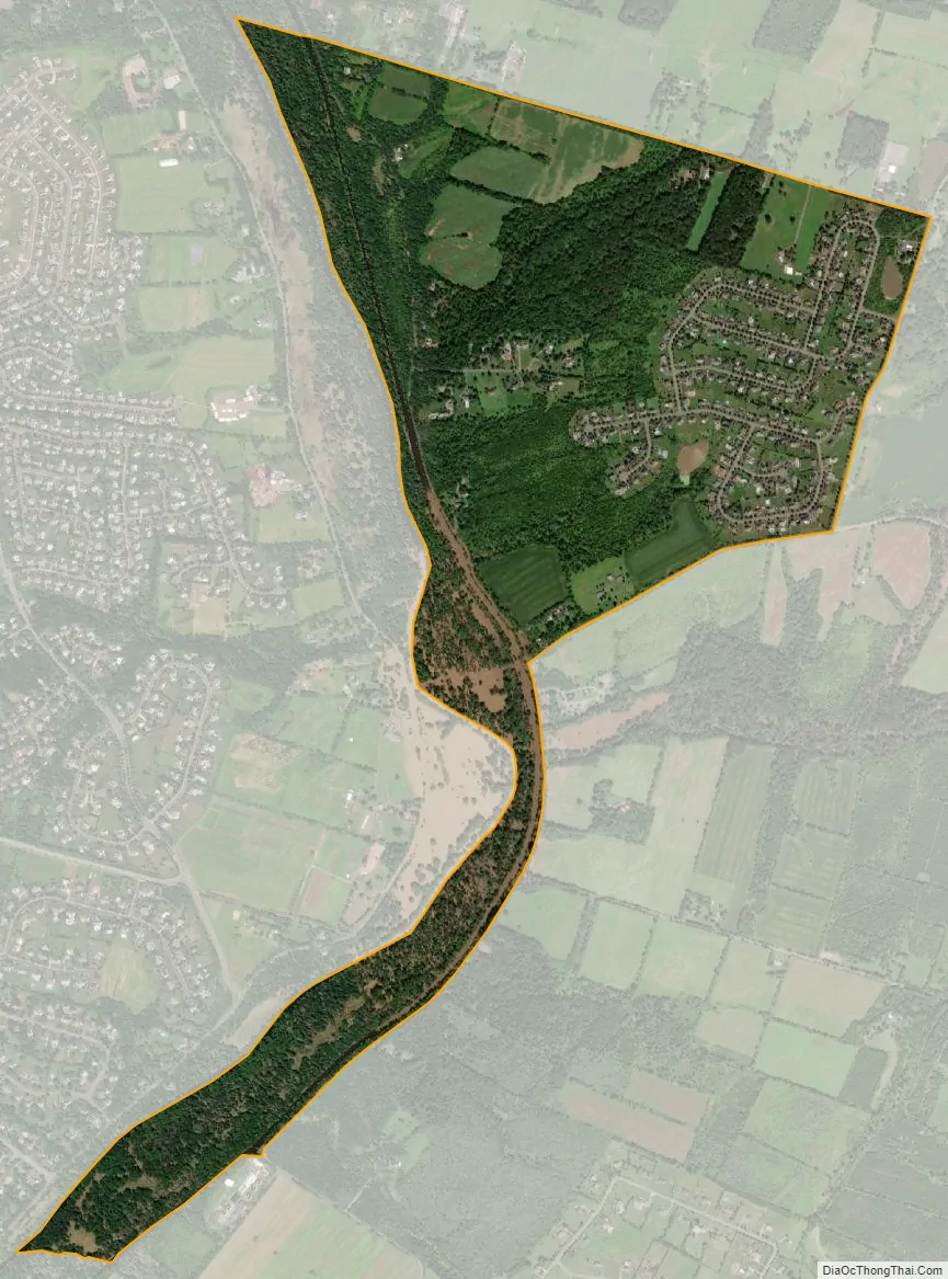
Blackwells Mills city Satellite Map
Geography
According to the U.S. Census Bureau, Blackwells Mills had a total area of 1.296 square miles (3.356 km), including 1.222 square miles (3.165 km) of land and 0.074 square miles (0.191 km) of water (5.70%).
See also
Map of New Jersey State and its subdivision: Map of other states:- Alabama
- Alaska
- Arizona
- Arkansas
- California
- Colorado
- Connecticut
- Delaware
- District of Columbia
- Florida
- Georgia
- Hawaii
- Idaho
- Illinois
- Indiana
- Iowa
- Kansas
- Kentucky
- Louisiana
- Maine
- Maryland
- Massachusetts
- Michigan
- Minnesota
- Mississippi
- Missouri
- Montana
- Nebraska
- Nevada
- New Hampshire
- New Jersey
- New Mexico
- New York
- North Carolina
- North Dakota
- Ohio
- Oklahoma
- Oregon
- Pennsylvania
- Rhode Island
- South Carolina
- South Dakota
- Tennessee
- Texas
- Utah
- Vermont
- Virginia
- Washington
- West Virginia
- Wisconsin
- Wyoming


