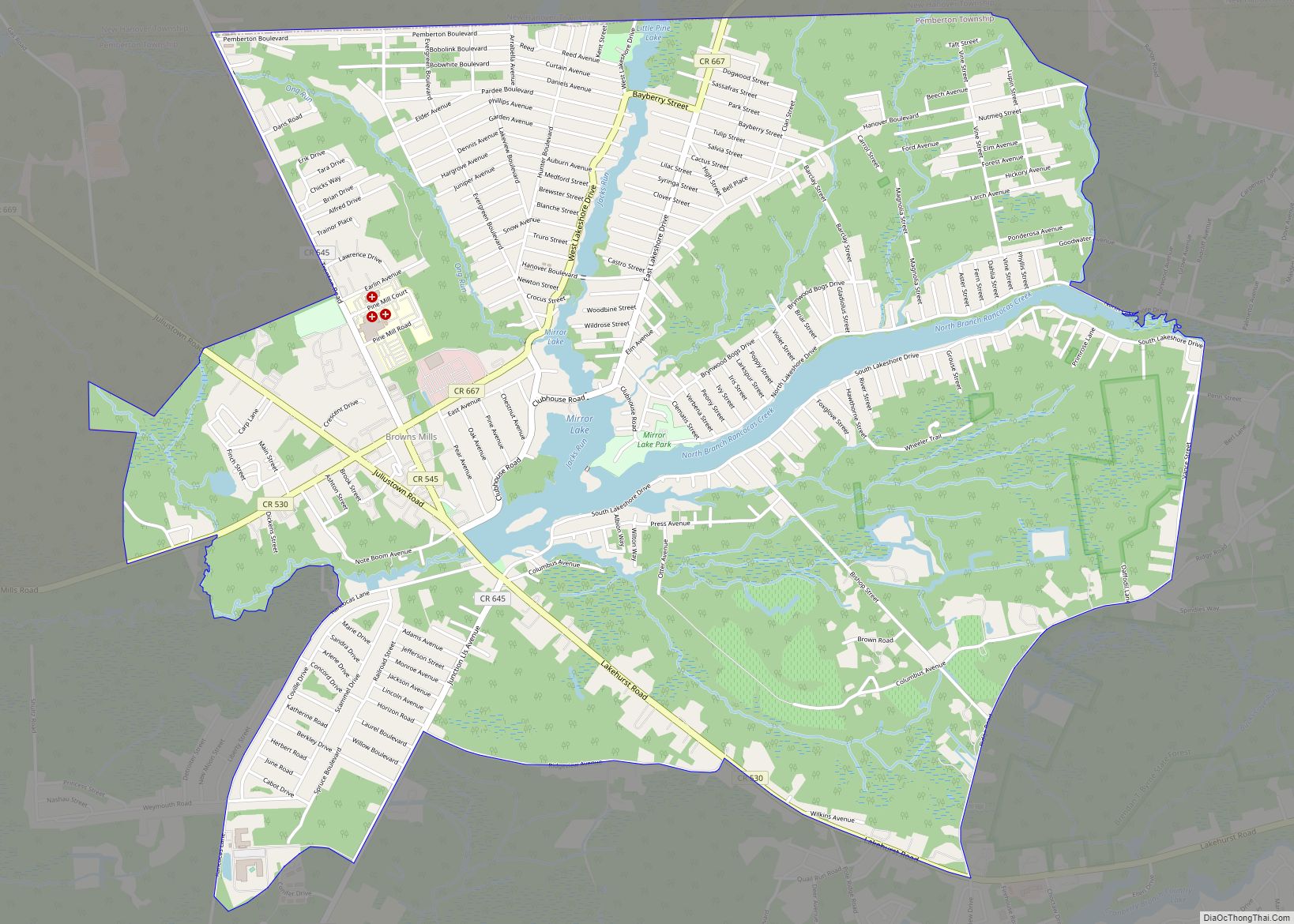
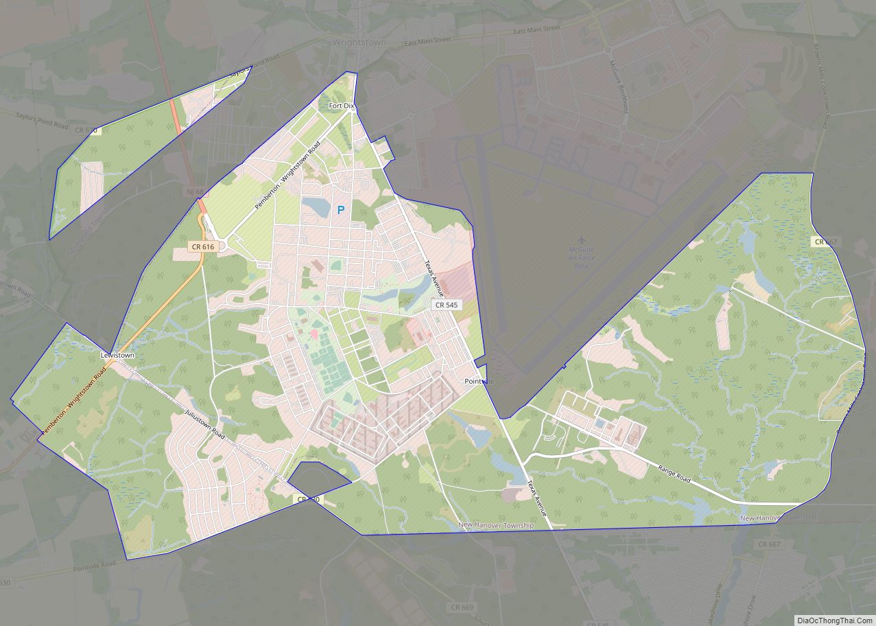
Browns Mills is an unincorporated community and census-designated place (CDP) located in Pemberton Township, in Burlington County, in the U.S. state of New Jersey. As of the 2020 United States census the CDP’s population was 10,734, a decrease of 489 (-4.4%) from the 11,223 counted at the 2010 United States census, which in turn reflected a decrease of 34 (-0.3%) from the 2000 census. Browns Mills is known as the home of Deborah Heart and Lung Center.
| Name: | Browns Mills CDP |
|---|---|
| LSAD Code: | 57 |
| LSAD Description: | CDP (suffix) |
| State: | New Jersey |
| County: | Burlington County |
| Elevation: | 66 ft (20 m) |
| Total Area: | 5.62 sq mi (14.55 km²) |
| Land Area: | 5.37 sq mi (13.92 km²) |
| Water Area: | 0.24 sq mi (0.63 km²) 4.36% |
| Total Population: | 10,734 |
| Population Density: | 1,997.8/sq mi (771.4/km²) |
| ZIP code: | 08015 |
| Area code: | 609 |
| FIPS code: | 3408455 |
| GNISfeature ID: | 2389252 |
Online Interactive Map
Click on ![]() to view map in "full screen" mode.
to view map in "full screen" mode.
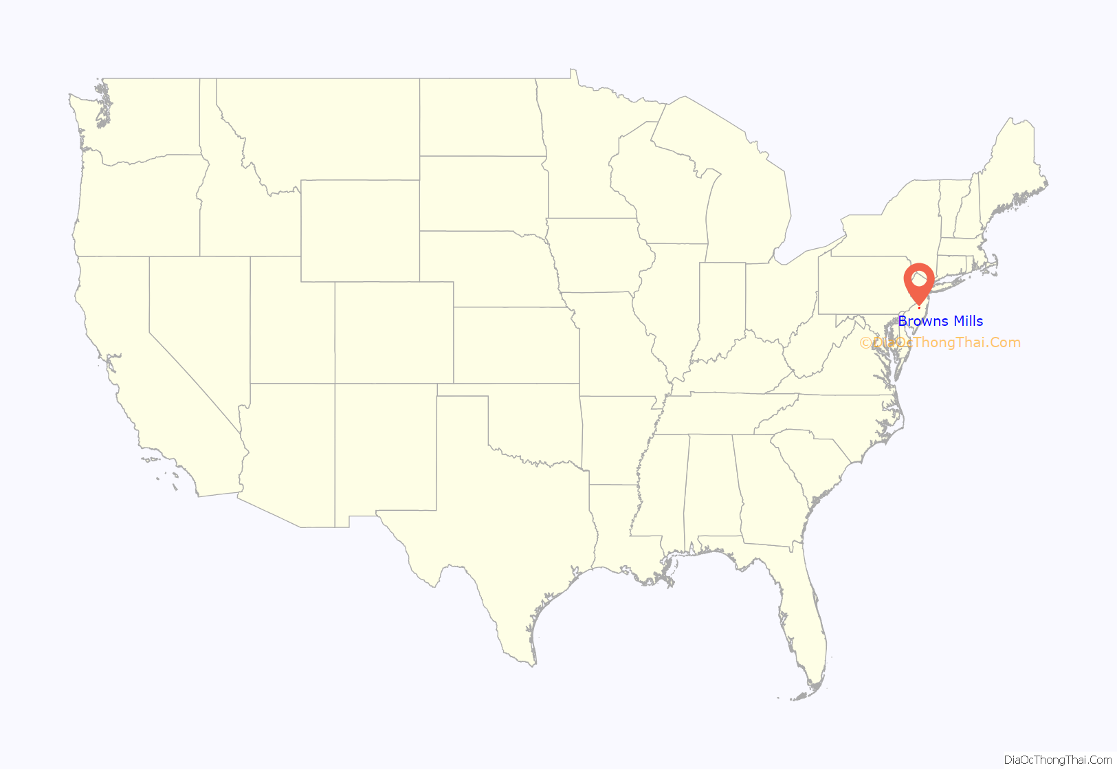
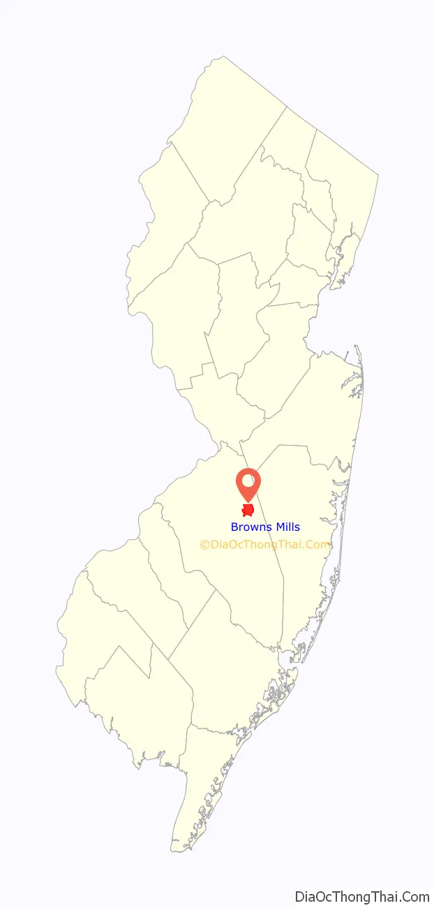
Browns Mills location map. Where is Browns Mills CDP?
Browns Mills Road Map
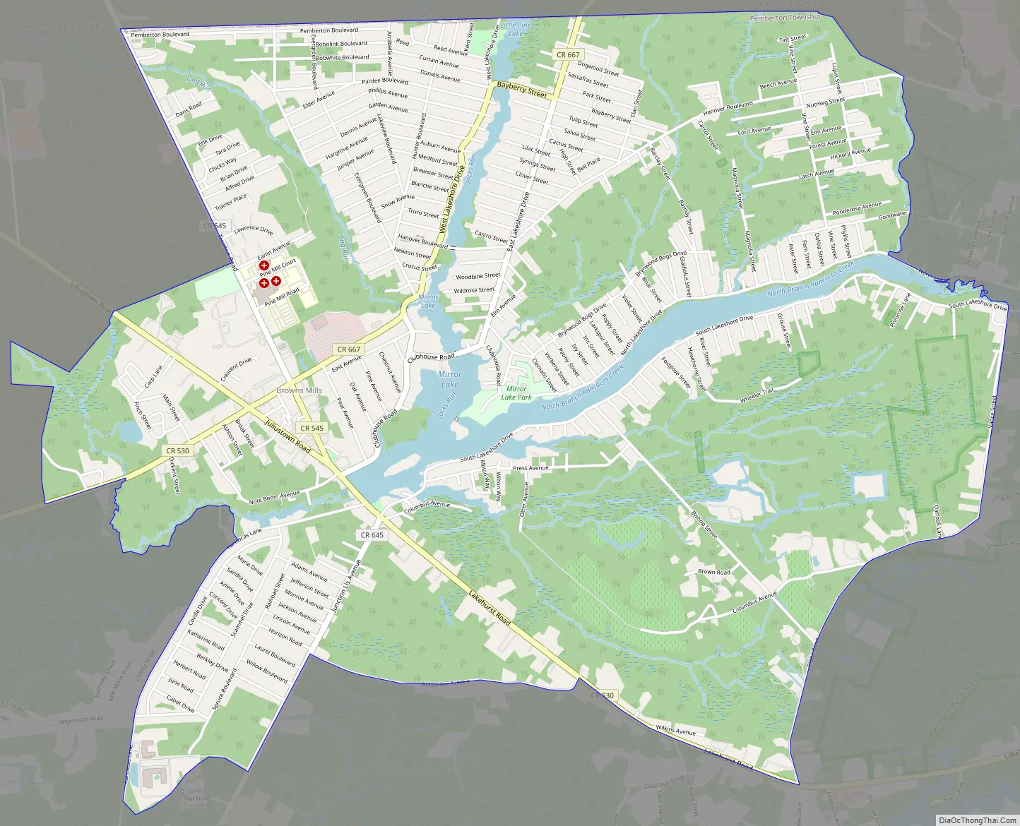
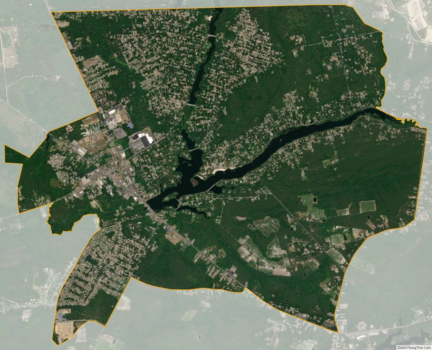
Browns Mills city Satellite Map
Geography
According to the United States Census Bureau, Browns Mills had a total area of 5.612 square miles (14.534 km), including 5.367 square miles (13.900 km) of land and 0.245 square miles (0.634 km) of water (4.36%).
See also
Map of New Jersey State and its subdivision: Map of other states:- Alabama
- Alaska
- Arizona
- Arkansas
- California
- Colorado
- Connecticut
- Delaware
- District of Columbia
- Florida
- Georgia
- Hawaii
- Idaho
- Illinois
- Indiana
- Iowa
- Kansas
- Kentucky
- Louisiana
- Maine
- Maryland
- Massachusetts
- Michigan
- Minnesota
- Mississippi
- Missouri
- Montana
- Nebraska
- Nevada
- New Hampshire
- New Jersey
- New Mexico
- New York
- North Carolina
- North Dakota
- Ohio
- Oklahoma
- Oregon
- Pennsylvania
- Rhode Island
- South Carolina
- South Dakota
- Tennessee
- Texas
- Utah
- Vermont
- Virginia
- Washington
- West Virginia
- Wisconsin
- Wyoming