Cherry Hill Mall is a unincorporated community and growing census-designated place (CDP) located in Cherry Hill, in Camden County, New Jersey, United States. As of the 2020 United States census, the CDP’s population was 14,805, its highest decennial count ever and an increase of 634 (+4.5%) from the 14,171 residents recorded at the 2010 census count, which in turn had reflected an increase of 933 (+7.0%) from the 13,238 counted at the 2000 census. The CDP is home to the namesake Cherry Hill Mall shopping complex.
| Name: | Cherry Hill Mall CDP |
|---|---|
| LSAD Code: | 57 |
| LSAD Description: | CDP (suffix) |
| State: | New Jersey |
| County: | Camden County |
| Elevation: | 36 ft (11 m) |
| Total Area: | 3.646 sq mi (9.443 km²) |
| Land Area: | 3.642 sq mi (9.433 km²) |
| Water Area: | 0.004 sq mi (0.010 km²) 0.10% |
| Total Population: | 14,805 |
| Population Density: | 4,059.5/sq mi (1,567.4/km²) |
| Area code: | 856 |
| FIPS code: | 3412385 |
| GNISfeature ID: | 02389309 |
Online Interactive Map
Click on ![]() to view map in "full screen" mode.
to view map in "full screen" mode.
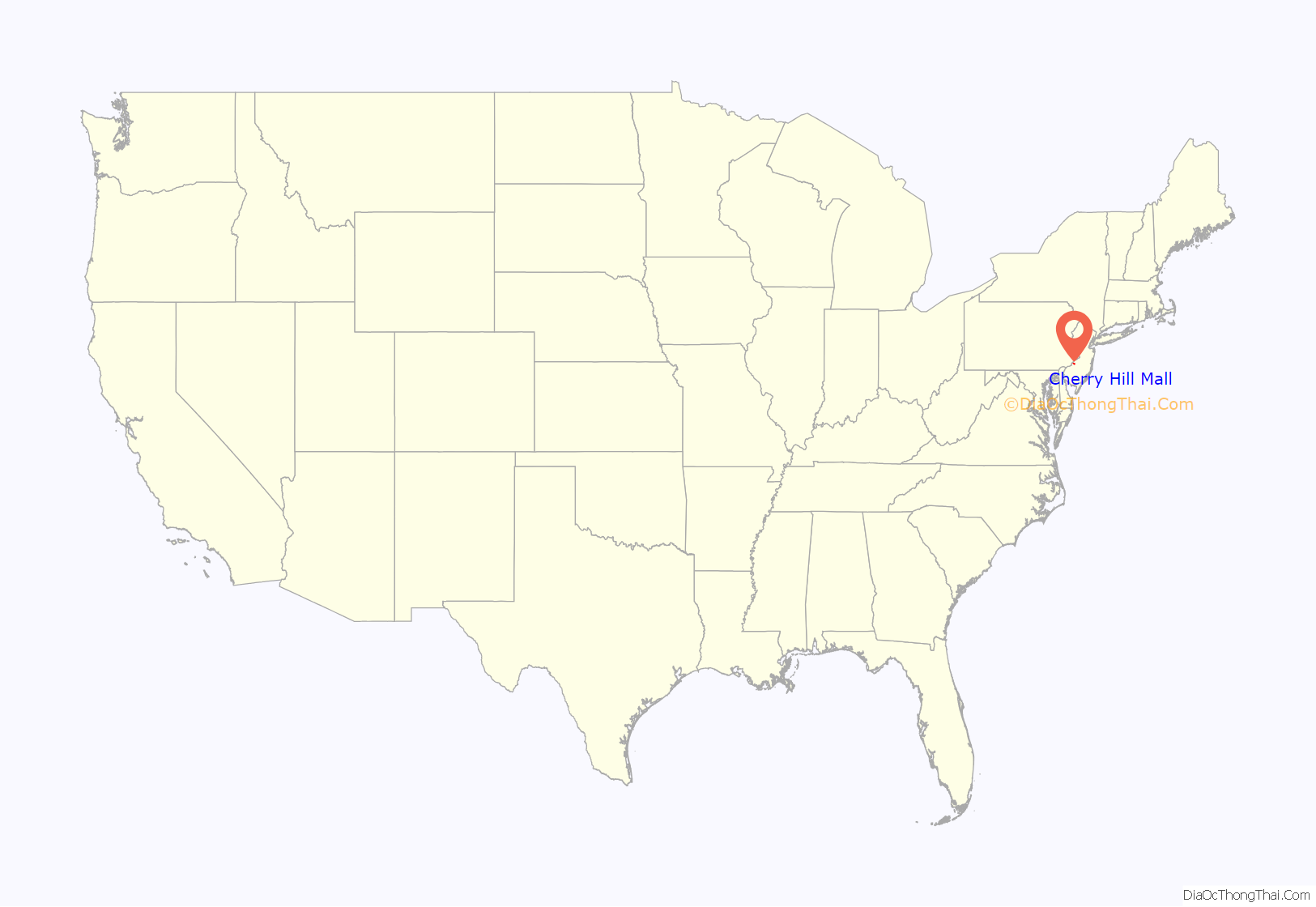
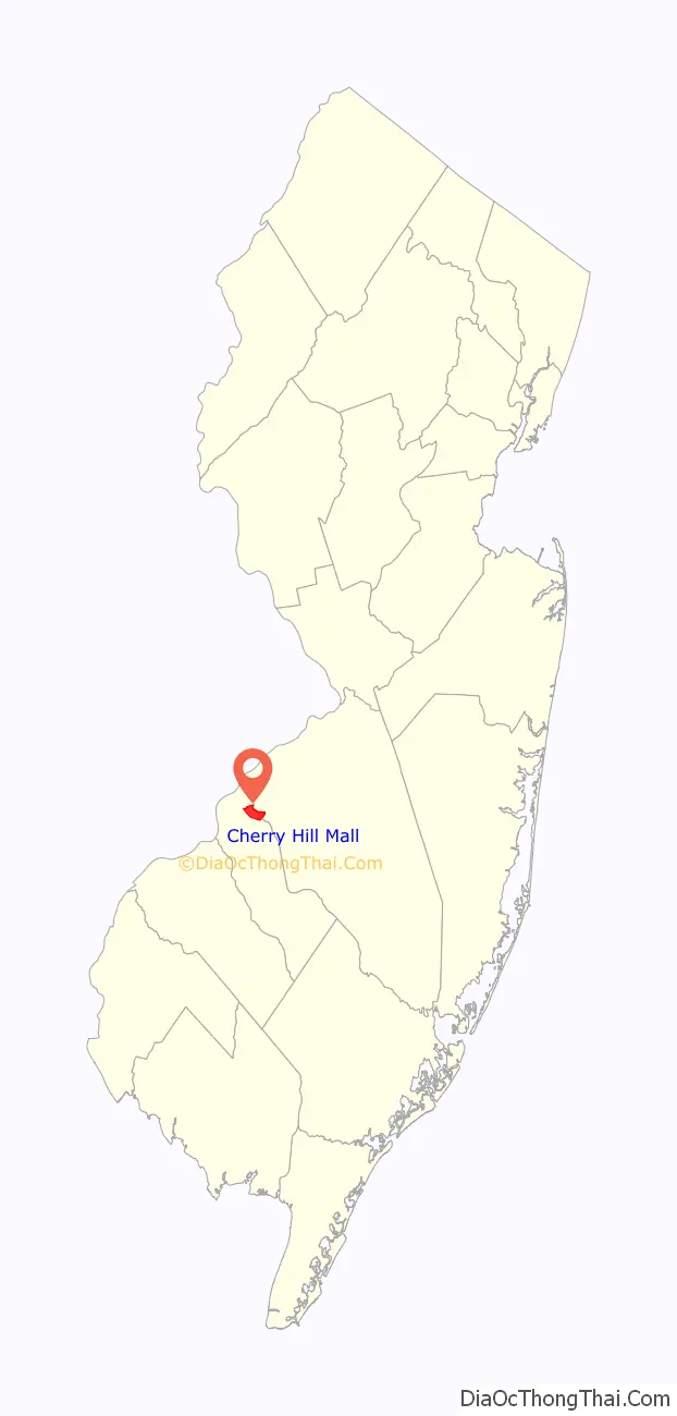
Cherry Hill Mall location map. Where is Cherry Hill Mall CDP?
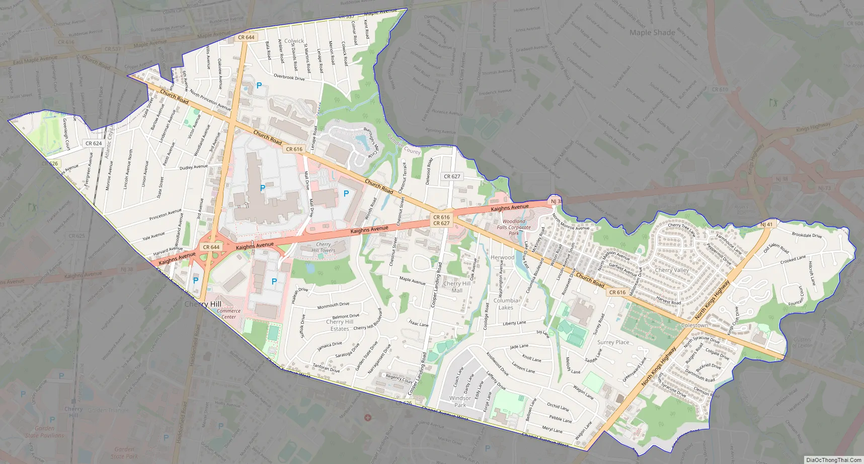
Cherry Hill Mall Road Map
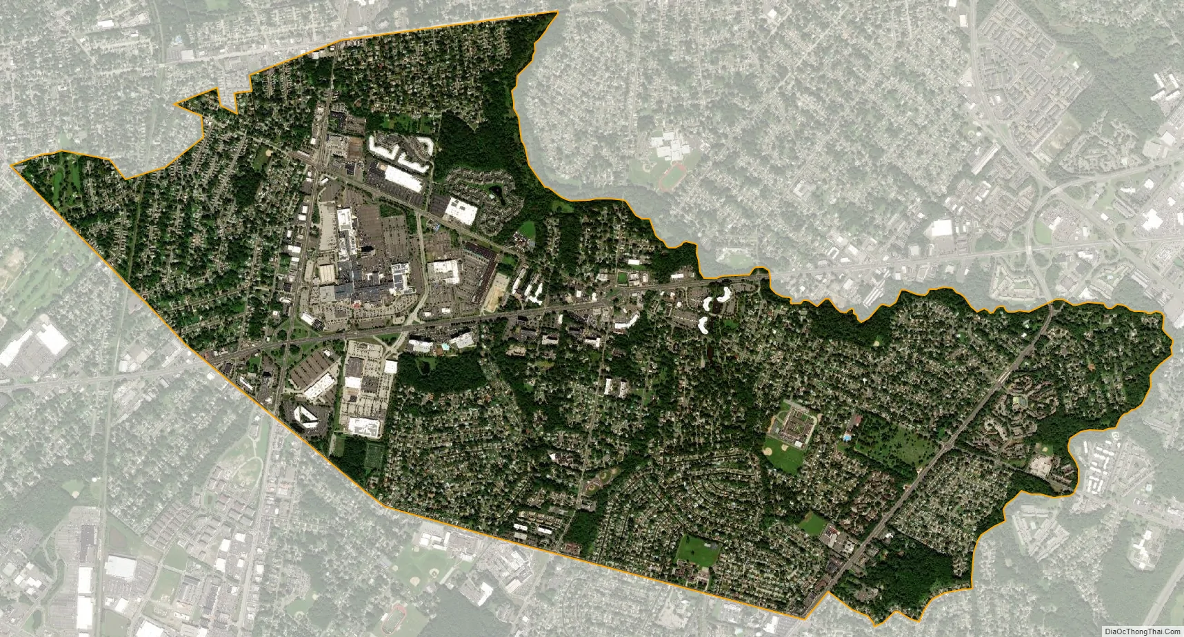
Cherry Hill Mall city Satellite Map
Geography
According to the United States Census Bureau, Cherry Hill Mall had a total area of 3.646 square miles (9.443 km), including 3.642 square miles (9.433 km) of it is land and 0.004 square miles (0.009 km) of water (0.10%).
See also
Map of New Jersey State and its subdivision: Map of other states:- Alabama
- Alaska
- Arizona
- Arkansas
- California
- Colorado
- Connecticut
- Delaware
- District of Columbia
- Florida
- Georgia
- Hawaii
- Idaho
- Illinois
- Indiana
- Iowa
- Kansas
- Kentucky
- Louisiana
- Maine
- Maryland
- Massachusetts
- Michigan
- Minnesota
- Mississippi
- Missouri
- Montana
- Nebraska
- Nevada
- New Hampshire
- New Jersey
- New Mexico
- New York
- North Carolina
- North Dakota
- Ohio
- Oklahoma
- Oregon
- Pennsylvania
- Rhode Island
- South Carolina
- South Dakota
- Tennessee
- Texas
- Utah
- Vermont
- Virginia
- Washington
- West Virginia
- Wisconsin
- Wyoming


