Clyde is an unincorporated community and census-designated place (CDP) located in Franklin Township, in Somerset County, New Jersey, United States. It was a station stop on the Penna RR’s Millstone Branch. As of the 2010 United States Census, the CDP’s population was 213.
| Name: | Clyde CDP |
|---|---|
| LSAD Code: | 57 |
| LSAD Description: | CDP (suffix) |
| State: | New Jersey |
| County: | Somerset County |
| Elevation: | 115 ft (35 m) |
| Total Area: | 0.38 sq mi (0.99 km²) |
| Land Area: | 0.38 sq mi (0.99 km²) |
| Water Area: | 0.00 sq mi (0.00 km²) 0.00% |
| Total Population: | 243 |
| Population Density: | 634.46/sq mi (244.80/km²) |
| Area code: | 609 and 732/848 |
| FIPS code: | 3413990 |
| GNISfeature ID: | 02583980 |
Online Interactive Map
Click on ![]() to view map in "full screen" mode.
to view map in "full screen" mode.
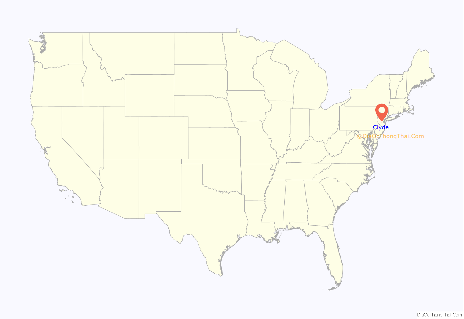
Clyde location map. Where is Clyde CDP?
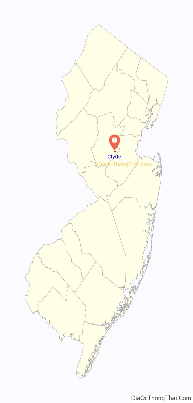
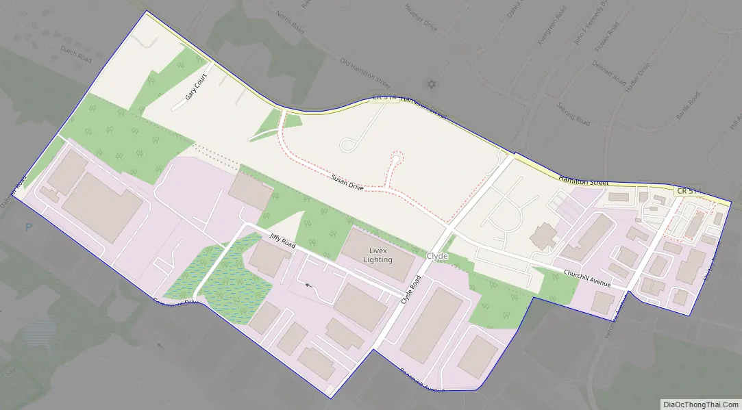
Clyde Road Map
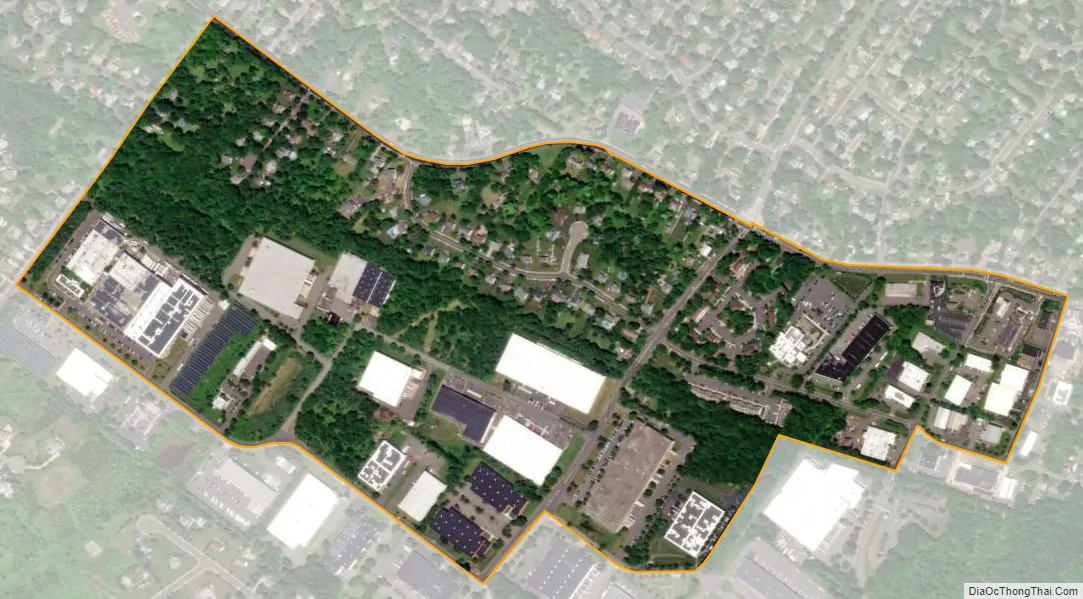
Clyde city Satellite Map
Geography
According to the United States Census Bureau, Clyde had a total area of 0.383 square miles (0.993 km), all of which was land.
See also
Map of New Jersey State and its subdivision: Map of other states:- Alabama
- Alaska
- Arizona
- Arkansas
- California
- Colorado
- Connecticut
- Delaware
- District of Columbia
- Florida
- Georgia
- Hawaii
- Idaho
- Illinois
- Indiana
- Iowa
- Kansas
- Kentucky
- Louisiana
- Maine
- Maryland
- Massachusetts
- Michigan
- Minnesota
- Mississippi
- Missouri
- Montana
- Nebraska
- Nevada
- New Hampshire
- New Jersey
- New Mexico
- New York
- North Carolina
- North Dakota
- Ohio
- Oklahoma
- Oregon
- Pennsylvania
- Rhode Island
- South Carolina
- South Dakota
- Tennessee
- Texas
- Utah
- Vermont
- Virginia
- Washington
- West Virginia
- Wisconsin
- Wyoming


