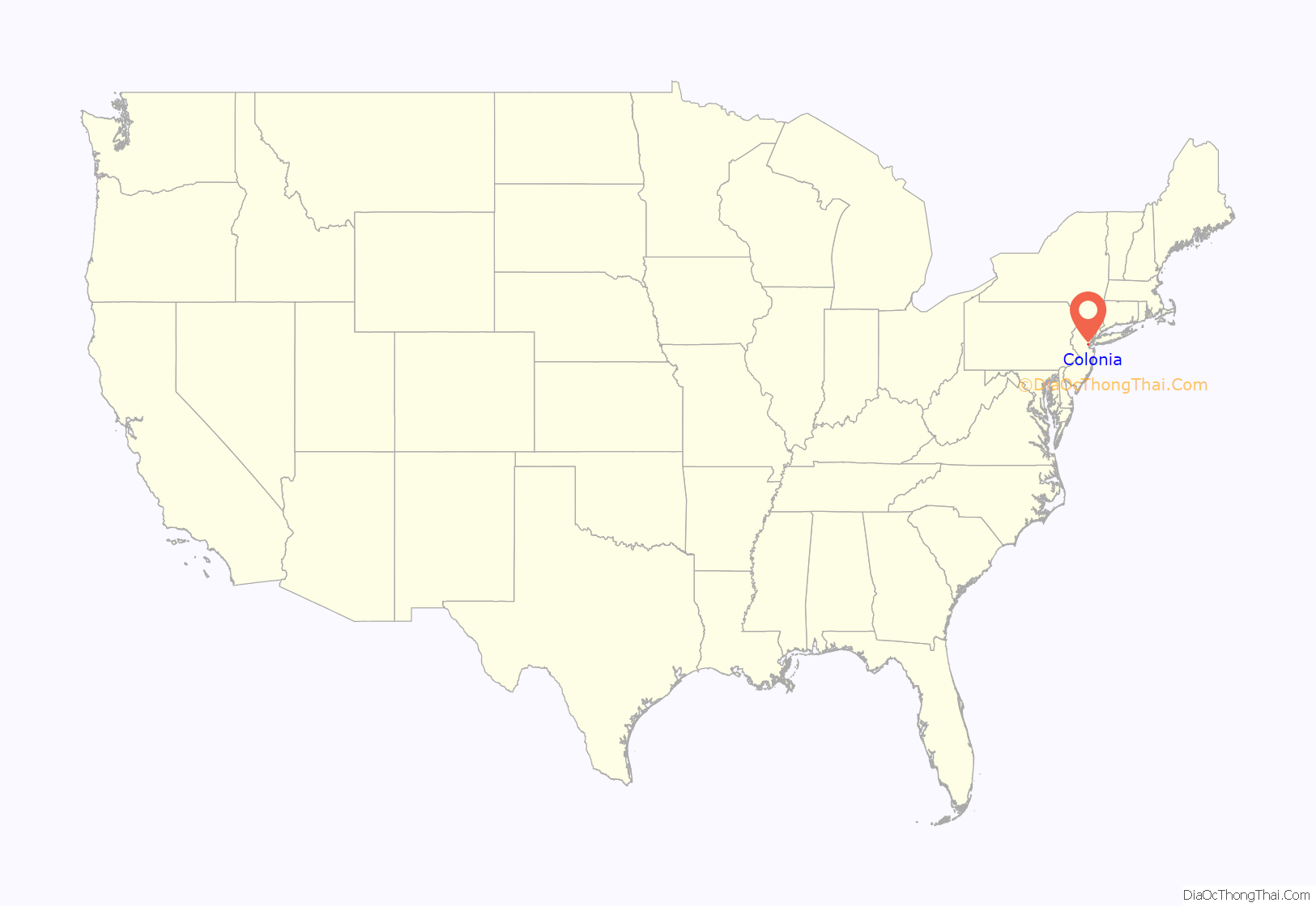
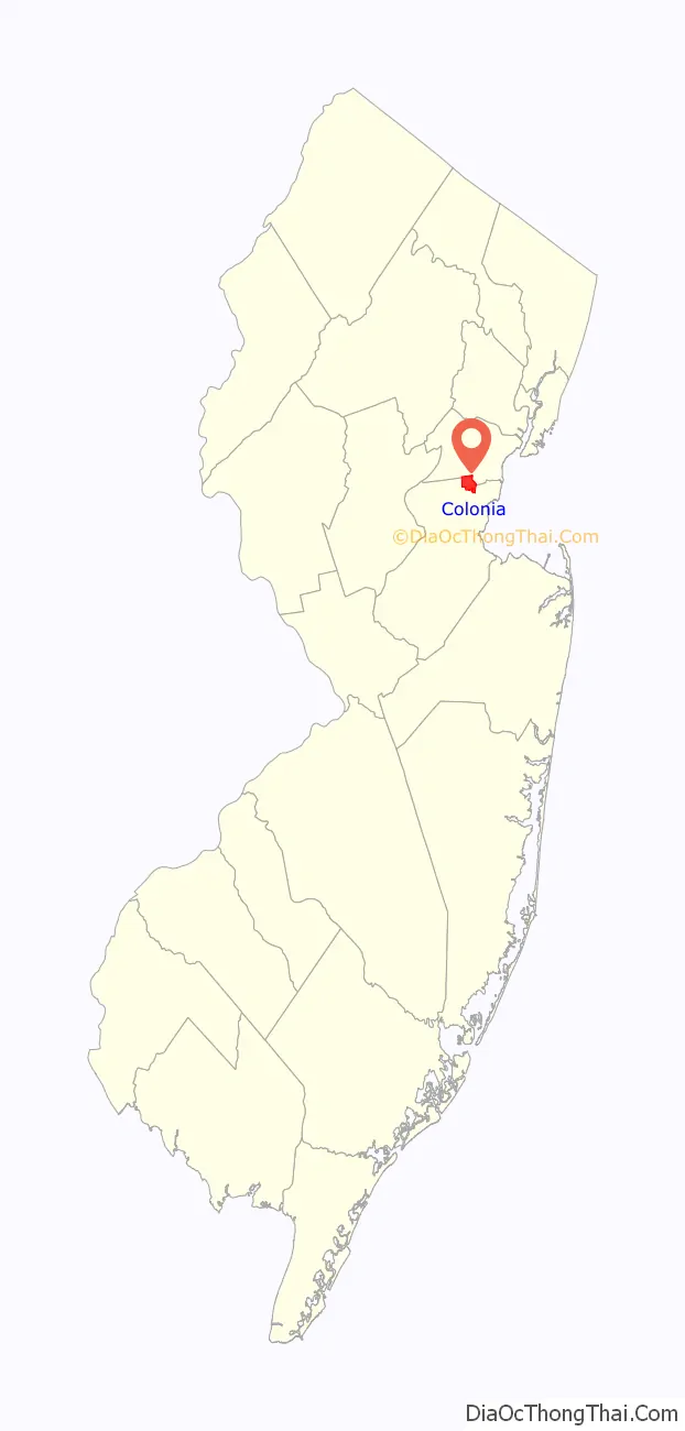
Colonia is an unincorporated community and census-designated place (CDP) located within Woodbridge Township, in Middlesex County, New Jersey, United States. As of the 2010 United States Census, the CDP’s population was 17,795.
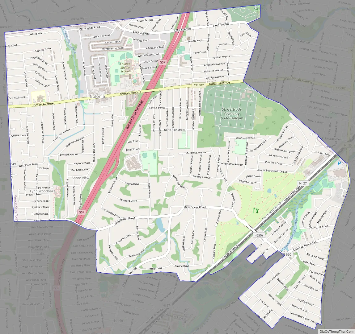
In 1919, the New Jersey State Highway Commission built a new road that became part of the Lincoln Highway, an early plan to create a transcontinental highway. The stretch was constructed on the west side of the Pennsylvania Railroad (now the Northeast Corridor) from near the northeast of Dow Avenue between Colonia and Iselin to Cedar Street in Menlo Park, to avoid two railroad crossings. The old road is now Middlesex-Essex Turnpike and Thornall Street, on the east side of the tracks.
| Name: | Colonia CDP |
|---|---|
| LSAD Code: | 57 |
| LSAD Description: | CDP (suffix) |
| State: | New Jersey |
| County: | Middlesex County |
| Elevation: | 69 ft (21 m) |
| Total Area: | 4.03 sq mi (10.45 km²) |
| Land Area: | 4.03 sq mi (10.44 km²) |
| Water Area: | 0.00 sq mi (0.01 km²) 0.11% |
| Total Population: | 18,609 |
| Population Density: | 4,617.62/sq mi (1,782.99/km²) |
| ZIP code: | 07067 |
| Area code: | 732/848 |
| FIPS code: | 3414380 |
| GNISfeature ID: | 02389346 |
Online Interactive Map
Click on ![]() to view map in "full screen" mode.
to view map in "full screen" mode.
Colonia location map. Where is Colonia CDP?
Colonia Road Map
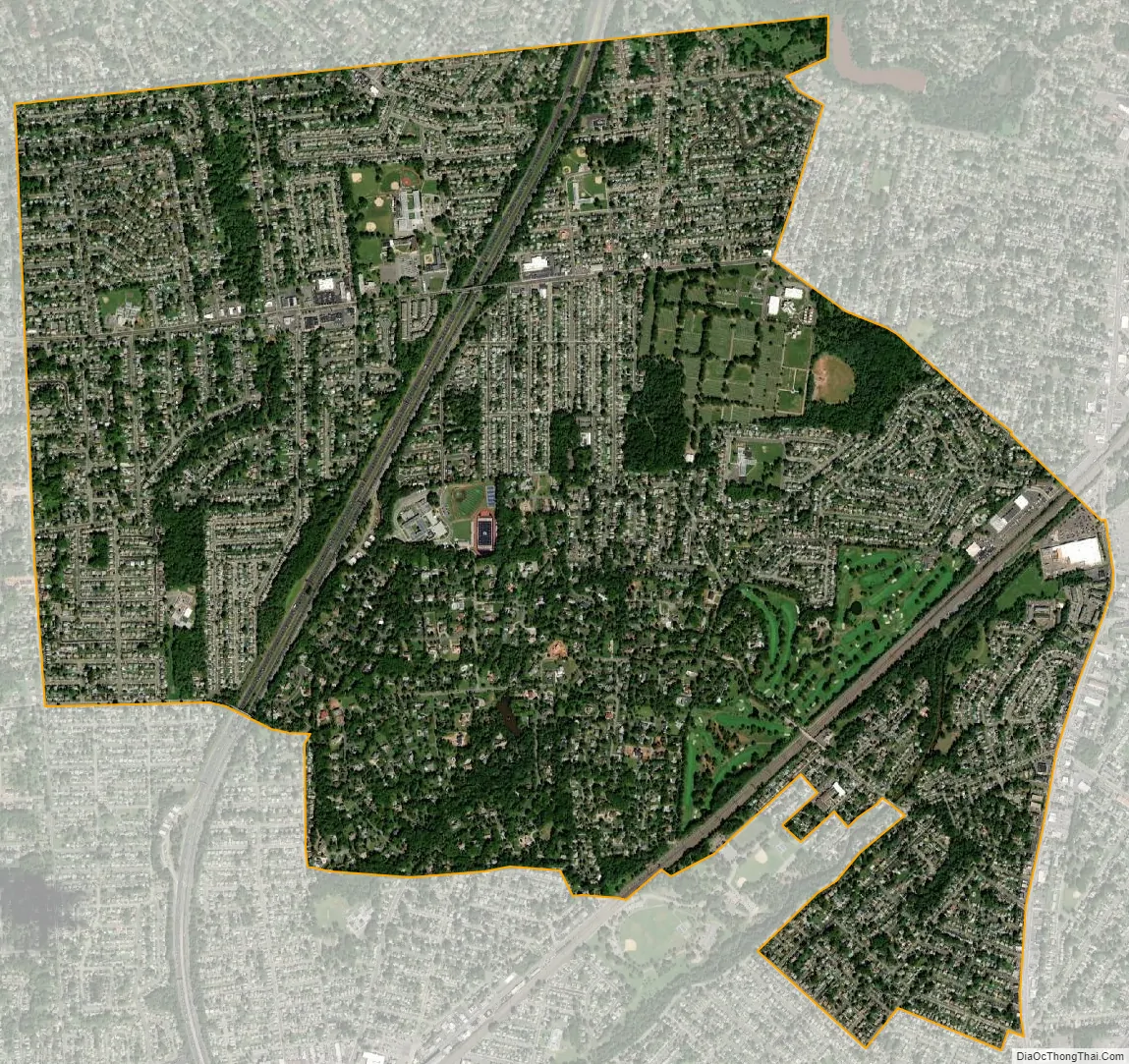
Colonia city Satellite Map
Geography
According to the United States Census Bureau, the CDP had a total area of 3.914 square miles (10.137 km), including 3.910 square miles (10.126 km) of land and 0.004 square miles (0.011 km) of water (0.11%). It has a humid subtropical climate (Cfa) and average monthly temperatures range from 33°F in January to 78.1 °F in July.
The Garden State Parkway passes through the western portion of the CDP but does not interchange there. For northbound Garden State Parkway traffic only there is a service plaza in Colonia, that is the parkway’s only area located on private property.
See also
Map of New Jersey State and its subdivision: Map of other states:- Alabama
- Alaska
- Arizona
- Arkansas
- California
- Colorado
- Connecticut
- Delaware
- District of Columbia
- Florida
- Georgia
- Hawaii
- Idaho
- Illinois
- Indiana
- Iowa
- Kansas
- Kentucky
- Louisiana
- Maine
- Maryland
- Massachusetts
- Michigan
- Minnesota
- Mississippi
- Missouri
- Montana
- Nebraska
- Nevada
- New Hampshire
- New Jersey
- New Mexico
- New York
- North Carolina
- North Dakota
- Ohio
- Oklahoma
- Oregon
- Pennsylvania
- Rhode Island
- South Carolina
- South Dakota
- Tennessee
- Texas
- Utah
- Vermont
- Virginia
- Washington
- West Virginia
- Wisconsin
- Wyoming


