Highland Park is a borough in Middlesex County, in the U.S. state of New Jersey, in the New York City metropolitan area. The borough is located on the northern banks of the Raritan River, in the Raritan Valley region. As of the 2020 United States census, the borough’s population was 15,072, an increase of 1,090 (+7.8%) from the 2010 census count of 13,982, which in turn reflected a decline of 17 (−0.1%) from the 13,999 counted in the 2000 census.
Highland Park was formed as a borough by an act of the New Jersey Legislature on March 15, 1905, when it broke away from what was then known as Raritan Township (present-day Edison). The borough was named for its location above the Raritan River.
| Name: | Highland Park borough |
|---|---|
| LSAD Code: | 21 |
| LSAD Description: | borough (suffix) |
| State: | New Jersey |
| County: | Middlesex County |
| Incorporated: | March 15, 1905 |
| Elevation: | 75 ft (23 m) |
| Total Area: | 1.83 sq mi (4.74 km²) |
| Land Area: | 1.82 sq mi (4.72 km²) |
| Water Area: | 0.01 sq mi (0.02 km²) 0.44% |
| Total Population: | 15,072 |
| Population Density: | 8,276.8/sq mi (3,195.7/km²) |
| ZIP code: | 08904 |
| Area code: | 732 / 908 |
| FIPS code: | 3431470 |
| GNISfeature ID: | 0885252 |
| Website: | www.hpboro.com |
Online Interactive Map
Click on ![]() to view map in "full screen" mode.
to view map in "full screen" mode.
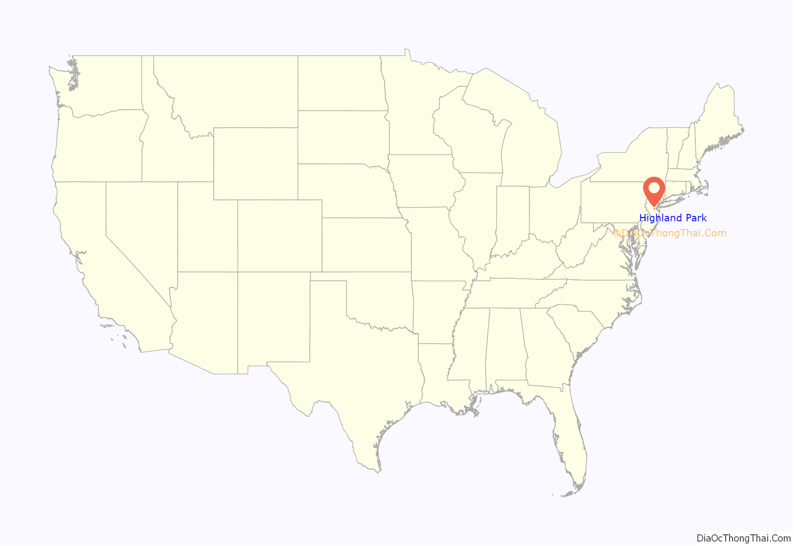
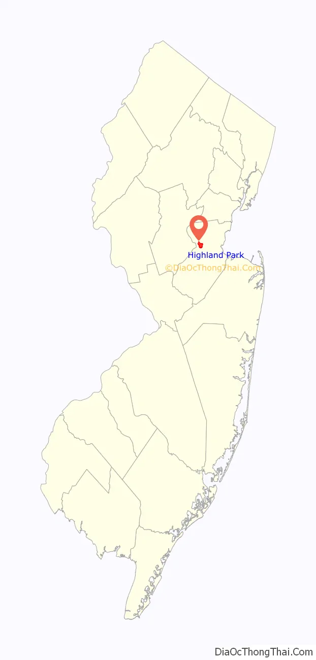
Highland Park location map. Where is Highland Park borough?
History
The earliest settlers of the land that would become Highland Park were the Lenape Native Americans, who hunted in the hills along the Raritan River and had trails that crisscrossed the area, providing a link between the Delaware River and Hudson River areas. In 1685, John Inian bought land on both shores of the Raritan River and built two new landings downstream from the Assunpink Trail’s fording place, which was later developed as Raritan Landing. He established a ferry service and the main road then was redirected to lead straight to the ferry landing. This river crossing was run by generations of different owners and a ferry house tavern operated for many years in the 18th century. A toll bridge replaced the ferry in 1795. The wood plank Albany Street Bridge was dismantled in 1848 and reconstructed in 1853. The present day seven-span stone arch road bridge was built in 1892 and stretches 595 feet (181 m) across the Raritan River to New Brunswick. It became the Lincoln Highway Bridge in 1914 and was widened in 1925.
In the late 17th century, Henry Greenland became one of the area’s first European settlers; he owned nearly 400 acres (1.6 km) of land on the Mill Brook section of the Assunpink Trail, where he operated an inn for travelers. Others early settlers included Captain Francis Drake and other members of the Drake family, relatives of the famous explorer. In the early 18th century, a few wealthy Europeans including the Van Horns and Merrills settled on large tracts of land establishing an isolated farmstead pattern of development that would continue for the next 150 years.
The Reverend John Henry Livingston of the famous Livingston family, newly chosen head of Queen’s College (now Rutgers University), purchased a 150-acre (0.61 km) plot of land in 1809, which would hereafter be known as the Livingston Manor. A gracious Greek Revival house built around 1843 by Robert and Louisa Livingston stands on this property, which remains Highland Park’s most prominent historic house. The Livingston Homestead, which is listed in the National Register of Historic Places, was owned by the Waldron family throughout most of the 20th century.
In the early 19th century, both the Delaware & Raritan Canal and a railroad were constructed largely to serve the commercial center of New Brunswick across the river. In 1836, the New Jersey Railroad and Transportation Company built a rail line that terminated on the Highland Park side of the Raritan River and established a station named “East New Brunswick.” The Camden and Amboy Railroad built a wood, double-deck bridge which eliminated the station stop in 1838. It was destroyed by a suspicious fire in 1878. A replacement iron truss bridge was constructed on the existing enlarged stone piers, which in turn was replaced in 1902 by the current twelve-span stone arch bridge encased in concrete in the 1940s.
Despite the canal and the railroad, Highland Park’s land continued to be used for agriculture. Residential development slowly began 30 years later, with several stately houses constructed on Adelaide Avenue and more modest houses constructed on Cedar, First, and Second Avenues and Magnolia, Benner, and Johnson Streets. In the 1870s, the small hamlet became better known as “Highland Park”, a name derived from the suburban housing development although the area adjacent to the railroad tracks continued to be called “East New Brunswick.” 1870 was also the year in which Highland Park was annexed to the newly formed township now called Edison, but at the time called Raritan Township.
Highland Park had its own school district and on March 15, 1905, the Borough of Highland Park was formed. Highland Park’s drive for independence from Raritan Township arose over the issue of public schooling. Residents wanted an independent school system and there was a related dispute over school taxes. The fire department, which had formed in 1899, also wanted more local control over their affairs. The 1905 New Jersey census counted 147 dwellings in the new borough. In 1918, Robert Wood Johnson II was appointed to the Highland Park Council and became mayor in 1920. His summer house and estate was located on River Road, just north of the railroad tracks.
Since its establishment as a borough, Highland Park’s lands have been parceled into ever-smaller suburban residential plots. Planned developments included Watson Whittlesey’s Livingston Manor development begun in 1906; the Viehmann Tract, also on the north side; Riverview Terrace on the south side; Raritan Park Terrace in the triangle between Raritan and Woodbridge Avenues; and East New Brunswick Heights in the Orchard Heights neighborhood. It has taken years of continuously constructing houses and apartment buildings to create the largely residential borough.
Highland Park’s industrial development in the 19th and 20th centuries included such businesses as a brewery, Johnson & Johnson, The John Waldron Machine Company, Turner Tubes, and the Janeway & Carpender Wallpaper factory. The borough is the birthplace of the Band-Aid. and Flako Products packaged mixes for baked goods. However, the industrial nature of the borough completely declined by the 1960s. The commercial zones along both Raritan and Woodbridge Avenues continue to thrive with “mom & pop” shops, many that have lasted for generations.
Throughout the 20th century, Highland Park’s religious institutions, educational facilities, and municipal governance have kept pace with the growth of the borough. The trends of local autonomy and control that shaped Highland Park in the past continue to this day.
In 2012, Highland Park became the first municipality in the state to contract a home performance company to help residents consume less energy. The program is a one-of-a-kind program that can offer up to a 30% energy savings for homeowners.
In 2016, Highland Park became the state’s first registered HeartSafe community.
Livingston Manor Historic District
Livingston Manor was a subdivision built upon the lands surrounding the Livingston Homestead. This subdivision was the brainchild of Watson Whittlesey (1863–1914), a real estate developer born in Rochester, New York. Whittlesey was more than a typical land speculator; he was a community builder, which was noted by his residency in various Livingston Manor houses from 1906 to 1914, and by his active involvement in the municipal affairs of Highland Park. Instead of auctioning lots like his 19th century predecessors, Whittlesey sold subdivided lots with either a house completely built by his company or with the promise of providing a company-constructed house similar to those previously constructed.
The suburban development grew between 1906 and 1925, when Whittlesey’s company, the Livingston Manor Corporation and its successor, the Highland Park Building Company, constructed single-family houses from plans produced by a select group of architects. While a variety of building types and styles are present on each block, the buildings in the district are distinguished by the use of specific building plans found nowhere else in Highland Park and by the embellishments that are typical of the Craftsman philosophy, which emphasized the value of the labor of skilled artisans who showed pride in their abilities.
In the first years of this development, the houses were constructed one entire block at a time beginning with the southeast side of Grant Avenue between Lawrence Avenue and North Second Avenue. The next block to be developed was the northwest side of Lincoln Avenue between Lawrence Avenue and North Second Avenue. Six stucco bungalows were then constructed on the southern side of Lawrence east of Lincoln Avenue. As the housing development grew in popularity, houses were constructed less systematically by block, and more often on lots that individual homeowners selected from the remaining available properties. Whittlesey used plans from architects George Edward Krug and Francis George Hasselman, as well as plans generated by several local architects including John Arthur Blish and William Boylan. Several of Livingston Manor’s Tudor Revival houses were designed by Highland Park’s eminent architect Alexander Merchant. Merchant created numerous buildings in New Brunswick and Highland Park (see list below). Like other early-20th century architects, he was active during the period of early American modernism, but, having trained at the firm of Carrère and Hastings, Merchant developed and maintained a classical design vocabulary.
Many workers in the building trades, such as Harvey E. Dodge, the carpenter Frederick Nietscke and the contractor Harold Richard Segoine, have also been identified as Livingston Manor Corporation employees as well as Livingston Manor residents. Whittlesey, with his wife Anna, also lived in several Livingston Manor houses, including the Spanish Colonial style house at 35 Harrison Avenue designed specifically for them.
On December 1, 1906, the first deeds were transferred to two individual homeowners. Many prominent New Brunswick and Highland Park residents bought houses in this new neighborhood. They included Rutgers College professors, school teachers, bank employees, factory owners, and store owners. Census data show that most of the women were housewives and mothers. There were many extended families. Some families took in boarders and several households included live-in servants. Sixty-two houses had been constructed in Livingston Manor by 1910.
In 1912, Watson Whittlesey hired a sales agent, John F. Green, and began selling bungalow lots. These properties were smaller and less expensive, and a set of plans for a bungalow was given to any purchaser. By 1913, 120 houses had been constructed in Livingston Manor.
Dubbed “Lord of the Manor”, Whittlesey created a neighborhood spirit by giving receptions for the residents, by providing playgrounds for the children, and by encouraging the men to take a more active part in public affairs. After his death on April 8, 1914, Manor residents turned out in the hundreds to attend a memorial service at his house.
The Highland Park Building Company was incorporated in 1914 by long-standing members of his company including builder Robert Lufburrow and engineer Harold Richard Segoine. In 1916, Mrs. Whittlesey, who was president of the Livingston Manor Corporation, turned over the privately owned streets, sidewalks, and curbs to the borough. Remarkably, there were no provisions for the borough to accept public ownership of the sewers. That required an act of legislation at the statehouse in Trenton, which was accomplished by Senator Florance and Assemblyman Edgar and signed by Governor Walter Evans Edge the following year. Anna Wilcox Whittlesey, “Lady of the Manor”, died on August 16, 1918. She was remembered as “a woman of rare refinement and culture, and the soul of hospitality.”
Highland Park’s identity as a streetcar suburb was transformed to that of an automobile suburb during the 1920s. By 1922, there had been 210 dwellings constructed in Livingston Manor. The Livingston Manor Corporation continued to have transactions into the 1960s, but the area’s significant development had taken place by 1925.
The Livingston Manor is an important neighborhood in Highland Park. The Livingston Manor Historic District was listed in the New Jersey Register of Historic Places on April 1, 2004, and in the National Register of Historic Places on July 7, 2004.
Buildings designed by Alexander Merchant
Alexander Merchant (1872–1952) designed the following buildings:
- 55 South Adelaide Avenue (1909)
- Lafayette School on South Second Avenue and Benner Street (original school-1907 and Second Avenue wing-1915). The third wing on Second Avenue was designed by Merchant’s son Alexander Merchant Jr. in 1952. The Lafayette School is now condominiums and no longer a school.
- Reformed Church of Highland Park on South Second Avenue (original church-1897 and auditorium wing c. 1920)
- Irving School on Central Avenue (original building-1914)
- The Center School on North Third Avenue (formerly the Hamilton School–opened 1915)
- The Pomeranz Building on Raritan Avenue and South Third Avenue (1920)
- 82 Harrison Avenue (1913)
- Two houses on Cliff Court (1914)
- Several houses on South Adelaide Avenue near Cliff Court (1910–1914)
- The Highland Park High School (original building-1926)
- The Masonic Temple on Raritan Avenue at North Fourth Avenue (1923) It remains as a one-story commercial building after a fire on March 10, 1965 destroyed the upper levels of the auditorium and offices.
- The Brody House at corner of Raritan and North Adelaide Avenues (built 1911–demolished 1997)
- The former Police Station at 137 Raritan Avenue (demolished).
- Anshe Emeth Memorial Temple on Livingston Avenue in neighboring New Brunswick (1929)
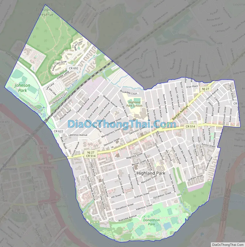
Highland Park Road Map
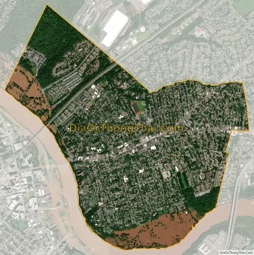
Highland Park city Satellite Map
Geography
According to the United States Census Bureau, the borough had a total area of 1.83 square miles (4.74 km), including 1.82 square miles (4.72 km) of land and 0.01 square miles (0.02 km) of water (0.44%).
The borough received its name for its “park-like” setting, on the “high land” of the banks of the Raritan River, overlooking New Brunswick. Highland Park borders the Middlesex County municipalities of Edison, New Brunswick, and Piscataway.
See also
Map of New Jersey State and its subdivision: Map of other states:- Alabama
- Alaska
- Arizona
- Arkansas
- California
- Colorado
- Connecticut
- Delaware
- District of Columbia
- Florida
- Georgia
- Hawaii
- Idaho
- Illinois
- Indiana
- Iowa
- Kansas
- Kentucky
- Louisiana
- Maine
- Maryland
- Massachusetts
- Michigan
- Minnesota
- Mississippi
- Missouri
- Montana
- Nebraska
- Nevada
- New Hampshire
- New Jersey
- New Mexico
- New York
- North Carolina
- North Dakota
- Ohio
- Oklahoma
- Oregon
- Pennsylvania
- Rhode Island
- South Carolina
- South Dakota
- Tennessee
- Texas
- Utah
- Vermont
- Virginia
- Washington
- West Virginia
- Wisconsin
- Wyoming


