Kingston Estates is an unincorporated community and census-designated place (CDP) located within Cherry Hill, in Camden County, New Jersey, United States, that had been part of the Barclay-Kingston CDP until the 2000 Census, which was split to form the CDPs of Barclay and Kingston Estates as of the 2010 Census. As of the 2010 United States Census, the CDP’s population was 5,685.
| Name: | Kingston Estates CDP |
|---|---|
| LSAD Code: | 57 |
| LSAD Description: | CDP (suffix) |
| State: | New Jersey |
| County: | Camden County |
| Elevation: | 43 ft (13 m) |
| Total Area: | 1.16 sq mi (3.00 km²) |
| Land Area: | 1.16 sq mi (3.00 km²) |
| Water Area: | 0.00 sq mi (0.00 km²) 0.13% |
| Total Population: | 6,322 |
| Population Density: | 5,459.41/sq mi (2,107.43/km²) |
| Area code: | 856 |
| FIPS code: | 3436960 |
| GNISfeature ID: | 02389172 |
Online Interactive Map
Click on ![]() to view map in "full screen" mode.
to view map in "full screen" mode.
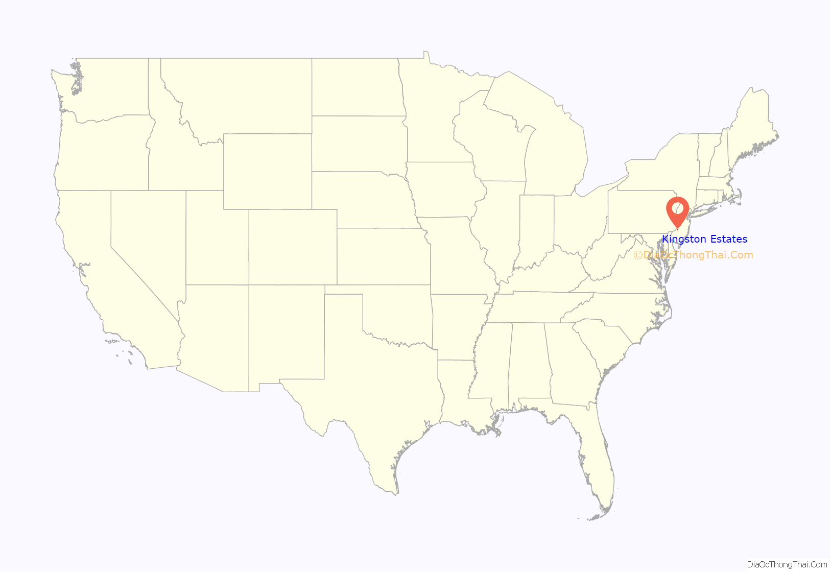
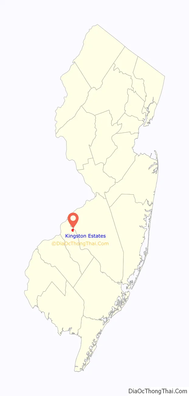
Kingston Estates location map. Where is Kingston Estates CDP?
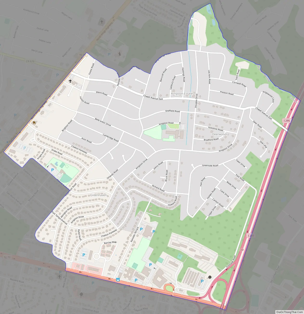
Kingston Estates Road Map
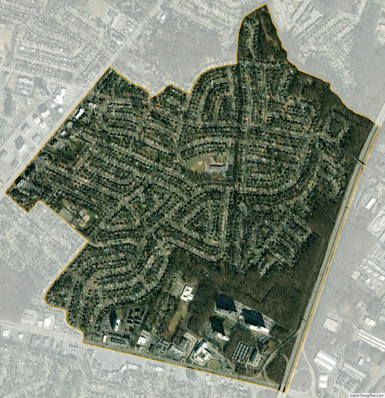
Kingston Estates city Satellite Map
Geography
According to the United States Census Bureau, the CDP had a total area of 1.164 square miles (3.013 km), including 1.162 square miles (3.009 km) of land and 0.002 square miles (0.004 km) of water (0.13%).
See also
Map of New Jersey State and its subdivision: Map of other states:- Alabama
- Alaska
- Arizona
- Arkansas
- California
- Colorado
- Connecticut
- Delaware
- District of Columbia
- Florida
- Georgia
- Hawaii
- Idaho
- Illinois
- Indiana
- Iowa
- Kansas
- Kentucky
- Louisiana
- Maine
- Maryland
- Massachusetts
- Michigan
- Minnesota
- Mississippi
- Missouri
- Montana
- Nebraska
- Nevada
- New Hampshire
- New Jersey
- New Mexico
- New York
- North Carolina
- North Dakota
- Ohio
- Oklahoma
- Oregon
- Pennsylvania
- Rhode Island
- South Carolina
- South Dakota
- Tennessee
- Texas
- Utah
- Vermont
- Virginia
- Washington
- West Virginia
- Wisconsin
- Wyoming


