Merchantville is a borough in Camden County, in the U.S. state of New Jersey. As of the 2020 United States census, the borough’s population was 3,820, a decrease of one person from the 2010 census count of 3,821, which in turn reflected an increase of 20 (+0.5%) from the 3,801 counted in the 2000 census.
The borough had the 22nd-highest property tax rate in New Jersey in 2020, with an equalized rate of 4.367% in 2020, compared to 3.470% in the county as a whole and a statewide average of 2.279%.
| Name: | Merchantville borough |
|---|---|
| LSAD Code: | 21 |
| LSAD Description: | borough (suffix) |
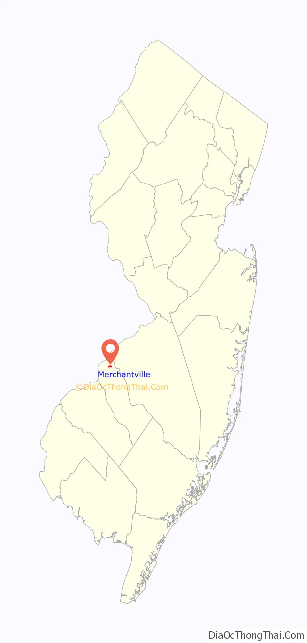
| State: | New Jersey |
| County: | Camden County |
| Incorporated: | March 3, 1874 |
| Elevation: | 82 ft (25 m) |
| Total Area: | 0.59 sq mi (1.54 km²) |
| Land Area: | 0.59 sq mi (1.54 km²) |
| Water Area: | 0.00 sq mi (0.00 km²) 0.00% |
| Total Population: | 3,820 |
| Population Density: | 6,437.0/sq mi (2,485.3/km²) |
| ZIP code: | 08109 |
| Area code: | 856 |
| FIPS code: | 3445510 |
| GNISfeature ID: | 0885297 |
| Website: | www.merchantvillenj.gov |
Online Interactive Map
Click on ![]() to view map in "full screen" mode.
to view map in "full screen" mode.
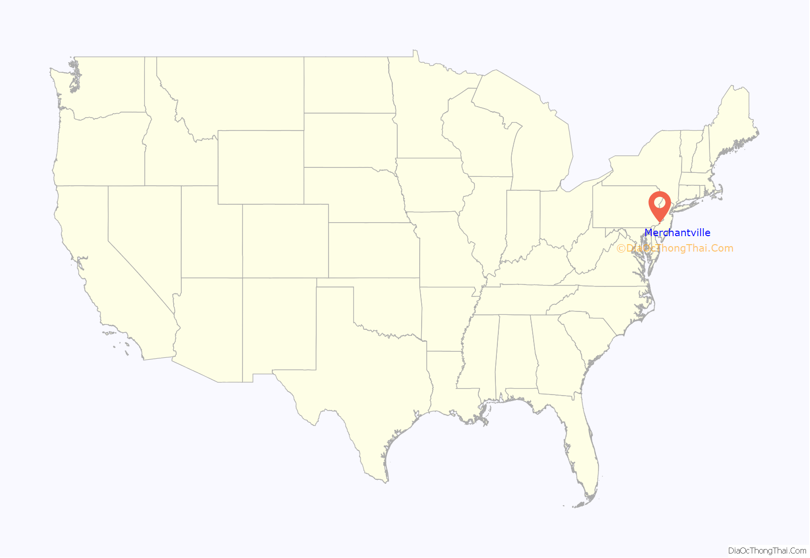
Merchantville location map. Where is Merchantville borough?
History
Merchantville was incorporated as a borough by an act of the New Jersey Legislature on March 3, 1874, from portions of Delaware Township (now Cherry Hill) and the now-defunct Stockton Township.
While one source attributes the borough’s name to a family named Merchant, Francis F. Eastlack, in his History of Merchantville, tells the story of the four developers of Merchantville—Matthias Homer, John Louty, Samuel McFadden and Frederick Gerker—meeting and discussing names, when it was suggested “Gentlemen, as you are all merchants, why not call it Merchantville?”
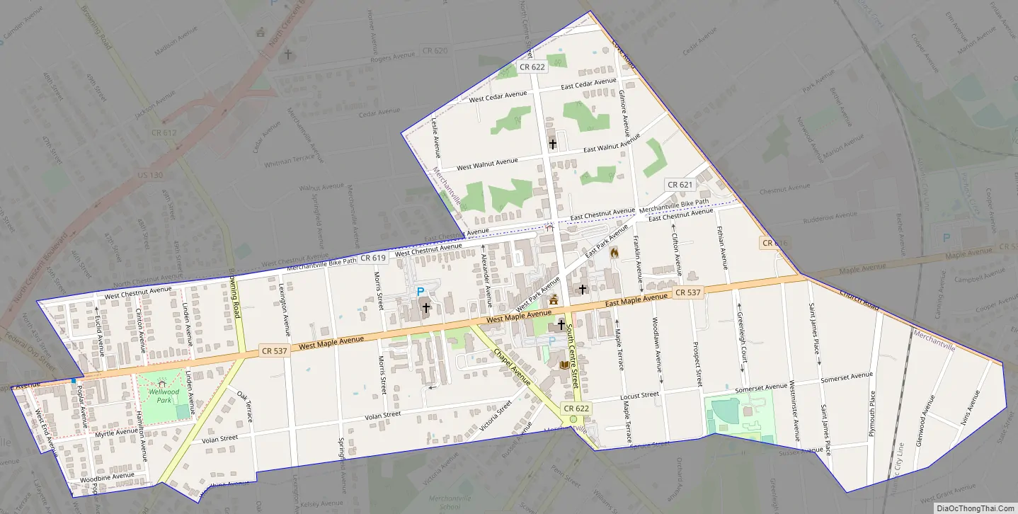
Merchantville Road Map
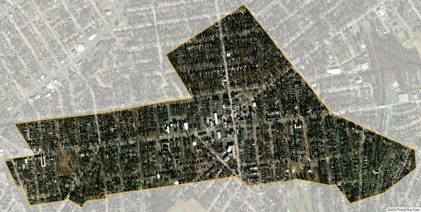
Merchantville city Satellite Map
Geography
According to the United States Census Bureau, Merchantville borough had a total area of 0.59 square miles (1.54 km), all of which was land.
The borough borders the Camden County municipalities of Cherry Hill and Pennsauken Township.
See also
Map of New Jersey State and its subdivision: Map of other states:- Alabama
- Alaska
- Arizona
- Arkansas
- California
- Colorado
- Connecticut
- Delaware
- District of Columbia
- Florida
- Georgia
- Hawaii
- Idaho
- Illinois
- Indiana
- Iowa
- Kansas
- Kentucky
- Louisiana
- Maine
- Maryland
- Massachusetts
- Michigan
- Minnesota
- Mississippi
- Missouri
- Montana
- Nebraska
- Nevada
- New Hampshire
- New Jersey
- New Mexico
- New York
- North Carolina
- North Dakota
- Ohio
- Oklahoma
- Oregon
- Pennsylvania
- Rhode Island
- South Carolina
- South Dakota
- Tennessee
- Texas
- Utah
- Vermont
- Virginia
- Washington
- West Virginia
- Wisconsin
- Wyoming


