Somerset is an unincorporated community and census-designated place (CDP) located within Franklin Township, in Somerset County, New Jersey, United States. As of the 2010 United States Census, the CDP’s population was 22,083.
Somerset housed one of the first Marconi Wireless Stations in the United States.
| Name: | Somerset CDP |
|---|---|
| LSAD Code: | 57 |
| LSAD Description: | CDP (suffix) |
| State: | New Jersey |
| County: | Somerset County |
| Elevation: | 118 ft (36 m) |
| Total Area: | 6.46 sq mi (16.74 km²) |
| Land Area: | 6.33 sq mi (16.39 km²) |
| Water Area: | 0.13 sq mi (0.35 km²) 1.82% |
| Total Population: | 22,968 |
| Population Density: | 3,629.01/sq mi (1,401.11/km²) |
| ZIP code: | 08873, 08875 |
| Area code: | 732/848 |
| FIPS code: | 3468370 |
| GNISfeature ID: | 02390312 |
Online Interactive Map
Click on ![]() to view map in "full screen" mode.
to view map in "full screen" mode.
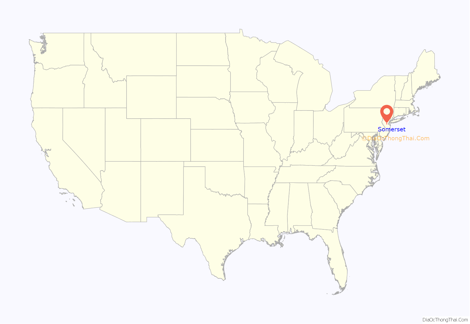
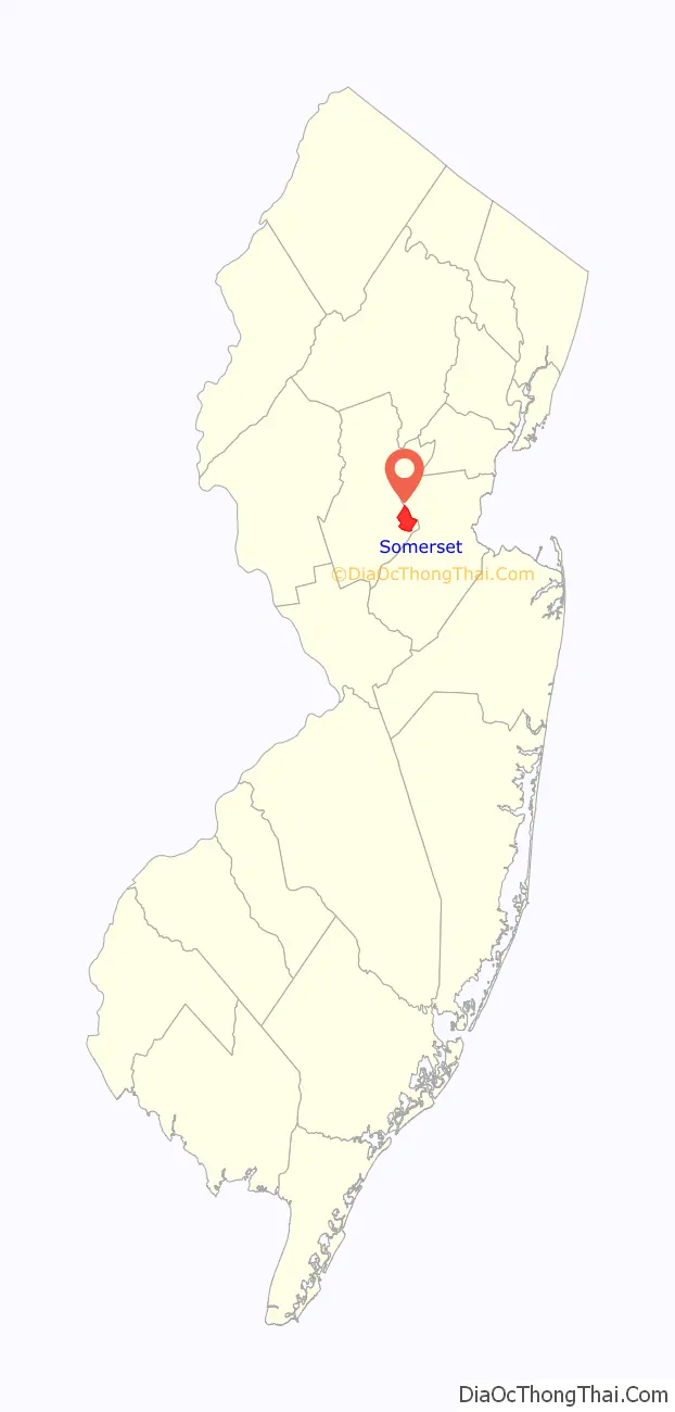
Somerset location map. Where is Somerset CDP?
History
New Brunswick Marconi Station was located at JFK Boulevard and Easton Avenue just a few minutes from the New Brunswick border. Today it is the site of Marconi Park. It was an early radio transmitter facility built in 1913 and operated by the Marconi Wireless Telegraph Company of America. After the interruption of transatlantic telegraph cables by enemy action, the facility was confiscated by the United States Navy on April 7, 1917, to provide transatlantic communications during World War I. The New Brunswick Naval Radio Station was the principal wartime communication link between the United States and Europe, using the callsign NFF. President Woodrow Wilson’s Fourteen Points speech was transmitted from the site in 1918. After the war, ownership of the station, along with Marconi’s other US assets, was transferred from the navy to RCA. The antenna masts were demolished in 1952 to make room for what is now a small mall containing a Kmart, but the buildings on the other side of JFK Boulevard were spared. All but one of the brick buildings were demolished around 2004 to make way for a storage locker facility. The bricks and tiles were saved for use in any future restoration of the spared building, and the Marconi facility in Belmar, New Jersey.
During World War I, the original Marconi spark-gap transmitter was replaced with an Alexanderson alternator, the invention of the famous General Electric engineer, with an output power of 200 kilowatts and looking like an ordinary power station generator. Its frequency was around 17 kHz, which made its wavelength around 17,500 meters. The station used a huge 5,000-foot-long (1,500 m) antenna supported by eight 400-foot (120 m) tall steel masts, similar to the AT&T long wave telephone transmitter at RCA’s Rocky Point, Long Island, transmitter facility.
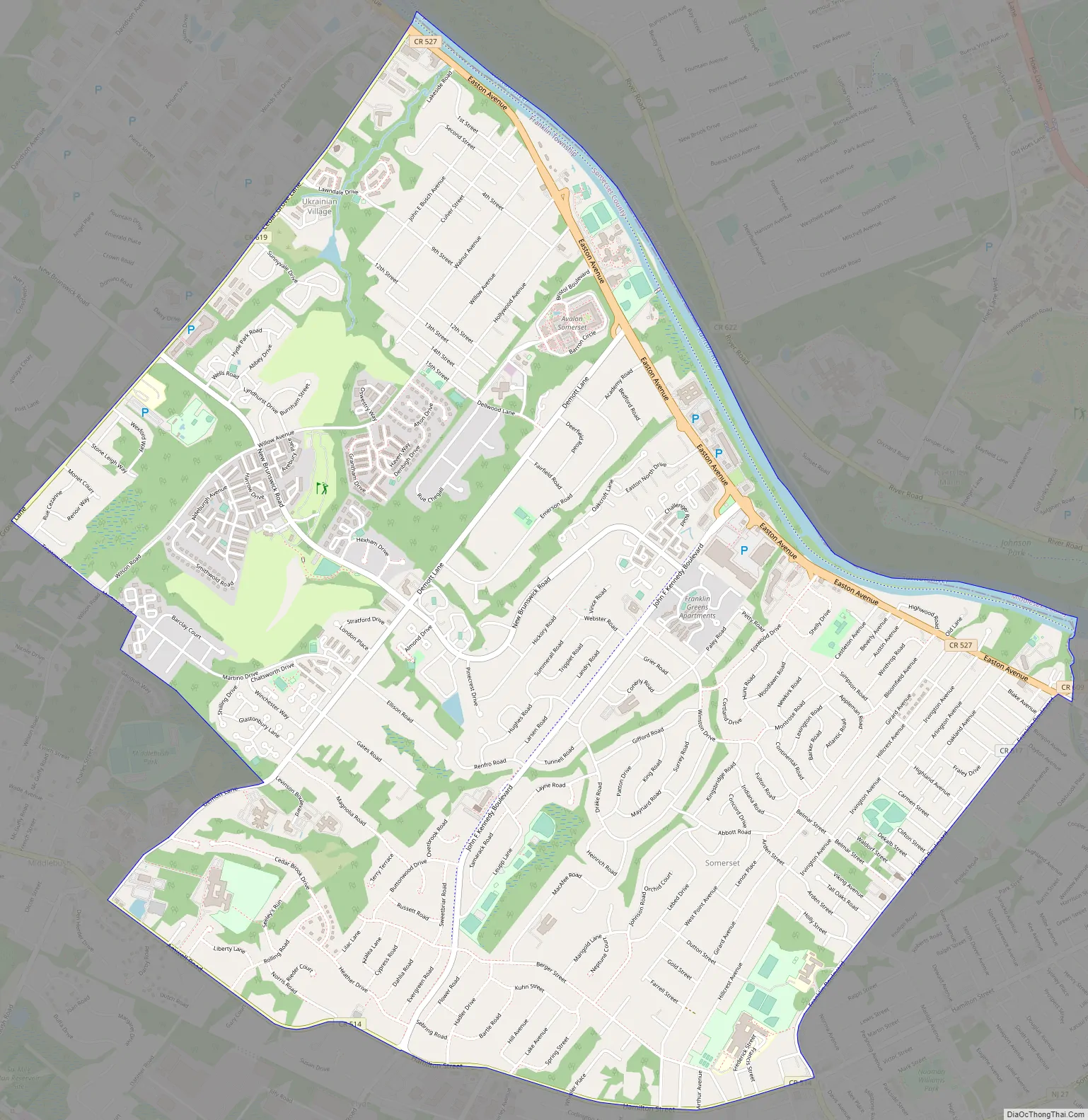
Somerset Road Map
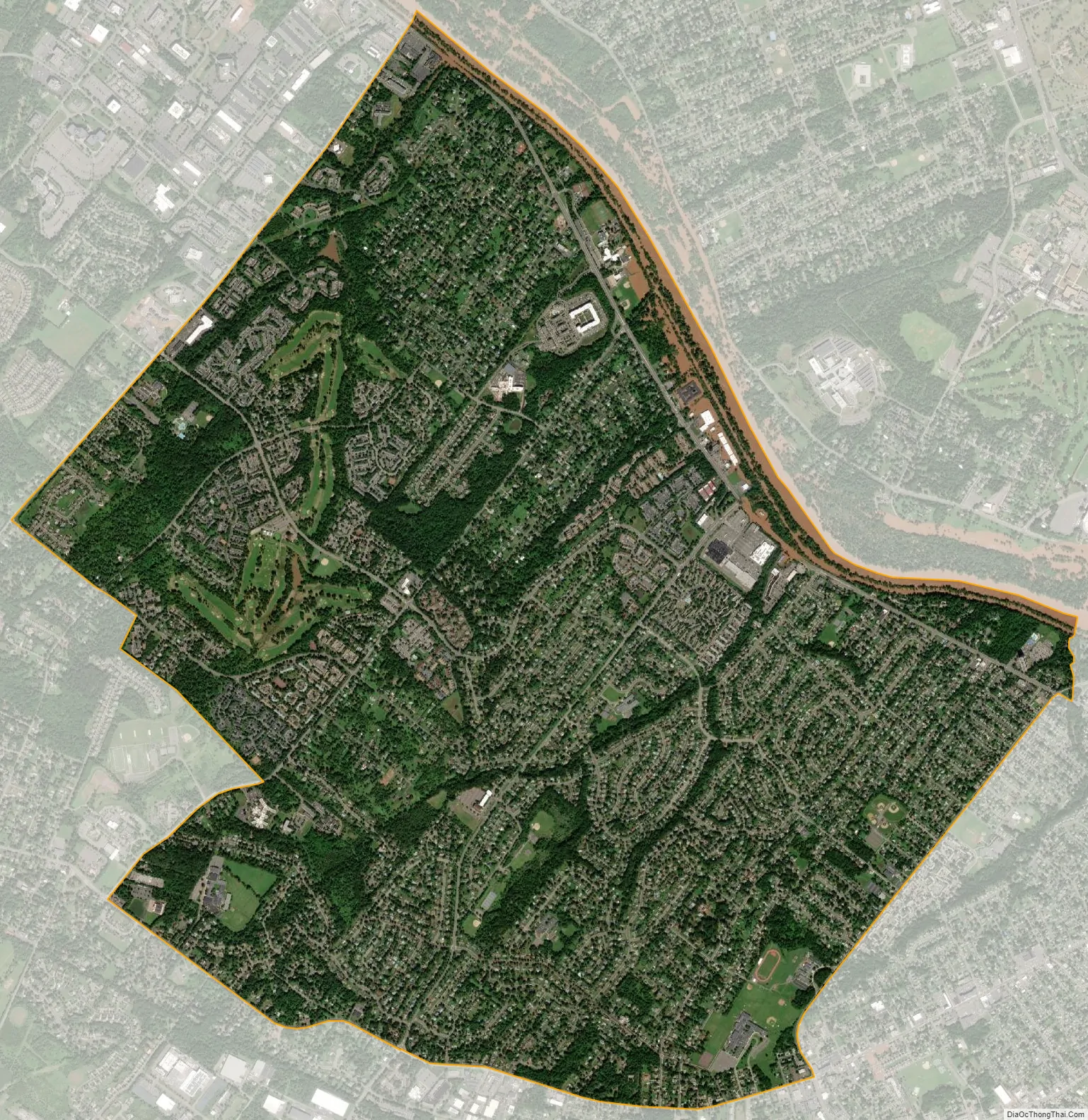
Somerset city Satellite Map
Geography
According to the United States Census Bureau, the CDP had a total area of 6.444 square miles (16.692 km), including 6.327 square miles (16.388 km) of land and 0.117 square miles (0.304 km) of water (1.82%).
Climate
The climate in the area is characterized by hot, humid summers and generally cool to cold winters. According to the Köppen climate classification system, Somerset has a humid continental climate, abbreviated “Dfa” on climate maps.
See also
Map of New Jersey State and its subdivision: Map of other states:- Alabama
- Alaska
- Arizona
- Arkansas
- California
- Colorado
- Connecticut
- Delaware
- District of Columbia
- Florida
- Georgia
- Hawaii
- Idaho
- Illinois
- Indiana
- Iowa
- Kansas
- Kentucky
- Louisiana
- Maine
- Maryland
- Massachusetts
- Michigan
- Minnesota
- Mississippi
- Missouri
- Montana
- Nebraska
- Nevada
- New Hampshire
- New Jersey
- New Mexico
- New York
- North Carolina
- North Dakota
- Ohio
- Oklahoma
- Oregon
- Pennsylvania
- Rhode Island
- South Carolina
- South Dakota
- Tennessee
- Texas
- Utah
- Vermont
- Virginia
- Washington
- West Virginia
- Wisconsin
- Wyoming


