Tavistock is a borough in Camden County, in the U.S. state of New Jersey. As of the 2020 United States census, the borough’s population was 9, an increase of 4 (+80.0%) from the 2010 census count of 5, which in turn reflected a decline of 19 (−79.2%) from the 24 counted in the 2000 census. As of the 2010 Census it was the smallest municipality by population in New Jersey, with seven fewer residents than nearby Pine Valley, which had 12, while the 2020 census placed Tavistock as second-smallest by population, two more than Walpack Township, New Jersey, which had a population of 7.
Tavistock was incorporated as a borough by an act of the New Jersey Legislature on February 16, 1921, from portions of the now-defunct Centre Township. The name of the borough came from the estate in England of a family of early settlers.
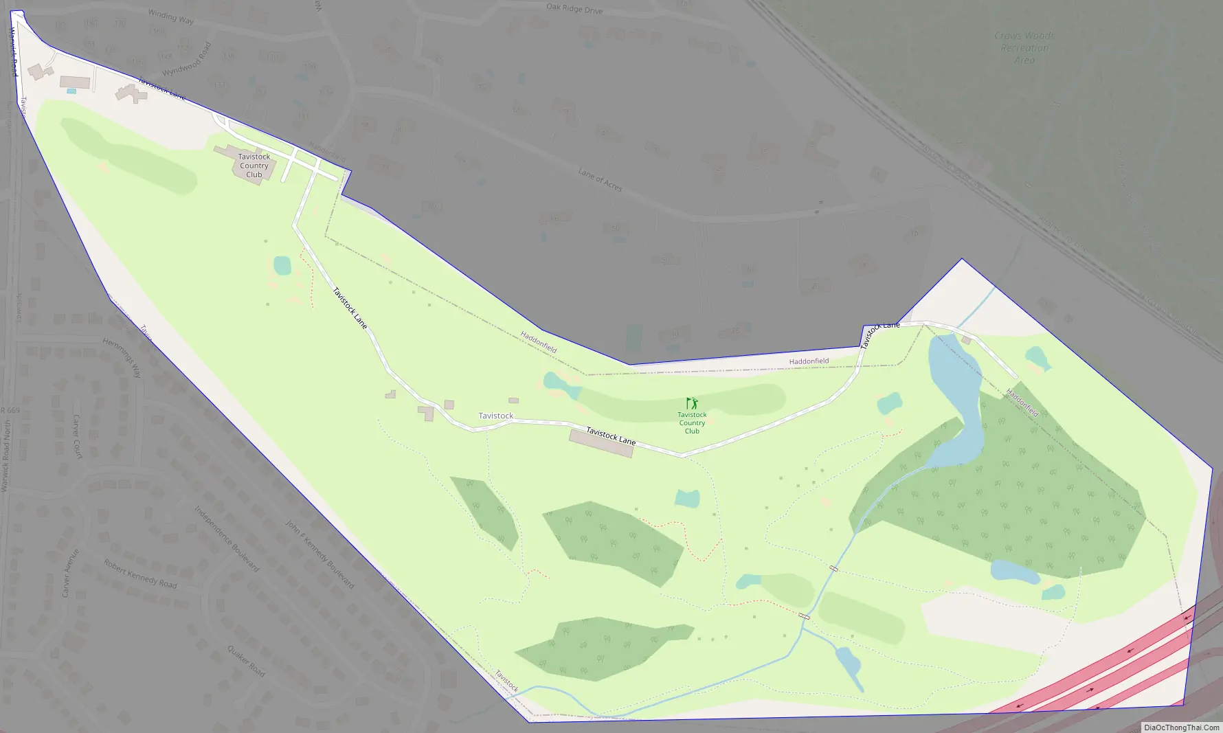
The borough was formed in order to allow the members of Tavistock Country Club to play golf on Sundays by members of the Victor Talking Machine Company. This was prohibited at the Haddon Country Club which was governed by a local blue law prohibiting sporting activities on Sundays. Tavistock’s secession from Haddonfield, New Jersey, the original site of the club, is said to have been driven by the fact that Haddonfield was (and remains) a dry borough, though Tavistock was formed in 1921 during Prohibition when liquor would have been banned. Members of the club included State Senator Joseph Wallworth and Assembly Speaker T. Harry Rowland, who helped push the bill that created the new municipality to unanimous approval in the New Jersey Legislature.
| Name: | Tavistock borough |
|---|---|
| LSAD Code: | 21 |
| LSAD Description: | borough (suffix) |
| State: | New Jersey |
| County: | Camden County |
| Incorporated: | February 16, 1921 |
| Elevation: | 46 ft (14 m) |
| Total Area: | 0.28 sq mi (0.71 km²) |
| Land Area: | 0.27 sq mi (0.71 km²) |
| Water Area: | 0.00 sq mi (0.01 km²) 1.07% |
| Total Population: | 9 |
| Population Density: | 33.0/sq mi (12.7/km²) |
| ZIP code: | 08033 – Haddonfield |
| Area code: | 856 |
| FIPS code: | 3472240 |
| GNISfeature ID: | 0885416 |
| Website: | www.tavistocknj.org |
Online Interactive Map
Click on ![]() to view map in "full screen" mode.
to view map in "full screen" mode.
Tavistock location map. Where is Tavistock borough?

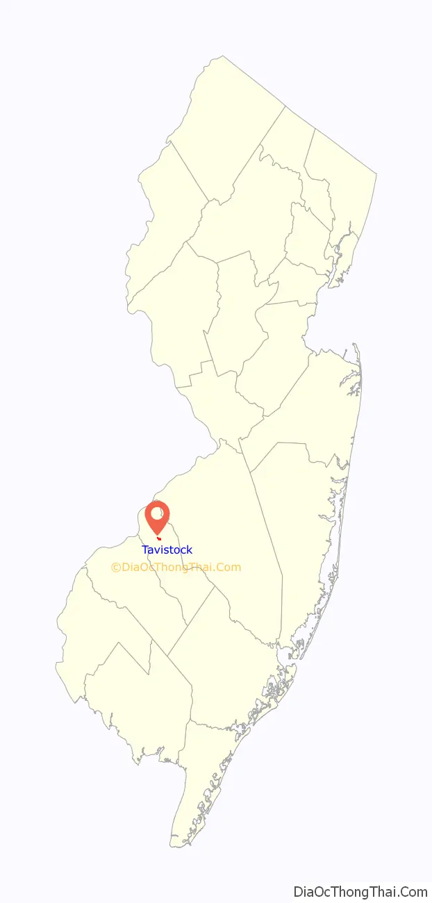
Tavistock Road Map
Tavistock city Satellite Map

Geography
According to the United States Census Bureau, the borough had a total area of 0.28 square miles (0.71 km), including 0.27 square miles (0.71 km) of land and <0.01 square miles (0.01 km) of water (1.07%).
The borough borders Barrington, Haddonfield, and Lawnside.
See also
Map of New Jersey State and its subdivision: Map of other states:- Alabama
- Alaska
- Arizona
- Arkansas
- California
- Colorado
- Connecticut
- Delaware
- District of Columbia
- Florida
- Georgia
- Hawaii
- Idaho
- Illinois
- Indiana
- Iowa
- Kansas
- Kentucky
- Louisiana
- Maine
- Maryland
- Massachusetts
- Michigan
- Minnesota
- Mississippi
- Missouri
- Montana
- Nebraska
- Nevada
- New Hampshire
- New Jersey
- New Mexico
- New York
- North Carolina
- North Dakota
- Ohio
- Oklahoma
- Oregon
- Pennsylvania
- Rhode Island
- South Carolina
- South Dakota
- Tennessee
- Texas
- Utah
- Vermont
- Virginia
- Washington
- West Virginia
- Wisconsin
- Wyoming


