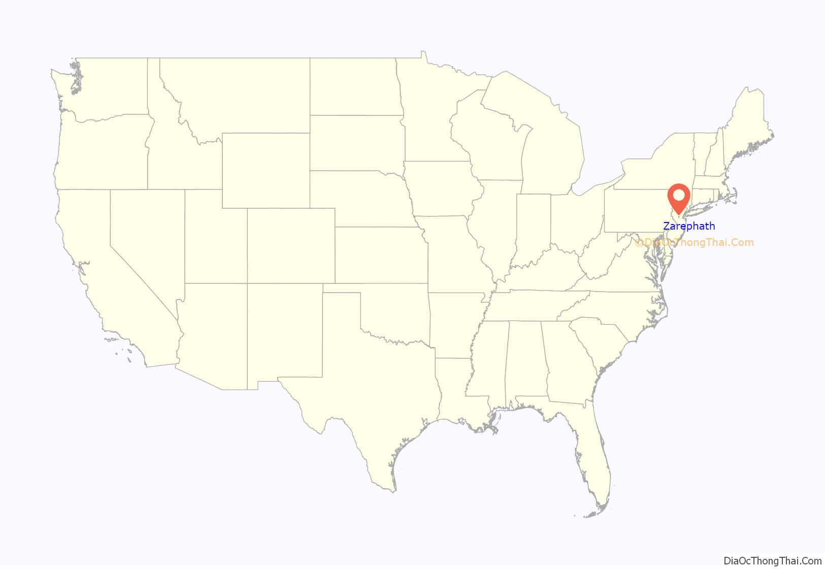
Zarephath (/ˈzærəˌfæθ/, ZARRA-fath) is an unincorporated community and census-designated place (CDP) and located in Franklin Township, in Somerset County, New Jersey, United States, about 15 mi (24 km) north of Princeton. As of the 2020 United States census, the CDP’s population was 69, an increase of 32 (+86.5%) from the 37 enumerated at the 2010 census.
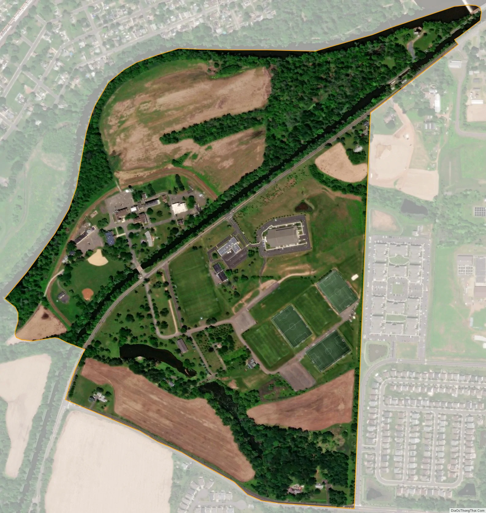
It was the communal home of the Pillar of Fire Church, and was the worldwide headquarters of Pillar of Fire International, which comprises the church’s college, Somerset Christian College, and radio station WAWZ-FM (the farm and publishing facilities have not been in operation since the late 1970s). It is named after Zarephath, the place in the Bible where the “widow woman” sustained the prophet Elijah. Zarephath was a group of buildings located between the Delaware and Raritan Canal and the Millstone River. Following the flooding in 2011 from Hurricane Irene, the College and all Pillar of Fire ministries were ordered to move out of this floodplain. The original campus has been slated for demolition and a new campus in Somerset was established.
| Name: | Zarephath CDP |
|---|---|
| LSAD Code: | 57 |
| LSAD Description: | CDP (suffix) |
| State: | New Jersey |
| County: | Somerset County |
| Elevation: | 75 ft (23 m) |
| Total Area: | 0.44 sq mi (1.13 km²) |
| Land Area: | 0.40 sq mi (1.04 km²) |
| Water Area: | 0.03 sq mi (0.09 km²) 9.12% |
| Total Population: | 69 |
| Population Density: | 172.5/sq mi (66.6/km²) |
| ZIP code: | 08890 |
| Area code: | 908 |
| FIPS code: | 3483290 |
| GNISfeature ID: | 02584041 |
Online Interactive Map
Click on ![]() to view map in "full screen" mode.
to view map in "full screen" mode.
Zarephath location map. Where is Zarephath CDP?
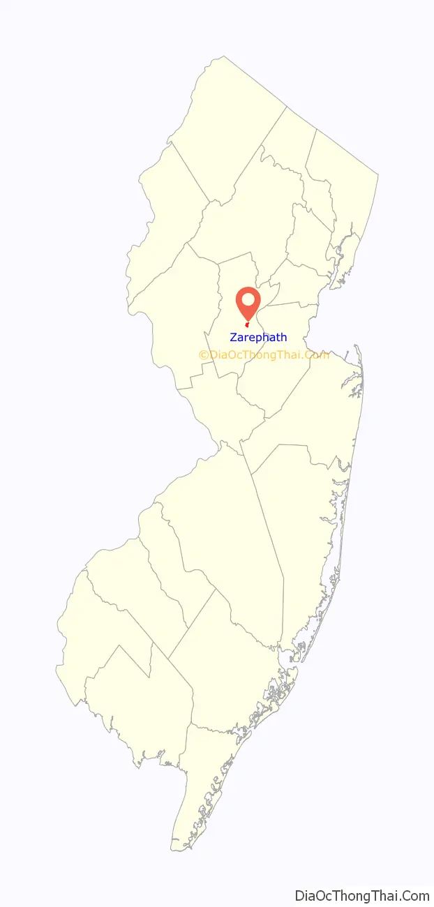
Zarephath Road Map
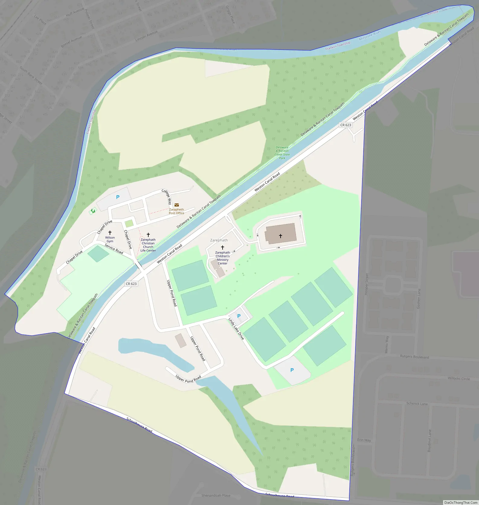
Zarephath city Satellite Map
Geography
According to the United States Census Bureau, Zarephath had a total area of 0.445 square miles (1.152 km), including 0.404 square miles (1.047 km) of it is land and 0.041 square miles (0.105 km) of water (9.12%) is water.
See also
Map of New Jersey State and its subdivision: Map of other states:- Alabama
- Alaska
- Arizona
- Arkansas
- California
- Colorado
- Connecticut
- Delaware
- District of Columbia
- Florida
- Georgia
- Hawaii
- Idaho
- Illinois
- Indiana
- Iowa
- Kansas
- Kentucky
- Louisiana
- Maine
- Maryland
- Massachusetts
- Michigan
- Minnesota
- Mississippi
- Missouri
- Montana
- Nebraska
- Nevada
- New Hampshire
- New Jersey
- New Mexico
- New York
- North Carolina
- North Dakota
- Ohio
- Oklahoma
- Oregon
- Pennsylvania
- Rhode Island
- South Carolina
- South Dakota
- Tennessee
- Texas
- Utah
- Vermont
- Virginia
- Washington
- West Virginia
- Wisconsin
- Wyoming


