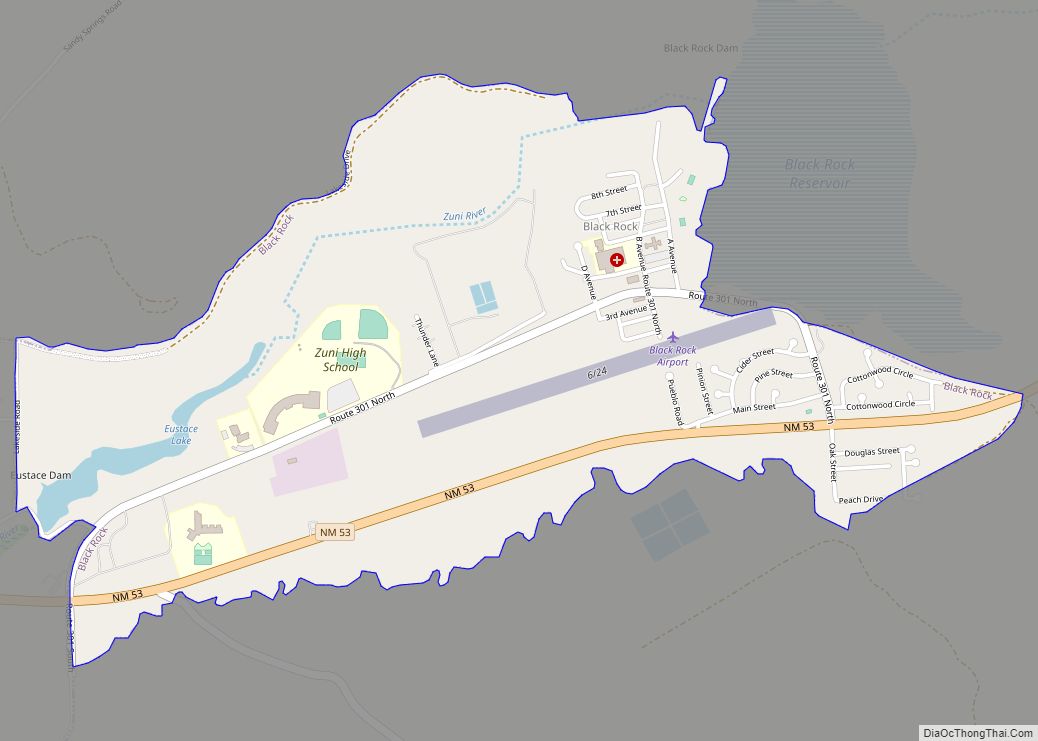
Black Rock (Navajo: Tsézhįįh Deezlį́) is an unincorporated community and a census-designated place (CDP) in McKinley County, New Mexico, United States. The population was 1,323 at the 2010 census.
| Name: | Black Rock CDP |
|---|---|
| LSAD Code: | 57 |
| LSAD Description: | CDP (suffix) |
| State: | New Mexico |
| County: | McKinley County |
| Elevation: | 6,453 ft (1,967 m) |
| Total Area: | 1.80 sq mi (4.66 km²) |
| Land Area: | 1.75 sq mi (4.52 km²) |
| Water Area: | 0.05 sq mi (0.14 km²) |
| Total Population: | 1,190 |
| Population Density: | 681.56/sq mi (263.15/km²) |
| ZIP code: | 87327 |
| Area code: | 505 |
| FIPS code: | 3507670 |
| GNISfeature ID: | 0899539 |
Online Interactive Map
Click on ![]() to view map in "full screen" mode.
to view map in "full screen" mode.
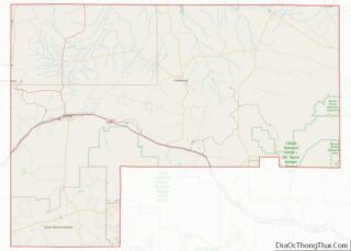
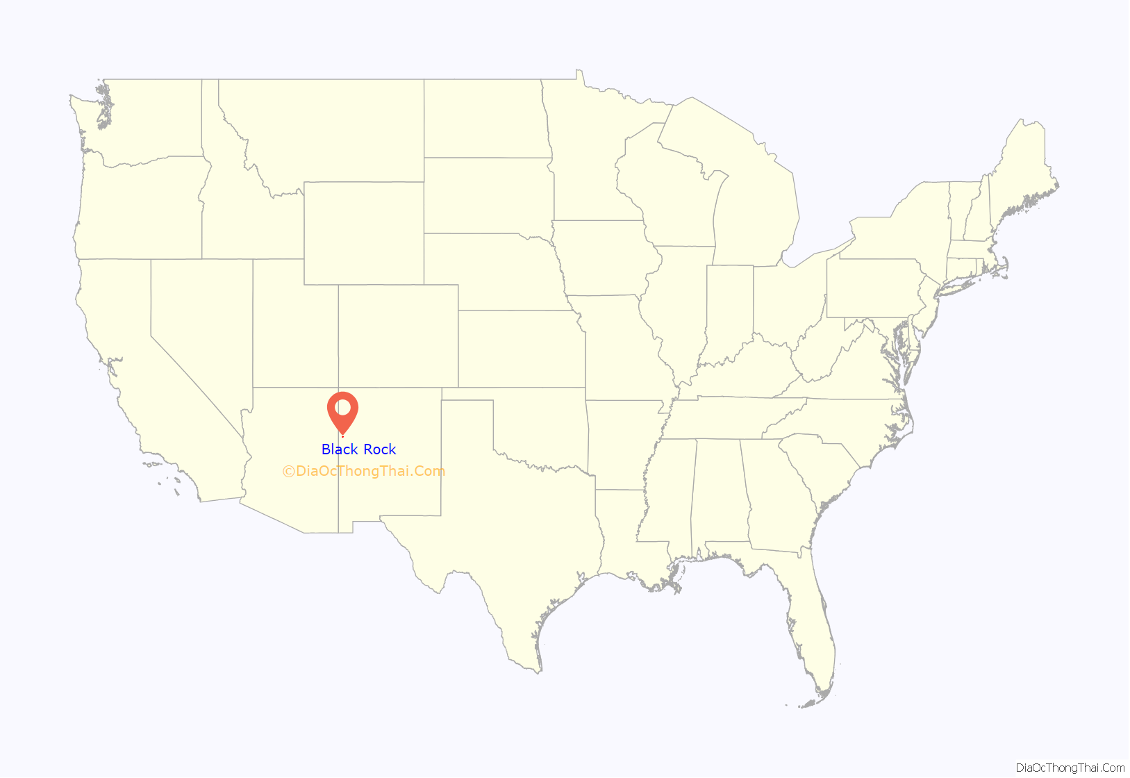
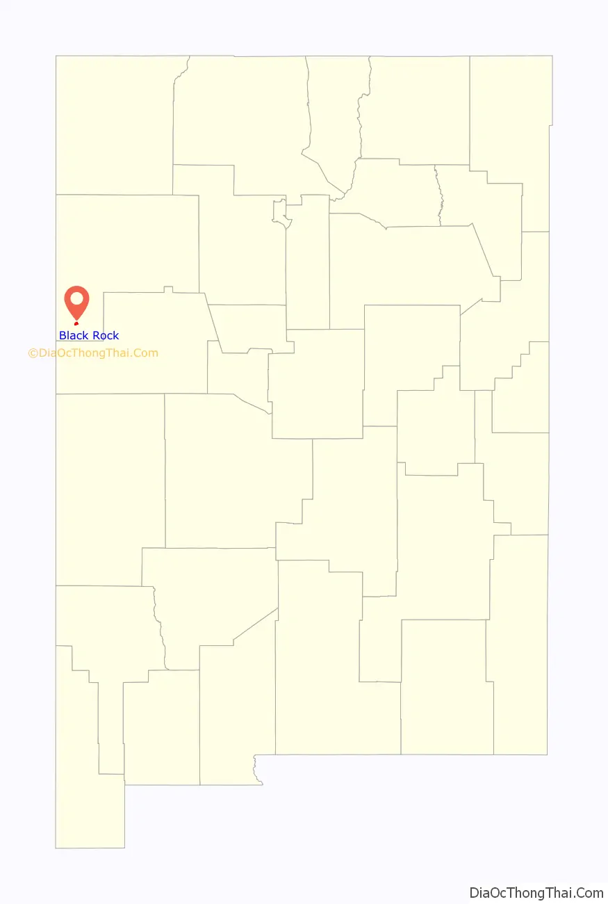
Black Rock location map. Where is Black Rock CDP?
History
There was a spring at Black Rock and the Zuñi had irrigated fields there since about 3000 BP (950 BCE). The Zuñi had a small, seasonally occupied village on the lava flow, just north of the river, which the Spanish called “Ranchos de Zuñi”.
Black Rock Road Map
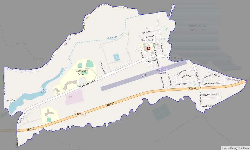
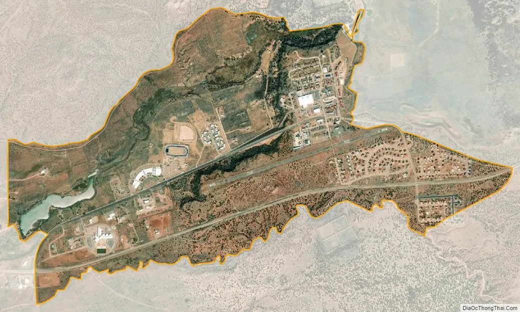
Black Rock city Satellite Map
Geography
Black Rock is located on the Zuñi Reservation on the left bank (south side) of the Zuñi River, approximately four miles east of the town of Zuñi, on the north side of NM Route 53. Immediately to the east of the community is the Black Rock Reservoir, which was created in 1908 by damming the Zuni River. The dam has undergone serious rebuilding three times since 1908, the most recent in the mid 1990s. Black Rock has a non-commercial airstrip built just after World War II, but not paved until 1970.
According to the United States Census Bureau, the CDP has a total area of 1.8 square miles (4.7 km), of which 1.7 square miles (4.4 km) is land and 0.1 square miles (0.26 km) (3.43%) is water.
See also
Map of New Mexico State and its subdivision: Map of other states:- Alabama
- Alaska
- Arizona
- Arkansas
- California
- Colorado
- Connecticut
- Delaware
- District of Columbia
- Florida
- Georgia
- Hawaii
- Idaho
- Illinois
- Indiana
- Iowa
- Kansas
- Kentucky
- Louisiana
- Maine
- Maryland
- Massachusetts
- Michigan
- Minnesota
- Mississippi
- Missouri
- Montana
- Nebraska
- Nevada
- New Hampshire
- New Jersey
- New Mexico
- New York
- North Carolina
- North Dakota
- Ohio
- Oklahoma
- Oregon
- Pennsylvania
- Rhode Island
- South Carolina
- South Dakota
- Tennessee
- Texas
- Utah
- Vermont
- Virginia
- Washington
- West Virginia
- Wisconsin
- Wyoming