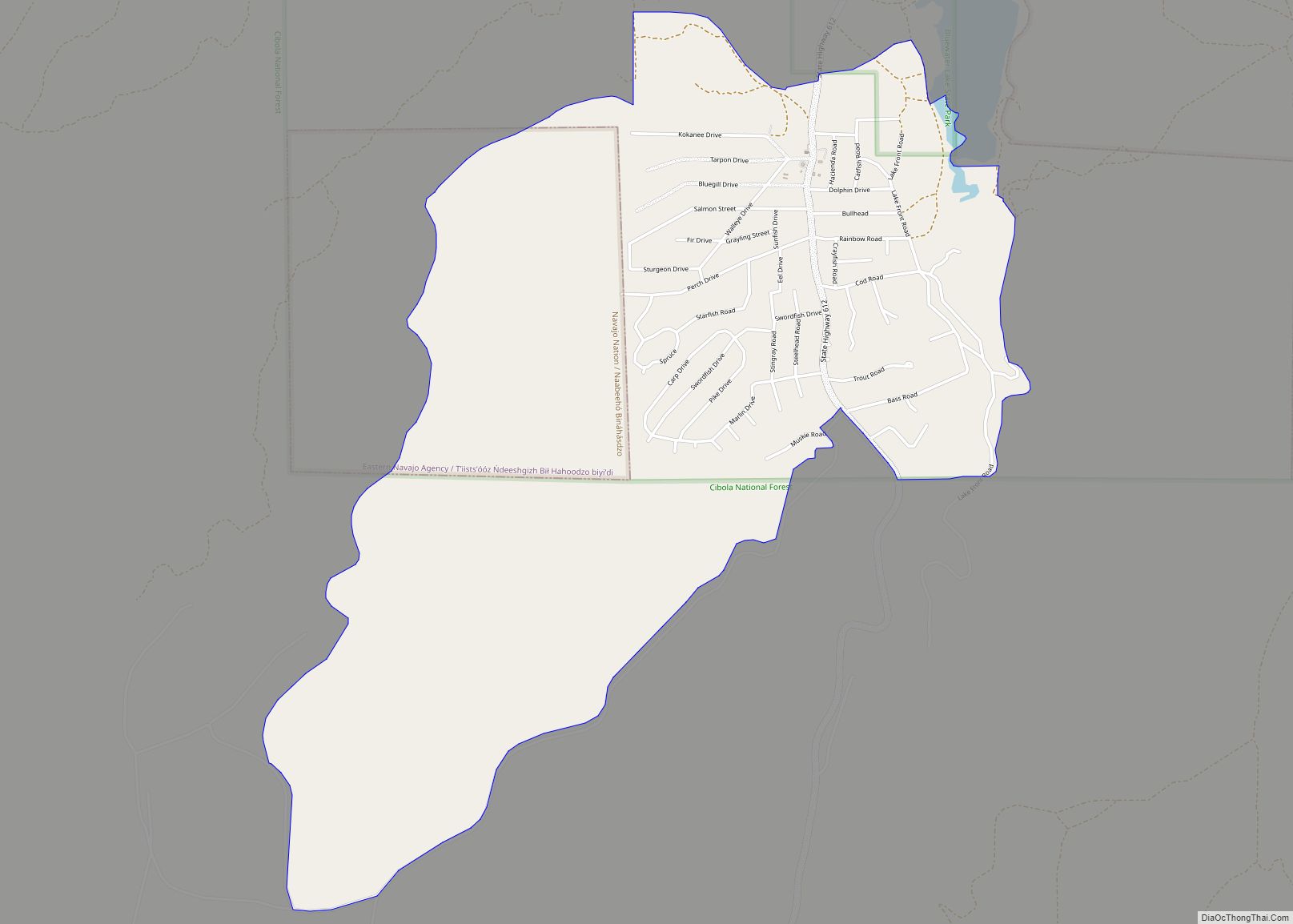
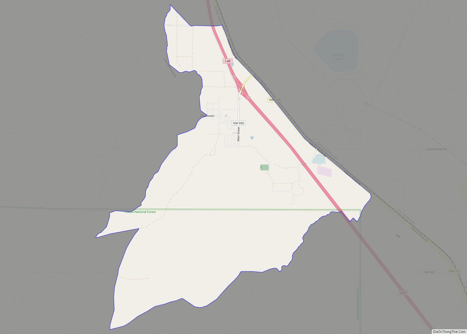
Las Tusas is a census-designated place (CDP) in Cibola County, New Mexico, United States. At the 2010 census the CDP was known as Bluewater Acres and had a population of 206.
| Name: | Bluewater Acres CDP |
|---|---|
| LSAD Code: | 57 |
| LSAD Description: | CDP (suffix) |
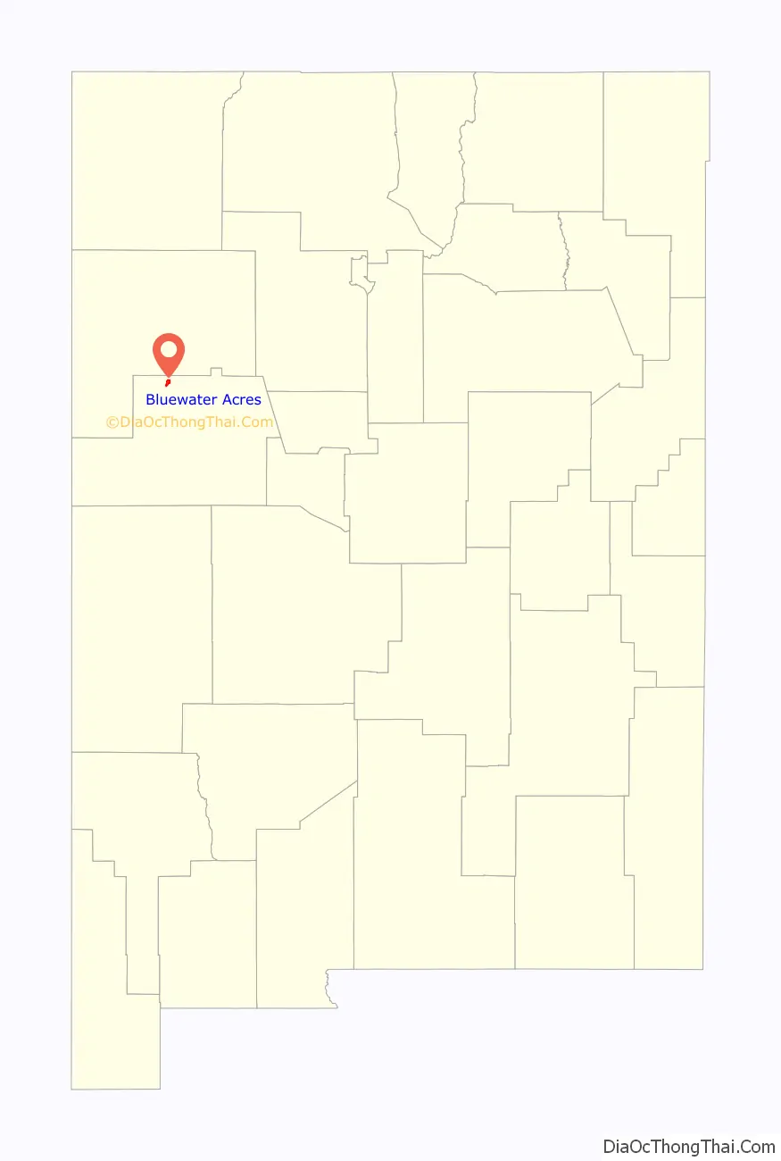
| State: | New Mexico |
| County: | Cibola County |
| Elevation: | 7,475 ft (2,278 m) |
| Total Area: | 1.27 sq mi (3.28 km²) |
| Land Area: | 1.27 sq mi (3.28 km²) |
| Water Area: | 0.00 sq mi (0.00 km²) |
| Total Population: | 253 |
| Population Density: | 199.84/sq mi (77.16/km²) |
| Area code: | 505 |
| FIPS code: | 3508185 |
| GNISfeature ID: | 2584058 |
Online Interactive Map
Click on ![]() to view map in "full screen" mode.
to view map in "full screen" mode.
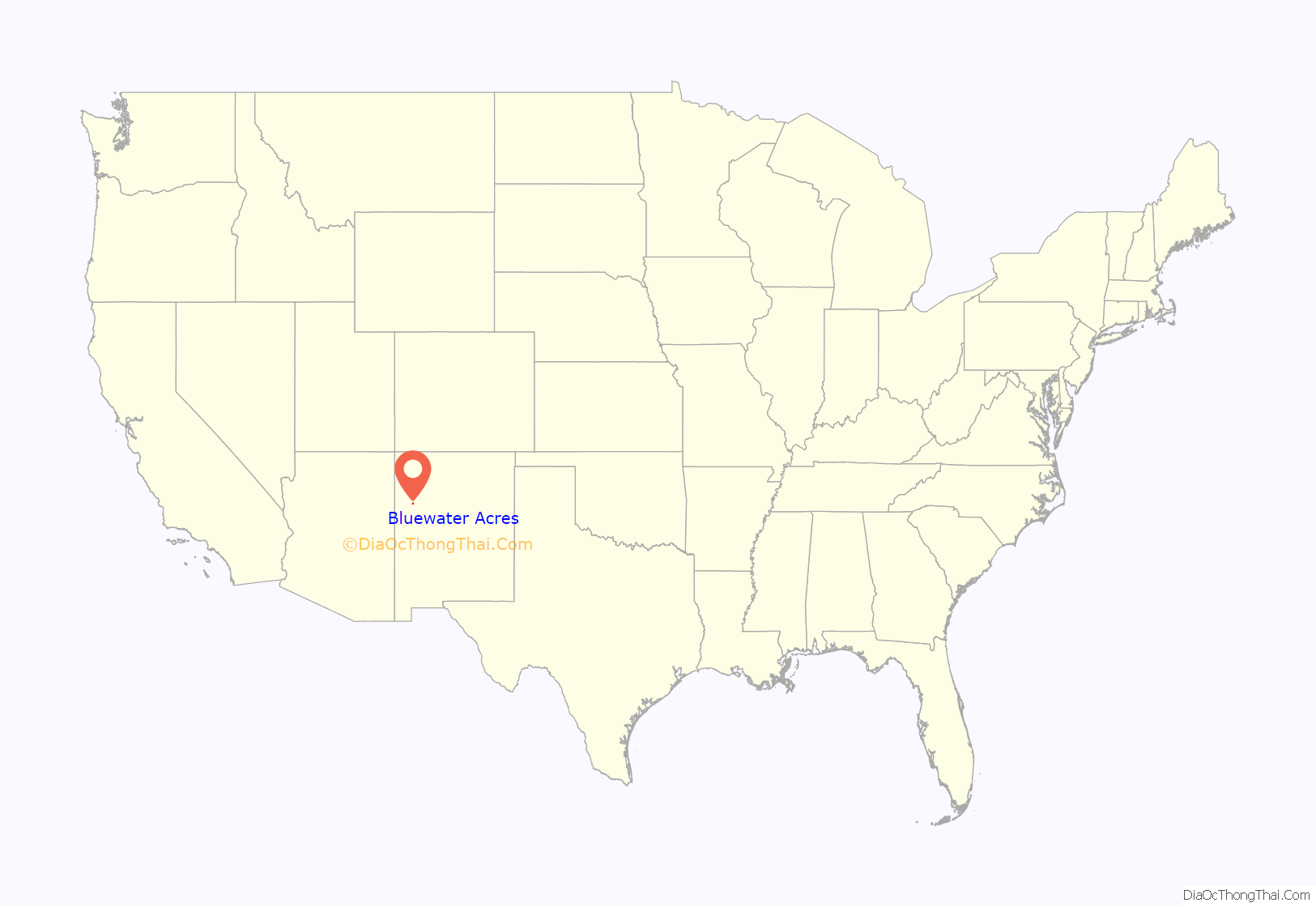
Bluewater Acres location map. Where is Bluewater Acres CDP?
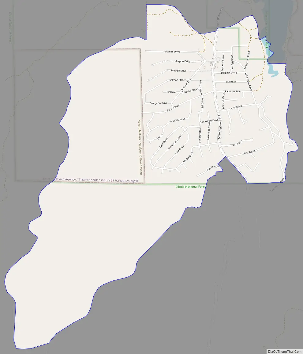
Bluewater Acres Road Map
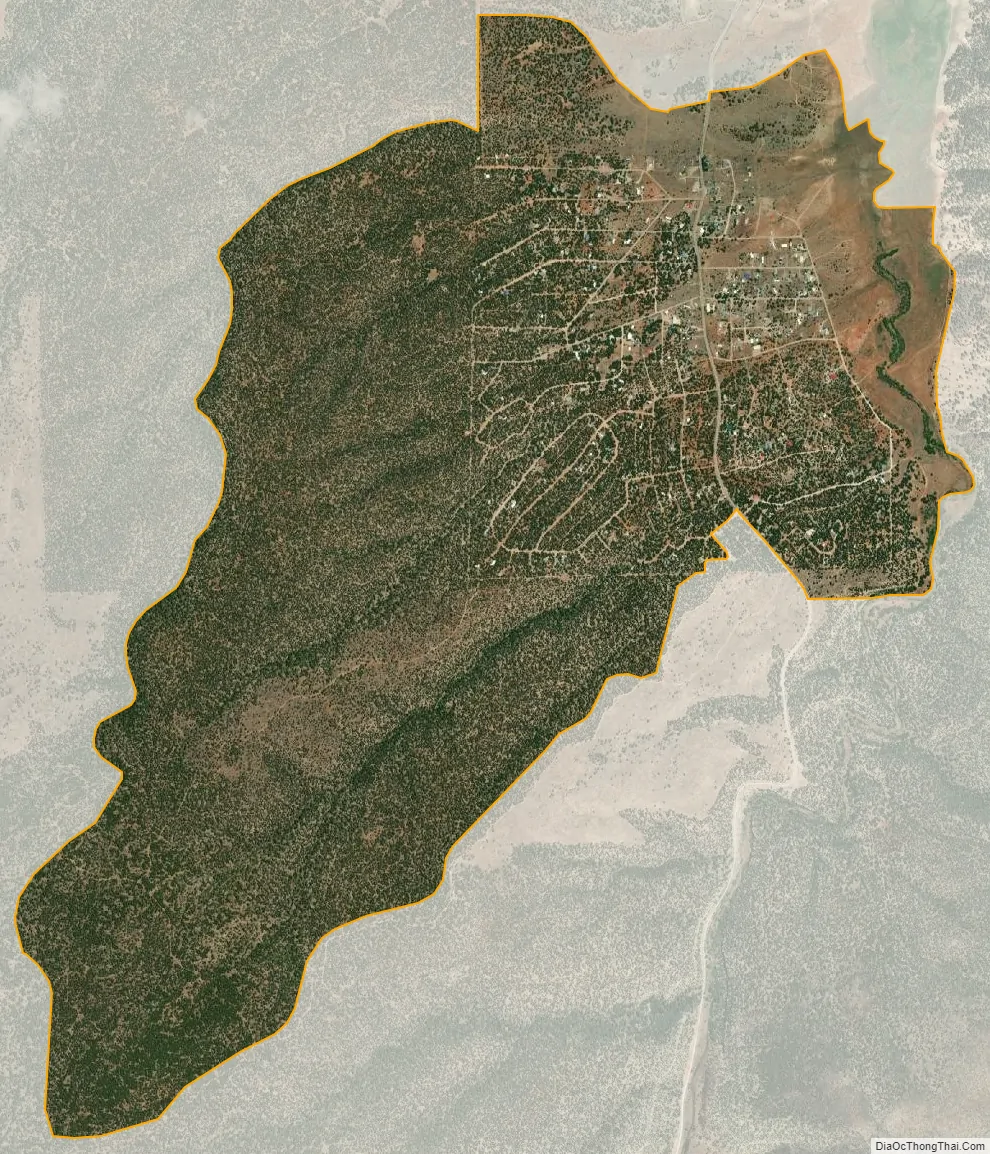
Bluewater Acres city Satellite Map
Geography
Las Tusas is located in northwestern Cibola County, near the southern tip of Bluewater Lake, a reservoir on Bluewater Creek north of Salitre Mesa. New Mexico State Road 612 (Bluewater Road) leads north from the community 12 miles (19 km) to Thoreau and Interstate 40. A Forest Service road leads south from Bluewater Acres through Cibola National Forest 25 miles (40 km) to NM 53 near the Continental Divide.
According to the United States Census Bureau, the Las Tusas CDP has a total area of 1.3 square miles (3.3 km), all land.
See also
Map of New Mexico State and its subdivision: Map of other states:- Alabama
- Alaska
- Arizona
- Arkansas
- California
- Colorado
- Connecticut
- Delaware
- District of Columbia
- Florida
- Georgia
- Hawaii
- Idaho
- Illinois
- Indiana
- Iowa
- Kansas
- Kentucky
- Louisiana
- Maine
- Maryland
- Massachusetts
- Michigan
- Minnesota
- Mississippi
- Missouri
- Montana
- Nebraska
- Nevada
- New Hampshire
- New Jersey
- New Mexico
- New York
- North Carolina
- North Dakota
- Ohio
- Oklahoma
- Oregon
- Pennsylvania
- Rhode Island
- South Carolina
- South Dakota
- Tennessee
- Texas
- Utah
- Vermont
- Virginia
- Washington
- West Virginia
- Wisconsin
- Wyoming