Grants is a city in Cibola County, New Mexico, United States. It is located about 78 miles (126 km) west of Albuquerque. The population was 9,163 at the 2020 Census. It is the county seat of Cibola County.
Grants is located along the Trails of the Ancients Byway, one of the designated New Mexico Scenic Byways.
| Name: | Grants city |
|---|---|
| LSAD Code: | 25 |
| LSAD Description: | city (suffix) |
| State: | New Mexico |
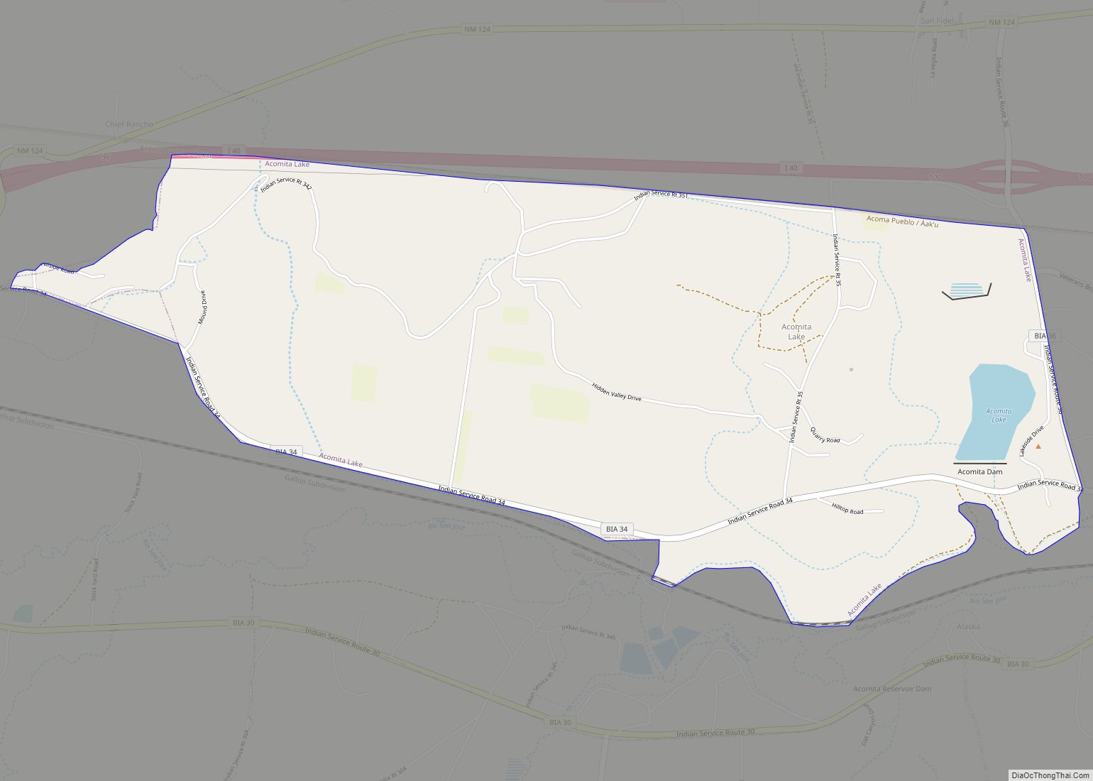
| County: | Cibola County |
| Founded: | 1872 (as Los Alamitos) |
| Elevation: | 6,460 ft (1,970 m) |
| Total Area: | 14.91 sq mi (38.62 km²) |
| Land Area: | 14.91 sq mi (38.62 km²) |
| Water Area: | 0.00 sq mi (0.00 km²) |
| Total Population: | 9,163 |
| Population Density: | 614.43/sq mi (237.24/km²) |
| ZIP code: | 87020 |
| Area code: | 505 |
| FIPS code: | 3530490 |
| GNISfeature ID: | 0933386 |
| Website: | www.cityofgrants.net |
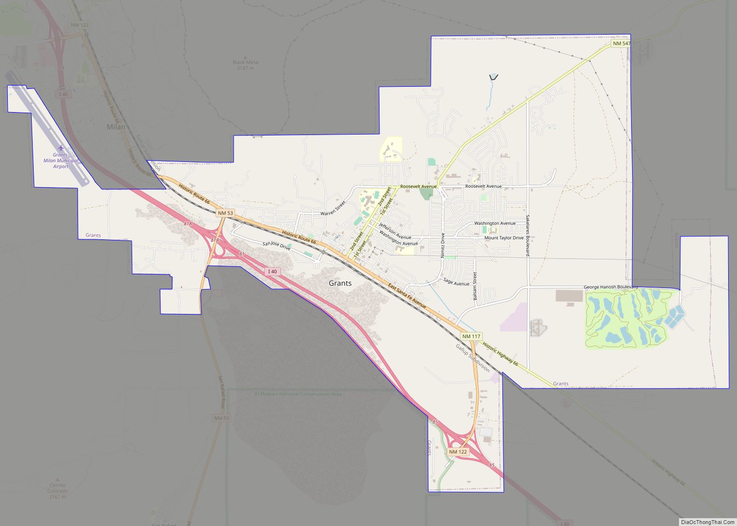
Online Interactive Map
Click on ![]() to view map in "full screen" mode.
to view map in "full screen" mode.
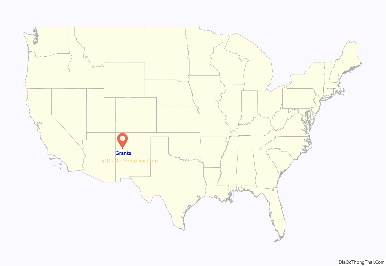
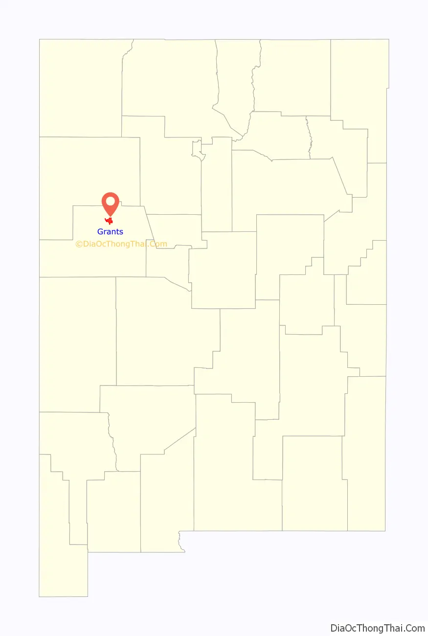
Grants location map. Where is Grants city?
History
Grants began as a railroad camp in the 1880s, when three Canadian brothers – Angus A. Grant, John R. Grant, and Lewis A. Grant – were awarded a contract to build a section of the Atlantic and Pacific Railroad through the region. The Grant brothers’ camp was first called Grants Camp, then Grants Station, and finally Grants. The new city enveloped the existing colonial New Mexican settlement of Los Alamitos and grew along the tracks of the Atlantic and Pacific Railroad.
The town prospered as a result of railroad logging in the nearby Zuni Mountains, and it served as a section point for the Atlantic and Pacific, which became part of the Atchison, Topeka and Santa Fe Railway. The Zuni Mountain Railroad short line had a roundhouse in town (near present-day Exit 81 off Interstate 40) and housed workers in a small community named Breecetown. Timber from the Zuni Mountains was shipped to Albuquerque, where a large sawmill converted the timber to wood products that were sold around the west.
After the decline of logging in the 1930s, Grants-Milan gained fame as the “carrot capital” of the United States. Agriculture was aided by the creation of Bluewater Reservoir, and the region’s volcanic soils provided ideal conditions for farming. Grants also benefited from its location, both being an airway beacon and later by U.S. Route 66, which brought travelers and tourists and the businesses that catered to them. Today the beacon and FSS building on the airport (KGNT) is being restored as the Western New Mexico Aviation Heritage Museum.
Perhaps the most memorable boom in the town’s history occurred when Paddy Martinez, a Navajo shepherd, discovered uranium ore near Haystack Mesa, sparking a mining boom that lasted until the 1980s (see Uranium mining in New Mexico). The collapse of mining pulled the town into a depression, but the town has enjoyed a resurgence based on interest in tourism and the scenic beauty of the region. Recent interest in nuclear power has revived the possibility of more uranium mining in the area, and energy companies still own viable mining properties and claims in the area.
Grants Road Map
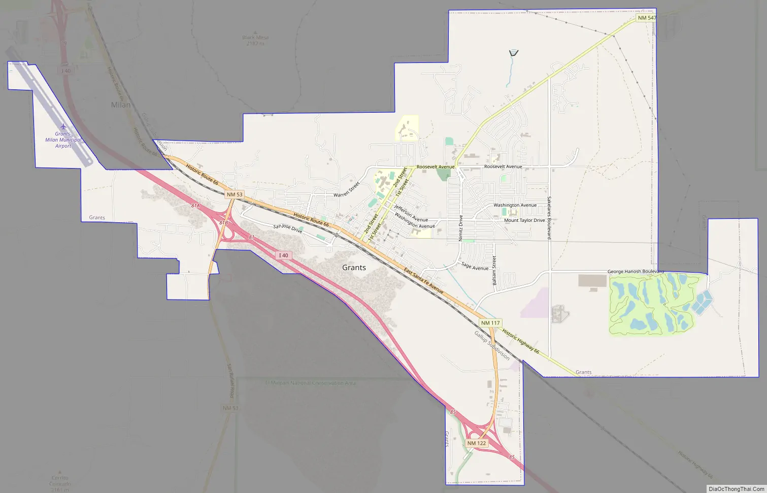
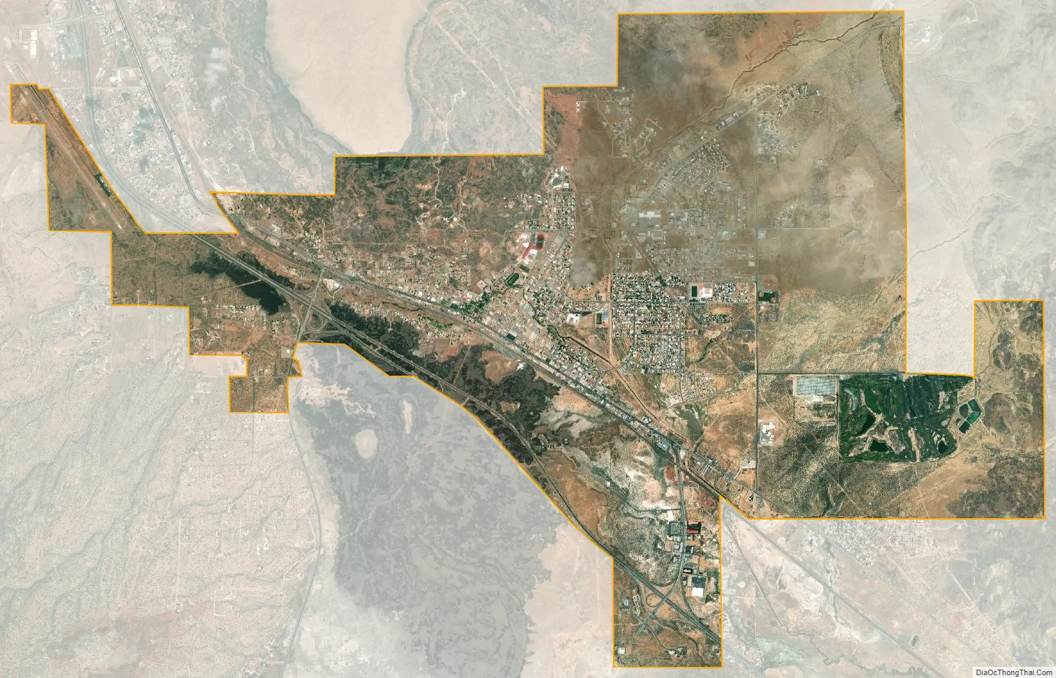
Grants city Satellite Map
Geography
Grants is located in north-central Cibola County. Santa Fe Avenue (former Route 66) is the main road through the city, while Interstate 40 passes through the south side of the city, with access from exits 81 and 85. I-40 leads 78 miles (126 km) east to Albuquerque and west 61 miles (98 km) to Gallup. The town of Milan borders the northwest end of Grants.
According to the United States Census Bureau, the city has a total area of 14.9 square miles (38.5 km), all land. Grants is on the north end of the large and recent (youngest flows around 3,000 years old) lava field known as El Malpais (“the badlands”), part of which is preserved as El Malpais National Monument. To the northeast of town are the San Mateo Mountains and Mount Taylor, at 11,301 feet (3,445 m) the highest peak in the region. West of the city is the Continental Divide and the Zuni Mountains, an eroded anticline with 2-billion-year-old Precambrian granites and metamorphic rocks at its core. The region is primarily high desert country, dominated by sandstones and lava flows.
See also
Map of New Mexico State and its subdivision: Map of other states:- Alabama
- Alaska
- Arizona
- Arkansas
- California
- Colorado
- Connecticut
- Delaware
- District of Columbia
- Florida
- Georgia
- Hawaii
- Idaho
- Illinois
- Indiana
- Iowa
- Kansas
- Kentucky
- Louisiana
- Maine
- Maryland
- Massachusetts
- Michigan
- Minnesota
- Mississippi
- Missouri
- Montana
- Nebraska
- Nevada
- New Hampshire
- New Jersey
- New Mexico
- New York
- North Carolina
- North Dakota
- Ohio
- Oklahoma
- Oregon
- Pennsylvania
- Rhode Island
- South Carolina
- South Dakota
- Tennessee
- Texas
- Utah
- Vermont
- Virginia
- Washington
- West Virginia
- Wisconsin
- Wyoming