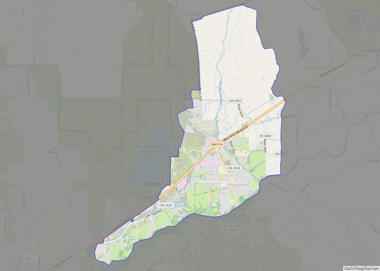
Flora Vista is a census-designated place (CDP) in San Juan County, New Mexico, United States. The population was 1,383 at the 2000 census. It is part of the Farmington Metropolitan Statistical Area. Flora Vista was founded in 1877 by settlers from Colorado who built cabins along the Animas River. A post office was established the following year. The name derived from the view of wildflowers in the valley.
| Name: | Flora Vista CDP |
|---|---|
| LSAD Code: | 57 |
| LSAD Description: | CDP (suffix) |
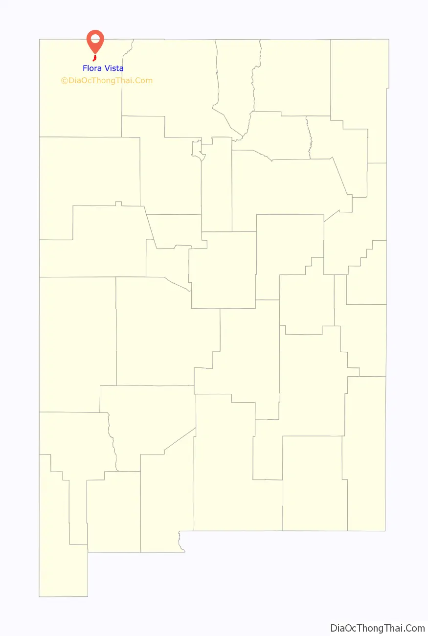
| State: | New Mexico |
| County: | San Juan County |
| Elevation: | 5,509 ft (1,679 m) |
| Total Area: | 5.04 sq mi (13.07 km²) |
| Land Area: | 4.95 sq mi (12.83 km²) |
| Water Area: | 0.09 sq mi (0.24 km²) |
| Total Population: | 2,048 |
| Population Density: | 413.57/sq mi (159.67/km²) |
| ZIP code: | 87415 |
| Area code: | 505 |
| FIPS code: | 3526360 |
| GNISfeature ID: | 0889098 |
Online Interactive Map
Click on ![]() to view map in "full screen" mode.
to view map in "full screen" mode.
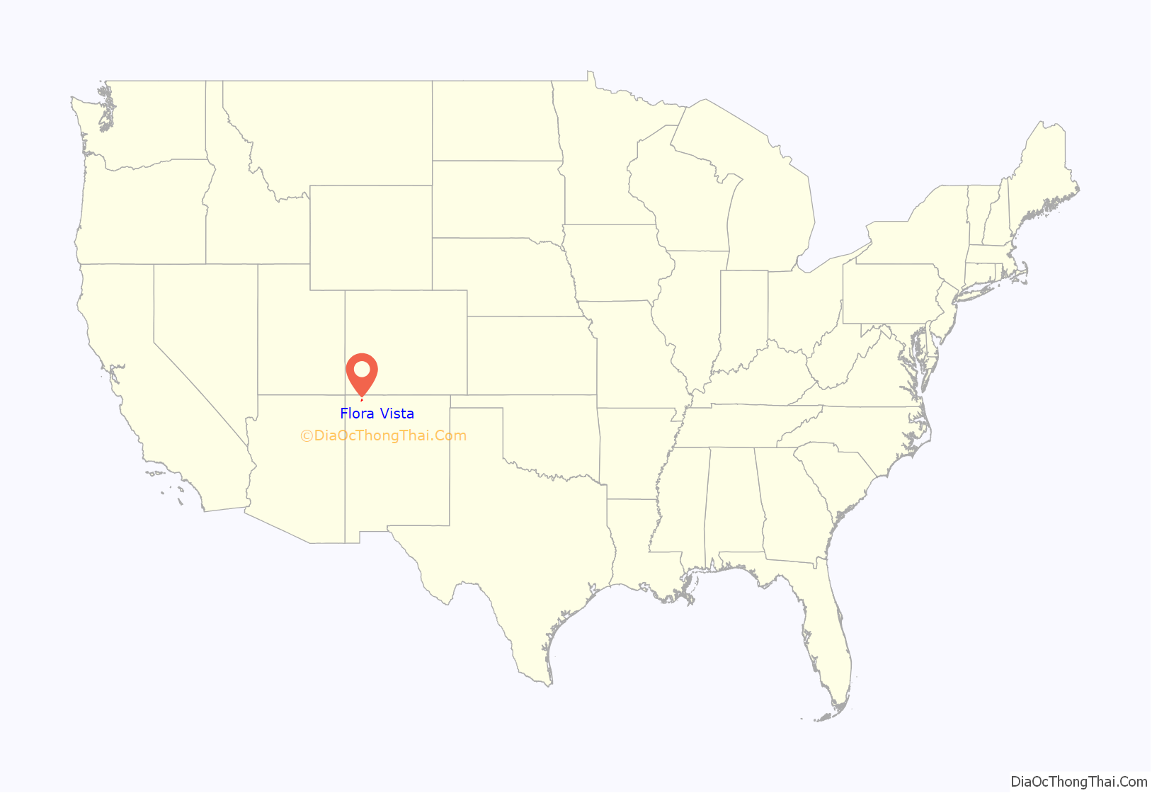
Flora Vista location map. Where is Flora Vista CDP?
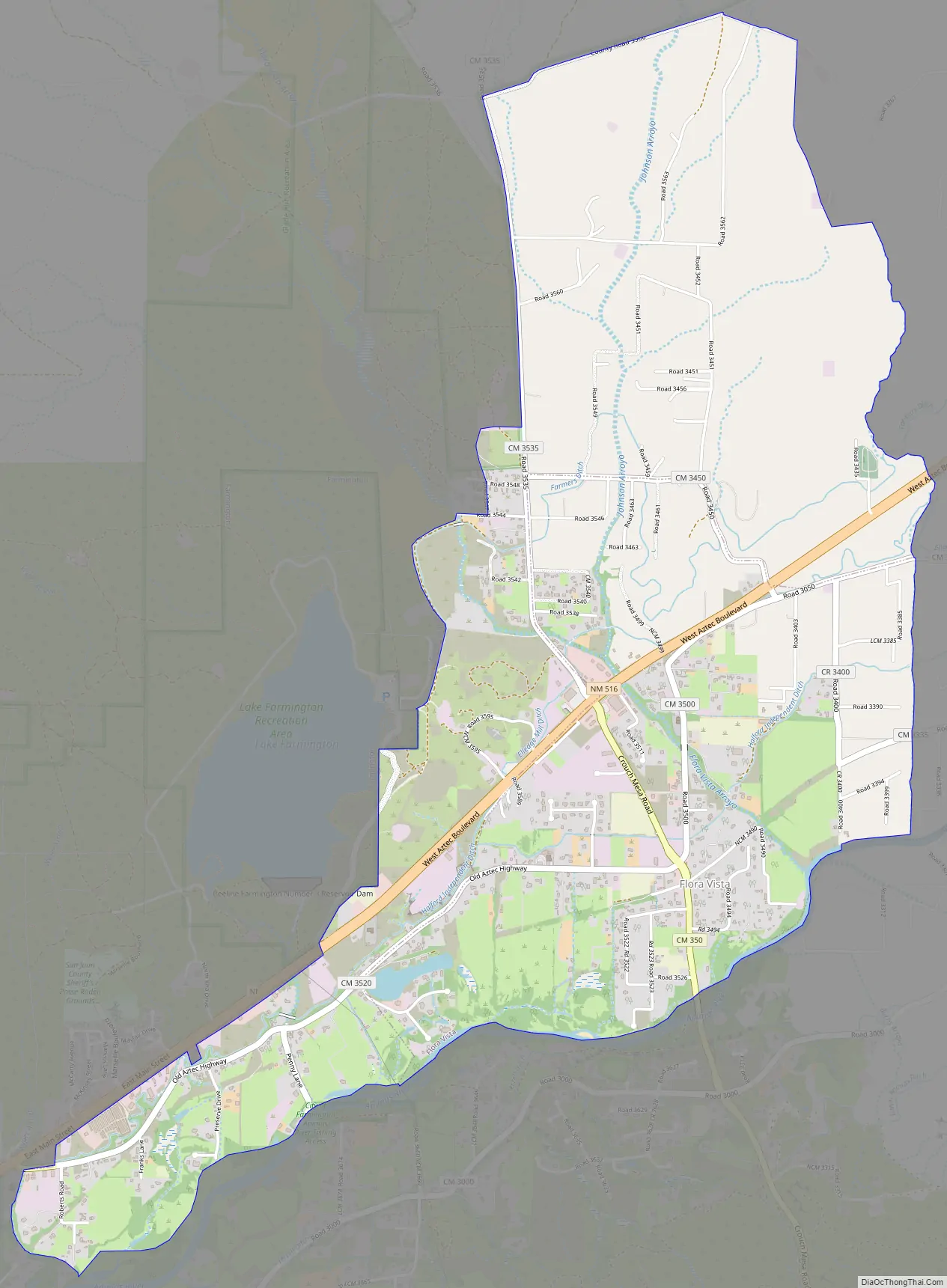
Flora Vista Road Map
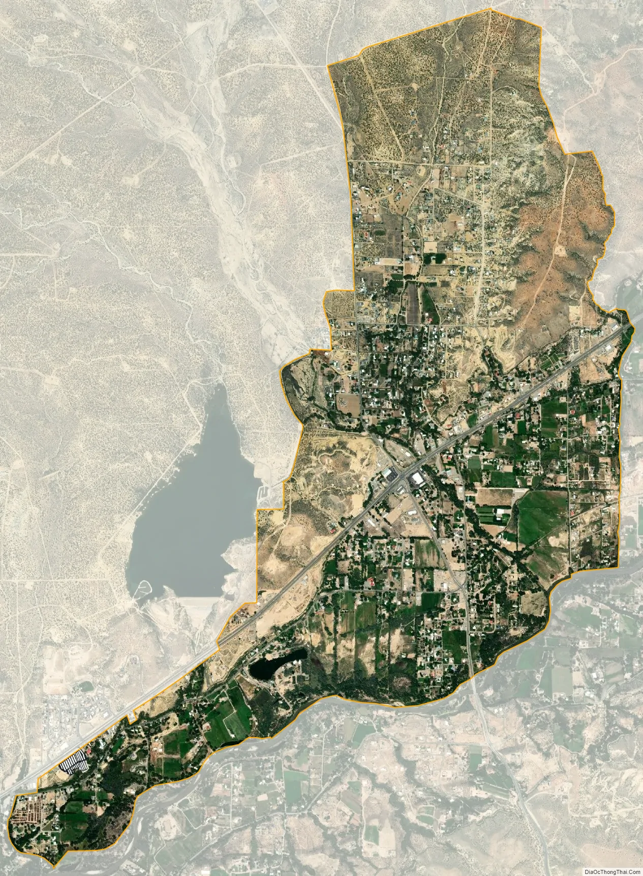
Flora Vista city Satellite Map
Geography
Flora Vista is located at 36°48′08″N 108°04′57″W / 36.802152°N 108.082603°W / 36.802152; -108.082603.
According to the United States Census Bureau, the CDP has a total area of 2.1 square miles (5.4 km), of which 2.0 square miles (5.2 km) is land and 0.04 square miles (0.10 km) (1.93%) is water.
See also
Map of New Mexico State and its subdivision: Map of other states:- Alabama
- Alaska
- Arizona
- Arkansas
- California
- Colorado
- Connecticut
- Delaware
- District of Columbia
- Florida
- Georgia
- Hawaii
- Idaho
- Illinois
- Indiana
- Iowa
- Kansas
- Kentucky
- Louisiana
- Maine
- Maryland
- Massachusetts
- Michigan
- Minnesota
- Mississippi
- Missouri
- Montana
- Nebraska
- Nevada
- New Hampshire
- New Jersey
- New Mexico
- New York
- North Carolina
- North Dakota
- Ohio
- Oklahoma
- Oregon
- Pennsylvania
- Rhode Island
- South Carolina
- South Dakota
- Tennessee
- Texas
- Utah
- Vermont
- Virginia
- Washington
- West Virginia
- Wisconsin
- Wyoming