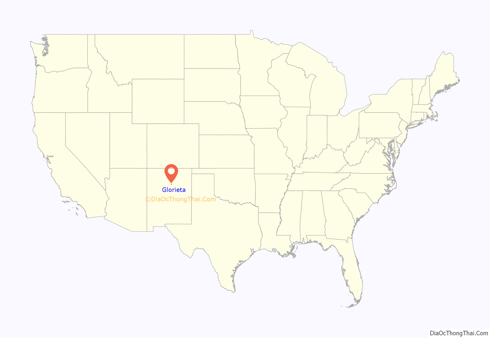
Glorieta is a census-designated place (CDP) in Santa Fe County, New Mexico, United States. It is part of the Albuquerque–Santa Fe–Las Vegas combined statistical area. The population was 430 at the 2010 census. The community is located in the southern Sangre de Cristo Mountains, along Interstate 25 on the east side of Glorieta Pass.
| Name: | Glorieta CDP |
|---|---|
| LSAD Code: | 57 |
| LSAD Description: | CDP (suffix) |
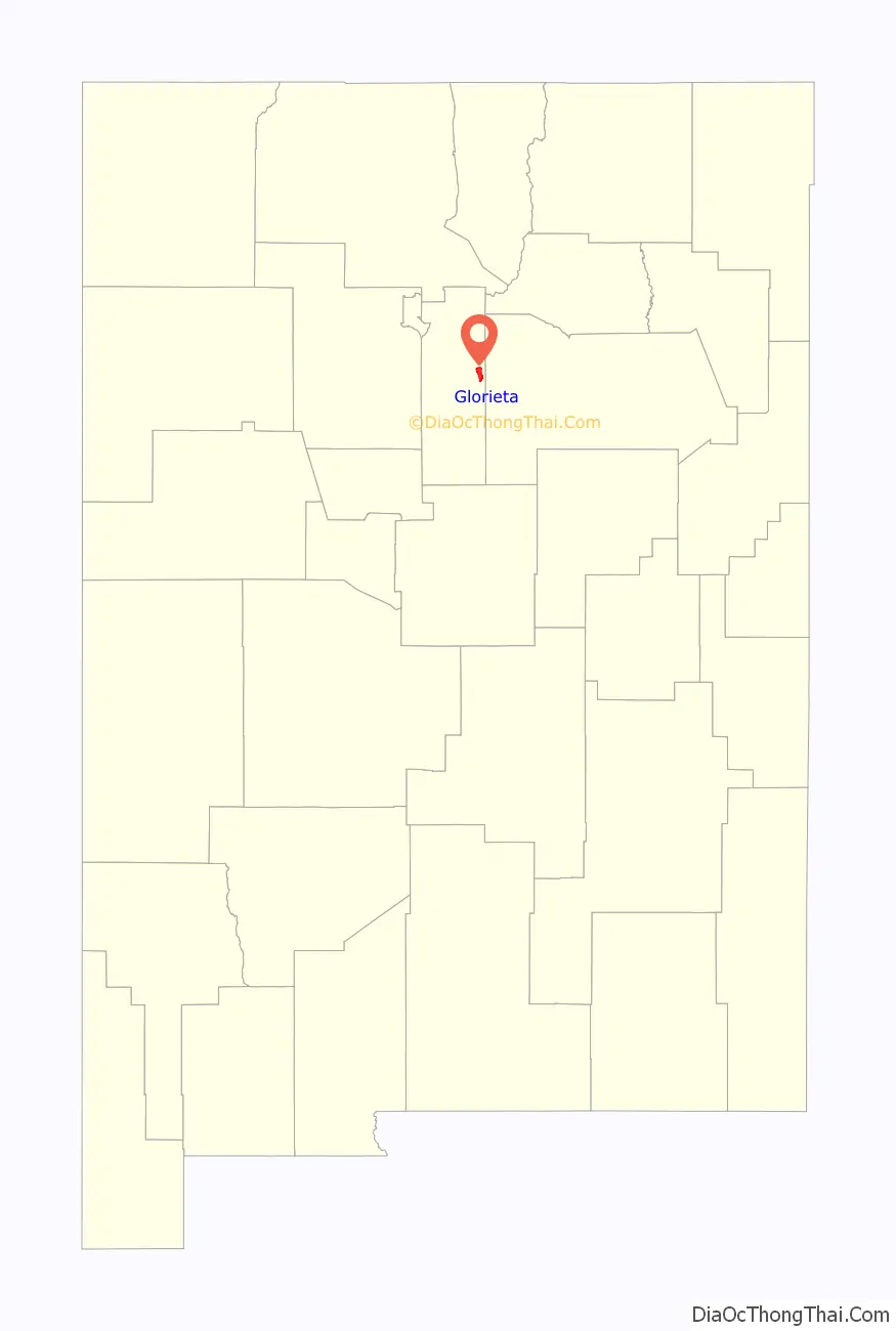
| State: | New Mexico |
| County: | Santa Fe County |
| Elevation: | 7,431 ft (2,265 m) |
| Total Area: | 7.65 sq mi (19.81 km²) |
| Land Area: | 7.65 sq mi (19.81 km²) |
| Water Area: | 0.00 sq mi (0.00 km²) |
| Total Population: | 511 |
| Population Density: | 66.81/sq mi (25.79/km²) |
| ZIP code: | 87535 |
| Area code: | 505 |
| FIPS code: | 3529860 |
| GNISfeature ID: | 0918193 |
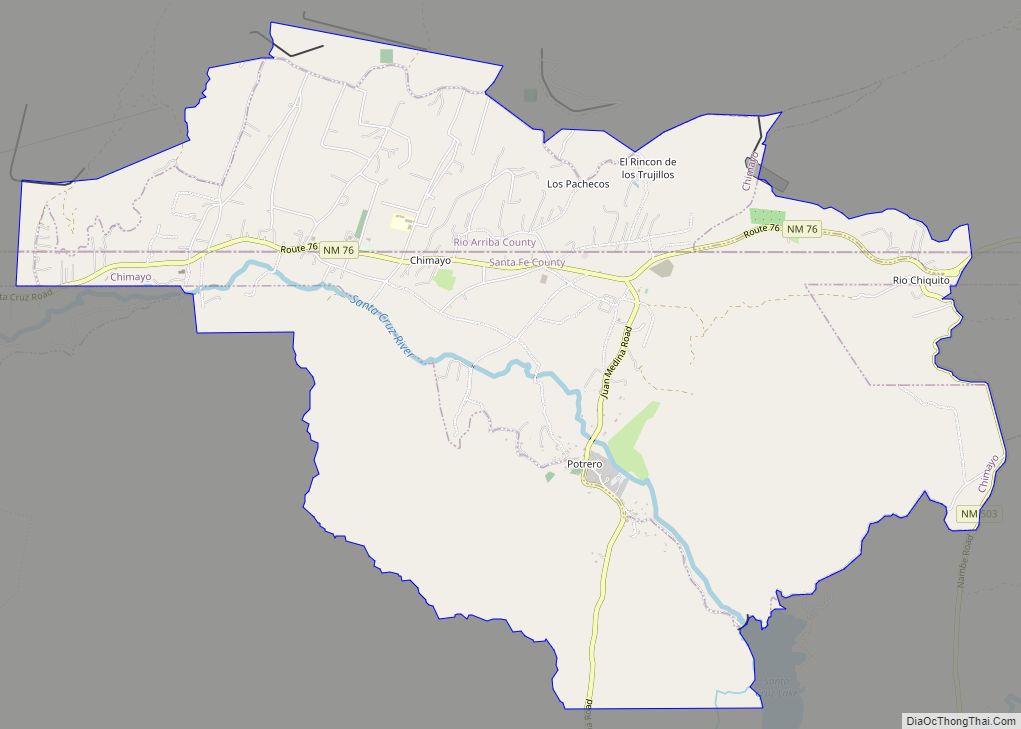
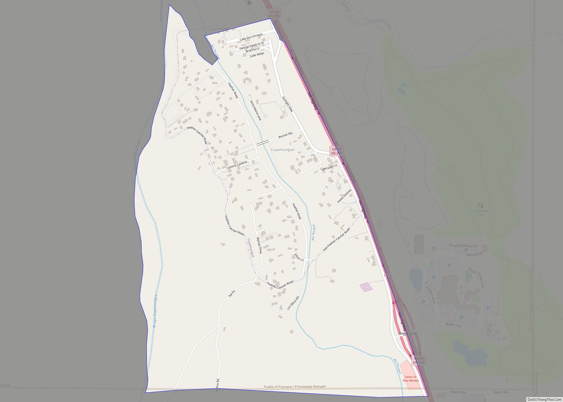
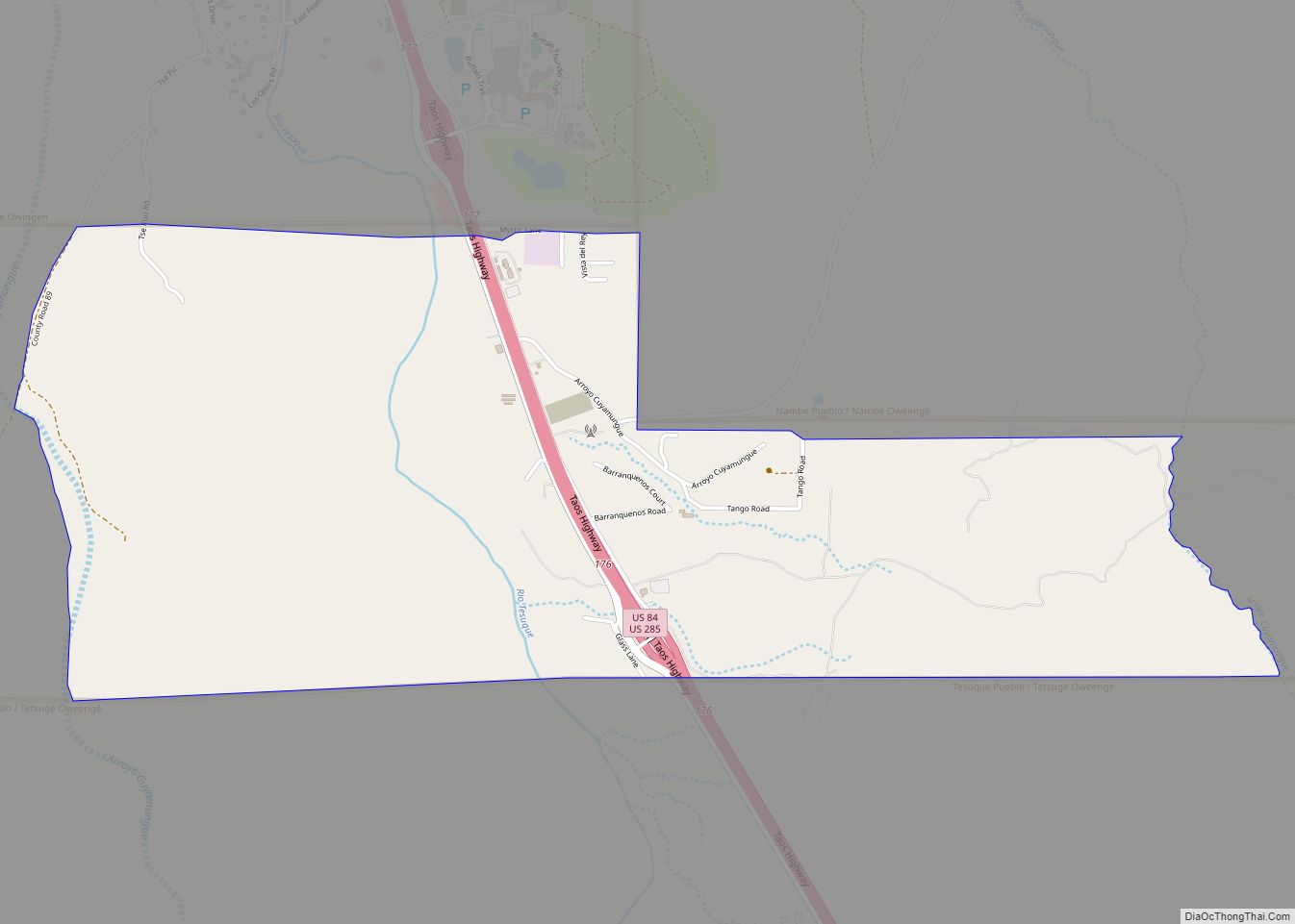
Online Interactive Map
Click on ![]() to view map in "full screen" mode.
to view map in "full screen" mode.
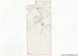
Glorieta location map. Where is Glorieta CDP?
History
The area was the site of two battles in New Mexico history, the Capture of Santa Fe and the Battle of Glorieta Pass.
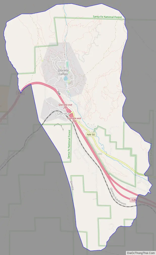
Glorieta Road Map
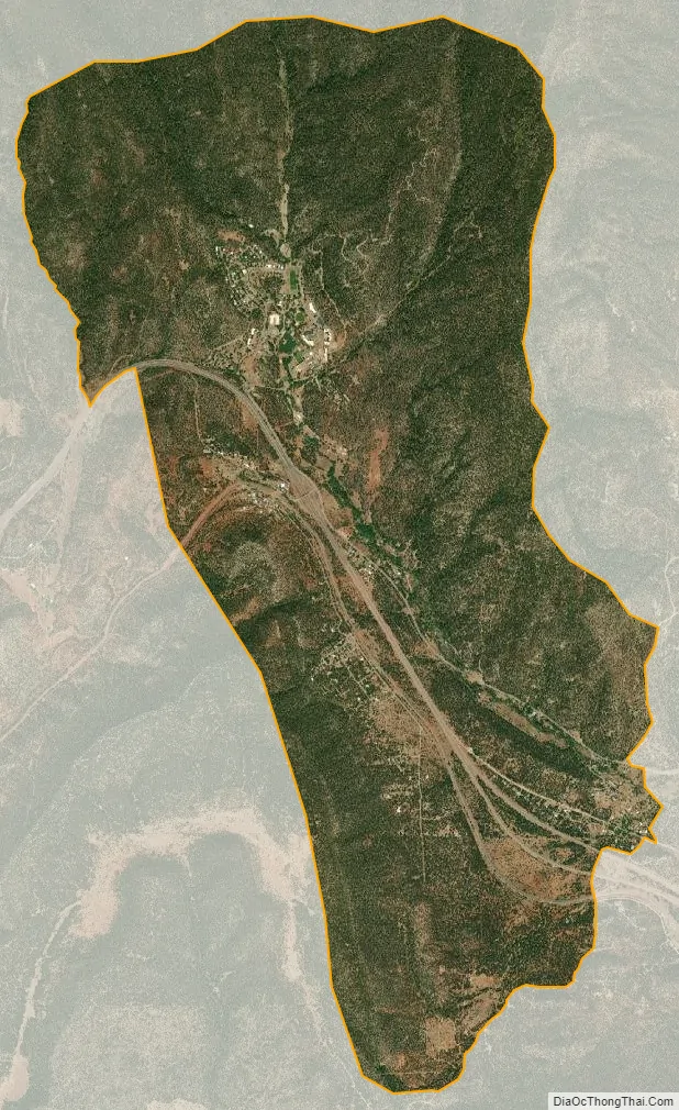
Glorieta city Satellite Map
Geography
Glorieta is located at 35°34′40″N 105°45′35″W / 35.57778°N 105.75972°W / 35.57778; -105.75972 (35.577653, -105.759655). It is located along the Atchison, Topeka and Santa Fe Railway (now the BNSF); it was a stop along the record-breaking Scott Special passenger train.
According to the United States Census Bureau, the CDP has a total area of 7.6 square miles (20 km), all land.
See also
Map of New Mexico State and its subdivision: Map of other states:- Alabama
- Alaska
- Arizona
- Arkansas
- California
- Colorado
- Connecticut
- Delaware
- District of Columbia
- Florida
- Georgia
- Hawaii
- Idaho
- Illinois
- Indiana
- Iowa
- Kansas
- Kentucky
- Louisiana
- Maine
- Maryland
- Massachusetts
- Michigan
- Minnesota
- Mississippi
- Missouri
- Montana
- Nebraska
- Nevada
- New Hampshire
- New Jersey
- New Mexico
- New York
- North Carolina
- North Dakota
- Ohio
- Oklahoma
- Oregon
- Pennsylvania
- Rhode Island
- South Carolina
- South Dakota
- Tennessee
- Texas
- Utah
- Vermont
- Virginia
- Washington
- West Virginia
- Wisconsin
- Wyoming